The best hikes from bus stations around Oberteuringen
4.5
(8525)
39,601
hikers
44
hikes
Bus station hiking trails around Oberteuringen offer access to a diverse landscape characterized by river valleys, reed landscapes, and extensive orchards. The Rotach River meanders through the region, providing a natural corridor for trails. Situated at the foot of the Gehrenberg, the area features gentle hills and offers views of the Lake Constance region and the Alps on clear days. Significant nature conservation areas, such as the Hepbacher-Leimbacher Ried, contribute to the varied terrain.
Best bus station hiking trails around…
Last updated: October 1, 2026
4.8
(6)
18
hikers
15.5km
04:02
110m
110m
Moderate hike. Good fitness required. Easily-accessible paths. Suitable for all skill levels.
12
hikers
9.97km
02:44
160m
160m
Moderate hike. Good fitness required. Easily-accessible paths. Suitable for all skill levels.

4.3
(6)
14
hikers
11.1km
03:04
200m
200m
Moderate hike. Good fitness required. Easily-accessible paths. Suitable for all skill levels.
4.3
(4)
22
hikers
Easy hike. Great for any fitness level. Easily-accessible paths. Suitable for all skill levels.
4.5
(4)
25
hikers
Easy hike. Great for any fitness level. Easily-accessible paths. Suitable for all skill levels.
Get access to more routes and recommendations from other explorers.
Already have an account?
Our route recommendations are based on thousands of hikes, rides, and runs completed by other people on komoot.
Start today with a free account
Your next adventure awaits.

Other adventures around Oberteuringen

Tips from the Community


Rustic cozy country inn in Bitzenhofen with affordable prices and friendly staff. There isn't much choice, but what there is tastes good 😋. Traditionally hearty Swabian cuisine. It's of course not a fancy "going-out restaurant", but it's perfect for a cozy end to the workday or the end of a hike with delicious food (large portions!) and a beer. Dining room upstairs, in summer Biergarten + playground. Opening hours: Sunday 10:00–14:00 and 17:00–23:00, Monday, Tuesday, Wednesday closed, Thursday, Friday, Saturday open from 17:00.
3
0

Simply a wonderful hiking trail
1
0

Dreamlike section, hills, trees and the stream
1
0

The path has been repaired and reopened since May 12, 2025.
1
0

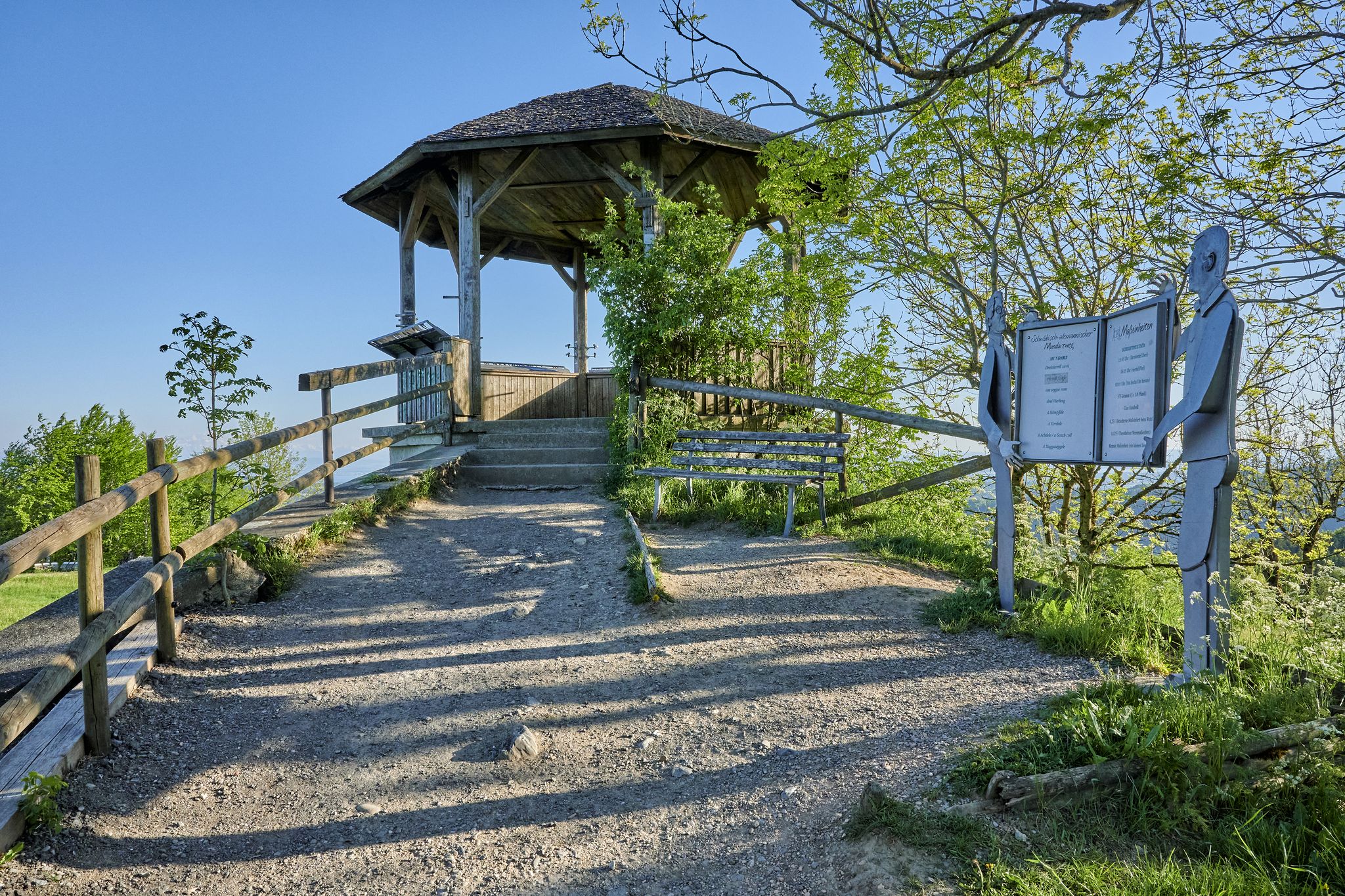
From the two benches, you have a fantastic view of the lake and the mountains. A sign in front of it tells you where each mountain is.
5
0

There is a table with seating here for a short rest.
2
0

A sign gives an overview of the mountains to be seen. Two benches invite you to take a rest. There are no trash cans here or in the surrounding area.
5
1
Frequently Asked Questions
How many bus station hiking trails are available in Oberteuringen?
There are over 40 hiking trails in Oberteuringen that are easily accessible from bus stations. These routes offer a variety of experiences, from easy strolls to more challenging hikes.
What types of landscapes can I expect on bus-accessible hikes in Oberteuringen?
Oberteuringen's bus-accessible hikes lead through diverse landscapes. You'll find trails winding through expansive fruit orchards, along the largely pristine Rotach River Valley, and into significant reed landscapes like the Hepbacher-Leimbacher Ried. Many routes also offer views of the Alps on clear days.
Are there easy hiking trails accessible by bus in Oberteuringen?
Yes, Oberteuringen offers a good selection of easy hiking trails accessible by bus. For example, the Path along the Rothach – Rotach Crossing loop from Oberteuringen is an easy 5.5 km route, and the Path to Wammeratswatt – Altweiherwiese Nature Reserve loop from Oberteuringen is another easy option at 5.3 km, perfect for a relaxed outing.
What are some notable viewpoints or landmarks along bus-accessible routes?
Many routes offer stunning views. The Picnic Area with View – Five Countries Viewpoint loop from Oberteuringen provides expansive vistas. You can also reach the Gehrenberg Tower Viewpoint, which offers panoramic views across the Lake Constance region and the Alps on clear days. Along the Rotach River, you might discover historical traces of old mills and the Rotach Waterfall.
When is the best time of year to go hiking from bus stations in Oberteuringen?
The best times to experience Oberteuringen's hiking offerings are during spring, when the fruit orchards are in bloom, and autumn, when the deciduous forests display vibrant colors. The weather is generally pleasant for hiking during these seasons.
Are there any circular hiking routes that start and end at a bus station?
Yes, many of the bus-accessible trails in Oberteuringen are circular routes, allowing you to return to your starting point without needing additional transport. Examples include the moderate Haldenberg Chapel – Rotach Riverside Trail loop from Oberteuringen and the Cow Pasture with Scenic View – Apple Orchard loop from Oberteuringen.
What do other hikers say about the trails in Oberteuringen?
The hiking trails around Oberteuringen are highly rated by the komoot community, with an average score of 4.5 stars from over 7,300 ratings. Reviewers often praise the diverse and picturesque landscapes, the well-maintained paths, and the stunning views of the Alps and Lake Constance.
Can I find waterfalls along the bus-accessible hiking trails?
Yes, the region features several waterfalls. The Rotach Waterfall and Riverside House is a notable highlight along the Rotach River. Other waterfalls in the wider area include the Schmalegger Tobel Waterfall and the Waterfall in the Schmalegger and Rinkenburger Tobel Nature Reserve.
Are there any nature reserves or unique geological features to explore?
Absolutely. The region is home to significant reed landscapes, such as the Hepbacher-Leimbacher Ried and the Altweiherwiesen Nature Reserve. These areas are recognized nature conservation areas and are part of the Bodenseepfad, offering insights into local flora and fauna. The drumlin landscape around Hepbacher-Leimbacher Ried is particularly notable as one of the last larger low moors in the Bodenseekreis district.
Are the bus-accessible trails suitable for families with children?
Yes, Oberteuringen offers many family-friendly paths. The diverse trail network includes routes suitable for all skill levels, with numerous easy options that are perfect for families. The Rotachpark, for instance, provides river access and an island for children to play, making it a great stop on a family hike.
Are there any external resources for more information about the Rotach Trail?
Yes, for more detailed information about the Rotach Trail, which leads from Oberteuringen to the mouth of the Rotach in Friedrichshafen, you can visit the Visit Baden-Württemberg website.
Most popular routes around Oberteuringen
Most popular attractions around Oberteuringen

Get inspired with the komoot mobile app


Explore more
Browse the best Hikes in other regions.
