The best hikes from bus stations around Alflen
4.5
(15534)
57,622
hikers
22
hikes
Bus station hiking trails around Alflen offer access to the diverse landscapes of Germany's Eifel region. The area is characterized by its volcanic-shaped terrain, featuring rolling hills, dense forests, and the notable Endert Valley. Hikers can explore former volcanic craters, juniper fields, and natural attractions like the Ulmener Maar. This region provides varied terrain for outdoor enthusiasts, with routes suitable for different skill levels.
Best bus station hiking trails around Alflen
- The most popular bus station hiking route is HeimatSpur…
Last updated: June 27, 2026
4.5
(78)
228
hikers
10.4km
02:52
180m
180m
Moderate hike. Good fitness required. Mostly accessible paths. Sure-footedness required.
4.5
(6)
18
hikers
18.0km
04:55
270m
270m
Hard hike. Good fitness required. Sure-footedness, sturdy shoes and alpine experience required.

Sign up for free
3.8
(5)
15
hikers
15.6km
04:14
230m
230m
Moderate hike. Good fitness required. Easily-accessible paths. Suitable for all skill levels.
8
hikers
Easy hike. Great for any fitness level. Easily-accessible paths. Suitable for all skill levels.
4.8
(4)
16
hikers
8.08km
02:13
130m
130m
Moderate hike. Good fitness required. Easily-accessible paths. Suitable for all skill levels.
Get access to more routes and recommendations from other explorers.
Sign up for free
Already have an account?
Our route recommendations are based on thousands of hikes, rides, and runs completed by other people on komoot.
Start today with a free account
Your next adventure awaits.
Login or Signup


Tips from the Community

Idyllic location with high geological information value regarding Eifel volcanism.
0
0

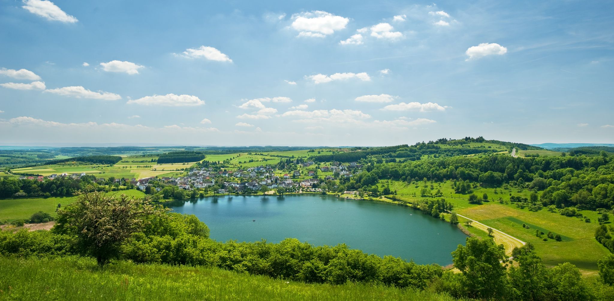
One of the youngest maars in the Eifel region nestles picturesquely against the small town of Ulmen with its castle ruins and church right on the shore - idyllic and simply beautiful!
0
0

A true paradise stretches out on the edge of the village of Ulmen on a plateau beneath the Steimelskopf, where a volcano once erupted with a tremendous bang, forming a deep crater with a maar lake, which now serves as a renowned bird sanctuary. The exact age of the Jungferweiher lake cannot be determined, but its morphological shape suggests it is several hundred thousand years old. In early modern times, the Lords of Ulmen used the lake as a fishpond for carp breeding, until it gradually silted up over time, and the residents of Ulmen harvested peat from the former maar for heating purposes. However, in 1942, the decision was made to flood the area again by damming the Ulmener Bach to secure the drinking water supply for the Cochem-Zell district. Today, the Jungferweiher lake, located at an altitude of 428 meters above sea level, covers an area of approximately 170,000 square meters with a depth of 0.8 meters. The pond, along with the Ulmener Maar, is protected for its rare flora and fauna. Many endangered species, such as the snipe and the meadow pipit, breed in the reed-rich banks, while ospreys have been observed hunting. Migratory birds such as cranes, teals, and great grey shrikes roost in the meadows near the Ulmener Jungferweiher every year. Therefore, a walk along the approximately 3-kilometer loop is a must, especially during the migration periods in spring and autumn. At the bird observatory on the western bank, you can observe the birds in their natural habitat. Nowadays, a wide variety of fish species thrive in the shallow waters of the Ulmener Weiher, which can be fished from a fishing pier on the southern bank. Swimming and other water sports are prohibited, however. Fishing permits are issued by the local municipal administration in Ulmen. Since 2023, the Ulmener Maar Tunnel has connected the Jungferweiher underground to the Ulmener Maar. A visit to the 126-metre-long tunnel is highly recommended!
7
0

Historic chapel and stamping point for Camino hikers.
0
0

Here is a nice rest area with a view of the Ulmener Maar.
3
0
The Ulmen Maar is a maar belonging to the town of Ulmen in the Eifel region of Rhineland-Palatinate. The meromictic lake is up to 37 meters deep and is surrounded by an average 20-meter-high wall of tuff rock formed from the eruptions of the former volcano.
2
0
According to legend, Heinrich von Ulmen is said to have deposited a bag of earth from Christ's grave at the St. Anthony's Cross in the 17th century.
1
0

Here you can relax with a great view of the Ulmener Maar
2
0
Frequently Asked Questions
How many bus-accessible hiking trails are there around Alflen?
There are over 20 bus station hiking trails available around Alflen, offering a variety of experiences for different skill levels. These routes are designed to be easily reachable by public transport, making it convenient to explore the beautiful Eifel region.
Are there easy bus-accessible hikes suitable for beginners or families?
Yes, Alflen offers several easy bus-accessible hikes perfect for beginners or families. For instance, the View of the Eifel – St. Mauritius Church, Schmitt loop from Alflen is an easy route that provides pleasant views without significant elevation changes.
What kind of landscapes can I expect on bus-accessible hikes near Alflen?
The bus-accessible hikes around Alflen traverse the diverse Volcanic Eifel landscape, featuring rolling hills, dense forests, and remnants of volcanic activity. You can also experience the picturesque Endert Valley with its unique juniper fields and the stunning Moselle River views from certain vantage points in the wider region.
Are there any circular walks starting directly from a bus station?
Yes, many of the bus-accessible routes around Alflen are circular walks, allowing you to start and end your hike at the same point, often conveniently located near a bus stop. The Jungfer Pond – Maiden Pond loop from Auderath is a great example of a circular route accessible by bus.
Can I find trails with waterfalls or other natural highlights accessible by bus?
Absolutely. The Endert Valley, known for its natural beauty, is home to the Rausch Waterfall. You can explore this area on routes like The Rausch Waterfall – Endert Valley Trail loop from Auderath, which is accessible via public transport.
What are some notable landmarks or points of interest along these bus-accessible routes?
Along the bus-accessible routes, you can discover various points of interest. Highlights include the historic Göbelsmühle and the historic mills of the Wild Endert Valley, and the scenic Panoramic view of the Moselle bend below the Calmont summit. The region also features charming huts like the Drei Eichen Hut & Wetland Biotope.
What is the best time of year to hike these bus-accessible trails?
The best seasons for hiking the bus-accessible trails around Alflen are typically spring and autumn. During these times, nature is either in full bloom or displaying vibrant colors, complemented by mild temperatures and a pleasant climate, making for ideal hiking conditions.
Are there any moderate difficulty trails for more experienced hikers that are bus-accessible?
Yes, for those seeking a more challenging experience, there are several moderate difficulty trails accessible by bus. The HeimatSpur Wacholder-Endert Pfad – GesundLand Vulkaneifel is a great option, offering a longer distance and varied terrain.
What do other hikers enjoy most about hiking in Alflen?
The hiking trails around Alflen are highly rated by the komoot community, with an average score of 4.5 stars. Reviewers often praise the diverse landscapes, the well-maintained paths, and the opportunity to immerse oneself in the peaceful nature of the Eifel region.
Are there any trails that pass by local farms or offer local produce?
Yes, some routes offer a glimpse into the local agricultural landscape. The Waldhof Farm Shop – Apple Orchard loop from Auderath is an example of a trail that takes you past local farms, potentially offering opportunities to experience local produce.
Most popular routes around Alflen
Most popular attractions around Alflen

Get inspired with the komoot mobile app


Explore more
Browse the best Hikes in other regions.
