The best family-friendly hikes and walks around Ulmen
4.5
(18387)
62,225
hikers
80
hikes
Family friendly hiking trails around Ulmen are characterized by the distinctive volcanic landscapes of the Eifel mountains. The region features unique natural formations such as volcanic maars, which are crater lakes, and dense forests. Hikers can explore the youngest maar in the Eifel, the Ulmener Maar, and the reflooded Jungferweiher, a protected bird sanctuary. Historical attractions like the Ulmen Castle Ruins also provide points of interest along the trails.
Best family friendly hiking trails around Ulmen
- The most popular family…
Last updated: October 1, 2026
4.3
(57)
247
hikers
20.2km
05:23
220m
220m
Hard hike. Very good fitness required. Easily-accessible paths. Suitable for all skill levels.
4.2
(41)
197
hikers
14.6km
03:53
150m
150m
Moderate hike. Good fitness required. Easily-accessible paths. Suitable for all skill levels.

4.2
(9)
69
hikers
3.32km
00:52
20m
20m
Easy hike. Great for any fitness level. Easily-accessible paths. Suitable for all skill levels.
4.7
(468)
1,530
hikers
6.28km
01:39
50m
50m
Easy hike. Great for any fitness level. Easily-accessible paths. Suitable for all skill levels.
4.8
(25)
90
hikers
26.1km
07:06
390m
390m
Hard hike. Very good fitness required. Easily-accessible paths. Suitable for all skill levels.
Get access to more routes and recommendations from other explorers.
Already have an account?
Our route recommendations are based on thousands of hikes, rides, and runs completed by other people on komoot.
Start today with a free account
Your next adventure awaits.

Other adventures around Ulmen


Tips from the Community

To all those who wander through the Wild Endert Valley with great joy, I would like to give a poem by the writer O. W. Ullmann as a parting gift: „Hiking, that means carrying longing for the sun and for sun-drenched heights for the mountains that tower in the clouds, for the murmuring springs and the quiet lakes, for the trees that reach into the blue air, for the fields that ripen for harvest, for the chirping crickets, for the finches' song: Hiking, that means carrying longing.”
0
0

From 13:00 o'clock many people are out and about when the sun ☀️ shines
0
0

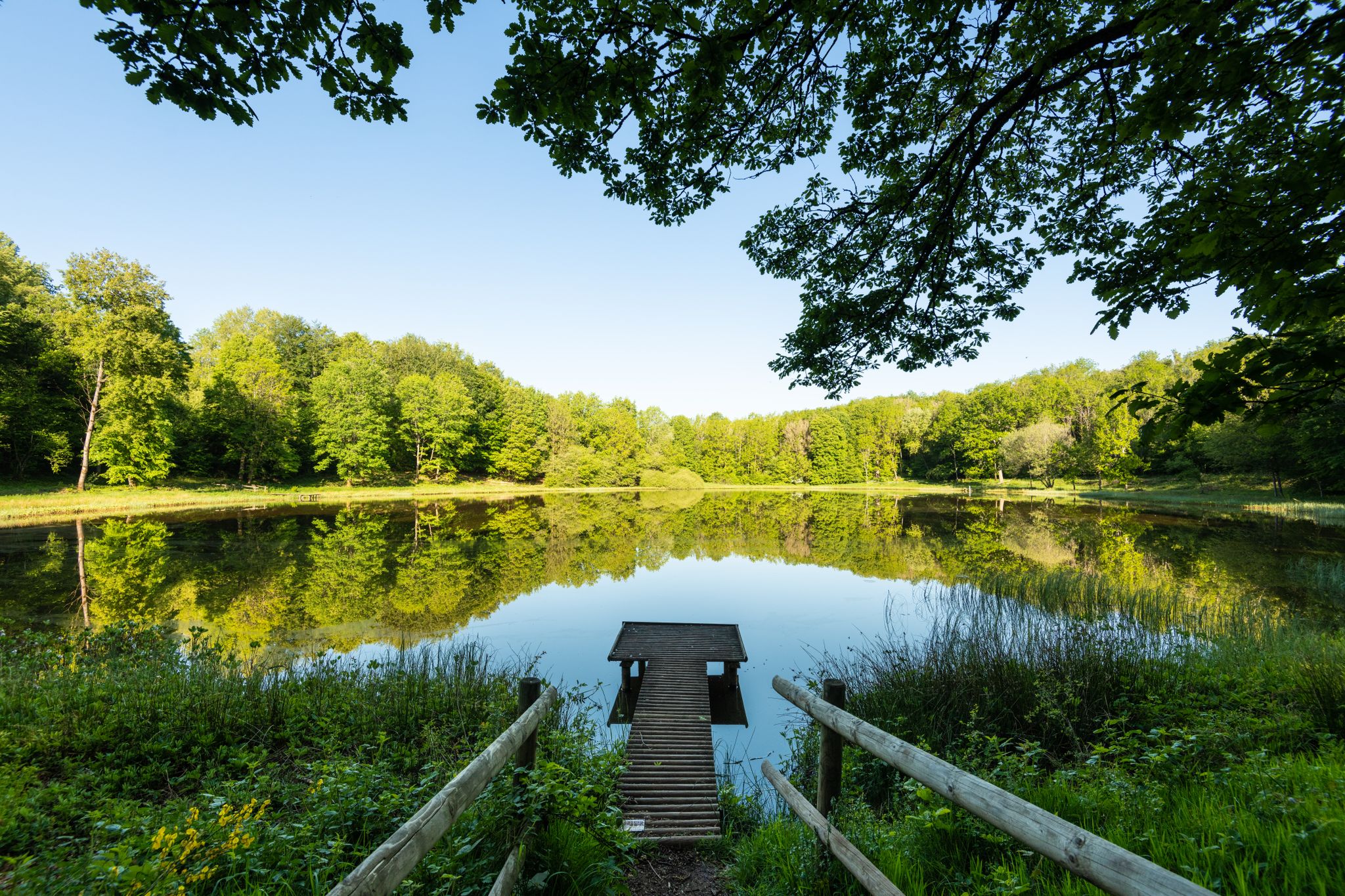
A true paradise stretches out on the edge of the village of Ulmen on a plateau beneath the Steimelskopf, where a volcano once erupted with a tremendous bang, forming a deep crater with a maar lake, which now serves as a renowned bird sanctuary. The exact age of the Jungferweiher lake cannot be determined, but its morphological shape suggests it is several hundred thousand years old. In early modern times, the Lords of Ulmen used the lake as a fishpond for carp breeding, until it gradually silted up over time, and the residents of Ulmen harvested peat from the former maar for heating purposes. However, in 1942, the decision was made to flood the area again by damming the Ulmener Bach to secure the drinking water supply for the Cochem-Zell district. Today, the Jungferweiher lake, located at an altitude of 428 meters above sea level, covers an area of approximately 170,000 square meters with a depth of 0.8 meters. The pond, along with the Ulmener Maar, is protected for its rare flora and fauna. Many endangered species, such as the snipe and the meadow pipit, breed in the reed-rich banks, while ospreys have been observed hunting. Migratory birds such as cranes, teals, and great grey shrikes roost in the meadows near the Ulmener Jungferweiher every year. Therefore, a walk along the approximately 3-kilometer loop is a must, especially during the migration periods in spring and autumn. At the bird observatory on the western bank, you can observe the birds in their natural habitat. Nowadays, a wide variety of fish species thrive in the shallow waters of the Ulmener Weiher, which can be fished from a fishing pier on the southern bank. Swimming and other water sports are prohibited, however. Fishing permits are issued by the local municipal administration in Ulmen. Since 2023, the Ulmener Maar Tunnel has connected the Jungferweiher underground to the Ulmener Maar. A visit to the 126-metre-long tunnel is highly recommended!
7
0
1 million years of geology. Worth putting your bike aside for a moment.
6
0
The fairy-tale fountain at the Alten Postplatz tells a story. Here, on this spot, it is at its most beautiful.
7
0
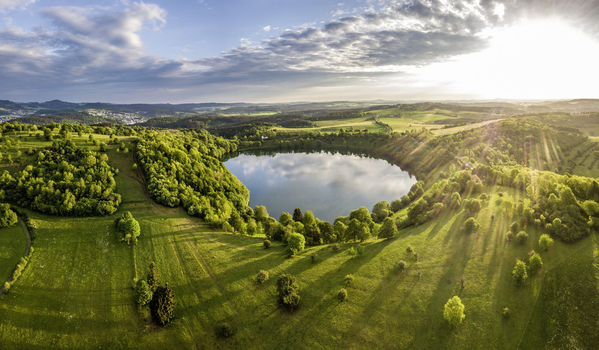
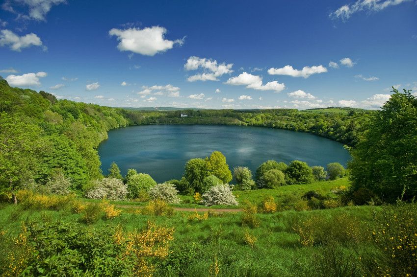
The Ulmen Maar lies 420 meters above sea level today, covers an area of 5.5 hectares, and is 36 meters deep. The bubbles at the maar's edge demonstrate that volcanism is still active. They bear witness to a turbulent past—but rest assured, there's no eruption in sight! A wall of various rocks and ash, up to 20 meters thick, surrounds the cone. For those interested, these testimonies to this explosive past are beautifully displayed in St. Matthias Church. This unique wall, with its different colored layers and rounded inclusions, is worth seeing for more than just geologists. The slopes of the maar basin are covered with a beautiful forest, which can be explored on a circular walk. A detour to the medieval castle ruins, from which the Crusaders once launched their campaigns, is recommended. The view from the crater rim over the maar and the Eifel beyond will take your breath away. Whether after a sweaty hike or a long drive, the blue of the Ulmer Eifel lake is all too tempting in summer. However, bathing in the maar is prohibited because it is designated as a nature and water protection area.
7
0
The lower castle has completely disappeared. You can still see the beginning of the ring that connected the lower castle and the Ulmen city wall, a two-story outer wall of the palace, as well as a cistern and some foundation walls of other buildings. The old part of Ulmen Castle was built around 1074 AD and likely rests on the remains of a Roman settlement. In the Middle Ages, Ulmen Castle was further expanded and divided into the upper castle, whose remains of the walls still exist, and the lower castle, which extended to the banks of the maar river. Two knightly families lived in the castle, which is believed to have never been attacked or destroyed until 1673 due to its size. Only the Sun King's troops succeeded. It was rebuilt, but fell again in 1689 during the War of the Succession. However, Ulmen Castle was also rebuilt this time, with only the city wall being abandoned. With the invasion of Napoleon's soldiers, Ulmen also became French and later Prussian. The empty castle, whose last descendant died in 1801, was auctioned to a merchant from Cochem, who sold it as a quarry. When a devastating fire burned Ulmen to the ground in the 19th century, the residents of Ulmen rebuilt their houses with stones from the castle. That's why you can still see a coat of arms on some of the stables today. It wasn't until the early twentieth century that Ulmen Castle was declared a listed building and became the property of the municipality of Ulmen. The castle is always freely accessible.
7
0

The Ulmen Maar is a maar belonging to the town of Ulmen in the Eifel region of Rhineland-Palatinate. The meromictic lake is up to 37 meters deep and is surrounded by an average 20-meter-high wall of tuff rock formed from the eruptions of the former volcano.
2
0
Frequently Asked Questions
How many family-friendly hiking trails can I find around Ulmen?
There are over 80 family-friendly hiking trails around Ulmen, with 36 classified as easy and 39 as moderate, offering plenty of options for all ages.
What makes Ulmen a great destination for family-friendly hiking?
Ulmen's unique volcanic landscapes, especially its maars like the Ulmener Maar and Jungferweiher, offer fascinating natural exploration. The region provides a mix of easy, circular routes and opportunities to discover historical sites like the Ulmen Castle Ruins, making it engaging for families with children.
Are there any easy, circular routes suitable for families with young children?
Yes, for a gentle and accessible option, consider the Ulmener Entdeckertour. This easy route is just over 3 km long and has minimal elevation gain, perfect for little legs. Another great choice is the barrier-free circular trail around the Jungferweiher, which is also a bird sanctuary.
Where can we see interesting natural features or landmarks along the trails?
Many trails lead past Ulmen's distinctive maars. The Ulmener Maar – Ulmener Maar Tunnel loop takes you around the youngest maar in the Eifel and past the Ulmen Castle Ruins. You can also visit the Dronke Tower on the Mäuseberg for panoramic views, or explore the Heinzelmännchen Cave.
Are there any trails that feature waterfalls?
Yes, for families interested in seeing a waterfall, the Ulmener Maar – The Rausch Waterfall loop is an option. Be aware that this route is longer and classified as difficult, so it's better suited for families with older, more experienced hikers.
What do other hikers enjoy most about the family-friendly trails in Ulmen?
The trails around Ulmen are highly rated by the komoot community, with an average score of 4.5 stars from over 16,000 ratings. Reviewers often praise the unique volcanic landscapes, the well-maintained paths, and the variety of routes that cater to different fitness levels, making it a rewarding experience for families.
Can we bring our dog on the family-friendly hikes?
Most hiking trails in the Ulmen region are dog-friendly, allowing your furry family members to join the adventure. However, always keep dogs on a leash, especially in nature reserve areas like the Jungferweiher, to protect local wildlife.
Are there any trails that offer a unique educational experience for children?
Yes, the region features a Bee Educational Trail in Ulmen, which provides engaging insights into the world of bees. This can be a wonderful addition to a family hike, offering both exercise and learning.
What is the best time of year to visit Ulmen for family hiking?
Spring, summer, and early autumn are generally the best times for family hiking in Ulmen. The weather is usually pleasant, and the natural landscapes are vibrant. In spring, you'll see blooming flora, while autumn offers beautiful foliage. Winter hikes are also possible, but some paths might be slippery or require appropriate gear.
Are there any longer, more challenging family-friendly routes for older children?
For families seeking a longer adventure, the HeimatSpur Große Ulmener Acht – GesundLand Vulkaneifel is a moderate route spanning over 14 km. It offers a good challenge with varied terrain and beautiful scenery, suitable for families with older children who are used to longer walks.
Is there parking available near the trailheads?
Yes, parking is generally available near the starting points of many popular trails in and around Ulmen. Specific parking information can often be found on the individual route pages on komoot or local signage.
Are there any places to eat or have a picnic along the trails?
While specific cafes directly on every trail might be limited, Ulmen itself offers dining options. Many trails also feature scenic spots perfect for a family picnic. It's always a good idea to pack snacks and drinks, especially for longer routes.
Most popular attractions around Ulmen

Get inspired with the komoot mobile app


Explore more
Browse the best Hikes in other regions.
