The best traffic-free bike rides around Söhrewald
4.4
(539)
2,793
riders
127
rides
No traffic gravel bike trails around Söhrewald are characterized by a diverse landscape, offering a mix of forest paths, country roads, and varied terrain. The region is situated within natural areas, providing scenic backdrops for gravel biking. Riders can expect routes through extensive forested areas and along river floodplains. This environment provides a dynamic experience for gravel bikers, combining elements of road and mountain biking.
Best no traffic gravel bike trails around Söhrewald
- The most popular no traffic gravel bike trail is View Towards Wattenbach – Warpel Hut loop from Wellerode, a 24.9 miles (40.1 km) trail that takes 2 hours 30 minutes to complete. This difficult route offers views towards Wattenbach and the Warpel Hut.
- Another top favourite among local gravel bikers is Auf dem Brand Parking Area – Warpel Hut loop from Wellerode, a moderate 11.4 miles (18.3 km) path. This route features varied terrain through forested sections and country roads.
- Local gravel bikers also love the Covered Bridge Over the Fulda – View of Lake Bugasee loop from Wellerode, a 35.3 miles (56.8 km) trail leading through the Fulda River floodplains, often completed in about 3 hours 26 minutes.
- Gravel biking around Söhrewald is defined by forested areas, varied terrain, and proximity to natural parks and rivers. The network offers options for different ability levels, from moderate paths to more challenging routes.
- The routes in Söhrewald are highly rated by the komoot community with an average score of 4.4 stars from over 400 reviews. More than 2,600 gravel bikers have used komoot to explore Söhrewald's varied terrain.
Last updated: June 27, 2026
4.0
(2)
13
riders
40.1km
02:30
660m
660m
Hard gravel ride. Very good fitness required. Mostly paved surfaces. Suitable for all skill levels.
5.0
(1)
9
riders
33.4km
02:28
590m
590m
Hard gravel ride. Very good fitness required. Mostly paved surfaces. Suitable for all skill levels.

Sign up for free
4.0
(1)
7
riders
26.0km
01:41
450m
450m
Hard gravel ride. Very good fitness required. Mostly paved surfaces. Suitable for all skill levels.
4.5
(2)
5
riders
18.3km
01:09
290m
290m
Moderate gravel ride. Good fitness required. Mostly paved surfaces. Suitable for all skill levels.
4.0
(2)
6
riders
18.8km
01:08
290m
290m
Moderate gravel ride. Good fitness required. Mostly paved surfaces. Suitable for all skill levels.
Get access to more routes and recommendations from other explorers.
Sign up for free
Already have an account?
Our route recommendations are based on thousands of hikes, rides, and runs completed by other people on komoot.
Start today with a free account
Your next adventure awaits.
Login or Signup




Tips from the Community

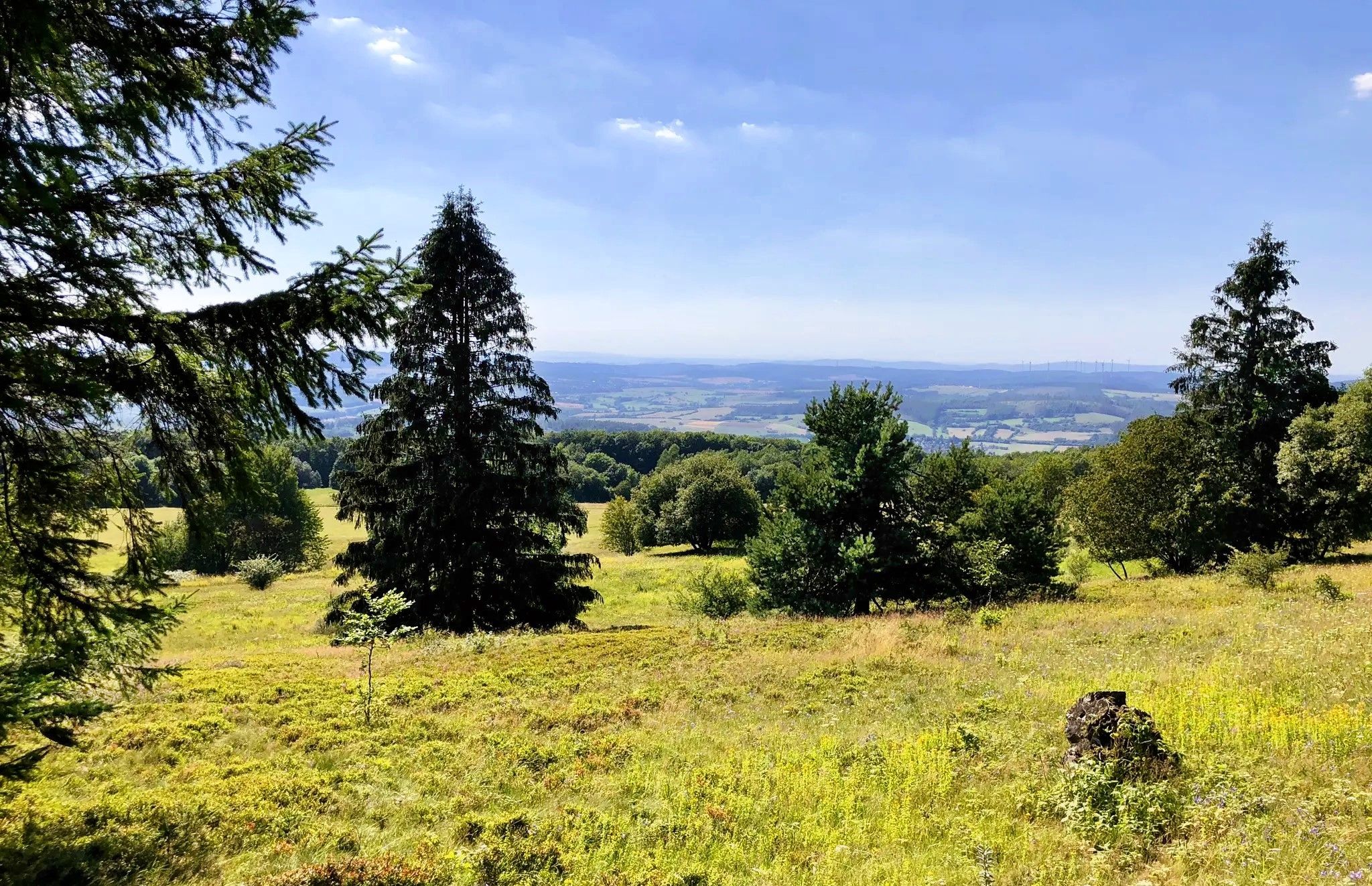
Shelter at a prominent crossroads - nearby you have a beautiful view all the way to Lower Saxony
0
0
next door a large hiking parking lot with many circular hiking trails
0
0

It is located directly at a crossroads.
0
0
In 1980, a storm washed the Welleröder Atonement Cross out of the Steinbach stream. It had been considered lost for decades, but was so well known in ancient times that a map from 1859 already referred to the parcel of land where it was erected as the "Steinkreuzerfeld" (Stone Cross Field). Atonement crosses are legal monuments dating from the 13th to 16th centuries and commemorate a homicide. In an atonement agreement, the perpetrator committed, among other things, to erecting such a cross. The church's efforts thus succeeded in curbing the blood feud that had previously been practiced for centuries. The Welleröder Atonement Cross, which overall can be considered a rather unsophisticated work, features a special feature, using a kind of scratch-line technique, depicting a person (Christ?) presumably holding a small cross in one hand. Tools were usually used in the depiction, indicating the profession of the victim or the instrument used in the crime. Source: Söhrewald History Circle
0
0
Beautiful cycle path along the former Söhrebahn route - unfortunately some of the joints have been washed out by rain
0
1
This atonement cross is based on a legend that tells of two siblings arguing so badly that they died from their injuries. What's special about this place is that the cross, which presumably dates back to the 15th century, was lost for decades. Only a storm and flooding in 1980 unearthed the cross. It was erected at its current location in 1982.
0
0
Beautifully laid out cycle path along the former Söhrebahn - with interesting information boards about the history.
0
0
a beautiful footpath and cycle path along the former Söhrebahn
0
0
Frequently Asked Questions
How many no-traffic gravel bike trails are available in Söhrewald?
Söhrewald offers a wide selection of traffic-free gravel bike trails, with over 120 routes available. These routes cater to various skill levels, from moderate to difficult, ensuring a suitable option for most riders looking to explore the region's natural beauty.
What kind of terrain can I expect on Söhrewald's gravel bike trails?
The gravel bike trails in Söhrewald feature diverse terrain, including forest paths, country roads, and some more challenging sections with fine gravel, roots, and stones. This variety provides an engaging experience, blending aspects of road and mountain biking through heavily forested areas and scenic landscapes.
Are there any family-friendly no-traffic gravel bike routes in Söhrewald?
While many routes in Söhrewald are rated moderate to difficult, some sections and shorter loops can be suitable for families. Look for routes with less elevation gain and smoother surfaces. For example, the Söhre Forest Trail – View of the Hercules Monument loop from Wellerode offers a moderate 16.5 km ride through the forest, which might be a good starting point for active families.
What are some scenic viewpoints or landmarks I can discover along the trails?
Söhrewald's trails offer several scenic spots and landmarks. You can enjoy views towards Wattenbach on the View Towards Wattenbach – Warpel Hut loop from Wellerode. Other notable attractions in the wider area include the Bismarck Tower Kassel and the Michelskopf Lake, which is part of the Michelskopf Lake – Old Söhrebahn Railway Track loop from Söhrewald.
What do other gravel bikers enjoy most about Söhrewald's no-traffic trails?
The komoot community highly rates the gravel biking experience in Söhrewald, with an average score of 4.4 out of 5 stars from nearly 500 ratings. Reviewers often praise the quiet, traffic-free nature of the trails, the beautiful forested landscapes, and the diverse terrain that keeps rides interesting and challenging.
Are there any circular gravel bike routes available?
Yes, many of the no-traffic gravel bike trails in Söhrewald are designed as circular routes, allowing you to start and end at the same point. Examples include the Auf dem Brand Parking Area – Warpel Hut loop from Wellerode, a moderate 18 km option, and the longer Covered Bridge Over the Fulda – View of Lake Bugasee loop from Wellerode, which is a more difficult 56 km ride.
What is the best time of year for gravel biking in Söhrewald?
Söhrewald is generally suitable for gravel biking throughout much of the year. Spring and autumn offer pleasant temperatures and beautiful scenery with changing foliage. Summer can also be great, especially on shaded forest paths. While winter biking is possible, be prepared for potentially wet or icy conditions on some trails.
Where can I find parking for gravel biking in Söhrewald?
Parking is often available near trailheads and popular starting points in Söhrewald. Many routes, like the Auf dem Brand Parking Area – Warpel Hut loop from Wellerode, are designed to start from designated parking areas, making access convenient for cyclists.
Are there any specific regulations or permits needed for cycling in Söhrewald?
Generally, no special permits are required for cycling on public paths and designated trails in Söhrewald. However, it's always good practice to respect local regulations, stay on marked trails, and be mindful of other users, especially in nature park areas. For broader information on outdoor activities in the region, you can visit Hessen Tourismus.
Are there any cafes or restaurants near the gravel bike trails in Söhrewald?
While specific cafes directly on every trail might be limited, Söhrewald and its surrounding villages offer various options for refreshments and meals. Many routes pass through or near communities where you can find local eateries. Planning your route with komoot allows you to identify potential stops along the way.
What is the difficulty level of the gravel bike trails in Söhrewald?
The gravel bike trails in Söhrewald range from moderate to difficult. Out of over 120 routes, about 50 are considered moderate, while over 70 are rated difficult. This means you'll find options for experienced riders seeking a challenge, as well as those looking for a solid, but less extreme, workout.
Most popular attractions around Söhrewald

Get inspired with the komoot mobile app


Explore more
Browse the best Gravel rides in other regions.
