The best traffic-free bike rides around Bösel
4.6
(164)
824
riders
48
rides
No traffic touring cycling routes around Bösel traverse a landscape characterized by a mix of moor and sandy geest areas, offering varied scenery. The region features established cycling routes that lead through forests and along old moor paths. A significant natural highlight is the Thülsfelder Talsperre recreation area, which includes a large water surface, forests, heathlands, and sand dunes. These routes provide a network of paths suitable for touring cyclists seeking quiet exploration.
Best no traffic touring cycling routes around…
Last updated: May 15, 2026
4.8
(53)
176
riders
Moderate bike ride. Good fitness required. Mostly paved surfaces. Suitable for all skill levels.
4.3
(19)
59
riders
Moderate bike ride. Good fitness required. Mostly paved surfaces. Suitable for all skill levels.

Sign up for free
5.0
(4)
43
riders
16.9km
01:00
20m
20m
Easy bike ride. Great for any fitness level. Mostly paved surfaces. Suitable for all skill levels.
4.5
(2)
39
riders
18.9km
01:11
40m
40m
Easy bike ride. Great for any fitness level. Mostly paved surfaces. Suitable for all skill levels.
5.0
(2)
9
riders
28.0km
01:38
40m
40m
Easy bike ride. Great for any fitness level. Mostly paved surfaces. Suitable for all skill levels.
Get access to more routes and recommendations from other explorers.
Sign up for free
Already have an account?
Our route recommendations are based on thousands of hikes, rides, and runs completed by other people on komoot.
Start today with a free account
Your next adventure awaits.
Login or Signup


Other adventures around Bösel

Tips from the Community

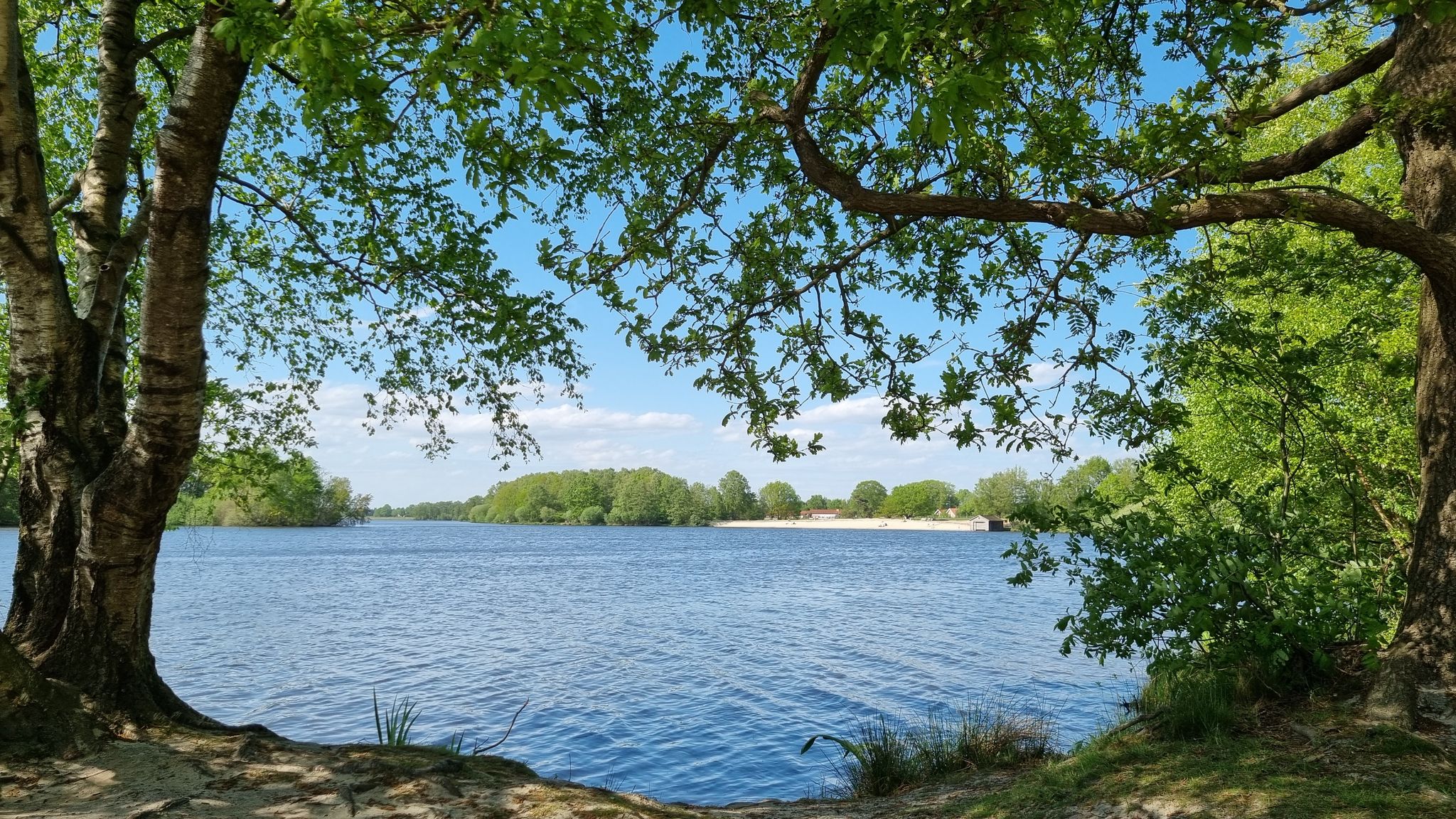
Homemade cakes and coffee specialties or a freshly tapped beer with an unbeatable view: The Seeterrasse is particularly popular on sunny days.
1
0

🚲✨ The route extends over approx. 12 to 14 kilometers and connects the Bad Zwischenahn train station with the Küstenkanal at Edewechterdamm. Since it is a former railway line, you ride almost without any gradients through a varied landscape of gardens, meadows, and moorlands.
3
0
🚲✨ The Kleinbahn trail between Bad Zwischenahn and Edewechterdamm is a real highlight for pleasure cyclists in Ammerland. It runs almost continuously on the route of the former Edewechter Kleinbahn and offers a relaxed ride away from car traffic.
3
0
🚲✨ The Kleinbahnwanderweg in Edewecht is one of the most idyllic routes in the Ammerland and a must for anyone who likes to be out in nature, away from car traffic. It runs along the route of the former narrow-gauge railway that used to connect Bad Zwischenahn with Edewecht and Edewechterdamm.
2
0
The buffer stop of the former narrow-gauge railway is a monument and a popular attraction along the narrow-gauge railway hiking trail near Edewechterdamm.
1
0
The tower is a popular destination for nature lovers and offers an impressive view, especially during bird migration times and in the evening hours.
1
0
The observation tower is located in the area of the renaturalized Vehnemoor and offers visitors an excellent opportunity to overlook the vastness and wildlife of the moorland.
1
0

The term "tower" is a bit of an exaggeration for a platform about 2 meters high. Nevertheless, the view of the renaturalized landscape is worth it.
3
0
Frequently Asked Questions
How many no-traffic touring cycling routes are available around Bösel?
There are nearly 50 dedicated no-traffic touring cycling routes around Bösel. The majority, over 30, are classified as easy, making them accessible for most cyclists. Another 15 are moderate, and a few are more challenging.
What kind of landscapes can I expect on these no-traffic cycling routes?
The routes around Bösel offer a unique blend of moor and sandy geest areas. You'll cycle through old moor paths, tranquil forests, and discover the diverse scenery of the Oldenburger Münsterland. A significant natural highlight is the Thülsfelder Talsperre recreation area, featuring a large water surface, heathlands, and sand dunes, with well-developed paths crossing wooden bridges and passing lagoons.
Are there family-friendly no-traffic cycling routes in Bösel?
Yes, Bösel is well-suited for family cycling. Many routes are designed to be easy and safe, following old moor paths and winding through forests. For example, the Thüle Animal and Amusement Park loop from Bösel is an easy 18.8 km route that could be a great option for families looking for a pleasant ride with an attraction nearby.
Can I find circular no-traffic touring routes around Bösel?
Absolutely. The Oldenburger Münsterland cycling network, which Bösel is part of, features approximately 340 km of circular routes. A great example is the Bösel Village Park – Zwei-Länder-Eck Shelter loop from Bösel, an easy 16.9 km circular route that starts directly from Bösel.
What do other cyclists say about the no-traffic routes in Bösel?
The no-traffic touring cycling routes around Bösel are highly rated by the komoot community, with an average score of 4.6 out of 5 stars. Reviewers often praise the quiet, well-maintained paths and the beautiful, varied landscapes, especially the serene moor and forest sections.
Are there any interesting landmarks or places to explore along the routes?
Yes, several routes pass by interesting points. You can explore the Beach at the Thülsfelder Reservoir or the Thülsfelder Reservoir North Shore and Spillway. The "Avenue route" specifically connects historic buildings and picturesque avenues between Garrel and Bösel. You might also find rest areas like the Eleonorenwald Rest Area for a break.
What are the options for parking when accessing these routes?
Many routes around Bösel offer convenient parking options at their starting points, especially those integrated into the broader Oldenburger Münsterland cycling network. Specific parking details are usually available on individual route pages on komoot, but generally, you'll find designated parking areas near popular trailheads or recreational facilities like the Thülsfelder Talsperre.
How can I reach the starting points of these routes using public transport?
Public transport access varies by route. Some routes, like the Observation tower at Vehnemoor – Weather shelter loop, indicate proximity to public transport stops, such as "ÖPNV Haltestelle Hahnenbergweg." It's advisable to check the specific route details on komoot for information on nearby bus stops or train stations to plan your journey.
What is the best time of year to enjoy no-traffic touring cycling in Bösel?
The spring, summer, and early autumn months (roughly April to October) are generally the best times for touring cycling in Bösel. During these periods, the weather is typically mild, and the natural landscapes, including the moor and forest areas, are at their most vibrant. The well-developed paths are usually in excellent condition, offering pleasant riding conditions.
Are dogs allowed on the no-traffic cycling routes?
While many outdoor areas in Germany are dog-friendly, specific rules can vary. Generally, dogs on a leash are welcome on most public cycling paths. However, when cycling through nature reserves or protected areas, it's always best to check local signage or specific route information on komoot to ensure compliance with any regulations regarding pets.
Are there any routes that offer a mix of terrain, like moor and forest?
Yes, the region is known for its diverse landscapes. The "Cycle route through geest and moor" is a longer, 168.1 km circular route specifically designed to let cyclists experience the characteristic geest and moor landscapes of the Cloppenburg district. Another route, the "Moor route," features easily navigable straight moor paths, particularly through the vast Fehn area around Petersfehn, where you can see peat harvesting fields.
Can I find longer no-traffic touring routes for multi-day trips?
While many routes are suitable for day trips, the extensive Oldenburger Münsterland cycling network includes longer options. The "Cycle route through geest and moor," for instance, is a substantial 168.1 km circular route, which could be broken down into multiple stages for a longer touring experience. The Kleinbahn Trail Edewecht – Ekerner Mill loop is also a good option at over 50 km.
Most popular attractions around Bösel

Get inspired with the komoot mobile app


Explore more
Browse the best Cycling routes in other regions.
