The best traffic-free bike rides around Buckenhofer Forst
4.5
(7195)
48,694
riders
682
rides
No traffic touring cycling routes around Buckenhofer Forst traverse a region characterized by expansive woodlands and diverse landscapes in Middle Franconia, Germany. The area offers a variety of well-developed routes, ranging from flat, easy paths to more challenging ascents. Adjacent to Buckenhofer Forst, the Tennenloher Forst nature reserve features unique sand ecosystems, though cycling is restricted to paved paths there. The terrain provides a scenic backdrop for cycling, with options for various fitness levels.
Best no traffic touring cycling routes…
Last updated: September 3, 2026
4.7
(40)
282
riders
22.9km
01:22
80m
80m
Easy bike ride. Great for any fitness level. Mostly paved surfaces. Suitable for all skill levels.
4.6
(8)
48
riders
46.8km
02:58
520m
520m
Hard bike ride. Very good fitness required. Mostly paved surfaces. Suitable for all skill levels.

Sign up for free
5.0
(1)
75
riders
11.0km
00:38
40m
40m
Easy bike ride. Great for any fitness level. Mostly paved surfaces. Suitable for all skill levels.
4.3
(12)
53
riders
16.1km
01:01
50m
50m
Easy bike ride. Great for any fitness level. Mostly paved surfaces. Suitable for all skill levels.
5.0
(3)
57
riders
Easy bike ride. Great for any fitness level. Mostly paved surfaces. Suitable for all skill levels.
Get access to more routes and recommendations from other explorers.
Sign up for free
Already have an account?
Our route recommendations are based on thousands of hikes, rides, and runs completed by other people on komoot.
Start today with a free account
Your next adventure awaits.
Login or Signup
Popular around Buckenhofer Forst
Tips from the Community

The Eisenstraße (Iron Road) runs for a few kilometers from Dormitzer Straße in the east to Buckenhof in the west, always between forest and meadow on a non-paved but easily passable path.
0
0

Paragliders also launch from here on the mountain.
0
0

View into the Indian Gorge. The Muckenbach "gorge" contains the Upper Burgsandstein geological layer. It is 150 meters long and up to 10 meters deep.
2
0

Other municipalities should look at such approaches and emulate them.
4
0

Easy-to-drive solid gravel highway with heavy traffic;
1
0

The following text is taken from the inscription: "The sandstone obelisk stands at the end of the "Hasensteinlinie" (Hare Stone Line). The Margrave had this forest clearing cut into the forest in 1750 for hunting purposes. Several legends surround the hare with three forelegs."
1
0

Great shop, great oat chocolate bars for the tour!
2
0

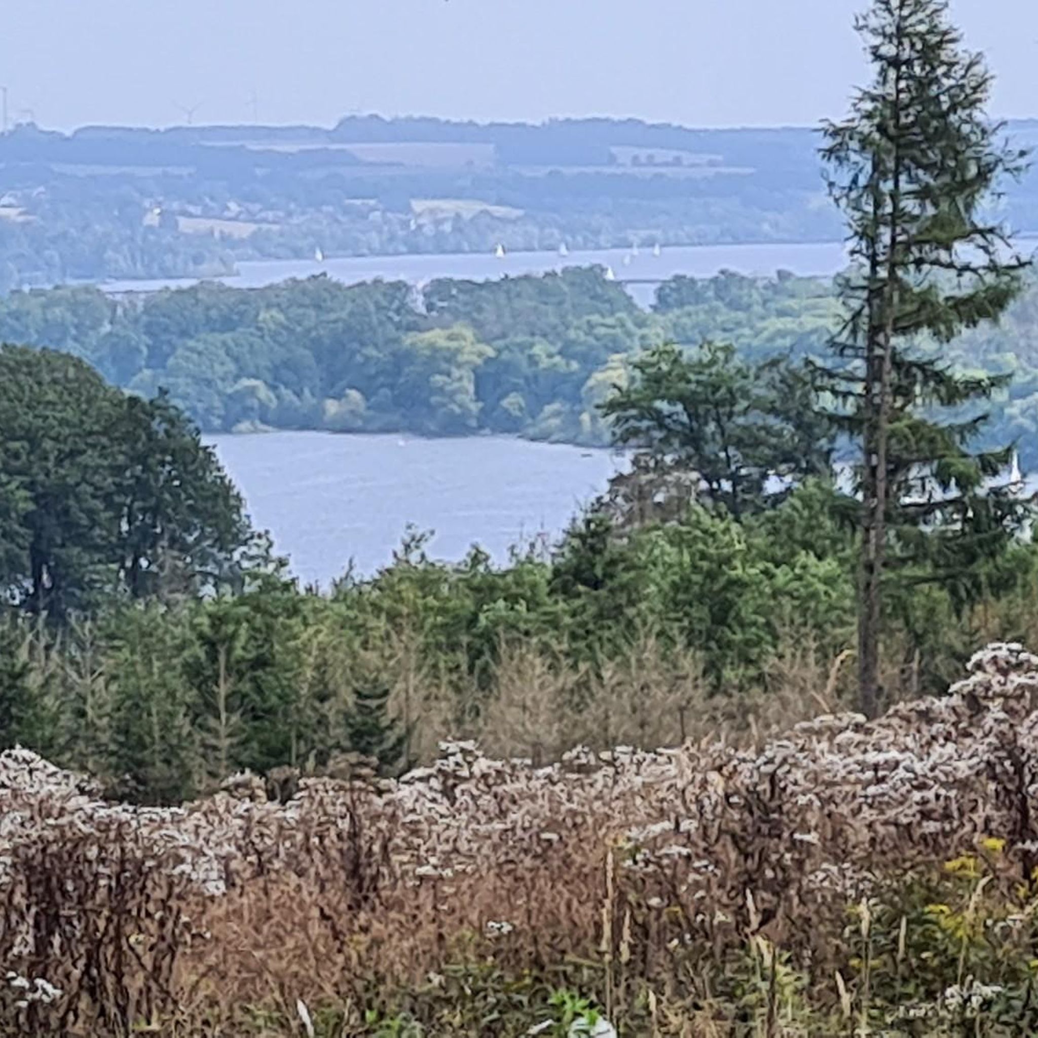
Great view
1
0
Frequently Asked Questions
How many no traffic touring cycling routes are available in Buckenhofer Forst?
Buckenhofer Forst offers a wide selection of no traffic touring cycling routes, with over 700 options available. These routes cater to various skill levels, including more than 330 easy routes, 220 moderate routes, and 140 challenging routes.
What kind of terrain can I expect on these no traffic touring cycling routes?
The terrain in Buckenhofer Forst is diverse, ranging from flat, easy paths suitable for relaxed rides to more challenging ascents with significant elevation gain. Many routes are on well-paved surfaces, making them ideal for touring bikes. The region is characterized by expansive woodlands and varied landscapes.
What natural features or landmarks can I see along the no traffic touring cycling routes?
While cycling, you can explore various natural features and landmarks. Notable attractions include the wild boar enclosure, natural springs like Hasenbrünnlein, and historical markers such as the Bannwaldgedenkstein Buckenhof. You might also encounter several huts and shelters, such as the Shelter or Meisen Hut, which provide convenient resting spots. The area also features interesting geological formations like the Bat cellar on Bierweg.
Are there any circular no traffic touring cycling routes?
Yes, many of the no traffic touring cycling routes in Buckenhofer Forst are circular, allowing you to start and end at the same point. An example of a circular route is the easy Gaberhofmühle Dormitz – Indian Gorge loop from Buckenhof, which covers over 23 km.
Are the no traffic touring cycling routes in Buckenhofer Forst suitable for families?
Absolutely. Buckenhofer Forst offers numerous easy, flat, and traffic-free routes that are well-suited for families. These paths are often accessible by bicycle, making them inclusive for various outdoor enthusiasts. The presence of attractions like the wild boar enclosure can also add to a family-friendly outing.
Can I bring my dog on these no traffic touring cycling routes?
Generally, dogs are welcome on the cycling routes in Buckenhofer Forst. However, it's always advisable to keep dogs on a leash, especially in areas with wildlife or near attractions like the wild boar enclosure, to ensure their safety and respect for the natural environment.
Where can I park my car to access the no traffic touring cycling routes?
Parking is generally available at various access points around Buckenhofer Forst. Specific parking areas can be found near popular starting points for routes, such as those originating from Buckenhof or Uttenreuth. It's recommended to check local signage for designated parking zones.
How can I reach the no traffic touring cycling routes using public transport?
Buckenhofer Forst is accessible via public transport, particularly from nearby towns like Erlangen. Bus services often connect to the villages surrounding the forest, providing convenient access points to the cycling routes. You can plan your journey using local public transport schedules.
Are there places to rest or get refreshments along the routes?
Yes, the region is equipped with numerous huts and shelters that serve as convenient resting spots along the cycling paths. While specific cafes or pubs might require a slight detour into nearby villages, the forest itself provides ample opportunities for breaks.
Are there any specific restrictions or permits needed for cycling in Buckenhofer Forst or nearby areas?
Within Buckenhofer Forst itself, general cycling is permitted on designated paths. However, it's important to note that in the adjacent Tennenloher Forst nature reserve, cycling is restricted to paved paths only. This is due to the presence of unexploded ordnance from its past as a military training ground and to protect the sensitive sand ecosystem. No specific permits are generally required for recreational cycling on the main routes.
What do other cyclists say about the no traffic touring routes in Buckenhofer Forst?
The no traffic touring routes in Buckenhofer Forst are highly regarded by the komoot community, with an average rating of 4.45 out of 5 stars from over 5,500 reviews. Cyclists often praise the quiet, well-maintained paths, the scenic woodlands, and the variety of routes suitable for different fitness levels.
Are there easy no traffic touring cycling routes for beginners?
Yes, Buckenhofer Forst is an excellent area for beginners, with over 330 easy no traffic touring cycling routes. These routes typically feature minimal elevation gain and are often on well-paved surfaces. An example is the Grinding Mill, Erlangen – Lorlebergplatz loop from Uttenreuth, which is just under 11 km with very little elevation.
Most popular routes around Buckenhofer Forst
Most popular attractions around Buckenhofer Forst

Get inspired with the komoot mobile app


Explore more
Browse the best Cycling routes in other regions.
