The best traffic-free bike rides around Kallmünz
4.7
(361)
6,273
riders
55
rides
Road cycling around Kallmünz offers varied terrain at the confluence of the Naab and Vils rivers, within the Bavarian Jura and Upper Palatinate Forest. The landscape features flat river plains, gentle hills, and rocky outcrops, providing diverse environments for road cyclists. Routes often follow river valleys, utilizing well-maintained paths and former railway lines, which contribute to a largely traffic-free experience. The region is characterized by its mix of forests, open fields, and the distinctive rock formations of the Jura.
Best no traffic road cycling routes around Kallmünz
- The most popular no traffic road cycling route is Kallmünz Stone Bridge – Eichenberg Cliffs loop from Kallmünz, a 31.1 miles (50.0 km) trail that takes 2 hours 4 minutes to complete. This route offers views of the Naab Valley and passes by significant rock formations.
- Another top favourite among local road cyclists is Inn to the three crowns – Eichenberg Cliffs loop from Burglengenfeld, an easy 14.0 miles (22.5 km) path. This route provides a relaxed ride through the river landscape, suitable for those seeking less elevation.
- Local road cyclists also love the Kallmünz Stone Bridge – House without a Roof (Kallmünz) loop from Kallmünz, a 24.7 miles (39.8 km) trail leading through river valleys and past historic landmarks, often completed in about 1 hour 41 minutes.
- Road cycling around Kallmünz is defined by river valleys, gentle hills, and historic town centers. The network offers options for different ability levels, from easy riverside paths to routes with moderate climbs.
- The routes in Kallmünz are highly rated by the komoot community with an average score of 4.6 stars from over 20 reviews. More than 650 road cyclists have used komoot to explore Kallmünz's varied terrain.
Last updated: August 21, 2026
5.0
(5)
73
riders
50.9km
02:07
240m
240m
Moderate road ride. Good fitness required. Mostly well-paved surfaces and easy to ride.
4.1
(8)
51
riders
22.5km
00:56
100m
100m
Easy road ride. Great for any fitness level. Mostly well-paved surfaces and easy to ride.

Sign up for free
4.5
(2)
30
riders
Easy road ride. Great for any fitness level. Mostly well-paved surfaces and easy to ride.
5.0
(1)
20
riders
Moderate road ride. Good fitness required. Some segments of this route may be unpaved and difficult to ride.
9
riders
26.8km
01:14
300m
300m
Easy road ride. Great for any fitness level. Mostly well-paved surfaces and easy to ride.
Get access to more routes and recommendations from other explorers.
Sign up for free
Already have an account?
Our route recommendations are based on thousands of hikes, rides, and runs completed by other people on komoot.
Start today with a free account
Your next adventure awaits.
Login or Signup


Tips from the Community

Wonderful sections of trail in a magnificent area
1
0

On this street, the path leads up to the Kallmünz castle ruins. Also reachable by bike.
0
0

Filial Church of St. Giles Unfortunately, the exact date of the first church in Pottenstetten's construction cannot be determined. Like in most other medieval villages, it was probably a simple wooden structure that over time gave way to a stone building with thick walls. The church, which existed in this form until 1964, with its almost 1-meter-thick walls and tower, was probably built in the 12th or 13th century. The church is built in the Romanesque style, with a Baroque onion-shaped dome. On the high altar of the old church is a picture of St. Giles, framed by the two princely apostles Peter and Paul. In the fall of 2023, a statue of the Virgin Mary from Burglengenfeld was hung in the old St. Giles Church. The "new" St. Giles Church, with its octagonal floor plan and distinctive tent roof, was designed by the Parsberg architect Alfred Spitzner and completed in 1964, the ceremony taking place on November 8, 1964. The church was created as an octagon, which not only dominates and concentrates, but also gives a convincing expression to the connection between old and new in a diffuse blend of light and dark. The roof structure has a unique tent-like character. Also unusual is the fact that there is no depiction of the "Crucified Christ" anywhere in the entire church. The central cross in the middle of the altar wall is an eye-catcher for everyone entering the church. There is no depiction of the Crucified Christ anywhere in the entire church. Thus, the "Gemmenkreuz" (gemstone cross) represents a victory cross. The sculptor Peter Mayer from Schwandorf attempted to do justice to the new architecture of the church with elementary and conservative stone forms, which he achieved excellently. The individual stone groups, consisting of the altar, ambo, baptismal font, and column, were intended to speak to one another through their related forms, forming a family, as it were. The painter Erich Schickling from Ottobeuren was responsible for the design of the modern Stations of the Cross. It wasn't until 1970, five years after the new church was completed, that a new organ was installed. The Weise company from Plattling was commissioned to build it, and an organ was created that met the needs of the branch congregation. Source: www.stadtkirche-burglengenfeld.de/kirchen-gebaeude/st-aegidius-pottenstetten/
1
0

a nice idea, hang watering cans on the tree
3
0

Flat and good
0
0

We always enjoy eating here; I am very satisfied.
4
0

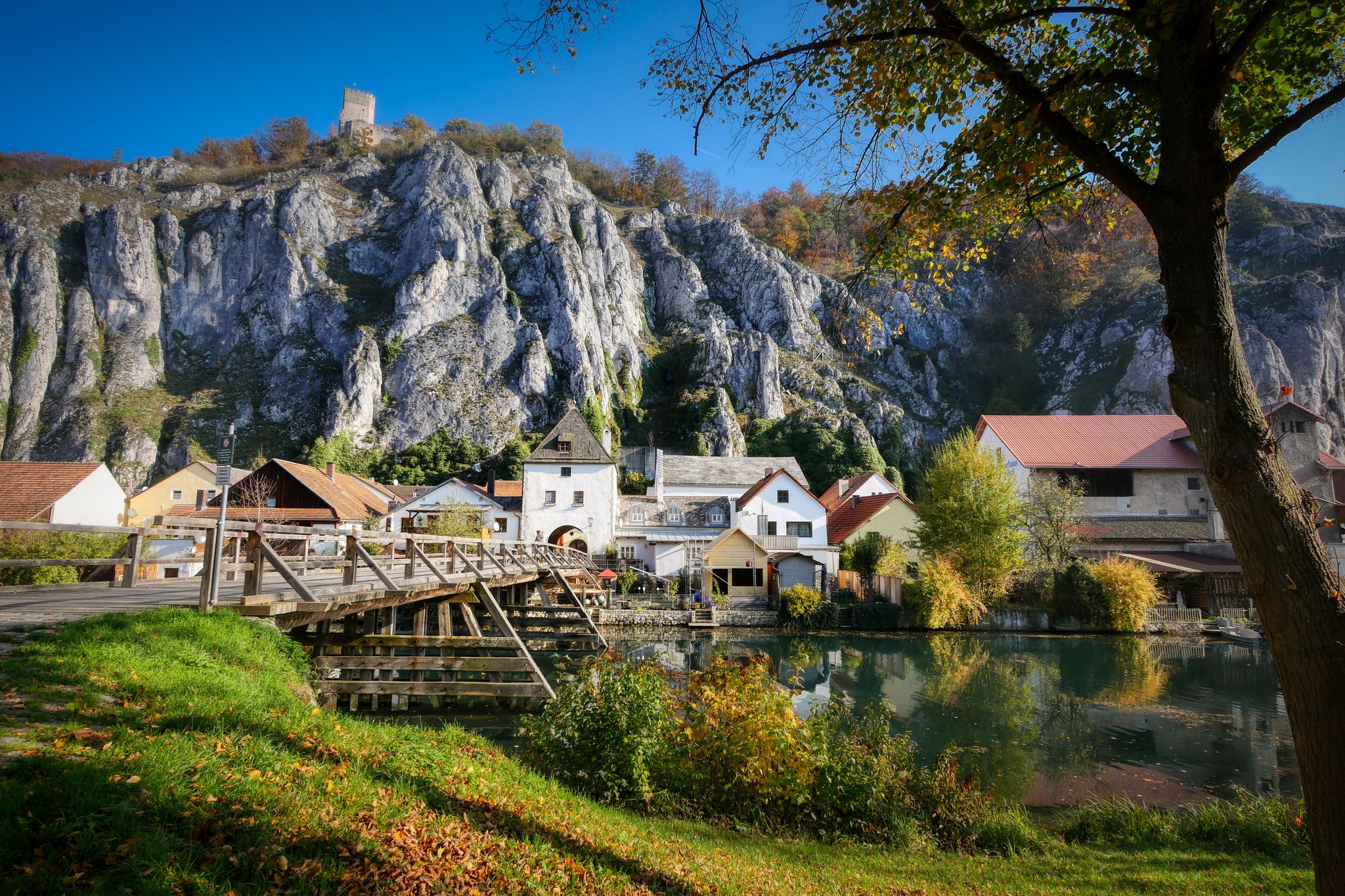
Picturesquely situated small artists' town on the Naab, the smallest cave dwelling in the rock can be seen directly above the main street. Stop at the outer market in the tiny restaurant "Zum Bürstenmacher" - main course "Bauchstecherla" (Schupfnudeln with various ingredients as desired), local beer daily from 11 a.m. to 8:30 p.m.
7
0

Since then, the new attraction has been standing just after the entrance to Schmidmühlen: a tree around 20 meters high, decorated with watering cans in bright colors. A total of around 250 of them hang from the branches. Mayor Peter Braun describes the tree as one of the most photographed motifs in Schmidmühlen. The tree is decorated every year before Easter - the watering cans then remain hanging until All Saints Day. However, to ensure that they can withstand heavy downpours, the building yard employees also had to take precautions. Among other things, the watering cans were drilled so that rainwater does not collect in them and the watering cans could become too heavy for the tree. Schmidmühlen's mayor Peter Braun simply calls this tree the "Kannenbaum". The name came about at an autumn festival organized by the Schmidmühlen senior citizens' group. The senior citizens there came up with something and turned the song "Oh Tannenbaum" into a humorous "Oh Kannenbaum" - a reference to the attraction at the entrance to the town. After the dreary winter - during Lent - the tree is decorated freshly every year. And in doing so it brings a bit of colour to the community - and perhaps currently to the whole time. https://www.otv.de/schmidmuehlen-giesskannenbaum-am-ortseingang-430939/
2
0
Frequently Asked Questions
How many traffic-free road cycling routes are available around Kallmünz?
There are over 50 dedicated traffic-free road cycling routes around Kallmünz, offering a wide range of distances and difficulties. These routes leverage the scenic river valleys and former railway lines to provide enjoyable rides away from car traffic.
Are there any easy, traffic-free road cycling routes suitable for beginners or families in Kallmünz?
Yes, Kallmünz offers several easy, traffic-free routes perfect for beginners or families. The Inn to the three crowns – Eichenberg Cliffs loop from Burglengenfeld is a great option, covering 22.5 km with minimal elevation gain. Many sections of the Naabtal-Radweg are also notably flat and asphalted, making them ideal for a relaxed ride.
What kind of scenery can I expect on the traffic-free road cycling routes in Kallmünz?
The routes in Kallmünz offer diverse and picturesque scenery. You'll cycle along tranquil river valleys, through dense forests, past striking rock formations, and gentle hills. The confluence of the Naab and Vils rivers provides unique landscapes, often with views of medieval towns and castles.
Are there any longer, more challenging traffic-free road cycling loops around Kallmünz?
For those seeking a longer, moderate challenge, the Kallmünz Stone Bridge – Eichenberg Cliffs loop from Kallmünz covers nearly 50 km with over 200 meters of elevation. Another option is the House without a Roof (Kallmünz) – Watering Can Tree Schmidmühlen loop from Burglengenfeld, which is almost 60 km long and features more significant climbs.
What are some notable landmarks or viewpoints along the traffic-free routes?
Many routes offer stunning views and pass by historical sites. The Kallmünz marketplace and the historic stone bridge are central attractions. You can also see the dramatic Kallmünz Castle Ruins perched above the town, offering panoramic views of the Naab Valley. The 'House Without a Roof' is another unique local curiosity.
What is the best time of year to enjoy traffic-free road cycling in Kallmünz?
The spring, summer, and early autumn months are generally the best for road cycling in Kallmünz. During these seasons, the weather is pleasant, and the natural landscapes are at their most vibrant. The paths are well-maintained and suitable for riding, offering a refreshing outdoor experience.
Are there places to stop for refreshments or food along the traffic-free cycling routes?
Yes, the region is known for its charming towns and villages, many of which feature traditional Bavarian beer gardens and cafes. Kallmünz itself has a historic town center with various options. Routes like the Vilstalradweg and Naabtal-Radweg often pass through places with opportunities for refreshment stops.
Can I find circular traffic-free road cycling routes around Kallmünz?
Absolutely. Many of the traffic-free routes around Kallmünz are designed as loops, allowing you to start and end in the same location. Examples include the Kallmünz Stone Bridge – House without a Roof (Kallmünz) loop from Kallmünz, which is an easy 40 km ride.
What do other road cyclists appreciate most about the traffic-free routes in Kallmünz?
The komoot community highly rates the road cycling experience in Kallmünz, with an average score of 4.6 stars. Reviewers often praise the peacefulness of the traffic-free paths, the beautiful river valley scenery, and the well-maintained surfaces that make for a smooth ride. The historical charm of Kallmünz itself is also frequently highlighted.
Are there any routes that follow old railway lines for a particularly smooth and flat ride?
Yes, parts of the Vilstalradweg and sections of the extensive Five Rivers Cycle Route utilize former railway lines. These paths are typically flat, well-surfaced, and offer a very smooth, traffic-free cycling experience through charming river valleys and past cultural highlights.
Where can I park my car when starting a traffic-free road cycling tour in Kallmünz?
Kallmünz, being a popular starting point for cyclists, offers various parking options within or near the town center. Look for designated public parking areas, especially close to the Naab and Vils rivers, which are convenient for accessing the main cycle paths.
Most popular attractions around Kallmünz

Get inspired with the komoot mobile app


Explore more
Browse the best Road cycling routes in other regions.
