The best traffic-free bike rides around Miltach
4.6
(294)
1,503
riders
25
rides
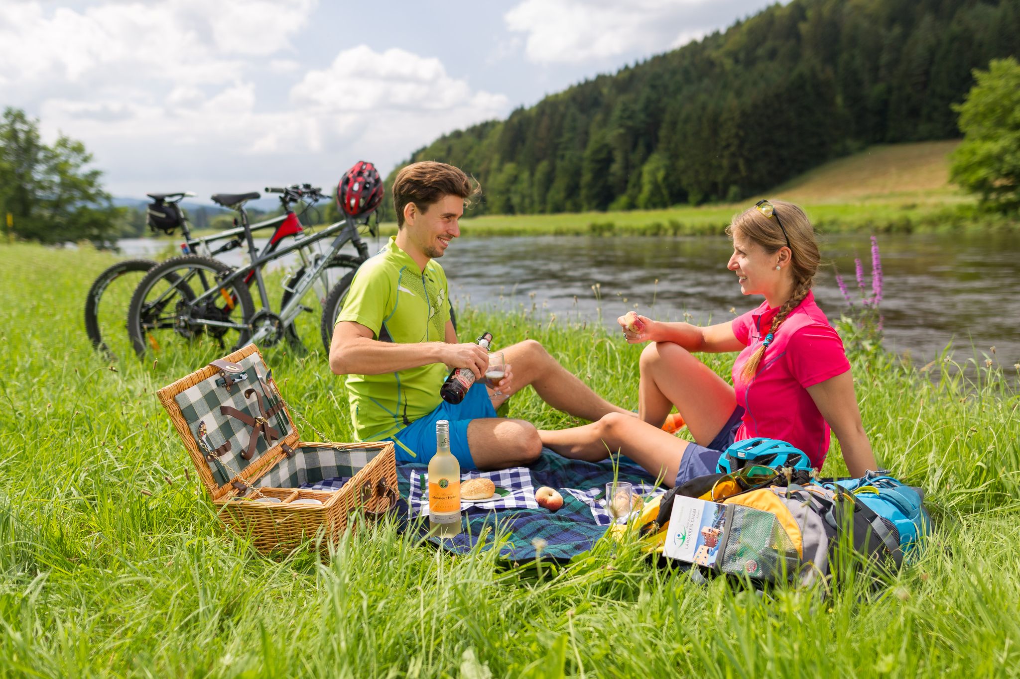
Miltach cycling routes low traffic are found within the Bavarian Forest nature park, characterized by a landscape of dense forests, rolling hills, and river valleys. The region features well-paved country roads, disused railway lines, and paths alongside the Regen river, providing varied terrain for touring cyclists. This area offers a network of routes suitable for exploring the natural beauty of the Bavarian Forest.
Best no traffic touring cycling routes around Miltach
- The most popular no traffic touring cycling route is Old Railway Bridge – Pullinger Lake and Dam loop from Miltach, a 12.8 miles (20.5 km) trail that takes 1 hour 15 minutes to complete. This easy route follows a disused railway line and passes by a picturesque lake.
- Another top favourite among local touring cyclists is Waffle Café in the Train Car – Bäckerwirt Inn on the Regen loop from Miltach, an easy 7.7 miles (12.4 km) path. This route offers gentle gradients along the Regen river.
- Local touring cyclists also love the Geodetic Observatory Wettzell – View of Schönau loop from Miltach, a 31.0 miles (49.9 km) trail leading through the Bavarian Forest with significant elevation gain, often completed in about 3 hours 39 minutes.
- Touring cycling around Miltach is defined by river-side paths, disused railway lines, and rolling hills of the Bavarian Forest. The network offers options for different ability levels, from easy loops to more challenging climbs.
- The routes in Miltach are highly rated by the komoot community with an average score of 4.6 stars from over 200 reviews. More than 1,400 touring cyclists have used komoot to explore Miltach's varied terrain.
Last updated: June 27, 2026
4.6
(29)
139
riders
Easy bike ride. Great for any fitness level. Mostly paved surfaces. Suitable for all skill levels.
5.0
(1)
26
riders
Easy bike ride. Great for any fitness level. Mostly paved surfaces. Suitable for all skill levels.

Sign up for free
3.0
(1)
13
riders
86.9km
06:25
1,490m
1,490m
Hard bike ride. Very good fitness required. Mostly paved surfaces. Suitable for all skill levels.
5.0
(1)
15
riders
46.1km
03:29
810m
810m
Hard bike ride. Very good fitness required. Mostly paved surfaces. Suitable for all skill levels.
5.0
(1)
25
riders
Easy bike ride. Great for any fitness level. Mostly paved surfaces. Suitable for all skill levels.
Get access to more routes and recommendations from other explorers.
Sign up for free
Already have an account?
Our route recommendations are based on thousands of hikes, rides, and runs completed by other people on komoot.
Start today with a free account
Your next adventure awaits.
Login or Signup

Other adventures around Miltach

Tips from the Community

There are not only delicious weapons👍 but also many other dishes and cakes🍰🍪🍩 and in the shop next door you can buy sweets 🍬🍭🧇of our own production
1
0

unfortunately I don't understand why several highlights need to be created for the same cycle path
0
0
the river is still relatively natural. Nothing has been artificially changed here. For some years now, the use with kayaks has also been regulated
0
0
The cycle path is very well passable with a gravel bike
0
0
beautiful cycle path that is very easy to ride with a gravel bike. Coming from Miltach, it stretches a bit to Konzell, but it's nothing serious
0
0
the large water wheel is clearly visible from the rain bridge
0
0
from the Donau-Regen-Radweg you have this view of the castle
0
0
The cycle path runs directly along the Regen river and therefore naturally has no significant climbs.
0
0
Frequently Asked Questions
How many traffic-free touring cycling routes are available around Miltach?
There are over 25 dedicated traffic-free touring cycling routes around Miltach, catering to various skill levels. You'll find 7 easy, 7 moderate, and 13 difficult routes to explore.
Are there family-friendly or beginner-level traffic-free cycling routes in Miltach?
Yes, Miltach offers several easy, traffic-free routes suitable for families and beginners. The Waffle Café in the Train Car – Bäckerwirt Inn on the Regen loop from Miltach is a gentle 12 km ride with minimal elevation, perfect for a relaxed outing. Another great option is the View of Altrandsberg Castle loop from Miltach, which is just under 10 km and also very easy.
Can I find circular traffic-free touring cycling routes in Miltach?
Many of the traffic-free routes around Miltach are designed as circular loops, allowing you to start and end in the same location. For example, the Old Railway Bridge – Pullinger Lake and Dam loop from Miltach is an easy 20 km circular route.
What kind of landscapes can I expect on traffic-free touring cycling routes in Miltach?
The routes around Miltach traverse diverse landscapes, including idyllic river meadows along the Regen river, enchanting forest sections within the Bavarian Forest nature park, and paths utilizing disused railway lines. You'll experience a mix of gentle river-side paths and well-paved country roads.
What can I see along the traffic-free touring cycling routes around Miltach?
Along the routes, you can discover various natural and historical attractions. Highlights include the striking Großer Pfahl rock formation, the scenic Lake Höllenstein, and the picturesque Lower Regen river. You might also pass by historical sites like Schloss Miltach or Schloss Altrandsberg.
Are there any routes with panoramic viewpoints?
Yes, for those willing to tackle more challenging ascents, routes can lead to summits offering magnificent panoramic views. While not all traffic-free routes reach these directly, you can find viewpoints like Cross rocks and Käsplatte Summit nearby, which provide expansive views of Bad Kötzting and the wider Bavarian Forest.
What is the best season for traffic-free touring cycling in Miltach?
The best season for touring cycling in Miltach is typically from spring through autumn (April to October). During these months, the weather is generally pleasant, and the natural landscapes are at their most vibrant. Winter cycling is possible but may require specific equipment due to colder temperatures and potential snow.
Are there options for advanced touring cyclists seeking a challenge?
Absolutely. For advanced cyclists, there are 13 difficult routes available. An example is the Geodetic Observatory Wettzell – View of Schönau loop from Miltach, which covers nearly 50 km with significant elevation gain, offering a demanding yet rewarding experience.
What do other touring cyclists enjoy most about cycling in Miltach?
The area is highly rated by the komoot community, with an average score of 4.59 stars. Reviewers often praise the quiet, traffic-free nature of the routes, the beautiful river and forest landscapes, and the variety of options available for different fitness levels.
Is public transport available to access the cycling routes in Miltach?
Miltach is strategically located, and the Regental Cycle Path, which passes through the town, is well-connected. While specific public transport options for route access vary, the region generally offers train and bus services that can facilitate reaching starting points, especially along major cycle paths like the Regental-Radweg. It's advisable to check local transport schedules for bike carriage options.
Where can I find parking for my car when starting a traffic-free touring cycle route in Miltach?
Miltach, as a hub for cycling, typically offers designated parking areas suitable for visitors. Look for public parking facilities within the town center or near major trailheads. Specific parking information is often available on local tourism websites or can be found on the komoot tour pages for individual routes.
Most popular attractions around Miltach

Get inspired with the komoot mobile app


Explore more
Browse the best Cycling routes in other regions.
