The best traffic-free bike rides around Pillig
4.6
(452)
6,245
riders
11
rides
No traffic road cycling routes around Pillig are situated within the diverse Eifel region, characterized by its varied natural landscapes and proximity to the Nette valley. The area features former railway lines converted into cycling paths, offering relatively flat and asphalted surfaces suitable for road cyclists. These routes often traverse gentle slopes and inclines, providing access to scenic views and historical points of interest. The region's terrain includes lush greenery and open stretches, with some routes connecting towards the wider Moselle valley.
Best no traffic road cycling routes around Pillig
- The most popular no traffic road cycling route is Old Ochtendung Station – Hansen Tunnel loop from Mertloch, a 27.5 miles (44.2 km) trail that takes 1 hour 56 minutes to complete. This route utilizes sections of the Maifeld Cycle Route, passing through tunnels and over a notable viaduct.
- Another top favourite among local road cyclists is Hausen-1 Tunnel – Hansen Tunnel loop from Kattenes, a difficult 57.0 miles (91.8 km) path. This longer route offers extensive exploration of the Eifel landscape, including multiple tunnels and varied terrain.
- Local road cyclists also love the Mertloch Water Playground – Eifel Rail Trail for Enjoyment loop from Polch, a 9.1 miles (14.6 km) trail leading through the Eifel Rail Trail, often completed in about 39 minutes.
- Road cycling around Pillig is defined by converted railway lines, the Nette valley, and the varied landscapes of the Eifel region. The network offers options for different ability levels, from shorter, flatter paths to longer, more challenging routes with greater elevation.
- The routes in Pillig are highly rated by the komoot community with an average score of 4.6 stars from over 400 reviews. More than 6,000 road cyclists have used komoot to explore Pillig's varied terrain.
Last updated: June 27, 2026
4.1
(28)
178
riders
44.2km
01:56
410m
410m
Moderate road ride. Good fitness required. Mostly well-paved surfaces and easy to ride.
5.0
(3)
39
riders
92.3km
04:17
1,080m
1,080m
Hard road ride. Very good fitness required. Some segments of this route may be unpaved and difficult to ride.

Sign up for free
13
riders
Moderate road ride. Great for any fitness level. Some segments of this route may be unpaved and difficult to ride.
5.0
(2)
11
riders
40.4km
02:01
390m
390m
Moderate road ride. Good fitness required. Mostly well-paved surfaces and easy to ride.
5.0
(1)
12
riders
20.9km
01:04
290m
290m
Moderate road ride. Great for any fitness level. Some segments of this route may be unpaved and difficult to ride.
Get access to more routes and recommendations from other explorers.
Sign up for free
Already have an account?
Our route recommendations are based on thousands of hikes, rides, and runs completed by other people on komoot.
Start today with a free account
Your next adventure awaits.
Login or Signup


Tips from the Community

There's always a cool breeze blowing here. But the tunnel is illuminated with LED lights all day long👍
1
0

A very nice wrought-iron signpost next to the shady bench.
1
0

The oldest part of Bürresheim Castle is the imposing keep, a 12th-century tower that clearly reflects the castle's defensive origins. Over time, the castle developed into a complex double complex, consisting of the so-called Cologne Castle and the Trier Castle, which underwent different construction and expansion phases. While the Cologne Castle formed the older part and primarily served economic purposes—leading to its eventual decline—the Trier Castle was transformed into a prestigious residential palace, which continues to shape the character of the entire complex to this day.
4
0

Nice barbecue area with picnic benches and toilet facilities.
11
0
The Streckenhäuschen restaurant in Mertloch is highly recommended. In summer, you can sit on the terrace and enjoy views of the bike path, playground, and barbecue area.
12
0

The castle belongs to the municipality of Sankt Johann in Rhineland-Palatinate and is located northwest of Mayen on a rocky outcrop at the confluence of the Nitzbach and Nette rivers. Along with Eltz Castle and Lissingen Castle, Bürresheim Castle is one of the few aristocratic residences in the Eifel region that was never conquered or destroyed, surviving unscathed both the wars of the 17th and 18th centuries and the social upheavals resulting from the French Revolution. Its history was largely shaped by its location on the border between the two ecclesiastical electorates of Cologne and Trier.
10
0

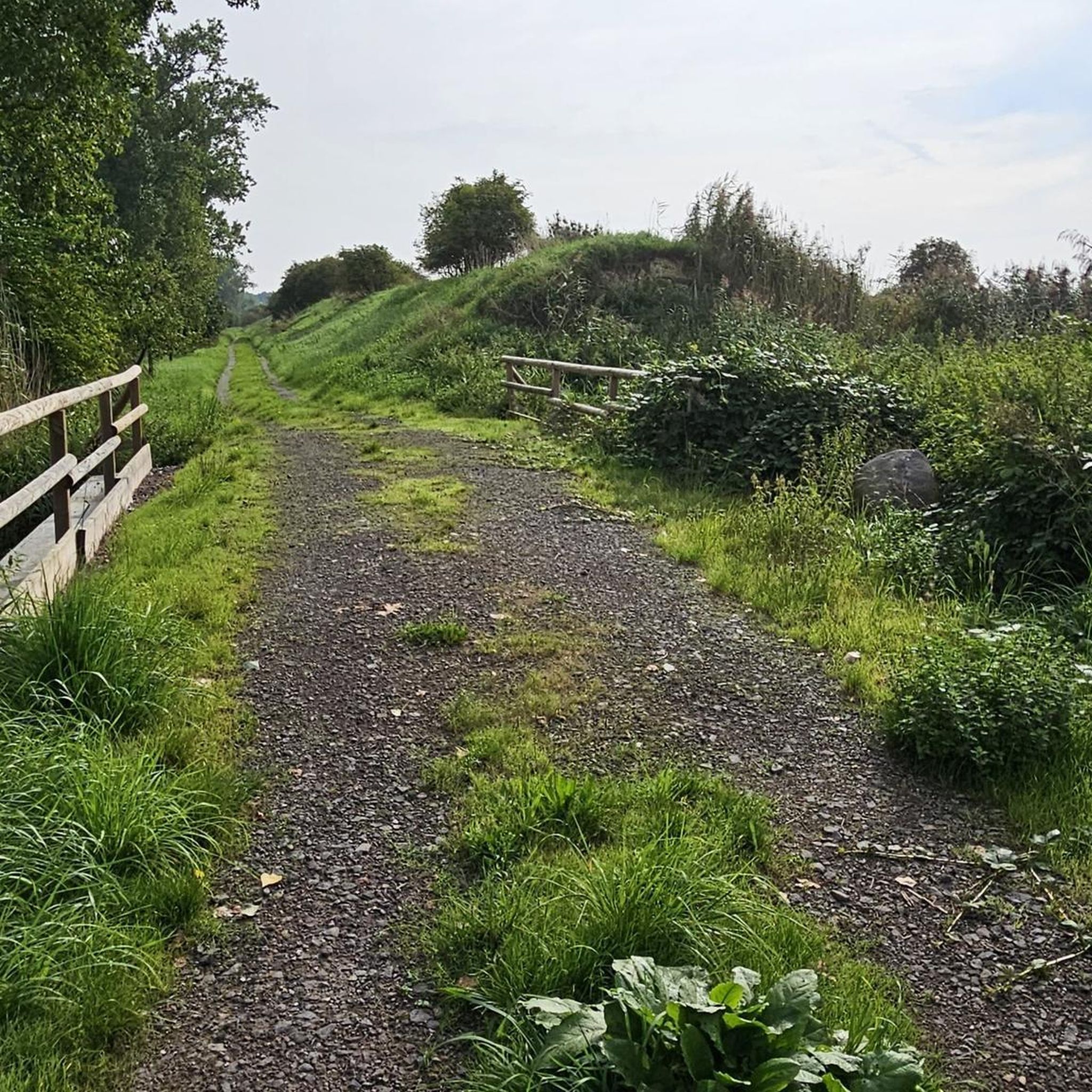
Nice back road. Rolls well. Very shady.
3
0
The tunnel was part of the Maifeld Railway, a branch line of the Eifelquerbahn (Eifel Cross Railway), which was closed in the 1980s. Today, the tunnel is integrated into the Maifeld Cycle Path, which runs along former railway lines in the Maifeld region. The tunnel is paved and illuminated, making it attractive for both cyclists and hikers.
55
0
Frequently Asked Questions
How many no-traffic road cycling routes are available around Pillig?
There are currently 11 dedicated no-traffic road cycling routes around Pillig listed in this guide. These routes offer a variety of distances and difficulty levels, ensuring there's something for every cyclist looking for a peaceful ride.
What makes the no-traffic road cycling routes around Pillig unique?
The routes around Pillig are special due to their focus on car-free paths, often utilizing former railway lines like the Maifeld Cycle Route. This means smooth, asphalted surfaces ideal for road bikes, combined with scenic landscapes of the Eifel and connections towards the Moselle. You can expect impressive features like a 40-meter-high natural stone viaduct and illuminated tunnels, providing a distinct cycling experience.
What scenic landmarks or natural features can I expect to see on no-traffic road cycling routes near Pillig?
Many routes offer stunning views and pass by notable attractions. You can cycle towards the iconic Eltz Castle, a well-preserved medieval fortress, or explore the picturesque Nette Valley. Some routes also feature unique elements of the Maifeld Cycle Route, such as art installations and the impressive viaduct. For natural beauty, consider routes that lead near the Eltzbach Valley or the Brodenbach Gorge with Waterfalls and Wooden Bridges.
Are there any easy, no-traffic road cycling routes suitable for beginners around Pillig?
Yes, there are 2 easy routes perfect for beginners or those seeking a relaxed ride. The Mertloch Water Playground – Eifel Rail Trail for Enjoyment loop from Polch is a great option, offering a relatively flat and shorter distance of just over 14 km with minimal elevation gain, making it very accessible.
Are there challenging no-traffic road cycling routes for experienced cyclists?
Yes, for experienced cyclists seeking a challenge, there is 1 difficult route available. The Hausen-1 Tunnel – Hansen Tunnel loop from Kattenes is a demanding 91.8 km ride with over 1000 meters of elevation gain, offering a significant workout while still enjoying car-free sections.
Are there circular no-traffic road cycling routes available?
Many of the no-traffic road cycling routes around Pillig are designed as loops, allowing you to start and end at the same point. For example, the Old Ochtendung Station – Hansen Tunnel loop from Mertloch offers a moderate 44 km circular ride, perfect for exploring the region without retracing your steps.
What is the best time of year for no-traffic road cycling near Pillig?
The best time for no-traffic road cycling near Pillig is generally from spring to autumn. During these seasons, the weather is most favorable, with pleasant temperatures and lush green landscapes. The Maifeld Cycle Route and other paths are well-maintained and enjoyable in these conditions. Always check the local weather forecast before heading out.
Are the no-traffic road cycling routes around Pillig suitable for families?
Absolutely! Many no-traffic routes, especially sections of the Maifeld Cycle Route, are ideal for families. They are typically flat, fully asphalted, and free from vehicle traffic, providing a safe and enjoyable environment. The Mertloch Water Playground – Eifel Rail Trail for Enjoyment loop from Polch even passes by a water playground in Mertloch, adding an extra fun stop for children.
What do other cyclists say about the no-traffic road cycling routes in Pillig?
The no-traffic road cycling routes around Pillig are highly regarded by the komoot community, with an average rating of 4.6 out of 5 stars from over 400 reviews. Cyclists often praise the smooth, car-free surfaces, the beautiful scenery of the Eifel region, and the well-maintained paths that make for a relaxing and enjoyable ride.
Where can I find parking for no-traffic road cycling routes near Pillig?
Parking is generally available at key access points along the major cycle routes. For routes connected to the Maifeld Cycle Route, you can often find parking in towns like Polch or Münstermaifeld, which serve as good starting points. Specific parking information for individual routes can usually be found on their respective komoot tour pages.
Can I combine road cycling with public transport in the Pillig region?
Yes, the region offers options to combine cycling with public transport, particularly for accessing the wider Moselle area. While specific details for Pillig itself might vary, the broader Moselle Cycle Route is known for its good connectivity with train services, allowing you to cover longer distances or return to your starting point. Some boat trips on the Moselle also allow bikes, offering a unique way to experience the landscape.
Are there any routes that connect to the famous Moselle Cycle Route?
While Pillig is in the Eifel, its region connects to the broader Moselle cycling network. Routes from the Maifeld can lead you towards the Moselle Valley, where you can then join the Moselle Cycle Route. This allows for extended tours along the river, past vineyards and charming villages, offering a different kind of scenic experience.
Most popular attractions around Pillig

Get inspired with the komoot mobile app


Explore more
Browse the best Road cycling routes in other regions.
