The best traffic-free bike rides around Dreggers
4.6
(260)
3,327
riders
96
rides
No traffic road cycling routes around Dreggers traverse a landscape characterized by rural roads, forest paths, and gentle rolling hills. The region features varied terrain suitable for road cycling, with routes often passing by small lakes and through open countryside. The elevation gains on these routes are generally moderate, with most climbs qualifying as hills rather than mountains.
Best no traffic road cycling routes around Dreggers
- The most popular no traffic road cycling route is Neversdorfer Forest Path – Green…
Last updated: May 15, 2026
4.3
(6)
37
riders
31.8km
01:21
130m
130m
Easy road ride. Great for any fitness level. Mostly well-paved surfaces and easy to ride.
4.8
(9)
17
riders
Easy road ride. Great for any fitness level. Mostly well-paved surfaces and easy to ride.

Sign up for free
14
riders
28.9km
01:16
180m
180m
Easy road ride. Great for any fitness level. Mostly well-paved surfaces and easy to ride.
11
riders
34.7km
01:27
190m
190m
Easy road ride. Great for any fitness level. Mostly well-paved surfaces and easy to ride.
7
riders
110km
04:29
430m
430m
Moderate road ride. Good fitness required. Some segments of this route may be unpaved and difficult to ride.
Get access to more routes and recommendations from other explorers.
Sign up for free
Already have an account?
Our route recommendations are based on thousands of hikes, rides, and runs completed by other people on komoot.
Start today with a free account
Your next adventure awaits.
Login or Signup
Popular around Dreggers
Tips from the Community

Very nice view and 2 small climbs
1
0

A wonderful descent towards Zarpen. It starts off rather gently and then becomes increasingly steeper. Certainly not easy, at least by northern German standards.
3
0

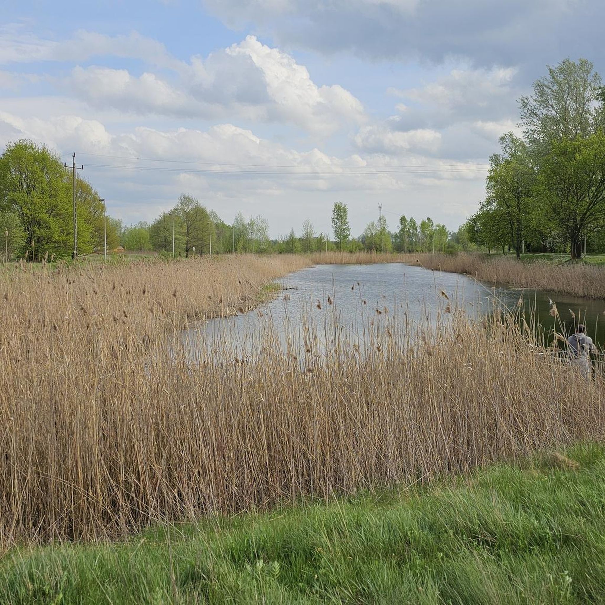
The Herrenteich Pond is located in the heart of the carp town of Reinfeld. It was artificially created in the 12th century by Cistercian monks as a reservoir for the Heilsau River for fish farming. Carp are still bred here today. A four-kilometer circular trail around the Lower Herrenteich invites you to discover this special ecosystem. 16 stations along the adventure trail offer fun and a nature experience in one, sharpening your awareness of the special features of this natural area. In summer, you can enjoy the cool water at the lido. See: https://tourismus-stormarn.de/de/naturerlebnis/herrenteich-reinfeld-5
2
0
The Herrenteich in Reinfeld is a popular tourist destination. The approximately 55-hectare body of water is divided into the upper and lower Herrenteich. The upper Herrenteich remains a recognized nature reserve. The lower Herrenteich is home to, among other things, a hiking trail and an outdoor pool in the summer. Due to melting snow, the Herrenteich flooded in early March 2010. A temporary dam erected at the time due to construction work threatened to no longer hold the water masses. A breach of the dam would have flooded the entire hinterland. The Hamburg/Lübeck railway embankment would also have been affected. See: https://www.thw-badoldesloe.de/aktuelles/aktuelle-meldungen/artikel/vor-10-jahren-hochwassereinsatz-am-herrenteich-fachgruppen-wasserschadenpumpen-verhindern-stauwe
2
1

Very nice, quiet route
0
0

... what you call a "mountain" ;-) ... definitely worth it!
0
0

Unfortunately, the now visible part of the Kalkberg is only a sad remnant of the once imposing hill, upon which once stood one of the few hilltop castles in Northern Germany. How different would the town's (tourist) development have been if there had been no intensive limestone mining and gypsum extraction, no Thingstätte (place of worship), and no Karl May Festival? A local historian and Hamburg's Hafencity University have undertaken a joint project on the Kalkberg and the Siegesburg castle on it, taking a virtual journey back in time to the era before both disappeared. A foretaste of the impressive result of this collaboration can be seen here: https://www.kreismuseum-segeberg.de/se1644/.
0
0

Frequently Asked Questions
How many no-traffic road cycling routes are available around Dreggers?
There are over 90 dedicated no-traffic road cycling routes around Dreggers, offering a wide variety of distances and difficulties to explore.
Are there easy, car-free road cycling routes suitable for beginners in Dreggers?
Yes, Dreggers offers a good selection of easy, car-free road cycling routes perfect for beginners. Nearly half of all available routes are classified as easy. For example, the Neversdorfer Forest Path – Green Tunnel to Klingberg loop from Neversdorf is an easy option covering about 31.7 km with minimal elevation.
What kind of landscapes or natural features can I expect to see on these no-traffic routes?
The no-traffic road cycling routes around Dreggers often lead through diverse landscapes. You can expect to encounter natural areas like the Brenner Moor Nature Reserve and enjoy views of bodies of water such as the Lakeside promenade at the Great Segeberg Lake. Many routes also utilize old railroad tracks converted into cycle paths, offering a unique cycling experience.
Are there any longer or more challenging no-traffic road cycling routes for experienced riders?
Yes, for more experienced riders seeking a longer challenge, there are moderate no-traffic road cycling routes available. The Duvenstedt–Wulksfelde Road loop from Wakendorf is a moderate route spanning over 109 km with significant elevation gain, providing a substantial ride without traffic.
Can I find circular no-traffic road cycling routes around Dreggers?
Many of the no-traffic road cycling routes in Dreggers are designed as loops, allowing you to start and finish at the same point. An example is the Sunset View of Bad Segeberg – View of Segeberger Kalkberg loop from Bühnsdorf, which offers a scenic circular ride.
What do other cyclists say about the no-traffic road cycling experience in Dreggers?
The no-traffic road cycling routes in Dreggers are highly rated by the komoot community, with an average score of 4.5 stars. Cyclists often praise the quiet roads and the opportunity to enjoy the scenery without vehicle interference.
Are there family-friendly no-traffic road cycling options in Dreggers?
Absolutely. Many of the easy and moderate no-traffic routes are suitable for families, especially those looking for a relaxed ride away from cars. Routes that follow old railway lines or pass through nature reserves are often ideal for a family outing. Always check the specific route details for suitability.
Where can I find viewpoints or interesting landmarks along the no-traffic routes?
Several routes offer opportunities to see interesting landmarks and viewpoints. You might pass by the Neverstaven Telecommunications Tower on Klingberg or cycle along sections of old railroad tracks that have been converted into scenic paths. Check the highlights section on individual route pages for specific points of interest.
What is the typical length and elevation gain for no-traffic road cycling routes in Dreggers?
The routes vary significantly. Easy routes, like the Reinfelder Berg – Herrenteich Reinfeld loop from Wakendorf, are around 28-35 km with elevation gains typically under 200 meters. Longer, moderate routes can extend over 100 km with elevation gains exceeding 400 meters.
Are there any unique or 'hidden gem' no-traffic road cycling routes worth exploring?
While all routes offer a traffic-free experience, the Stormarn Alps – Picnic Shelter at Bahrenhof loop from Altengörs is a great option. It's an easy route that takes you through pleasant landscapes, offering a peaceful ride and a chance to discover a picnic spot.
Most popular attractions around Dreggers

Get inspired with the komoot mobile app


Explore more
Browse the best Road cycling routes in other regions.
