The best hikes from bus stations around Mittenaar
4.6
(530)
1,651
hikers
68
hikes
Bus station hiking trails around Mittenaar offer access to a diverse landscape characterized by rolling hills, dense forests, and picturesque reservoirs. The region is home to the Hörre, a significant forest area with rich beech tree populations, and features the scenic Aartalsee and Breitenbachsee. Hikers can explore varied terrain, from developed forest paths to narrow trails, with routes often following the Dill River or traversing historical trade routes. The area provides a range of options suitable for various skill levels.
…Last updated: June 27, 2026
4.5
(10)
54
hikers
15.4km
03:58
80m
80m
Moderate hike. Good fitness required. Easily-accessible paths. Suitable for all skill levels.
4.5
(17)
27
hikers
9.15km
02:35
200m
200m
Moderate hike. Good fitness required. Easily-accessible paths. Suitable for all skill levels.

Sign up for free
5.0
(3)
23
hikers
28.7km
08:18
730m
730m
Hard hike. Very good fitness required. Easily-accessible paths. Suitable for all skill levels.
4.7
(6)
23
hikers
Moderate hike. Good fitness required. Easily-accessible paths. Suitable for all skill levels.
4.9
(8)
25
hikers
9.99km
02:51
230m
230m
Moderate hike. Good fitness required. Easily-accessible paths. Suitable for all skill levels.
Get access to more routes and recommendations from other explorers.
Sign up for free
Already have an account?
Our route recommendations are based on thousands of hikes, rides, and runs completed by other people on komoot.
Start today with a free account
Your next adventure awaits.
Login or Signup

Tips from the Community

Rest area with a great view of the lake. Animal lovers will also get their money's worth.
0
0

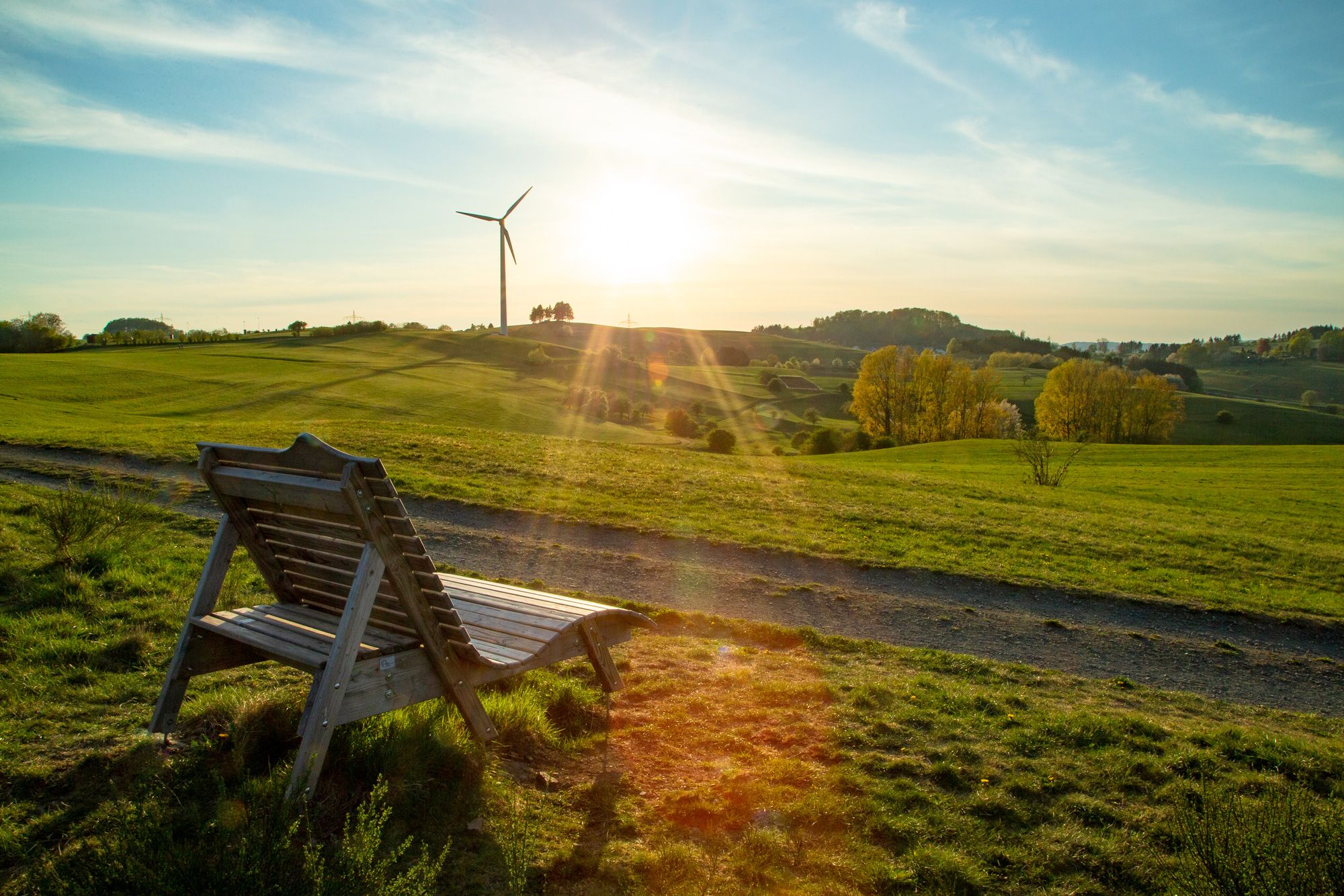
Beautifully prepared place with a bench and fresh spring water.
2
0
Beautifully prepared place with a bench and fresh spring water.
2
0
Funny bench, nothing else there, in the middle of the forest on the Jubiläumsweg.
1
0
The Aartal reservoir was created in the 1990s for flood protection. It is mainly divided into 2 parts, with the forebay serving as a nature reserve. Thus, a huge protected area has been created here for all birds that like to stay in and around the water. Especially since the lake has the second largest water surface in Hesse.
1
0
Beautifully situated, Niederweidbach directly on the opposite bank. An almost romantic view of the town can be seen from here.
2
0

Here you have a good view of the fore-dam of the Aartalsee - an official bird sanctuary.
1
0
Frequently Asked Questions
How many bus station hiking trails are available in Mittenaar?
There are nearly 70 hiking trails around Mittenaar that are easily accessible from bus stations. These routes offer a variety of experiences, from leisurely walks to more challenging treks through the region's diverse landscapes.
What types of terrain can I expect on bus-accessible hikes in Mittenaar?
Mittenaar's bus-accessible trails feature a mix of rolling hills, dense forests, and open fields. You'll find varied terrain, including developed forest paths and narrower trails, particularly within the significant Hörre forest area. Many routes also offer scenic views of valleys and picturesque lakes.
Are there easy hiking trails accessible by bus in Mittenaar?
Yes, approximately 31 of the bus-accessible routes in Mittenaar are considered easy, making them suitable for a relaxed outing. These trails often feature gentler ascents and well-maintained paths, perfect for a leisurely stroll.
What are some notable natural features or landmarks I can see on these hikes?
Many trails lead to or pass by significant natural features and landmarks. You can explore the dense forests of the Hörre, visit the picturesque Aartalsee Dam, or enjoy views from the Auf der Wade Observation Tower. The region also features the unique Wilhelmsteine Rock Formation and the tranquil Nesselhofer Ponds.
Are there any loop hikes that start and end near a bus station?
Yes, many of the bus-accessible routes are circular, allowing you to start and finish at the same point. For example, the Aartalsee Loop Trail offers views of Niederweidbach, while the Nesselhofer Ponds loop from Mittenaar explores local water features. Another option is the Rennweg Trail Rest Area loop from Mittenaar, which follows a historic trade route.
What is the best time of year to go hiking from bus stations in Mittenaar?
Spring and autumn are particularly beautiful seasons for hiking in Mittenaar. In spring, you'll witness numerous flowers in bloom, while autumn transforms the landscape with golden hues, creating a perfect setting for forest walks. The varied terrain and natural beauty are enjoyable throughout these seasons.
Are there family-friendly hiking options accessible by bus?
Yes, Mittenaar offers several family-friendly routes. The area around the Dill River, for instance, provides recreational opportunities including playgrounds and rest areas. Many of the easier, shorter loop trails are also well-suited for families with children.
Can I bring my dog on these bus-accessible hiking trails?
Most hiking trails in Mittenaar are dog-friendly, allowing you to enjoy the natural beauty with your canine companion. Always ensure your dog is on a leash where required, especially in nature reserves or near livestock, and remember to carry water and waste bags.
What do other hikers enjoy most about the bus-accessible trails in Mittenaar?
The komoot community highly rates the trails around Mittenaar, with an average score of 4.6 stars from over 480 ratings. Hikers often praise the diverse landscapes, the tranquility of the forests, and the well-maintained paths that make exploring the region accessible and enjoyable.
Are there any viewpoints along the bus-accessible hiking routes?
Yes, several routes offer excellent viewpoints. You can find panoramic vistas from the Auf der Wade Observation Tower or the Kornberg Viewpoint. The trail leading to the Kreuzhege bench also provides scenic views of the Gellerbach Valley.
What is the typical duration of a bus-accessible hike in Mittenaar?
The duration of hikes varies, but many popular routes range from 2 to 4 hours. For example, the Goith's Börnche loop from Mittenaar can be completed in about 2 hours, while longer trails like the Aartalsee Loop Trail might take around 4 hours and 15 minutes.
Most popular routes around Mittenaar
Most popular attractions around Mittenaar

Get inspired with the komoot mobile app


Explore more
Browse the best Hikes in other regions.
