The best family-friendly hikes and walks around Kreuzau
4.6
(5674)
19,217
hikers
347
hikes
Family friendly hiking trails around Kreuzau are found in a diverse landscape at the edge of the Eifel National Park, characterized by the Rur river valley and rolling hills. The region features impressive sandstone cliffs, such as those near the Hindenburg Gate, and the open heath of Drover Heide with its level trails and boardwalks. Hikers can explore varied terrain, from idyllic floodplains to forested areas and elevated viewpoints offering expansive countryside vistas.
Best family friendly hiking trails around Kreuzau
…Last updated: September 30, 2026
4.7
(563)
1,615
hikers
11.6km
03:01
80m
80m
Moderate hike. Good fitness required. Easily-accessible paths. Suitable for all skill levels.
4.7
(433)
1,278
hikers
14.9km
03:51
70m
70m
Moderate hike. Good fitness required. Easily-accessible paths. Suitable for all skill levels.

4.6
(318)
877
hikers
5.59km
01:29
50m
50m
Easy hike. Great for any fitness level. Easily-accessible paths. Suitable for all skill levels.
4.7
(242)
804
hikers
Moderate hike. Good fitness required. Mostly accessible paths. Sure-footedness required.
4.8
(246)
720
hikers
6.73km
01:54
150m
150m
Easy hike. Great for any fitness level. Easily-accessible paths. Suitable for all skill levels.
Get access to more routes and recommendations from other explorers.
Already have an account?
Our route recommendations are based on thousands of hikes, rides, and runs completed by other people on komoot.
Other adventures around Kreuzau

Tips from the Community

In wet times, certainly extremely helpful to get through the terrain with dry feet
0
0

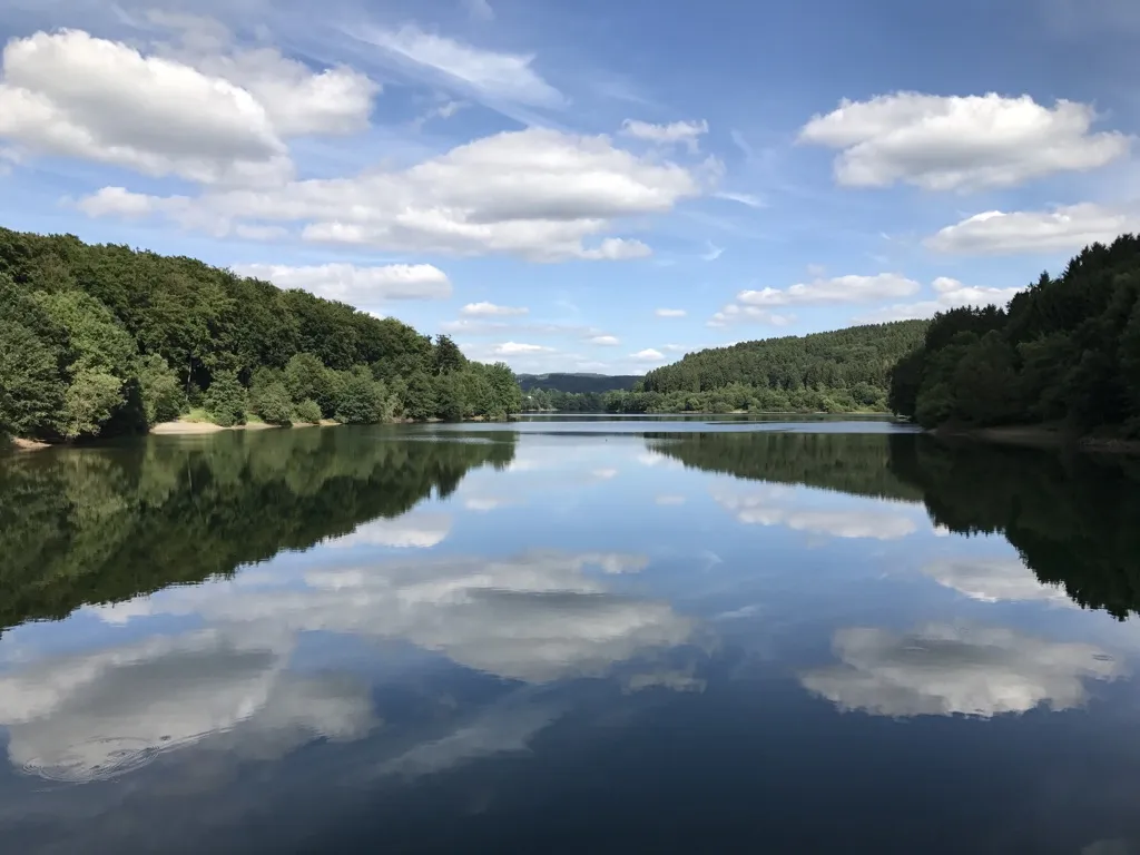
From here you have a fantastic view of the Obermaubach reservoir, surrounded by wooded slopes. The lake was created in the 1930s and holds approximately 1.65 million cubic meters of water. Here you can enjoy absolute peace and quiet.
0
0

A very communicative bank.
1
1

In the picturesque village of Zerkall, part of the municipality of Hürtgenwald in the Rureifel region (North Rhine-Westphalia), lies a pedestrian bridge over the Rur River, providing a charming and convenient connection for hikers and nature lovers exploring the Rur Valley. Often referred to on hiking trails as the Wanderer Bridge Over the Rur at Zerkall, this bridge is part of a network of paths and trails in the Eifel National Park and the adjacent Hohes Venn-Eifel Nature Park, where the river plays a significant role. This pedestrian bridge over the Rur provides a resting point and transition between the riverside trails. From the bridge, you have a beautiful view of the water, the banks, and the surrounding landscape, characterized by forests, meadows, and gently rolling hills. It's a place where you literally stand in the middle of the valley, with a view of the river below and often bird and aquatic life nearby. The bridge is located on a popular hiking trail that begins, among other places, at the National Park Information Point in Zerkall, an information point from which various hikes towards the Kall Valley, the RurUfer Trail, and the Rureifel cliffs begin. From this point, you can walk either towards the bridge or further into the valley, enjoying views of the river and the surrounding nature. Many hikers appreciate this pedestrian bridge not only for its function but also for the experience of the landscape and the connection with the river it offers. You can literally walk across the Rur without traffic, with space to pause for a moment to enjoy the babbling water or take photos of the Rur and its banks. The bridge also serves as a beautiful anchor point for hikes that follow the RurUfer Cycle Path or the Wilde Weg routes through the Kall Valley and the Rureifel. Combined with other trails and sights such as the sandstone cliffs, the Gut Kallerbend landscape, and the Rurtalbahn railway line, the bridge adds an extra dimension to your exploration of the region's nature and culture.
0
0
The Rur Valley Cycle Path (in German: RurUfer‑Radweg or RoerOever Fietspad) is one of the most beautiful long-distance cycling experiences in Belgium, Germany, and the Netherlands. This route follows the course of the Rur River (Roer in Dutch) for approximately 180 km, from its source in the High Fens (Belgium) through the Rureifel and Düren-Heinsberg region to its confluence with the Meuse River near Roermond. What makes this route so appealing is that you have the river almost constantly at your side, meandering through valleys past nature reserves and historic villages. The cycle paths run both directly along the river and on country roads that regularly offer views of the valley and its meanders. Along the way, you cross the Rur several times over bridges; some are simple cycle paths to the other side, others are old stone and metal structures with historic charm. These bridges serve as functional junctions for the cycle routes and viewpoints, offering beautiful views of the river's course and the surrounding landscape from various points. Rur Bridge and Other Crossings Along sections of the Rur Ufer Cycle Path, there are bridges where the path crosses the river, for example, bridges near villages or at characteristic transitions in the landscape. From these bridges, you often have panoramic views of the Rur Valley with its gentle valleys and wooded slopes, expansive meadows, and river arms in the Heinsberger Land region. And in some cases, the historic buildings close to the riverbanks (for example, around Wassenberg-Orsbeck). This viewpoint is an attractive resting point for cyclists and hikers who pause to enjoy the river's reflection in the water, the surrounding fields or meadows, and the horizon that extends beyond to villages, forests, or winding sections of the Rur Valley. On some connections, such as wooden or concrete bridges specifically built for the cycle path, you can literally stand right above the water and enjoy the view. This makes them natural photo and resting spots, where you can see the river meandering, hear the water lapping, and enjoy views of the typical German river landscape, much appreciated by cyclists who cycle the RurUfer Cycle Path.
1
0

The views from the south bank are particularly beautiful.
0
0

Beautiful scenery is everywhere here
0
0

It's best to hike the route when it's not too hot!
1
0
Frequently Asked Questions
How many family-friendly hiking trails are available around Kreuzau?
The Kreuzau region offers a fantastic selection of family-friendly hiking trails, with over 200 routes specifically categorized as easy or moderate. This ensures there's a suitable option for families with children of all ages and fitness levels.
What kind of terrain can we expect on family hikes in Kreuzau?
You'll find a diverse range of terrain suitable for families. Many trails feature level paths through open heathland, like those in the Drover Heath Nature Reserve, which are often suitable for prams. Other routes may include narrow forest paths, gentle ascents, and scenic riverside walks along the Rur. Some trails, particularly those leading to viewpoints, might have steeper sections but are generally manageable for active families.
Are there any circular routes suitable for families?
Yes, many of the family-friendly trails around Kreuzau are circular, making them convenient for day trips. For example, the Obermaubach Reservoir loop from Untermaubach-Schlagstein offers beautiful views and brings you back to your starting point.
What natural attractions can we see along the trails?
Kreuzau's trails are rich in natural beauty. You can explore the picturesque Rur River Valley, discover impressive Buntsandstein Cliffs, and visit the open heath of Drover Heide with its unique flora and fauna. The Obermaubach Reservoir is another highlight, offering stunning water views and even a fish ladder.
Are there any viewpoints with great scenery for families?
Absolutely! The region is known for its 'Eifelblicke' (Eifel viewpoints). The Obermaubach Reservoir loop offers the 'Engelsblick' with panoramic views over the reservoir. You can also find breathtaking vistas from trails traversing mountainous areas, where on clear days, you might even spot the Cologne Cathedral.
Can we bring our dog on these family hikes?
Many trails in the Kreuzau area are dog-friendly, allowing your furry family members to join the adventure. However, it's always recommended to keep dogs on a leash, especially in nature reserves like Drover Heide, to protect local wildlife and ensure a pleasant experience for all hikers. Always check local signage for specific rules.
What is the best time of year for family hikes in Kreuzau?
Kreuzau is beautiful year-round. Spring brings blooming wildflowers, summer offers lush green forests and pleasant temperatures for riverside walks, and autumn transforms the landscape with vibrant colors. Even in winter, a crisp, clear day can make for a magical hike. For families, late spring to early autumn generally provides the most comfortable weather conditions.
Are there any cafes or places to eat near the family hiking trails?
Yes, several villages and towns along the hiking routes, such as Obermaubach, offer cafes and restaurants where families can refuel. It's a good idea to check opening times in advance, especially if you're hiking in smaller communities or during off-peak seasons.
How long do family-friendly hikes typically take in Kreuzau?
The duration varies greatly depending on the route and your family's pace. Many easy trails can be completed within 1-2 hours, while moderate routes like the Drover Heath loop might take around 3-4 hours. You can find routes ranging from short strolls to half-day adventures, allowing you to choose based on your family's stamina.
Is public transport available to reach the trailheads?
Yes, the region's hiking areas are well-connected. The Rurtalbahn (Rur Valley Railway) provides convenient public transport options to reach various starting points for trails around Kreuzau, making it easy to access the outdoors without a car.
What do other hikers enjoy most about family-friendly trails in Kreuzau?
The komoot community highly rates the trails around Kreuzau, with an average score of 4.58 stars. Reviewers often praise the well-maintained paths, the diverse scenery ranging from river valleys to heathlands, and the peaceful atmosphere. The clear signage and variety of routes suitable for all ages are also frequently highlighted.
Most popular routes around Kreuzau
Most popular attractions around Kreuzau

Get inspired with the komoot mobile app


Explore more
Browse the best Hikes in other regions.
