The best hikes from bus stations around Sarstedt
4.5
(612)
3,630
hikers
95
hikes
Bus station hiking trails around Sarstedt offer access to diverse natural landscapes, characterized by riverine environments, tranquil lakes, and surrounding forests. The region features the River Leine and Innerste, providing water-rich paths through meadows. While generally flat, some routes include gentle ascents and descents, offering varied terrain for hikers.
Best bus station hiking trails around Sarstedt
- The most popular bus station hiking route is Koldingen Lakes – Koldinger See loop from Leineaue zwischen Ruthe und Koldingen, a moderate 7.7…
Last updated: June 27, 2026
4.2
(95)
269
hikers
Moderate hike. Good fitness required. Easily-accessible paths. Suitable for all skill levels.
4.8
(12)
61
hikers
7.25km
01:50
10m
20m
Easy hike. Great for any fitness level. Easily-accessible paths. Suitable for all skill levels.

Sign up for free
4.8
(13)
50
hikers
7.29km
01:55
70m
70m
Easy hike. Great for any fitness level. Easily-accessible paths. Suitable for all skill levels.
4.7
(49)
243
hikers
4.28km
01:05
10m
10m
Easy hike. Great for any fitness level. Easily-accessible paths. Suitable for all skill levels.
4.8
(22)
32
hikers
11.3km
02:52
30m
30m
Moderate hike. Good fitness required. Easily-accessible paths. Suitable for all skill levels.
Get access to more routes and recommendations from other explorers.
Sign up for free
Already have an account?
Our route recommendations are based on thousands of hikes, rides, and runs completed by other people on komoot.
Start today with a free account
Your next adventure awaits.
Login or Signup


Tips from the Community

Narrow paths lead past the Innerste weir. Very beautiful view to pause for a moment.
0
0

In earlier times, people crossed the Leine at this spot via a ford. Today, nothing of this remains, but the beautiful roofed hut invites you to take a break.
0
0
The path takes you between the Schliekum quarry lake and the Schliekum Pond. Wonderful!
0
0

It looks like an old gravestone.
0
0
The weir near Sarstedt is part of a historic mill. It serves to dam the Innerste River, thus influencing its course before it flows into the Leine.
1
0

An important piece of backup infrastructure for air traffic that enables positioning without GPS
0
0

Frequently Asked Questions
How many hiking trails are accessible directly from bus stations around Sarstedt?
There are over 90 hiking trails around Sarstedt that you can easily start from a bus station. These routes offer diverse experiences, from tranquil river walks to scenic lake loops.
What kind of terrain can I expect on bus-accessible hikes in Sarstedt?
The region around Sarstedt features diverse terrain. You'll find many routes along the River Leine and Innerste, offering generally flat and easy paths through meadows. Other trails, like those around the Koldingen Lakes, provide tranquil waterside walks. While Sarstedt is on the edge of the Harz Mountains, local routes tend to have gentle elevations, with some offering more dynamic terrain through forests and countryside.
Are there easy hiking options suitable for beginners or casual walkers?
Yes, Sarstedt is excellent for easy hikes. Many routes, particularly those along the riverbanks and around the lakes, are designed for leisurely strolls. For example, the Lakes Near Ahrbergen – Innerste Riverside Path loop from Sarstedt is an easy option, offering pleasant views with minimal elevation change.
Can I find family-friendly hiking trails accessible by bus in Sarstedt?
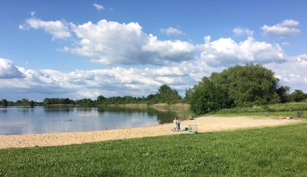
Absolutely! Many of the trails are suitable for families. The gentle paths along the Leine and Innerste rivers, as well as loops around lakes like the Giftener See, are perfect for all ages. These areas provide safe and enjoyable environments for a family outing in nature.
Are dogs allowed on the hiking trails around Sarstedt?
Yes, many trails around Sarstedt are dog-friendly, especially those through the natural landscapes like the Leine meadows and forest paths. Always remember to keep your dog on a leash where required and to clean up after them to ensure a pleasant experience for everyone.
Are there circular hiking routes that start and end at the same bus station?
Yes, many of the bus-accessible routes around Sarstedt are circular, allowing you to start and finish your hike at the same point. Examples include the Koldingen Lakes – Koldinger See loop and the Giftener Lake loop, which offer convenient round trips.
What natural features or landmarks can I see on these hikes?
The trails often lead through scenic riverine environments along the Leine and Innerste rivers, past tranquil lakes like the Koldingen Lakes and Giftener Lake, and through surrounding forests. You might also encounter interesting viewpoints such as the Kronsberg Viewpoint or the View from the Gallberg Nature Reserve, offering panoramic vistas of the landscape.
Are there any castles or historical sites near the bus station hiking trails?
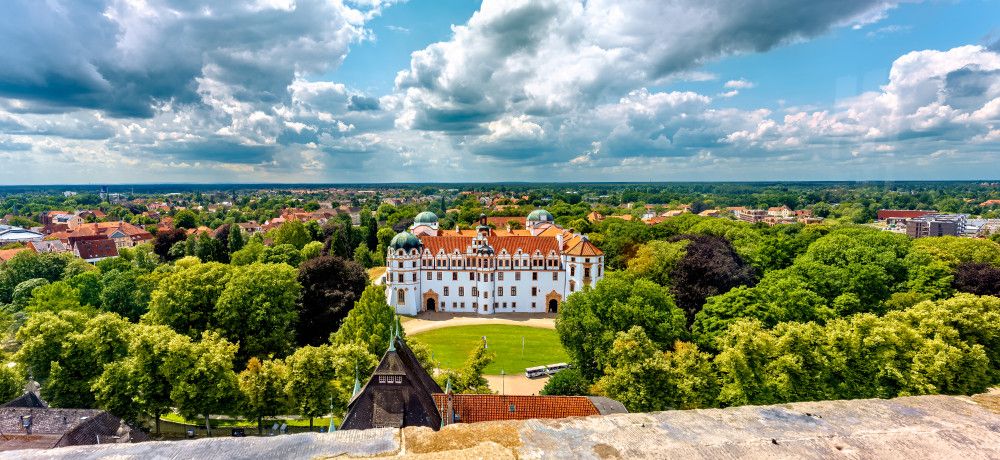
While the immediate trails focus on natural beauty, the broader region around Sarstedt is home to historical sites. You can find highlights like Marienburg Castle or the Rössing Moated Castle, which could be visited as part of a longer excursion or a separate trip after your hike.
What do other hikers enjoy most about hiking in Sarstedt?
The area is highly rated by the komoot community, with an average score of 4.5 stars. Reviewers often praise the peaceful river landscapes, the tranquil lake walks, and the accessibility of the trails from public transport, making it easy to connect with nature.
Are there any short hiking loops near Sarstedt bus stations?
Yes, there are several shorter loops perfect for a quick escape into nature. The Giftener Lake – View of Lake Giften loop is a great example, offering a pleasant walk of around 4 kilometers, easily accessible and ideal for a shorter outing.
When is the best time of year to hike around Sarstedt?
Sarstedt offers enjoyable hiking experiences throughout the year. Spring brings blooming meadows, summer provides lush greenery, and autumn transforms the forests with vibrant colors. Even in winter, the tranquil river and lake paths can be beautiful for a crisp walk, though some paths might be muddy or icy. Always check local conditions before heading out.
Most popular routes around Sarstedt
Most popular attractions around Sarstedt

Get inspired with the komoot mobile app


Explore more
Browse the best Hikes in other regions.
