The best hikes from bus stations around Ölbronn-Dürrn
4.5
(776)
3,094
hikers
33
hikes
Bus station hiking trails around Ölbronn-Dürrn traverse a landscape characterized by green, rolling hills at the transition between the Kraichgau and Stromberg regions. The area features numerous trails winding through forests and open fields, often following the picturesque Ölbronntal. This terrain offers varied experiences, from gentle paths to more undulating routes.
Best bus station hiking trails around Ölbronn-Dürrn
- The most popular bus station hiking route is Dürrn Fortified Church – Zigeunerwälder Forest Playground loop from GVV Neulingen, a 4.4…
Last updated: May 15, 2026
4.6
(5)
41
hikers
Easy hike. Great for any fitness level. Easily-accessible paths. Suitable for all skill levels.
4.6
(5)
27
hikers
6.77km
01:51
100m
100m
Easy hike. Great for any fitness level. Easily-accessible paths. Suitable for all skill levels.

Sign up for free
4.3
(8)
32
hikers
Moderate hike. Good fitness required. Easily-accessible paths. Suitable for all skill levels.
4.5
(2)
21
hikers
5.54km
01:29
70m
70m
Easy hike. Great for any fitness level. Easily-accessible paths. Suitable for all skill levels.
4.6
(21)
57
hikers
4.52km
01:15
80m
80m
Easy hike. Great for any fitness level. Easily-accessible paths. Suitable for all skill levels.
Get access to more routes and recommendations from other explorers.
Sign up for free
Already have an account?
Our route recommendations are based on thousands of hikes, rides, and runs completed by other people on komoot.
Start today with a free account
Your next adventure awaits.
Login or Signup



Other adventures around Ölbronn-Dürrn

Tips from the Community


The so-called "Hercules Stone" in front of Dürrn's town hall is the most impressive relic from the Roman period in Ölbronn-Dürrn. The intermediate piece of a Roman tomb with four depictions from the Hercules mythical cycle – in the image "Hercules strangling the Nemean lion" – was discovered in the 18th century in the Dallfingen field. The stone in front of the town hall is a replica; the original is on display in the Baden State Museum in Karlsruhe.
5
0
The former fortified church is a reminder that the people of Dürrn – like their neighbors in Ölbronn, for example – were repeatedly plagued by war and destruction. Residents could bring themselves and their belongings to safety in their shelters, known as "Gaden" (forts). The oldest parts of the listed church date back to the 15th century.
5
0
On the ascending path to Dürrn there is a good view of the Bauschlotter Au nature and landscape conservation area.
5
0

There are plenty of parking spaces along the street.
2
0

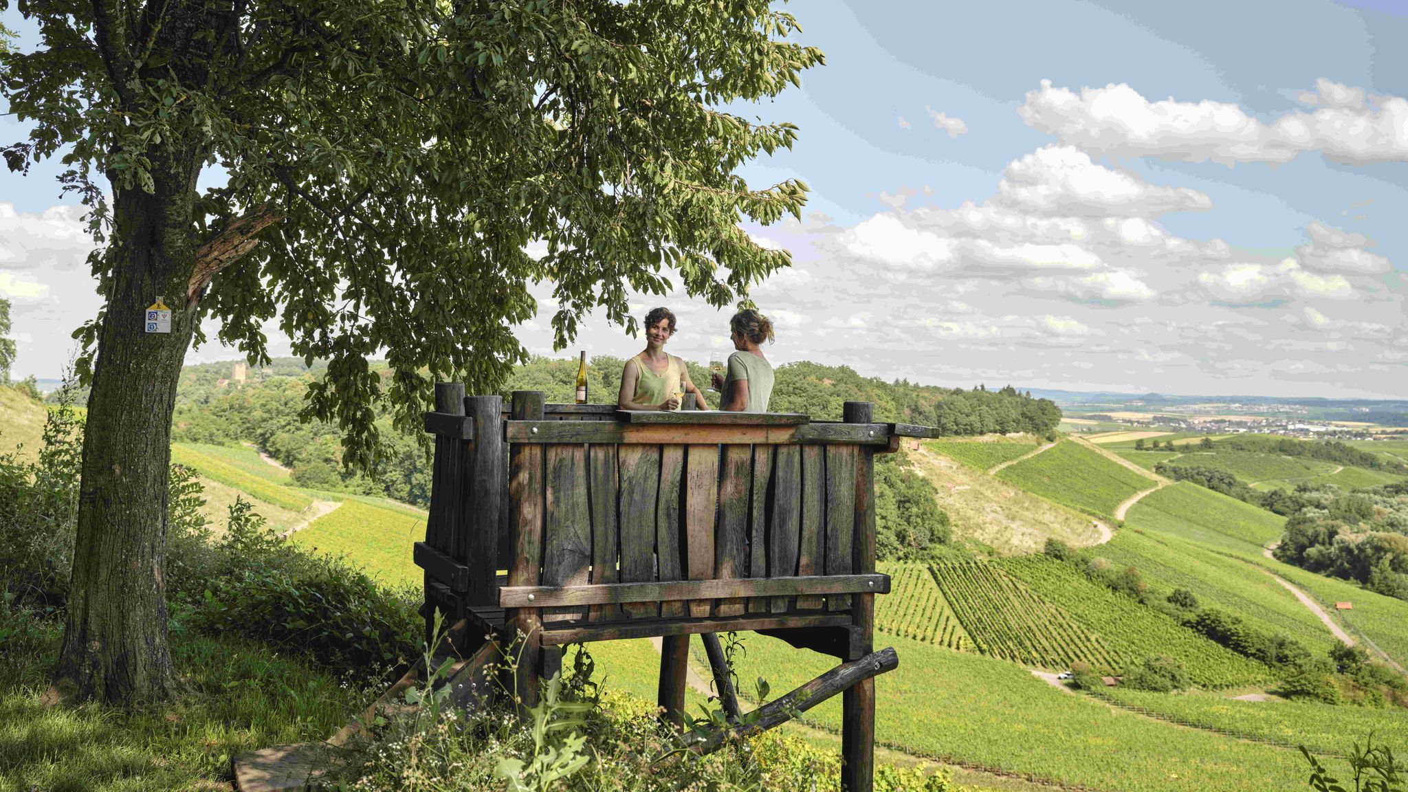
There is an old bench above the vineyard. The view is a bit overgrown but is still beautiful, especially in the winter months.
3
1
An originally designed bench with an integrated table. Located in the forest with no view, but a pleasant place to have a snack in the summer.
4
0
Frequently Asked Questions
How many bus station hiking trails are available in Ölbronn-Dürrn?
Ölbronn-Dürrn offers over 30 hiking trails that are easily accessible from bus stations. These routes cater to various fitness levels, with a majority being easy to moderate.
Are there easy bus station hikes suitable for beginners or families?
Yes, the region is ideal for beginners and families, with 23 easy routes starting directly from bus stops. A great option is the View of Eichelberg – View Towards Dürrn loop from Ölbronn-Dürrn, which is relatively short and offers pleasant scenery.
Can I find circular hiking routes starting from bus stops?
Absolutely. Many of the bus-accessible trails in Ölbronn-Dürrn are circular, allowing you to start and end your hike at the same bus stop. For example, the Dürrn Fortified Church – Zigeunerwälder Forest Playground loop from GVV Neulingen is a popular circular option.
What kind of natural landscapes can I expect to see on these bus-accessible trails?
The bus-accessible trails in Ölbronn-Dürrn traverse a diverse landscape of green, rolling hills, dense forests, and open fields. You'll experience the picturesque Ölbronntal and may encounter natural features like the Würm Valley or the unique Rock Gardens Mühlhausen.
Are there any historical or cultural attractions along the bus station hiking routes?
Yes, the region is rich in history. While hiking, you might encounter well-preserved half-timbered houses in village centers, historical markers like a Roman Hercules memorial stone, or ancient Celtic graves. The Historical boundary stone – Erlenbach Floodplain loop from GVV Neulingen is one route that highlights historical elements.
Are the bus station trails in Ölbronn-Dürrn dog-friendly?
Many trails in the Ölbronn-Dürrn area are suitable for dogs, especially those winding through forests and open fields. It's always recommended to keep dogs on a leash, particularly near wildlife or agricultural areas. Always check local regulations for specific nature reserves.
What are some recommended bus station hikes for a moderate challenge?
For a moderate challenge, consider routes that feature more varied terrain or slightly longer distances. The Historical boundary stone – Erlenbach Floodplain loop from GVV Neulingen is classified as moderate and offers a good balance of distance and elevation.
When is the best time of year to go hiking from bus stations in Ölbronn-Dürrn?
The region is beautiful year-round. Spring brings blooming fruit trees and vibrant colors, especially in areas like the Rock Gardens Mühlhausen. Summer offers pleasant walks through shaded woodlands and the cool Würm Valley. Autumn is spectacular with colorful vineyards and foliage. Even winter can be charming for a crisp walk, though some paths might be muddy.
Are there any bus station hikes that offer great viewpoints?
Yes, the hilly terrain of Ölbronn-Dürrn provides several excellent viewpoints. The Eichelberg, for instance, offers panoramic views and features a 'Hügel-Sofa' for relaxation. The View of Eichelberg – View Towards Dürrn loop from Ölbronn-Dürrn is a great choice for scenic vistas.
What do other hikers say about the bus station trails in Ölbronn-Dürrn?
The komoot community highly rates the bus station trails in Ölbronn-Dürrn, with an average score of 4.5 stars. Hikers often praise the well-maintained paths, the peaceful natural surroundings, and the convenience of public transport access to diverse routes.
Are there any bus station hikes that pass by lakes or water features?
Yes, you can find routes that incorporate water features. The idyllic West shore of Aalkistensee is a popular natural lake and nature reserve, offering tranquil spots. While not directly on a featured route here, the region's proximity to such sites means many trails are within easy reach of these natural beauties.
Can I find bus station hikes that are relatively short in duration?
Certainly. Many of the bus-accessible routes are designed for shorter excursions. For example, the View of the Bauschlotter Au – Dürrn Fortified Church loop from GVV Neulingen can be completed in under 1.5 hours, making it perfect for a quick nature escape.
Most popular routes around Ölbronn-Dürrn
Most popular attractions around Ölbronn-Dürrn

Get inspired with the komoot mobile app


Explore more
Browse the best Hikes in other regions.
