The best hikes from bus stations around St. Veit in Defereggen
4.7
(1750)
8,375
hikers
29
hikes
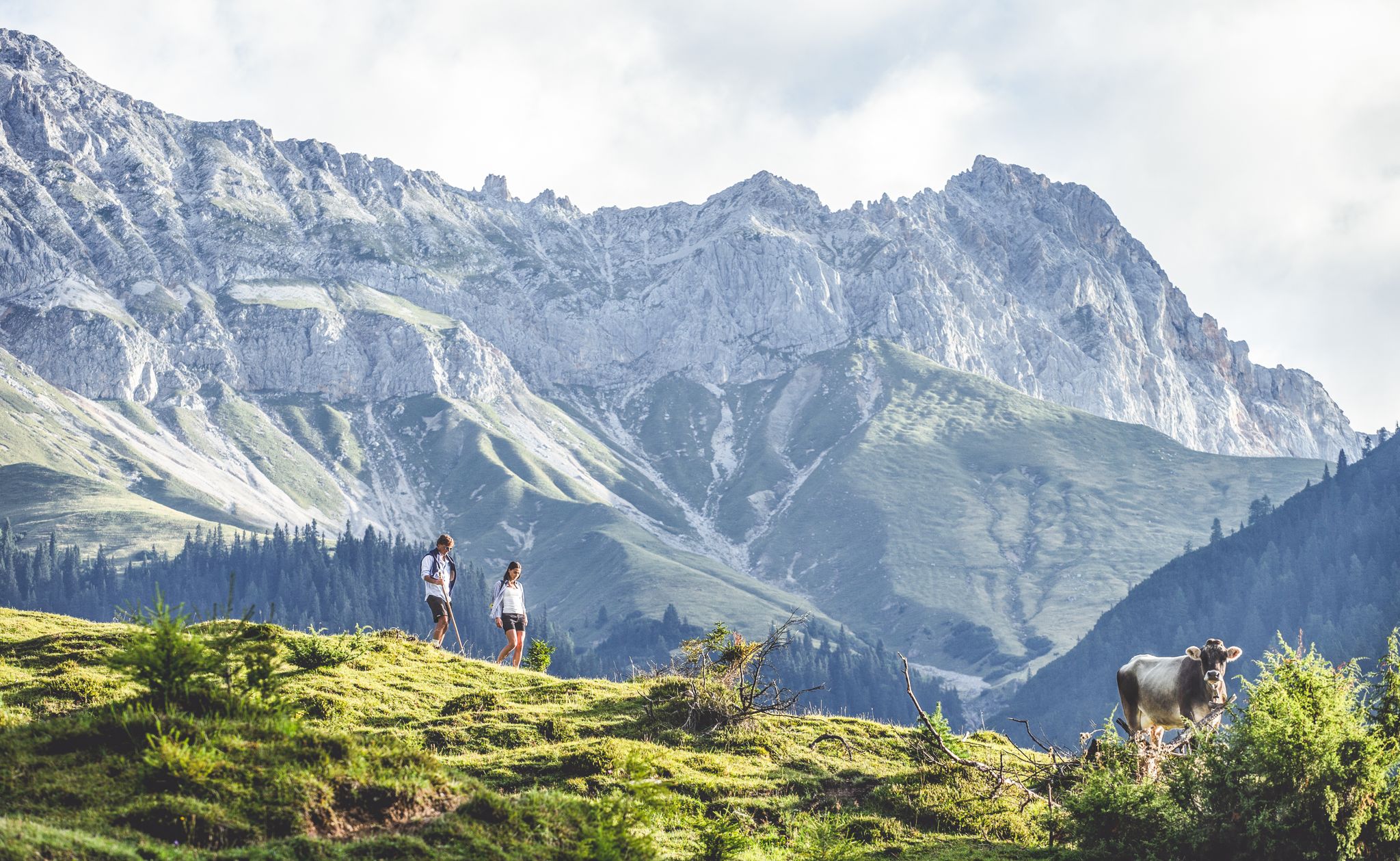
Bus station hiking trails around St. Veit in Defereggen are set within East Tyrol's Defereggental, a region characterized by alpine landscapes and abundant water features. The area includes high mountain lakes, waterfalls, mountain rivers like the Schwarzach, and glaciers, all within the Hohe Tauern National Park. The terrain varies from lush meadows to higher alpine environments, offering diverse hiking experiences. St. Veit in Defereggen is known for its unspoiled environment and high-altitude setting.
Best bus station hiking trails around St.…
Last updated: June 27, 2026
4.9
(34)
172
hikers
Hard hike. Good fitness required. Sure-footedness, sturdy shoes and alpine experience required.
4.6
(23)
131
hikers
9.59km
03:19
540m
540m
Moderate hike. Good fitness required. Easily-accessible paths. Suitable for all skill levels.

Sign up for free
4.6
(28)
92
hikers
11.2km
03:27
390m
390m
Moderate hike. Good fitness required. Easily-accessible paths. Suitable for all skill levels.
4.7
(41)
188
hikers
12.9km
04:31
600m
600m
Moderate hike. Good fitness required. Mostly accessible paths. Sure-footedness required.
4.4
(13)
51
hikers
8.15km
02:16
150m
150m
Moderate hike. Good fitness required. Easily-accessible paths. Suitable for all skill levels.
Get access to more routes and recommendations from other explorers.
Sign up for free
Already have an account?
Our route recommendations are based on thousands of hikes, rides, and runs completed by other people on komoot.
Start today with a free account
Your next adventure awaits.
Login or Signup
Popular around St. Veit in Defereggen
Other adventures around St. Veit in Defereggen

Tips from the Community

Beautiful mountain hut, friendly staff, easily reachable goal with a path through the woods in two hours. Or without poetry with a forest road.
1
0

Just try the different types of water, including the sulphurous one.
0
0

Great waterfall seen from the old mill. But if you want to take the climb to the viewing platform, you can expect an even more impressive view of the cascading water masses.
10
0
The Schwarzach is an approximately 42 km long river in East Tyrol. It rises in the Schwarzachtal at almost 2500 m. On its way to its mouth in the Isel it flows through the Defereggental. It is very relaxing to walk along the banks of this mountain river.
8
0
St. Jakob is a beautiful, quiet place in the Defereggental in East Tyrol. If you want to avoid the hustle and bustle of tourists, this is the right place for you. There are many opportunities for wonderful hikes or leisurely walks. Recovery is certain.
9
0
Together with the waterfall, the Stadtner Mühle is a worthwhile excursion destination. In summer you can watch the grain being ground.
8
0
The Ragötzbach is a beautiful mountain stream that flows into the Schwarzach just below the Stallerbach Falls
9
0
Nice rest area at the Rachbodenquelle on the way to the old mill.
8
0
Frequently Asked Questions
How many bus-accessible hiking trails are available in St. Veit in Defereggen?
There are over 25 hiking trails in St. Veit in Defereggen that are easily accessible from bus stations, offering a variety of experiences for all skill levels.
Are there any easy bus-accessible hikes suitable for beginners or families?
Yes, St. Veit in Defereggen offers several easy bus-accessible routes perfect for families or those seeking a gentle stroll. One such moderate option is the Schwarzach River – Parish Church in St. Jakob loop from Defereggental, which follows the scenic Schwarzach River.
Can I find circular hiking routes starting from bus stations?
Absolutely. Many of the bus-accessible trails in the region are designed as circular routes, allowing you to start and end at the same bus stop without retracing your steps. An example is the Speikboden Hut – Speikboden Summit Cross loop from St. Veit in Defereggen, which offers stunning views.
What kind of natural features or landmarks can I expect to see on these bus-accessible trails?
The bus-accessible trails in St. Veit in Defereggen are rich in natural beauty. You can encounter crystal-clear high mountain lakes like Zupalseehütte (near Zupalsee) and Bergersee Hut (near Bergersee), impressive waterfalls such as the Zotten Waterfall, and picturesque alpine villages like the Bruggeralm. The region is part of the Hohe Tauern National Park, ensuring pristine alpine landscapes.
Are there any trails that feature waterfalls or significant water bodies?
Yes, the Defereggental is known for its 'water treasures.' You can explore trails that lead past numerous waterfalls, mountain rivers like the Schwarzach, and high mountain lakes. The Boardwalk Through the Wetlands – Stadtner Mühle and Waterfall loop from Defereggental is a great option to experience these features.
Are dogs allowed on the bus-accessible hiking trails in St. Veit in Defereggen?
Generally, dogs are welcome on hiking trails in St. Veit in Defereggen, especially within the Hohe Tauern National Park, provided they are kept on a leash. Always ensure you carry water for your dog and clean up after them. Specific bus regulations for pets should be checked with the local transport provider.
What is the best time of year to hike from bus stations in St. Veit in Defereggen?
The best time for hiking from bus stations in St. Veit in Defereggen is typically from late spring to early autumn, once the snow has melted and the alpine meadows are lush. This period offers pleasant temperatures and full accessibility to the trails. Winter also offers opportunities for snowshoeing, but trail conditions will vary.
Are there any alpine huts or places to stop for refreshments along these routes?
Many bus-accessible routes in St. Veit in Defereggen feature cozy alpine huts where you can stop for refreshments and traditional Tyrolean cuisine. Notable huts include the Zupalseehütte, the Bruggeralm, and the Bergersee Hut, which often serve as popular stopovers or starting points for further excursions.
Do I need any special permits to hike in the Hohe Tauern National Park area from a bus station?
For general hiking on marked trails within the Hohe Tauern National Park, no special permits are usually required. However, if you plan to undertake specific activities like guided tours into core zones or certain mountaineering expeditions, it's advisable to check with the National Park administration for any specific regulations or permits.
What do other hikers say about the bus-accessible trails in St. Veit in Defereggen?
The bus-accessible trails in St. Veit in Defereggen are highly rated by the komoot community, with an average score of 4.65 stars. Reviewers often praise the stunning alpine landscapes, the pristine nature of the Defereggental, and the convenience of accessing beautiful routes via public transport.
Are there any challenging bus-accessible hikes for experienced hikers?
Yes, for experienced hikers seeking a challenge, there are several difficult bus-accessible routes. The Boardwalk Through the Wetlands – Stadtner Mühle and Waterfall loop from Defereggental, for example, is rated as difficult and offers a longer, more demanding experience with significant elevation changes.
How can I find bus schedules for reaching these trailheads?
Information on local bus routes and schedules for reaching trailheads in St. Veit in Defereggen and the wider Defereggental can typically be found on the official websites of the regional public transport providers or the local tourism office. The Osttirol Card often includes public transport, which can be a convenient option.
Are there any educational or themed trails accessible by bus?
Yes, the region offers informative trails. The 'Life on the steep slope' nature and culture trail, starting from Bruggen, provides insights into mountain farming and local history. Another informative trail can be found in the picturesque 'Gassen' settlement, both offering a deeper understanding of the area's heritage.
Most popular routes around St. Veit in Defereggen
Most popular attractions around St. Veit in Defereggen

Get inspired with the komoot mobile app


Explore more
Browse the best Hikes in other regions.
