The best hikes from bus stations around Weitersfelden
4.6
(2034)
10,879
hikers
13
hikes
Bus station hiking trails around Weitersfelden are situated in the Mühlviertel region of Austria, characterized by rolling hills and dense forests. The landscape features river valleys, such as those formed by the Black and White Aist rivers, and varied elevations. Hikers can expect a mix of open meadows, wooded paths, and some more challenging ascents. The area offers diverse terrain suitable for various hiking preferences.
Best bus station hiking trails around Weitersfelden
- The most popular bus station hiking route is…
Last updated: September 30, 2026
5.0
(10)
48
hikers
Moderate hike. Good fitness required. Easily-accessible paths. Suitable for all skill levels.
4.3
(3)
22
hikers
10.8km
03:06
260m
260m
Moderate hike. Good fitness required. Easily-accessible paths. Suitable for all skill levels.

4.3
(3)
13
hikers
Moderate hike. Good fitness required. Easily-accessible paths. Suitable for all skill levels.
5.0
(3)
21
hikers
11.0km
03:07
240m
240m
Moderate hike. Good fitness required. Easily-accessible paths. Suitable for all skill levels.
3.0
(2)
22
hikers
5.99km
01:43
140m
140m
Easy hike. Great for any fitness level. Easily-accessible paths. Suitable for all skill levels.
Get access to more routes and recommendations from other explorers.
Already have an account?
Our route recommendations are based on thousands of hikes, rides, and runs completed by other people on komoot.
Start today with a free account
Your next adventure awaits.
Popular around Weitersfelden
Other adventures around Weitersfelden

Tips from the Community

You shouldn't miss this place, fruit garden, distillery, organic products and lovely rest areas
0
0

From the plateau, there's a beautiful view of the west side—mostly nature, with a few houses/settlements. The "bridges" over the cracks between the rocks are sturdy, but don't trust the wooden railing.
0
0
Signposts along the road point to this granite group—yes, the wind whistles through the holes between the rocks. There's no obvious path leading up—the sign also says "View to..." 😎
0
0

and schnapps at the Thauerböcks
0
0


Great view!! A great place to enjoy everything
0
0
Great little summit cross - the view is great!!
0
0

Frequently Asked Questions
How many hiking trails accessible by bus are available around Weitersfelden?
There are 14 diverse hiking trails around Weitersfelden that are easily accessible from bus stations. These routes offer a range of experiences, from moderate walks to more challenging treks through the picturesque Mühlviertel region.
Are there any easy or beginner-friendly hikes from bus stops in Weitersfelden?
Yes, Weitersfelden offers several easier routes accessible by bus. For instance, the region features trails like the Weitersfelden Town Center – Stone Chapel near Wienau loop, which is a moderate 10.8 km walk, perfect for those looking for a less strenuous option while still enjoying the scenery.
What kind of natural attractions can I expect to see along these bus-accessible hiking routes?
The trails around Weitersfelden offer a variety of natural sights. You might encounter unique rock formations like the Herrgottssitz Rock Formation or the Herzogreitherfelsen. The region is also known for its serene bodies of water, such as the Rubner Pond in the Tannermoor, and the unique 'Zwischenstromwies'n' where the Black and White Aist rivers merge.
Are there any circular hiking routes starting from bus stations in Weitersfelden?
Many of the bus-accessible routes in Weitersfelden are designed as circular walks, allowing you to return to your starting point without needing additional transport. An example is the Rehberg Summit Viewpoint – Windlochstein loop from Freudenthal b.Weitersfelden Landesstraße, which offers a rewarding 12.9 km circular experience.
Can I find hikes with viewpoints accessible by bus in this area?
Absolutely. The Weitersfelden region, nestled at the foot of the Königswarte, offers numerous trails leading to scenic viewpoints. The Kammererkreuz Chapel – Mountain Chapel “Kammerer Cross” loop, for instance, provides elevated perspectives of the surrounding landscape, including the Kammererberg, the highest point of the Johannesweg.
What is the best time of year to go hiking from bus stations in Weitersfelden?
The Mühlviertel region around Weitersfelden is beautiful throughout the year. Spring and autumn offer pleasant temperatures and vibrant colors, while summer provides lush green landscapes. Even winter can be enchanting for snowshoeing or crisp walks, though some trails might require appropriate gear.
Are there any family-friendly hiking options accessible by bus around Weitersfelden?
While specific 'family-friendly' designations vary, many of the moderate routes are suitable for families with older children. The region's diverse trails, including themed paths like the 'Wollness Trail' (a 12 km circular route focused on sheep's wool), offer engaging experiences for all ages, often with opportunities to spot local wildlife.
What do other hikers enjoy most about the bus-accessible trails in Weitersfelden?
The komoot community highly rates the hiking experiences around Weitersfelden, with an average score of 4.6 stars. Hikers often praise the well-maintained trails, the diverse landscapes ranging from rolling hills to forests, and the peaceful atmosphere. The accessibility via public transport is also a significant plus for many.
Are there any historical or religious landmarks to see on these bus-accessible hikes?
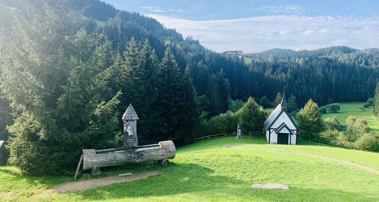
Yes, the region is dotted with charming chapels and historical sites. You can visit the Johannesbrunnen and Engelskapelle in Pierbach, or the Mountain Chapel “Kammerer Cross” – Ursprung Chapel loop, which connects two significant religious sites. The 'Mystical Legend Trail' near Liebenau also leads to ancient cult sites and cup-marked stones.
Can I find routes that include stops at huts or places for refreshments?
Many trails in the Mühlviertel region pass by traditional inns or huts where you can enjoy regional delicacies. While specific pub stops aren't listed for every bus-accessible route, you might find options like the Braunberg Hut or the 'Wollstub'n' along the 'Wollness Trail', offering a chance to rest and refuel.
Are there any longer, more challenging bus-accessible hikes for experienced trekkers?
For experienced hikers, Weitersfelden offers more demanding routes. The Mountain Chapel “Kammerer Cross” – Ursprung Chapel loop from Weitersfelden is a challenging 19.7 km hike with significant elevation gain, providing a rewarding experience for those seeking a longer adventure.
Most popular routes around Weitersfelden
Most popular attractions around Weitersfelden

Get inspired with the komoot mobile app


Explore more
Browse the best Hikes in other regions.
