The best hikes from bus stations around Großgmain
4.5
(1182)
9,730
hikers
55
hikes
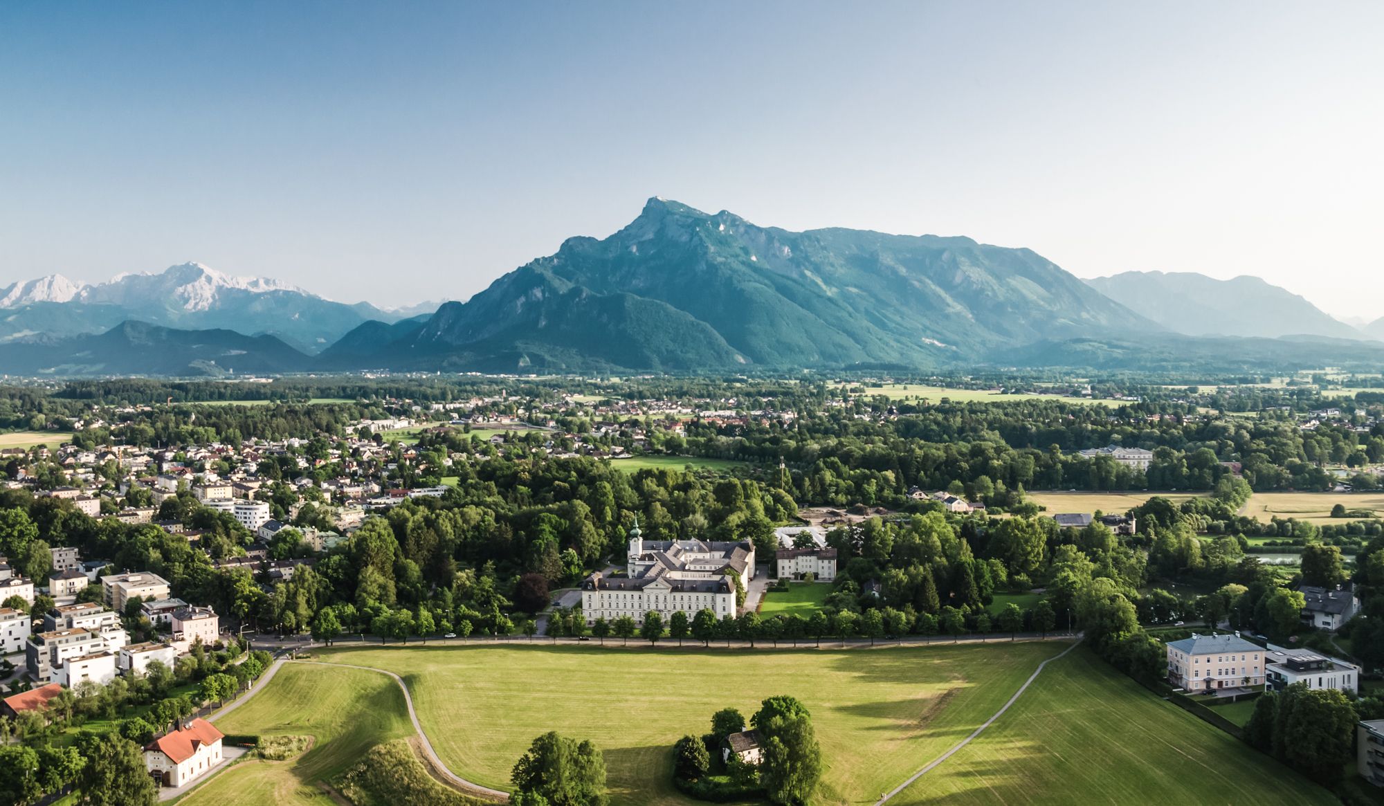
Hiking around Großgmain, an idyllic town in the Salzburg-Umgebung district of Austria, offers diverse bus station hiking trails. The region is characterized by its location at the foot of the Untersberg mountain, featuring green forests, undulating plateaus, and rocky areas. Numerous streams and natural features contribute to varied landscapes, providing panoramic views of the Salzburger Land.
Best bus station hiking trails around Großgmain
- The most popular bus station hiking route is Pilgrimage Church of Großgmain – Kirchholz Trail loop from Großgmain, a 5.0 miles (8.0 km) moderate trail that takes 2 hours 15 minutes to complete. This route explores the area around the historic Pilgrimage Church and through the Kirchholz forest.
- Another top favourite among local hikers is View of the Sleeping Witch – Wayside Crucifix loop from Großgmain, an easy 2.4 miles (3.8 km) path. This trail offers views towards the "Sleeping Witch" rock formation and passes a traditional wayside crucifix.
- Local hikers also love the Historic Hop Field – Lumberjack Cabin loop from Marzoll, a 2.3 miles (3.7 km) trail leading through historic agricultural areas and past a lumberjack cabin, often completed in about 1 hour.
- Hiking around Großgmain is defined by the majestic Untersberg mountain, green forests, and picturesque streams, with a network of trails offering options for various ability levels.
- The routes in Großgmain are highly rated by the komoot community with an average score of 4.5 stars from more than 1000 reviews. More than 9000 hikers have used komoot to explore Großgmain's varied terrain.
Last updated: July 10, 2026
4.7
(11)
51
hikers
7.84km
02:12
150m
150m
Moderate hike. Good fitness required. Easily-accessible paths. Suitable for all skill levels.
4.1
(14)
85
hikers
3.83km
01:02
50m
50m
Easy hike. Great for any fitness level. Easily-accessible paths. Suitable for all skill levels.

Sign up for free
4.7
(3)
61
hikers
3.44km
00:57
60m
60m
Easy hike. Great for any fitness level. Easily-accessible paths. Suitable for all skill levels.
4.0
(7)
48
hikers
Moderate hike. Good fitness required. Mostly accessible paths. Sure-footedness required.
4.8
(15)
94
hikers
9.83km
03:02
220m
220m
Moderate hike. Good fitness required. Mostly accessible paths. Sure-footedness required.
Get access to more routes and recommendations from other explorers.
Sign up for free
Already have an account?
Our route recommendations are based on thousands of hikes, rides, and runs completed by other people on komoot.
Start today with a free account
Your next adventure awaits.
Login or Signup


Tips from the Community

Idyllic place, great photo opportunity
0
0


A beautiful church with a great interior
5
0

well-developed cycle path with views of the surrounding mountains
0
0

Great view of Großgmain and the surrounding mountains
0
0

Unfortunately, access is blocked due to renovation work
0
0
Frequently Asked Questions
How many bus station hiking trails are available in Großgmain?
There are over 50 bus-accessible hiking trails around Großgmain, offering a wide range of options for all skill levels. You'll find everything from easy strolls to more moderate excursions, all conveniently reachable by public transport.
Are there easy bus-accessible hikes suitable for beginners or families in Großgmain?
Yes, Großgmain offers many easy bus-accessible trails perfect for beginners and families. For a gentle walk with scenic views, consider the View of the Sleeping Witch – Wayside Crucifix loop from Großgmain, which is just under 4 km. Another family-friendly option is the Wetterkreuz on Reiterweg – Randersberg Trail loop from Großgmain, a pleasant 3.4 km route.
Can I find circular routes starting from bus stations in Großgmain?
Absolutely! Many of the bus-accessible trails in Großgmain are circular, allowing you to start and end your hike at the same bus stop without retracing your steps. Examples include the Pilgrimage Church of Großgmain – Kirchholz Trail loop from Großgmain and the View of the Salzburg Mountains – Ruins of Plainburg Castle loop from Großgmain.
What kind of natural features or landmarks can I expect to see on these trails?
The trails around Großgmain offer diverse natural beauty. You can explore the picturesque Untersberg mountain region, with its verdant forests and panoramic views. The area is also known for idyllic mountain lakes like Thumsee and the Almbach stream with its small waterfalls. For specific natural highlights, consider visiting the Almbach Gorge (Almbachklamm) or the Sulzer Waterfall in the Almbach Gorge.
Are there any dog-friendly bus station hikes in Großgmain?
Most hiking trails in Großgmain are dog-friendly, provided your dog is kept on a leash and you clean up after them. The region's diverse terrain, from forest paths to open fields, offers plenty of opportunities for you and your canine companion to enjoy the outdoors. Always check local signage for any specific restrictions, especially in nature reserve areas.
What is the best season for bus station hiking in Großgmain?
The best seasons for hiking in Großgmain are generally spring and autumn. During these times, the weather is mild, and nature displays its most vibrant colors, making for particularly scenic walks. While summer is also popular, spring and autumn offer more comfortable temperatures for longer excursions.
Are there any longer, more challenging bus-accessible routes for experienced hikers?
While many routes are easy to moderate, some trails offer a bit more challenge. For example, the Pilgrimage Church of Großgmain – Kirchholz Trail loop from Großgmain is a moderate 8 km route with over 150 meters of elevation gain, providing a good workout. The region's proximity to the Untersberg mountain also means more challenging ascents are available, though these might require a short walk from the bus stop to the trailhead.
What do other hikers enjoy the most about hiking in Großgmain?
The area is highly rated by the komoot community, with an average score of 4.5 stars. Reviewers often praise the stunning natural surroundings, the well-marked trails, and the convenience of accessing diverse routes directly from bus stations. The panoramic views of the Salzburger Land and the majestic Untersberg mountain are frequently highlighted as favorites.
Are there any historical sites or cultural attractions accessible via bus station hikes?
Yes, Großgmain offers several historical and cultural points of interest. The Pilgrimage Church of Großgmain – Kirchholz Trail loop passes by the historic Pilgrimage Church. You can also explore the Ruins of Plainburg Castle, one of Austria's oldest castle ruins, which offers magnificent views. The Salzburg Open Air Museum, showcasing rural life and history, is also located within the Untersberg Nature Park and can be integrated into longer hikes.
Can I find routes with panoramic views from bus stations?
Definitely! Many trails in Großgmain provide spectacular panoramic views of the surrounding mountains, including the Untersberg and the wider Salzburger Land. The View of the Salzburg Mountains – Ruins of Plainburg Castle loop from Großgmain is an excellent choice for breathtaking vistas after a moderate climb to the castle ruins.
What are some good options for a shorter hike from a bus station?
For a shorter, refreshing walk, the View of the Sleeping Witch – Wayside Crucifix loop from Großgmain is a great option, taking just over an hour to complete. Another short and pleasant route is the Wetterkreuz on Reiterweg – Randersberg Trail loop from Großgmain, which is around 3.4 km and can be finished in about an hour.
Are there any routes that explore the Untersberg Nature Park?
Yes, the Untersberg Nature Park is a defining feature of the region and offers numerous hiking opportunities. While specific bus-accessible routes directly within the park might vary, many trails in Großgmain provide access to its fringes or offer views of the majestic Untersberg mountain. The region research mentions a 'NATURE PARK UNTERSBERG - HIKE' which is a more extensive route through the park, passing the Salzburg Open Air Museum.
Most popular routes around Großgmain
Most popular attractions around Großgmain

Get inspired with the komoot mobile app


Explore more
Browse the best Hikes in other regions.
