The best hikes from bus stations around Hainzenberg
4.5
(23781)
110,981
hikers
9
hikes
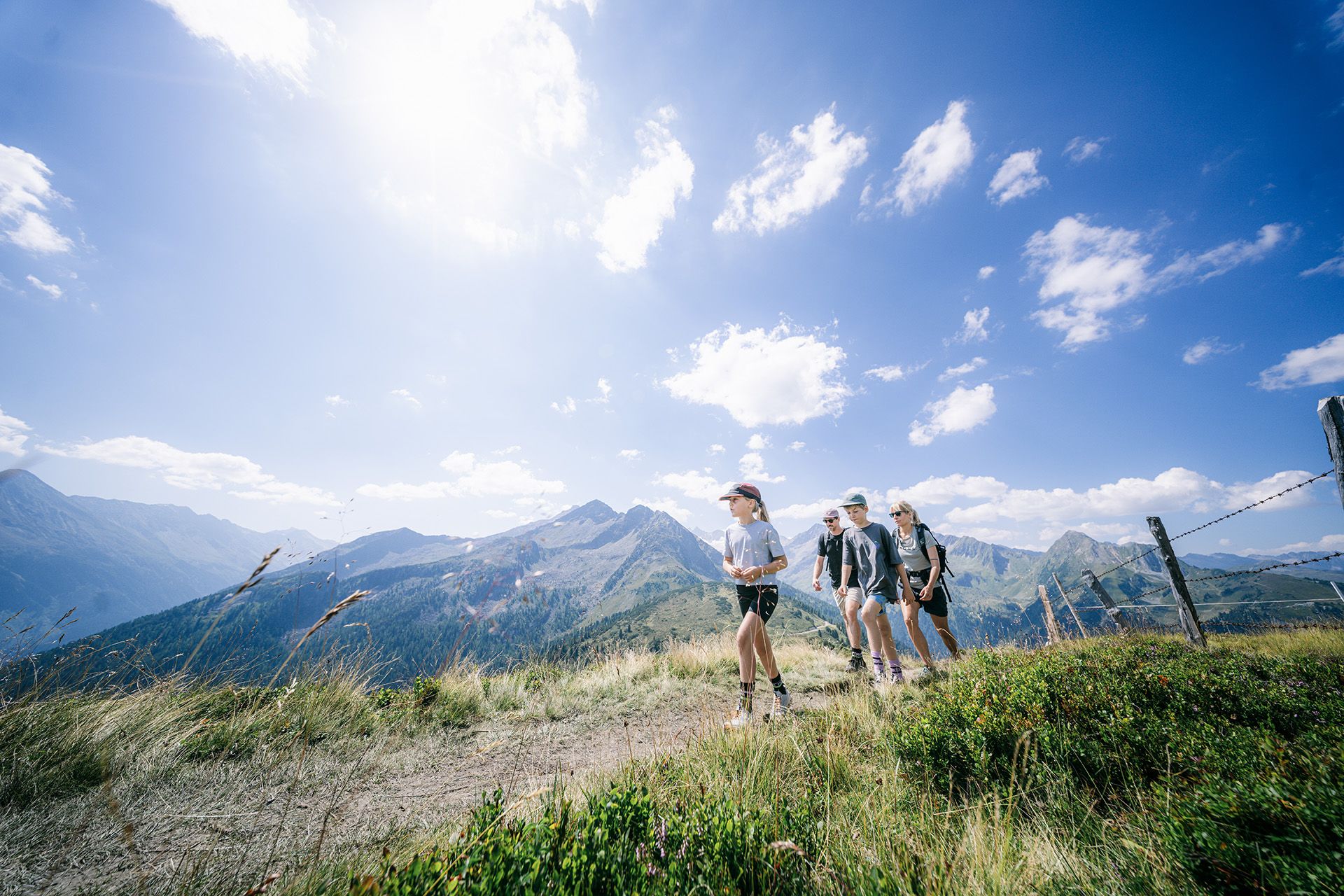
Bus station hiking trails around Hainzenberg offer access to the diverse alpine landscapes of the Zillertal Valley in Austria. The region is characterized by towering mountains, lush green forests, and vibrant alpine meadows, with elevations ranging from 540 m to 1,100 m above sea level. Hikers can explore serene lakes and streams, enjoying panoramic views of the Zillertal Alps and the Gerlossteinwand. The extensive network of trails caters to various fitness levels, providing options from leisurely walks to challenging high-altitude…
Last updated: June 27, 2026
4.6
(42)
205
hikers
18.9km
07:22
1,230m
1,230m
Hard hike. Very good fitness required. Mostly accessible paths. Sure-footedness required.
4.0
(16)
100
hikers
8.30km
02:42
400m
400m
Moderate hike. Good fitness required. Easily-accessible paths. Suitable for all skill levels.

Sign up for free
4.4
(23)
172
hikers
16.4km
05:36
890m
890m
Hard hike. Very good fitness required. Easily-accessible paths. Suitable for all skill levels.
4.5
(21)
145
hikers
10.7km
03:35
550m
550m
Moderate hike. Good fitness required. Easily-accessible paths. Suitable for all skill levels.
4.4
(32)
146
hikers
13.6km
04:54
790m
790m
Moderate hike. Good fitness required. Mostly accessible paths. Sure-footedness required.
Get access to more routes and recommendations from other explorers.
Sign up for free
Already have an account?
Our route recommendations are based on thousands of hikes, rides, and runs completed by other people on komoot.
Start today with a free account
Your next adventure awaits.
Login or Signup


Tips from the Community


A good starting point for various hiking tours that aren't too crowded. Be sure to check the timetable for the ascents and descents. There's also a lunch break between 12:15 and 1 p.m.
1
0
There's a wonderful diversity of plants around the Heimjöchl. It's especially beautiful there in early summer, when everything is in bloom and colorful.
1
0

These elevators don't run continuously. Normally, they run every half hour.
0
0

Very nice mountain hotel located below the Gerlosstein. Very easy to reach by Gerlossteinbahn or on foot from Hainzenberg. Unfortunately the road is closed to bicycles. Very good regional cuisine. The cordon bleu with grey cheese is a dream.
0
0

The loop with Heimjoch on the descent is nicer to run.
0
1

Below the Gerlosstein and the Freikopf there are lush alpine meadows that are full of flowers in spring and summer. Their biodiversity is enormous and the mountain panorama all around is truly unique.
0
0
The 2,166 meter high Gerlosstein is a striking mountain in the Zillertal Alps. From up here you can enjoy impressive 360° views of the Tux and Zillertal Alps. It is a popular destination for hikers and climbers. The ascent is more suitable for experienced hikers and you should definitely make sure you are sure-footed when it rains.
0
2
Frequently Asked Questions
How many bus station hiking trails are available around Hainzenberg?
There are 9 distinct hiking trails around Hainzenberg that are easily accessible from bus stations. These routes offer a variety of experiences, including 3 easy, 4 moderate, and 2 difficult options.
Are there any easy bus station hikes suitable for beginners or families in Hainzenberg?
Yes, Hainzenberg offers several easy bus station hikes perfect for beginners or families. One excellent option is the Kneipp Playground Hainzenberg – View of Zell am Ziller loop from Hainzenberg. This moderate route is family-friendly and includes the Zillertal Valley, offering scenic views and a playground.
What kind of views can I expect on bus station hikes in Hainzenberg?
Hikes from Hainzenberg's bus stations offer stunning panoramic views of the Zillertal Valley and the majestic Zillertal Alps. Many routes provide vistas of prominent features like the Gerlossteinwand. For example, the View of the Zillertal Valley – View of Gerlosstein loop from Hainzenberg specifically highlights these breathtaking landscapes.
Are there any circular bus station hikes in Hainzenberg?
Yes, many of the bus station accessible trails in Hainzenberg are circular, allowing you to start and end at the same point without needing to retrace your steps. Examples include the View of the Zillertal Valley – View of Gerlosstein loop from Hainzenberg and the View of Zell am Ziller – View of Gerlossteinwand loop from Hainzenberg.
Can I find any waterfalls or gorges along the bus station hiking trails?
While not directly on every bus station trail, the Hainzenberg region is rich in natural water features. The nearby Stilluptal Valley and Waterfall is a notable attraction, and you can explore impressive gorges like the Leitenkammerklamm Gorge and the Devil’s Bridge over the Tuxbach Gorge in the wider area.
What is the best time of year to go hiking from bus stations in Hainzenberg?
The best time for hiking in Hainzenberg is generally from late spring through early autumn (May to October). During these months, the weather is most favorable, alpine meadows are vibrant, and trails are typically clear of snow. The Zillertal Valley offers lush green forests and serene streams, making it ideal for outdoor activities.
Are there any points of interest or landmarks to explore on these hikes?
Absolutely. Hainzenberg's bus station hikes can lead you to various points of interest. You might encounter historical sites like the Zillertal Gold Show Mine, or scenic spots such as Maria Rast, a popular pilgrimage site. The Zillertal Valley itself is a major landmark, and routes often pass through charming alpine villages.
What do other hikers enjoy most about the bus station trails in Hainzenberg?
The bus station trails in Hainzenberg are highly rated by the komoot community, with an average score of 4.48 stars from over 23,000 ratings. Hikers frequently praise the diverse landscapes, the accessibility of trails via public transport, and the stunning panoramic views of the Zillertal Alps.
Are there any bus station hikes that lead to mountain huts or refreshment stops?
While specific routes from bus stations directly to huts are not detailed, the extensive network in the Zillertal Valley means many trails connect to mountain huts. For example, the Melchboden Snack Hut is a well-known stop in the region, often accessible via various hiking paths.
Can I bring my dog on the bus station hiking trails in Hainzenberg?
Generally, dogs are welcome on hiking trails in the Hainzenberg region. However, it's always advisable to keep your dog on a leash, especially in areas with livestock or wildlife, and to check local regulations for specific trails or nature reserves. Ensure you carry enough water for your dog and clean up after them.
Are there any bus station hikes that offer views of the Gerlossteinwand?
Yes, several bus station hikes provide excellent views of the impressive Gerlossteinwand. The View of Zell am Ziller – View of Gerlossteinwand loop from Hainzenberg is a challenging route specifically designed to showcase this iconic natural feature.
Most popular routes around Hainzenberg
Most popular attractions around Hainzenberg

Get inspired with the komoot mobile app


Explore more
Browse the best Hikes in other regions.
