The best hikes from bus stations around Freyung
4.6
(1423)
5,297
hikers
123
hikes
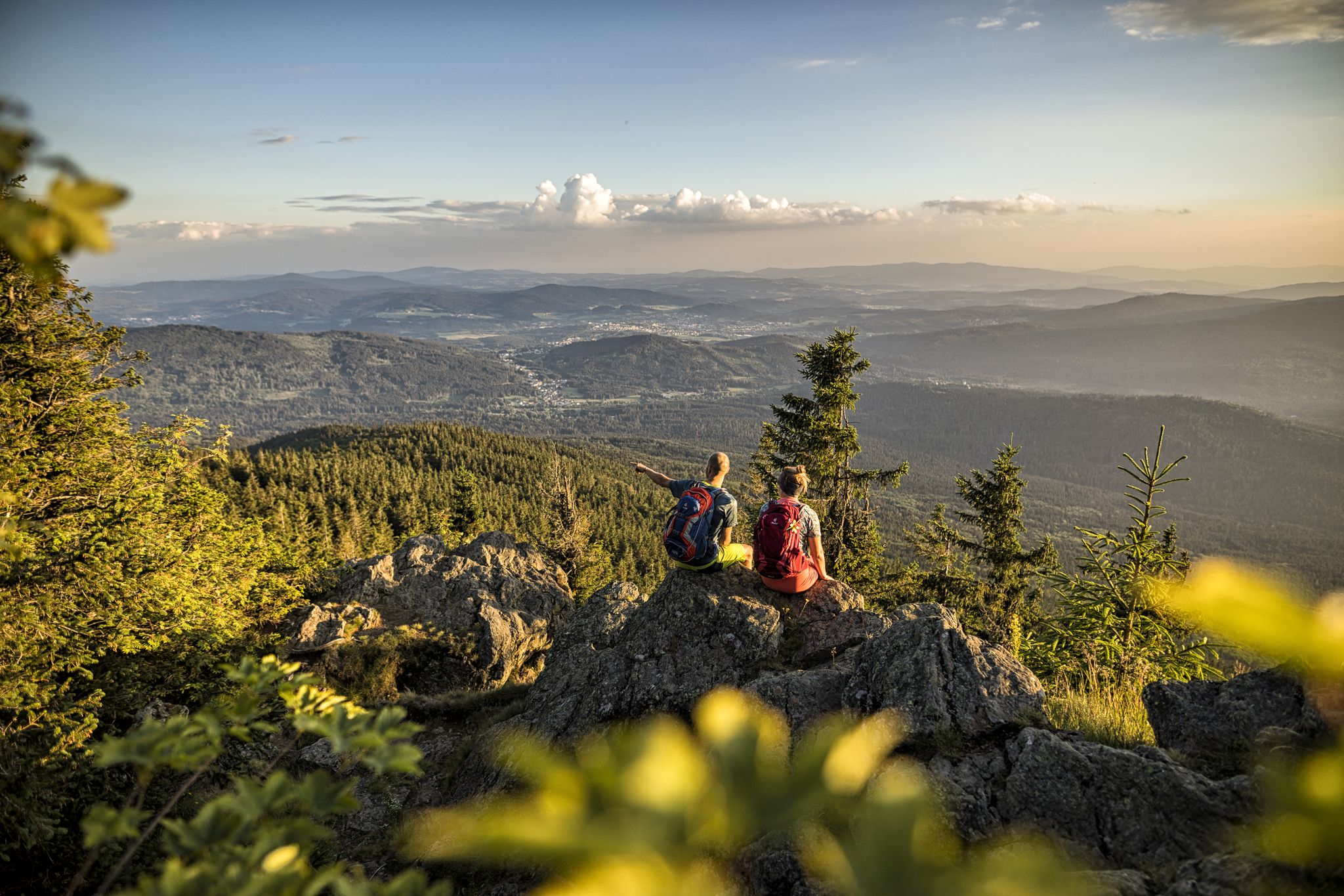
Hiking around Freyung offers access to a diverse natural landscape characterized by dense forests, rugged terrain, and unique granite rock formations. The region serves as a gateway to the Bavarian Forest National Park, featuring untouched woodlands and varied flora and fauna. Hikers can explore prominent peaks like Rachel and Lusen, as well as the Buchberger Leite Gorge, known for its whitewater and adventure trails. The area also includes the source of the River Ilz and the Saußbach Reservoir, providing varied natural experiences.
Best bus station hiking trails around Freyung
- The most popular bus station hiking route is Buchberger Leite Rock Tunnel – Buchberger Leite Gorge loop from Freyung, a 8.9 miles (14.3 km) trail that takes 4 hours 11 minutes to complete. This moderate route explores the scenic Buchberger Leite Gorge and its distinctive rock tunnel.
- Another top favourite among local hikers is Bubbling Spring on the Ohe River – Buchberger Leite Rock Tunnel loop from Neureut, a moderate 8.5 miles (13.6 km) path. This trail features the Ohe River and the Buchberger Leite Rock Tunnel, offering varied natural scenery.
- Local hikers also love the Buchberger Reservoir – View of Freyung loop from Freyung, a 5.3 miles (8.5 km) trail leading through landscapes around the reservoir, often completed in about 2 hours 26 minutes.
- Hiking around Freyung is defined by dense forests, granite rock formations, and scenic gorges, with routes available for easy strolls, moderate excursions, and more challenging mountain trails.
- The routes in Freyung are highly rated by the komoot community with an average score of 4.6 stars from over 1200 reviews. More than 4800 hikers have used komoot to explore Freyung's varied terrain.
Last updated: August 20, 2026
4.8
(115)
377
hikers
13.9km
04:02
360m
360m
Moderate hike. Good fitness required. Easily-accessible paths. Suitable for all skill levels.
4.7
(49)
220
hikers
9.33km
02:31
120m
120m
Moderate hike. Good fitness required. Easily-accessible paths. Suitable for all skill levels.

Sign up for free
4.5
(49)
152
hikers
Moderate hike. Good fitness required. Easily-accessible paths. Suitable for all skill levels.
4.6
(16)
53
hikers
8.55km
02:26
200m
200m
Moderate hike. Good fitness required. Easily-accessible paths. Suitable for all skill levels.
4.5
(10)
64
hikers
6.66km
01:53
140m
140m
Easy hike. Great for any fitness level. Easily-accessible paths. Suitable for all skill levels.
Get access to more routes and recommendations from other explorers.
Sign up for free
Already have an account?
Our route recommendations are based on thousands of hikes, rides, and runs completed by other people on komoot.
Start today with a free account
Your next adventure awaits.
Login or Signup

Other adventures around Freyung


Tips from the Community

Unfortunately the well is currently dry. Nice resting place
0
0

Buchberger Leite Wild Stream Gorge - In the Realm of Mosses and Ferns The Buchberger Leite Gorge between Ringelai and Freyung is one of Bavaria's most impressive gorge landscapes, awarded the seal of "Bavaria's Most Beautiful Geotopes." Gravel-laden streams, steep rocky ridges, and primeval forests characterize this natural spectacle of water and wilderness. Remnants of primeval forest survive in moss- and fern-rich gorges. The legendary cliffs of the Bayerischer Pfahl force the Wolfsteiner Ohe River into its channel, which is up to 100 meters deep in the landscape. The Buchberger Leite is a significant natural heritage site and is part of the EU's Natura 2000 network. River dams and canals, where the water appears to flow uphill at first glance, bear witness to human activity. The eight-kilometer-long adventure trail "Man and Nature in the Buchberger Leite" invites you to an exciting hike. Between Freyung and Ringelai, you can learn about interesting facts and information in the Wildbachklamm Gorge and experience the gorge's special charm. At prominent points in the Buchberger Leite, there are information boards and numbered markers that highlight special features of the landscape, such as the stream and river system, the power of water, the rafting industry, the geological history (Pfahlfelsen), and the Puchberg dynasty, who once lived high above the Wolfsteiner Ohe River – now the Neuenpuchberg ruins. The Buchberger Leite hiking trail also runs along the European pilgrimage route "VIA NOVA," which leads from the Danube Valley to the Czech Republic. https://www.nationalpark-ferienland-bayerischer-wald.de/wildbachklamm-buchberger-leite/
2
0


A small, hidden fountain
0
0
very beautiful handmade glass items
0
0


Anyone who wants to know exactly how the stone was formed here can learn something about it.
0
0
Frequently Asked Questions
How many bus-accessible hiking trails are there around Freyung?
There are over 130 hiking trails around Freyung that are easily accessible by bus, offering a wide range of experiences for all skill levels. You'll find everything from easy strolls to more challenging mountain excursions.
What kind of terrain can I expect on these bus-accessible trails in Freyung?
The bus-accessible trails around Freyung traverse diverse and stunning natural landscapes. You can expect dense forests, rugged terrain, and unique granite rock formations, especially within the Bavarian Forest National Park and areas like the Buchberger Leite Gorge. Some routes offer panoramic views from prominent peaks.
Are there any family-friendly hiking options accessible by bus from Freyung?
Yes, Freyung offers several family-friendly hiking options accessible by bus. Many trails are well-signposted and suitable for all ages. For instance, the area around the Saußbach Reservoir provides a pleasant circular route, and the Schwellhäusl on the Saußbachweg is ideal for families to explore the stream's habitat playfully.
Can I bring my dog on these bus-accessible hikes?
Many trails in the Freyung region are dog-friendly, but it's always recommended to keep your dog on a leash, especially in nature reserves like the Bavarian Forest National Park, to protect wildlife and ensure a pleasant experience for all hikers. Specific rules may vary, so check local signage.
Which bus-accessible trails offer the best views or natural landmarks?
For exceptional views and natural landmarks, consider routes that lead to the Buchberger Leite Gorge, such as the Buchberger Leite Rock Tunnel – Buchberger Leite Gorge loop from Freyung. This area is known for its whitewater gorge and intriguing rock formations. Other prominent peaks like Rachel and Lusen mountains (though potentially requiring a longer bus journey or connection) offer panoramic vistas of the surrounding forest.
Are there any circular routes I can start from a bus station in Freyung?
Absolutely. Many of the bus-accessible trails are designed as circular routes, allowing you to return to your starting point without retracing your steps. An example is the Buchberger Reservoir – View of Freyung loop from Freyung, which offers a moderate hike with scenic views.
What are some interesting attractions or points of interest near the bus-accessible trails?
Along and near the bus-accessible trails, you can discover several interesting attractions. These include natural highlights like the Reschbachklause and Erlauzwieseler Reservoir. You might also encounter unique man-made monuments such as the Glas Ark in Bavarian Forest National Park or the Teufelsbachklause — dam and shelter.
What is the best time of year to hike these bus-accessible trails in Freyung?
The best seasons for hiking in Freyung are typically spring and autumn. During these times, the weather is pleasant, and the landscapes are particularly beautiful, with spring blossoms or the vibrant changing leaves of autumn adding a golden hue to the forests. While summer is also popular, autumn offers cooler temperatures and stunning foliage.
Are there any easy bus-accessible hikes for beginners around Freyung?
Yes, Freyung offers a good selection of easy bus-accessible hikes perfect for beginners or those looking for a relaxed outing. Out of the 135 available routes, 79 are classified as easy. An example is the View of Freyung – Weinfurtner Glass Village loop from Geyersberg, which is an easy route with gentle elevation changes.
How do other hikers rate the bus-accessible trails around Freyung?
The bus-accessible trails around Freyung are highly rated by the komoot community, with an average score of 4.6 out of 5 stars from over 1200 ratings. Hikers often praise the well-maintained paths, the stunning natural beauty of the Bavarian Forest, and the convenience of public transport access to these diverse routes.
Are there any longer, more challenging bus-accessible routes for experienced hikers?
For experienced hikers seeking a challenge, there are indeed more demanding bus-accessible routes. Out of the 135 trails, 54 are rated as moderate and 2 as difficult. A moderate option is the Buchberger Leite Gorge – Buchberger Leite Rock Tunnel loop from Freyung, which covers a distance of almost 10 km with significant elevation gain, offering a rewarding experience.
Can I find refreshments or places to eat along these bus-accessible routes?
While specific amenities vary by route, many trails in the Freyung region pass through or near villages where you can find cafes, pubs, or restaurants. It's always a good idea to check the route details on komoot beforehand to see if there are any refreshment stops directly along your chosen path, or plan to bring your own snacks and drinks.
Most popular routes around Freyung
Most popular attractions around Freyung

Get inspired with the komoot mobile app


Explore more
Browse the best Hikes in other regions.
