The best hikes from bus stations in Nickerson State Park
4.6
(45)
369
hikers
5
hikes
Bus station hiking trails in Nickerson State Park offer access to a diverse landscape characterized by kettle ponds, pine and oak forests, and areas of scrub pines and cedar swamps. The park spans over 1,900 acres, providing a network of trails that wind through these varied natural features. Hikers can explore the unique aquatic habitats of the park's eight freshwater kettle ponds, which were formed by retreating glaciers. The extensive trail system connects to the Cape Cod Rail Trail, allowing for extended exploration beyond the park's boundaries.
Best bus station hiking trails in Nickerson State Park
- The most popular bus station hiking route is Nauset Bicycle Trail, a 4.3 miles (7.0 km) trail that takes 1 hour 47 minutes to complete. This easy route offers a path through the park's woodlands, connecting to wider trail networks.
- Another top favourite among local hikers is Salt Pond loop from Cape Cod National Seashore, an easy 1.5 miles (2.4 km) path. This trail provides views of Salt Pond, a notable kettle pond within the region.
- Local hikers also love the Salt Pond – Nauset Bicycle Trail loop from Cape Cod National Seashore, a 2.9 miles (4.6 km) trail leading through varied terrain including pond views and forested sections, often completed in about 1 hour 11 minutes.
- Hiking in Nickerson State Park is defined by kettle ponds, diverse pine and oak forests, and connections to regional rail trails. The network offers options for different ability levels, primarily featuring easy routes.
- The routes in Nickerson State Park are highly rated by the komoot community with an average score of 4.6 stars from over 40 reviews. More than 300 hikers have used komoot to explore Nickerson State Park's varied terrain.
Last updated: June 26, 2026
4.7
(13)
83
hikers
6.96km
01:47
30m
30m
Embark on the Nauset Bicycle Trail for an easy hiking experience that winds through classic Cape Cod woodlands. You will cover 4.3 miles (7.0 km) with a gentle elevation gain of 91 feet (28 metres), typically taking about 1 hour and 47 minutes to complete. The paved path offers diverse scenery, including a notable long boardwalk bridge that spans a salt marsh, leading you towards the coast.
To plan your visit, you can find maps and restrooms at the Salt Pond Visitor Center, which also serves as a convenient starting point for the trail. Parking is generally available there, making access straightforward. Keep in mind that this is a multi-use path, so you will share it with cyclists, especially during peak seasons.
This route is a great way to experience the natural beauty of Cape Cod National Seashore, showcasing dense groves of scrub oak, cedar, and pine trees. As you hike, you will enjoy panoramic views of Nauset Marsh and the expansive Nauset Bay, culminating in stunning Atlantic Ocean views near Coast Guard Beach.
5.0
(1)
15
hikers
Easy hike. Great for any fitness level. Easily-accessible paths. Suitable for all skill levels.

Sign up for free
11
hikers
5.08km
01:19
30m
30m
Easy hike. Great for any fitness level. Easily-accessible paths. Suitable for all skill levels.
5.0
(1)
13
hikers
4.36km
01:08
30m
30m
Easy hike. Great for any fitness level. Easily-accessible paths. Suitable for all skill levels.
7
hikers
5.23km
01:22
30m
30m
Easy hike. Great for any fitness level. Easily-accessible paths. Suitable for all skill levels.
Our route recommendations are based on thousands of hikes, rides, and runs completed by other people on komoot.
Start today with a free account
Your next adventure awaits.
Login or Signup
Popular around Nickerson State Park
Other adventures in Nickerson State Park

Tips from the Community

Coast Guard Beach is located in Eastham, Massachusetts, and is one of Cape Cod National Seashore’s most popular destinations. Known for its stunning views and expansive sandy shores, it is a favorite among locals and visitors for swimming, sunbathing, and surfing. Visitors can enjoy birdwatching and explore the nearby Nauset Marsh Trail. During the summer, shuttle services provide access from the Salt Marsh Visitor Center due to limited parking.
1
0

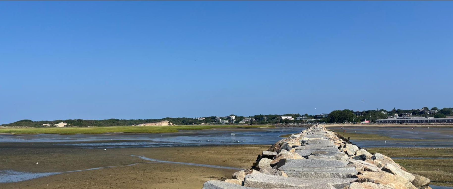
What is now Nauset Marsh was once a freshwater system until the shoreline in the area eroded, connecting the landscape to the sea. When the area was mapped by French explorer Champlain in 1605, it was a navigable bay. Over the years, ocean currents deposited a narrow strip of sand along the outer shore, now known as Nauset Spit. The spit acts as a barrier to the Atlantic Ocean and allowed the extensive marsh landscape to develop. https://npshistory.com/publications/caco/guides-guide/salt-pond-nauset-marsh.pdf
2
0
The Salt Pond Visitor Center is the year-round visitor center of the Cape Cod National Seashore. The center on State Highway 6 has a theater, the National Parks Store, a museum, restrooms and a spacious parking lot. https://www.nps.gov/caco/planyourvisit/visitorcenters.htm
1
0
Coast Guard Beach is a popular swimming beach during the summer season. Further south along the coast is Nauset Spit, where the ocean water flows into the Nauset Marsh during the tides. This is where writer Henry Beston lived in a beach house when he wrote The Outermost House in 1928. The book describes life on the beach in detail during the four seasons. https://www.nps.gov/caco/planyourvisit/coast-guard-beach-eastham.htm
1
0
The Salt Pond is a twelve-meter-deep tidal pool that flows into the Atlantic Ocean. The lake was formed about 18,000 years ago when glaciers retreated and left depressions. The Salt Pond was originally a freshwater lake and became a saltwater lake that is subject to the tides. A narrow channel connects the lake to the Nauset Marsh on the Atlantic Ocean. The Salt Pond continues to change; the connecting channel to the marsh is gradually filling with sand. https://npshistory.com/publications/caco/guides-guide/salt-pond-nauset-marsh.pdf
2
0
Access to Chatham Lighthouse Beach is across from the Coast Guard Station and the lighthouse. The beach was formed in recent years and was shaped by wind and waves. As in other areas of Cape Cod, Chatham's coastline is changing. In 1958, Nauset Beach ran uninterrupted for miles along the coast from Monomoy Island in southern Cape Cod to Orleans/Eastham north of Chatham. Fishermen and boaters used the Southway to get to the sea from Chatham Harbor. Several storms have since fundamentally changed the coastline in this section. In January 1987, a strong northeast storm broke through the offshore beach barrier east of Chatham Light. The beach was formed in the years following this breach, when the northern tip of South Beach curved inward and connected to the mainland in 1994. In the meantime, this connection has disappeared again or is only partially accessible during low tide (2024). The popular beach in front of the lighthouse has been preserved. Read more at: https://capecodlife.com/changing-shape-cape-islands-chathams-monomoy-islands-stage-harbor/
1
0
The new Mitchell River Drawbridge was completed in 2016. The previous historic drawbridge was one of the wooden bridges that have spanned Mill Pond and its access to Stage Harbor and the bay to the sea for more than 150 years. The bridge is considered the last remaining wooden drawbridge in the United States and has been listed for inclusion in the National Register of Historic Places.
3
0
The town of Chatham is located on the southeastern tip of Cape Cod and was first settled by the English in 1664. The original name ‘Monomoit’ refers to the indigenous population in the region. https://en.wikipedia.org/wiki/Chatham,_Massachusetts
1
0
Frequently Asked Questions
How many bus-accessible hiking trails are available in Nickerson State Park?
There are 8 easy hiking routes in Nickerson State Park that are accessible from bus stations, offering a variety of experiences for all skill levels.
What kind of natural features can I expect to see on these trails?
Nickerson State Park is renowned for its unique 'kettle ponds' like Cliff Pond and Flax Pond, formed by retreating glaciers. Many trails offer stunning views of these clear freshwater bodies. You'll also hike through diverse pine and oak woodlands, providing a shaded and scenic environment.
Are there any circular routes starting from a bus stop?
Yes, several circular routes are available. For example, the Salt Pond loop from Cape Cod National Seashore is an easy 2.4 km circular hike. Another option is the Chatham Town Center loop from Chatham, which is 4.3 km long.
What is the best time of year to hike in Nickerson State Park?
The park is beautiful year-round. Spring brings fresh greenery, while summer is perfect for combining hikes with a swim in the kettle ponds. Autumn offers spectacular fall foliage, and winter provides a serene, quiet experience, though some services might be limited.
Are the bus-accessible trails in Nickerson State Park suitable for families with children?
Yes, all 8 bus-accessible trails in Nickerson State Park are rated as easy, making them ideal for families. The varied landscapes and opportunities to spot wildlife provide an engaging experience for children. Routes like the Salt Pond loop from Cape Cod National Seashore are relatively short and manageable for younger hikers.
Can I bring my dog on the hiking trails?
Yes, dogs are generally welcome on trails in Nickerson State Park, but they must be kept on a leash. Always remember to clean up after your pet to help keep the park beautiful for everyone.
What do other hikers say about the trails in Nickerson State Park?
The area is highly rated by the komoot community, with an average score of 4.6 stars from 46 reviews. Reviewers often praise the park's tranquil atmosphere, the beauty of the kettle ponds, and the well-maintained, easy-to-navigate trails.
Are there any longer routes for more extended hikes from a bus stop?
For a longer excursion, consider the Nauset Bicycle Trail, which is nearly 7 km long and offers a scenic journey through the park's diverse woodlands. Another option is the Chatham Town Center – Mitchell River Drawbridge loop from Chatham, spanning over 5 km.
Are there any connections to other trail networks from Nickerson State Park?
Yes, an 8-mile paved bike path within Nickerson State Park connects directly to the 26-mile Cape Cod Rail Trail. This allows for extended hiking and biking opportunities beyond the park's boundaries, exploring six Cape Cod towns.
What kind of wildlife might I encounter while hiking?
The park's natural environment provides opportunities to spot local wildlife. Hikers often see various bird species, turtles, and deer. The kettle ponds also support diverse aquatic life.
Are there any specific viewpoints or scenic spots along the bus-accessible trails?
Many trails offer picturesque views of the park's crystal-clear kettle ponds, such as Cliff Pond and Flax Pond. These spots provide excellent opportunities for photography and peaceful breaks amidst nature. The diverse woodlands also offer scenic beauty throughout the seasons.
Most popular routes in Nickerson State Park

Get inspired with the komoot mobile app


Explore more
Browse the best Hikes in other regions.
