The best MTB trails in Spring Creek Canyon Wilderness Study Area
5.0
(4)
112
riders
3
rides
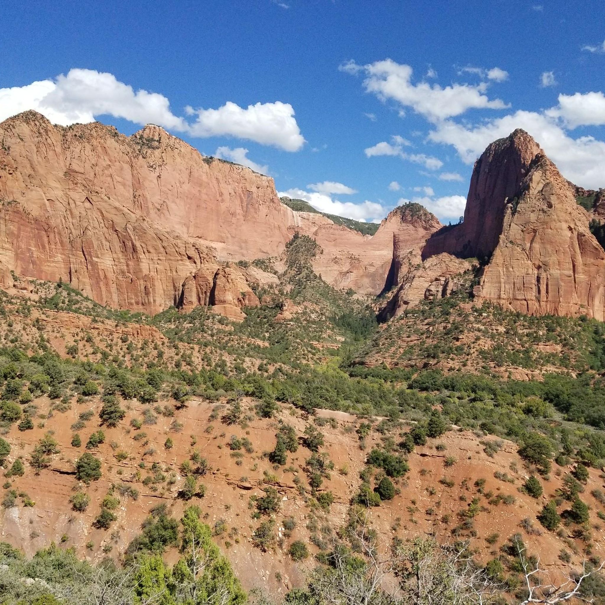
Mountain biking in Spring Creek Canyon Wilderness Study Area offers routes through diverse terrain characterized by red rock canyons, sandstone cliffs, and varied vegetation including juniper and scrub oak. The region features significant elevation changes, from approximately 5,600 feet at the base of the Hurricane Cliffs to nearly 7,900 feet on ridge tops. While the Wilderness Study Area itself is closed to mechanical transport, the surrounding area provides challenging mountain bike trails. The landscape is known for its scenic quality…
Last updated: May 14, 2026
23.4km
02:52
930m
930m
Hard mountain bike ride. Very good fitness required. Suitable for all skill levels.
5.0
(1)
48
riders
17.7km
01:43
320m
320m
Moderate mountain bike ride. Good fitness required. Advanced riding skills necessary.

Sign up for free
5.0
(1)
13
riders
12.0km
01:18
320m
320m
Hard mountain bike ride. Good fitness required. Advanced riding skills necessary. Some portions of the route may require you to push your bike.
5.0
(1)
31
riders
7.71km
00:45
150m
150m
Easy mountain bike ride. Great for any fitness level. Suitable for all skill levels.
8
riders
25.3km
02:38
710m
710m
Hard mountain bike ride. Good fitness required. Advanced riding skills necessary. Some portions of the route may require you to push your bike.
Our route recommendations are based on thousands of hikes, rides, and runs completed by other people on komoot.
Start today with a free account
Your next adventure awaits.
Login or Signup
Popular around Spring Creek Canyon Wilderness Study Area
Tips from the Community

Kanarra Mountain Road is a dirt road that provides a steady climb with some rough sections. It's a good option for those seeking for a mix of gravel and rocky terrain. Be prepared for some steep grades and carry plenty of water, as there are limited amenities along the route.
0
0
Lichen It Trail is a well-maintained trail that is partially shaded, going between forests. The trail has a lot of switchbacks that make the way up more gradual and smooth. It’s a nice path to appreciate the beauty of the flora and fauna.
0
0
Green Hollow Trail takes you to the hills up above Cedar City. The trail is not so steep, and it can be narrow in some spots. This is a popular trail for mountain biking, so you might see some riders on your walk. The trail can be muddy during or after the winter.
0
0
This viewpoint gives a panoramic view of Cedar City and its surroundings. There are informative boards along the overlook telling the history of the city.
0
0

Boneyard features cool jumps, a great drop, and is steep.
0
0
Frequently Asked Questions
Can I mountain bike directly within the Spring Creek Canyon Wilderness Study Area?
No, mountain biking is not permitted within the Spring Creek Canyon Wilderness Study Area itself. As a Wilderness Study Area, it is closed to all forms of mechanical transport, including bicycles. However, this guide features mountain biking trails in the surrounding areas near Kanarraville and Cedar City, which offer similar stunning red rock landscapes.
What kind of terrain and difficulty can I expect on mountain bike trails near Spring Creek Canyon WSA?
The mountain bike trails in the vicinity offer a range of experiences. For instance, Kanarra Mountain Road is rated as difficult, featuring substantial elevation gain and technical sections. The Boneyard Trail loop from Shurtz Canyon Trailhead also presents a challenging ride. There are also moderate options like the Green Hollow Trail loop from Cedar Highlands and easier routes such as the Lichen It Trail loop from Cedar Highlands.
Are there any family-friendly mountain bike trails in the area?
Yes, for families looking for a less strenuous ride, the Lichen It Trail loop from Cedar Highlands is rated as easy. It offers a shorter distance and less elevation, making it suitable for riders of varying skill levels.
What are the best seasons for mountain biking near Spring Creek Canyon WSA?
The region experiences hot summers, so spring and fall are generally the most pleasant seasons for mountain biking. The cooler temperatures make for more comfortable rides, and the natural scenery is particularly vibrant during these times. Winter riding may be possible at lower elevations, but higher trails could be affected by snow.
Where can I park for mountain bike trails in this area?
Parking availability varies by trailhead. For routes like the Boneyard Trail loop, you would typically look for parking near the Shurtz Canyon Trailhead. For trails originating near Cedar Highlands, parking would be available in that vicinity. Always check specific route details for precise parking information.
Are dogs allowed on the mountain bike trails near Spring Creek Canyon WSA?
Policies regarding dogs can vary by specific trail and land management. While the Wilderness Study Area itself has strict regulations, trails outside its boundaries may be more accommodating. It's always best to check local signage or specific trail guidelines before bringing your dog, and always keep them on a leash and clean up after them.
Are there any loop trails for mountain biking?
Yes, several loop trails are available. The Boneyard Trail loop from Shurtz Canyon Trailhead, the Lichen It Trail loop from Cedar Highlands, and the Green Hollow Trail loop from Cedar Highlands all offer circular routes, allowing you to start and end at the same point without retracing your path.
What kind of natural features can I expect to see while mountain biking in the region?
While mountain biking is outside the Spring Creek Canyon WSA, the surrounding areas share similar stunning red rock landscapes. You can expect impressive sandstone cliffs, diverse desert vegetation including juniper and scrub oak, and potentially riparian zones with cottonwoods and willows along streambeds. The views often include the imposing Hurricane Cliffs and vistas towards Zion National Park.
Where can I find amenities like bike shops or accommodation nearby?
Kanarraville is a small community, but nearby Cedar City offers a wider range of amenities. In Cedar City, you can find bike shops for repairs or gear, various accommodation options, and restaurants or cafes to refuel after your ride.
What is the longest mountain bike trail featured in this guide?
The longest mountain bike trail featured is Kanarra Mountain Road, which spans over 23 kilometers. This challenging route also features the most elevation gain, making it a significant undertaking for experienced riders.
What do other mountain bikers enjoy most about riding in this area?
The komoot community rates the trails in this region highly, with an average score of 5.0 stars. Riders often praise the challenging terrain, the stunning red rock scenery, and the opportunity to experience the natural beauty of southern Utah away from more crowded destinations.
Most popular routes in Spring Creek Canyon Wilderness Study Area

Get inspired with the komoot mobile app


Explore more
Browse the best MTB trails in other regions.
