Hambledon Hill National Nature Reserve
Hambledon Hill National Nature Reserve
The best hikes from bus stations in Hambledon Hill National Nature Reserve
4.6
(388)
2,574
hikers
44
hikes
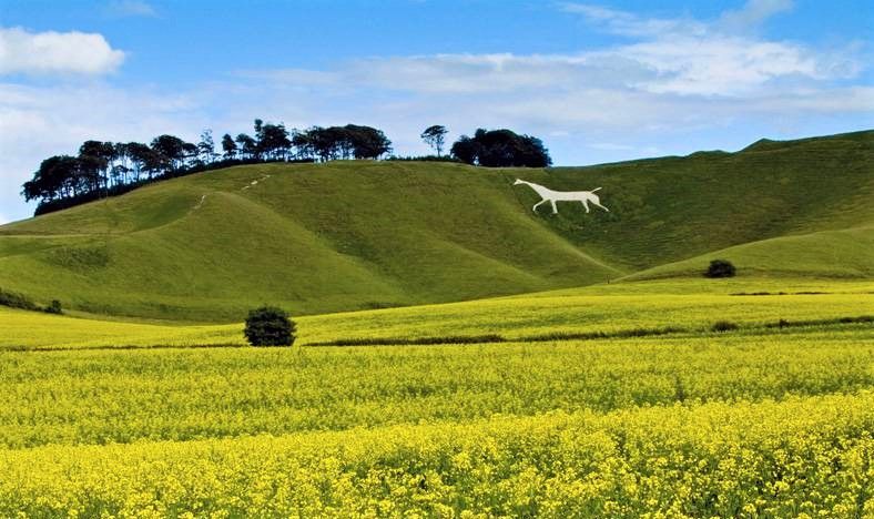
Bus station hiking trails in Hambledon Hill National Nature Reserve traverse a landscape characterized by its prominent Iron Age hill fort, rising to 190 meters above the Blackmore Vale. The area features well-preserved ancient earthworks and offers panoramic views across the surrounding counties. This National Nature Reserve is also a Site of Special Scientific Interest, known for its calcareous grassland and diverse plant and wildlife. The terrain includes both challenging ascents and gentler paths, suitable for various hiking preferences.
Best…
Last updated: July 9, 2026
5.0
(7)
20
hikers
6.84km
01:57
150m
150m
Easy hike. Great for any fitness level. Easily-accessible paths. Suitable for all skill levels.
4.8
(4)
9
hikers
9.40km
02:39
190m
190m
Moderate hike. Good fitness required. Easily-accessible paths. Suitable for all skill levels.

Sign up for free
5.0
(1)
66
hikers
9.48km
02:49
280m
280m
Moderate hike. Good fitness required. Easily-accessible paths. Suitable for all skill levels.
5.0
(3)
18
hikers
4.88km
01:27
140m
140m
Easy hike. Great for any fitness level. Easily-accessible paths. Suitable for all skill levels.
5.0
(4)
15
hikers
Easy hike. Great for any fitness level. Easily-accessible paths. Suitable for all skill levels.
Get access to more routes and recommendations from other explorers.
Sign up for free
Already have an account?
Our route recommendations are based on thousands of hikes, rides, and runs completed by other people on komoot.
Start today with a free account
Your next adventure awaits.
Login or Signup
Popular around Hambledon Hill National Nature Reserve
Other adventures in Hambledon Hill National Nature Reserve


Tips from the Community

Perched 800 feet above sea level in the Cranborne Chase, the view from Compton Abbas offers a breathtaking 30-mile panorama. From the hilltop airfield, you can look north toward the historic town of Shaftesbury and west across the patchwork fields of the Blackmore Vale. The vista captures rolling Dorset hills, dense woodland, and ancient chalk downland, famously immortalized in the novels of Thomas Hardy.
0
0
Was so fortunate to stay here the night and catch the beautiful sunset. Roll on next year. I'll be back
0
0
The structure you see today stands in isolation in the flood meadows and acts as a major landmark for the area. North Dorset Trailway: The former railway line's route, including the embankment leading up to the remaining arches, has been repurposed as the North Dorset Trailway. This popular multi-use path is enjoyed by walkers, cyclists, and horse riders, and stretches for miles along the former trackbed. Stour Meadows Park: The park itself is a beautiful area for recreation and nature walks, situated next to the River Stour, and the preserved arches are a key historic feature on the route. Essentially, the remaining spans of the railway bridge are a powerful, tangible reminder of a celebrated piece of British railway history that once played a vital role in the commercial and social life of Blandford Forum.
0
0
The former railway bridge in Stour Meadows (part of the wider flood meadows near the River Stour) is significant for several reasons: The Line: It carried the Somerset & Dorset Joint Railway line, which ran a crucial cross-country route connecting Bath to Bournemouth. The Town's Station: The bridge was essential for the railway to reach the final location of Blandford Forum Station, which opened north of the River Stour in 1863. This required the extension of the line from its original temporary terminus south of the river at Blandford St Mary. Closure: The entire S&DJR line, often referred to simply as the "S&D," was closed as a result of the infamous Beeching Cuts. The Blandford station closed to passengers in March 1966, with the track eventually lifted around 1969. Demolition & Preservation: Following the line's closure, the original railway bridge that crossed the River Stour was largely demolished. However, two of its arches/spans were saved and are still visible in the meadows today. This is thanks to the efforts of local groups, like the Blandford Railway Arches Trust, who recognized their historical importance.
1
0
Came across a sheep stuck on her back early in the morning, not that a time of particularly mattered to the sheep, took some going but I uprighted said sheep, and off she went.
0
0

Melbury beacon is one of the highest points in north Dorset and the views are amazing I would recommend parking on spread eagle hill if you plan to hike x
1
0
A very nice route indeed. Nothing too demanding at all. Give it a whirl!!!
1
0
Frequently Asked Questions
How many bus-accessible hiking trails are available in Hambledon Hill National Nature Reserve?
There are over 45 hiking routes in Hambledon Hill National Nature Reserve that are accessible from bus stations. These routes offer a variety of experiences, from easy strolls to more challenging ascents.
What kind of terrain can I expect on bus-accessible hikes in Hambledon Hill National Nature Reserve?
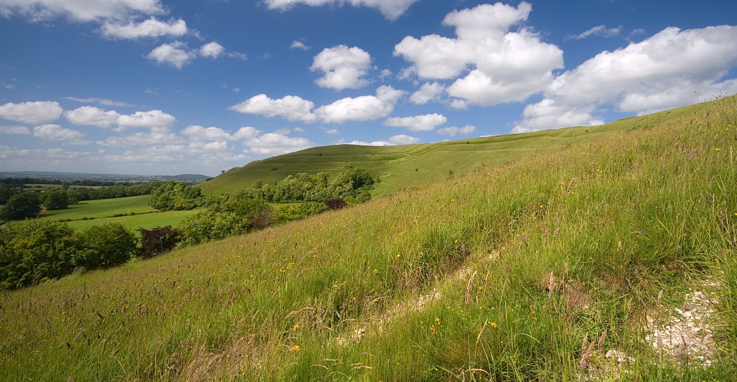
The terrain around Hambledon Hill is primarily unimproved calcareous grassland, known for being 'grippy and forgiving.' You'll encounter ancient earthworks, including ramparts and ditches, which provide engaging, sometimes steep, ascents and descents. Many paths are well-trodden footpaths, offering a mix of open hilltops and valley views.
Are there easy, family-friendly hikes accessible by bus in the area?
Yes, there are several easy routes suitable for families. For example, the Ice bath? – Sunset Viewpoint loop from Compton Abbas is an easy 4.9 km hike with moderate elevation, offering rewarding views. These trails often feature gentle gradients and clear paths.
Can I bring my dog on bus-accessible trails in Hambledon Hill National Nature Reserve?
Yes, many trails in Hambledon Hill National Nature Reserve are dog-friendly. However, as it is a National Nature Reserve and a Site of Special Scientific Interest, and home to grazing livestock and diverse wildlife, it is crucial to keep dogs on a lead, especially during nesting seasons and near livestock. Always follow local signage.
What historical sites or natural attractions can I see along these bus-accessible routes?
The region is rich in history and natural beauty. You can explore the impressive Hambledon Hill Iron Age hill fort, one of Britain's best-preserved, and its extensive Hambledon Hill Ramparts. The summit also offers breathtaking views from Hambledon Hill across the Blackmore Vale and into neighboring counties.
Are there circular hiking routes available from bus stops?
Yes, many of the bus-accessible routes are circular, allowing you to start and end your hike at the same point, often near a bus stop. An example is the Ice bath? – Scenic View of Rolling Hills loop from Sutton Waldron, which is an easy circular hike.
What are some moderate or challenging bus-accessible hikes in the area?
For a more challenging experience, consider routes like the Sunset Viewpoint – Melbury Beacon loop from Compton Abbas. This moderate 9.5 km hike involves significant elevation gain, offering panoramic views and a good workout. Another option is the Scenic View of Rolling Hills – The Uprighting loop from Sutton Waldron.
When is the best time of year to hike in Hambledon Hill National Nature Reserve from a bus station?
Spring and summer are particularly rewarding for hiking, as the calcareous grasslands burst with wildflowers like pyramidal orchids and horseshoe vetch, and butterflies such as the Adonis blue are abundant. Autumn offers beautiful colors and cooler temperatures, while winter can provide crisp, clear views, though paths may be muddy.
What wildlife can I expect to see on the trails?
Hambledon Hill is a haven for wildlife. You might spot numerous butterfly species, including dingy and grizzled skippers, chalkhill blues, and dark green fritillaries. Birdwatchers can look out for skylarks, buzzards, kestrels, and various warblers. Keep an eye out for brown hares and, if you're lucky, glow worms in the evenings.
Are there any cafes or pubs near the bus-accessible trailheads?
While the immediate vicinity of some bus stops might be rural, nearby villages like Child Okeford and Iwerne Minster often have local pubs or cafes where you can refresh yourself before or after your hike. It's advisable to check opening times in advance, especially if relying on public transport schedules.
What do other hikers enjoy most about hiking in Hambledon Hill National Nature Reserve?
The area is highly rated by the komoot community, with an average score of 4.7 stars. Reviewers often praise the breathtaking panoramic views from the hill's summit, the historical significance of the Iron Age hill fort, and the rich biodiversity, especially the wildflowers and butterflies. The varied terrain and well-maintained paths also receive positive feedback.
Most popular routes in Hambledon Hill National Nature Reserve

Get inspired with the komoot mobile app


Explore more
Browse the best Hikes in other regions.
