The best hikes from bus stations in Vlijmens Ven, Moerputten & Bossche Broek
4.4
(13011)
70,187
hikers
1,370
hikes
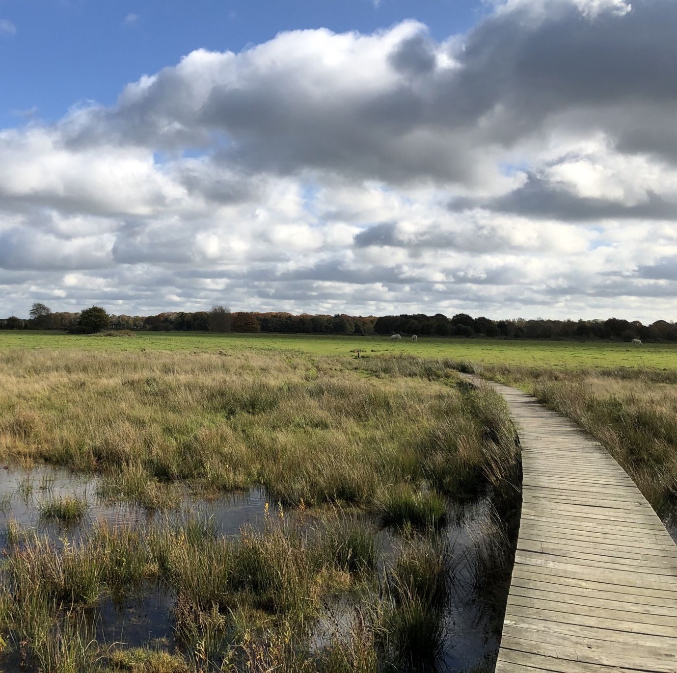
Bus station hiking trails in Vlijmens Ven, Moerputten & Bossche Broek traverse a unique landscape characterized by expansive wetlands, low-fen marshland, and historic peat bogs. This region, part of the 'Naad van Brabant' transition zone, features diverse ecosystems including blue grasslands and numerous waterways. The terrain is generally flat and low-lying, offering broad views across fields and dikes, with historical industrial heritage evident in structures like the Moerputten Bridge.
Best bus station hiking trails in Vlijmens Ven, Moerputten & Bossche…
Last updated: October 26, 2026
4.3
(15)
31
hikers
20.6km
05:14
50m
50m
Hard hike. Very good fitness required. Mostly walkable paths. Sure-footedness required.
4.5
(138)
652
hikers
15.4km
03:53
30m
30m
Moderate hike. Good fitness required. Easily walkable paths.

4.7
(36)
143
hikers
14.0km
03:32
20m
20m
Moderate hike. Good fitness required. Easily walkable paths.
4.1
(7)
86
hikers
Easy hike. Easily walkable paths.
4.4
(23)
130
hikers
Easy hike. Easily walkable paths.
Get access to more routes and recommendations from other explorers.
Already have an account?
Our route recommendations are based on thousands of hikes, rides, and runs completed by other people on komoot.
Start today with a free account
Your next adventure awaits.
Popular around Vlijmens Ven, Moerputten & Bossche Broek
Other adventures in Vlijmens Ven, Moerputten & Bossche Broek


Tips from the Community


Beautiful photo spot right on the market square.
0
0

The Sint Hubertuskapel on the Steegerf in Drunen is a small, atmospheric field chapel built by the guild of the same name.
0
0

Loop or cycle a round over the terrain itself, worth it!
0
0

Fort Isabella is located just outside ’s-Hertogenbosch and is a historical defense work that was part of the southern lines around the city. The fort was built in the 17th century during the Eighty Years' War, when ’s-Hertogenbosch was an important fortress city in the border area between the Republic and the Southern Netherlands. The fort was strategically built on a higher spot in the landscape, offering a good overview of the surrounding roads and the open terrain towards the city. Over the centuries, it lost its military function, but the structure of ramparts, moats, and open spaces is still recognizably present. Nowadays, Fort Isabella has been given a new purpose and the area has been developed into a place where living, working, and recreation come together. Old buildings have been reused and the terrain has partly remained green, making the historical structure still palpable in the surroundings. The combination of military heritage and modern interpretation makes Fort Isabella a special place in the landscape around Vught. A location where the history of the fortress city is still visibly interwoven with the current use of the area.
1
0
The Golden Dragon Fountain is one of the most famous landmarks of ’s-Hertogenbosch and is located on the Stationsplein, close to the center and the train station. The fountain was placed in 1903 in honor of the 25th anniversary of Queen Wilhelmina's reign. The striking golden statue depicts a dragon standing on top of a high column. The dragon is not just a decoration: it refers to the legend of Saint John, the patron saint of the city. The statue was designed by the Bossche artist August Falise and later became a symbol of the city. Over the years, the Golden Dragon has been restored several times and regained its characteristic shiny appearance. The fountain has acquired a special place in the cityscape: for many visitors, this is the first striking monument they see when they arrive in Den Bosch. A small but striking piece of city history, where art, history, and the identity of ’s-Hertogenbosch come together.
0
0

Nice former fort now transformed into a resendential area with quite a selection of restaurants scattered around the central places.
1
0

Nice break spot on the square
0
0
Frequently Asked Questions
How many bus station hiking trails are available in Vlijmens Ven, Moerputten & Bossche Broek?
There are over 1300 hiking routes accessible from bus stations in Vlijmens Ven, Moerputten & Bossche Broek. This includes a wide variety of trails, with more than 840 easy routes, 420 moderate options, and 35 more challenging hikes.
Are there easy hiking trails accessible by bus for beginners or families?
Yes, the region offers many easy trails perfect for beginners or families, often starting conveniently near bus stops. For a pleasant and accessible option, consider the View of Vlijmens Ven Wetlands – Vughts Gement loop from 's-Hertogenbosch, which is an easy 5.2 km route. Another great choice is the Bossche Broek – Het Bossche Broek Nature Reserve loop from 's-Hertogenbosch, an easy 5.6 km walk through varied landscapes.
What kind of landscapes can I expect on bus-accessible hikes in this region?
Hikes accessible by bus in Vlijmens Ven, Moerputten & Bossche Broek showcase diverse landscapes, primarily characterized by expansive wetlands, historic structures, and rich biodiversity. You'll encounter rare low-fen marshlands, historic railway lines, and open polder landscapes. The area lies in the 'Naad van Brabant' transition zone, offering unique base-loving vegetation and significant blue grasslands.
Are there any notable attractions or viewpoints along bus station hiking routes?
Absolutely. Many bus-accessible routes pass by significant attractions. You can walk across the impressive Moerputten Bridge, a historic steel railway bridge, or explore the Moerputten Boardwalk and Halvezolenlijntje Boardwalk through the wetlands. For scenic views, visit the Vlijmense Polder Observation Deck or the Turfship Lookout Point, Vlijmens Ven. The Bossche Broek also offers impressive views of 's-Hertogenbosch's skyline.
Can I find circular hiking routes that start and end near bus stops?
Yes, many routes in the region are designed as circular paths, making them ideal for public transport users. For example, the Bossche Broek – Polder landscape loop from 's-Hertogenbosch is a moderate 13.8 km circular hike that offers broad views across fields and waterways.
What is the best season for hiking in Vlijmens Ven, Moerputten & Bossche Broek when using public transport?
The region is beautiful year-round. Spring and summer are excellent for experiencing the vibrant flora, including orchids and blooming wildflowers, and spotting diverse birdlife and butterflies. Autumn offers stunning colors, while winter can provide tranquil, crisp walks through the wetlands. Public transport schedules generally remain consistent, making access reliable in all seasons.
Are there any long-distance or more challenging hikes accessible by bus?
While many routes are easy or moderate, there are options for longer and more challenging hikes. The Nieuwkuijk – pancake hikes in the Netherlands is a difficult 20.6 km route that can be accessed via public transport, offering a full day's adventure through varied terrain.
What kind of wildlife can I expect to see on bus-accessible trails?
The wetlands are rich in biodiversity. You might spot various bird species, including migratory birds like the black-tailed godwit and common redshank, and even marsh harriers. The area is also known for its insects, especially dragonflies, and is a vital habitat for the protected 'pimpernelblauwtje' (scarce large blue) butterfly, particularly in the blue grasslands of Moerputten and Vlijmens Ven.
How do other hikers rate the trails in Vlijmens Ven, Moerputten & Bossche Broek?
The hiking trails in this region are highly regarded by the komoot community, with an average rating of 4.4 out of 5 stars from over 10,800 reviews. Hikers frequently praise the unique wetland landscapes, the well-maintained boardwalks, and the peaceful atmosphere, making it a popular destination for nature lovers.
Are there any historical sites or landmarks to explore near bus-accessible routes?
Yes, the region has a rich history. Besides the historic Moerputten Bridge, you can find remnants of former railway lines that now serve as walking paths, offering a glimpse into the area's industrial past. The Binnendieze Canal, Den Bosch – St. John's Cathedral loop from Vught, for instance, connects natural beauty with urban history, including views of the iconic St. John's Cathedral.
Are the bus station hiking trails generally flat or do they involve elevation changes?
The terrain in Vlijmens Ven, Moerputten & Bossche Broek is generally flat and low-lying. Most trails involve minimal elevation changes, making them accessible for a wide range of fitness levels. This characteristic allows for broad views across fields, waterways, and historic dikes, especially in areas like Bossche Broek.
Most popular routes in Vlijmens Ven, Moerputten & Bossche Broek
Most popular attractions in Vlijmens Ven, Moerputten & Bossche Broek

Get inspired with the komoot mobile app


Explore more
Browse the best Hikes in other regions.
