The best traffic-free bike rides in Gipskarstlandschaft Pölsfeld
4.8
(11)
44
riders
7
rides
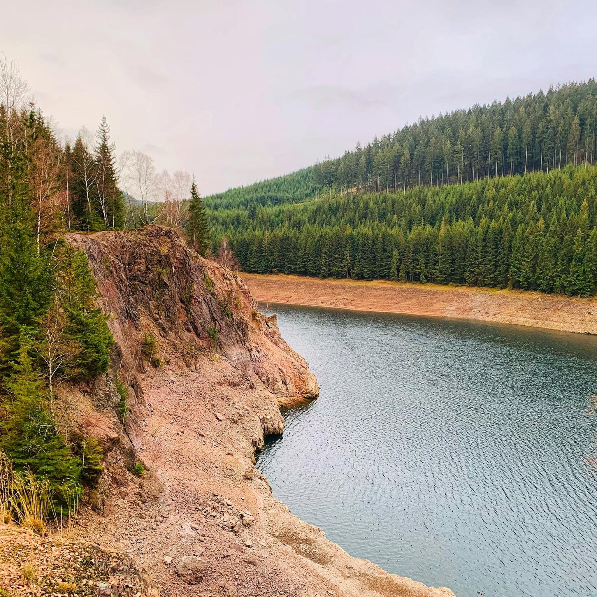
Gravel biking in Gipskarstlandschaft Pölsfeld offers routes through a distinctive gypsum karst landscape, characterized by numerous sinkholes, dolines, and diverse soil types. The region features a mosaic of habitats including dry meadows, lime-beech forests, and gypsum escarpments. The eastern part of the area also shows the influence of former copper shale mining, creating a unique terrain with spoil heaps. This varied geology provides a range of surfaces suitable for no traffic gravel bike trails.
Best no traffic gravel bike trails…
Last updated: September 28, 2026
2
riders
29.2km
01:41
320m
320m
Moderate gravel ride. Good fitness required. Mostly paved surfaces. Suitable for all skill levels.
3
riders
13.4km
00:47
130m
130m
Easy gravel ride. Great for any fitness level. Mostly paved surfaces. Suitable for all skill levels.

4.0
(1)
2
riders
30.8km
02:11
510m
510m
Hard gravel ride. Very good fitness required. Mostly paved surfaces. Suitable for all skill levels.
5.0
(1)
5
riders
52.5km
02:57
510m
510m
Hard gravel ride. Very good fitness required. Mostly paved surfaces. Suitable for all skill levels.
5.0
(1)
2
riders
Hard gravel ride. Very good fitness required. Mostly paved surfaces. Suitable for all skill levels.
Get access to more routes and recommendations from other explorers.
Already have an account?
Our route recommendations are based on thousands of hikes, rides, and runs completed by other people on komoot.
Start today with a free account
Your next adventure awaits.
Popular around Gipskarstlandschaft Pölsfeld

Tips from the Community

The widely visible landmark of Sangerhausen is the enormous spoil heap on the "Hohe Linde". In Sangerhäusern, they simply call it Schachthalde. Located high above the city, more than 20 million tons of rock are stored here, piled up to form an approximately 150-meter-high mountain.
0
0

The bridge over the stream is now crooked and a real danger. Whoever steps on it should really know what they are getting into. Behind it, only wilderness. Difficult to penetrate
0
0

Invites for a short break
1
0
The route starts at Klostermansfeld station. The station is not located in the municipality of Klostermansfeld, but in Benndorf. The Wipperliese offers direct transfer connections here to the regional express trains of line RE 10 (Erfurt–Magdeburg) and a connection to the Mansfelder Bergwerksbahn museum railway. From Klostermansfeld station, the route initially runs parallel to the Berlin–Blankenheim railway line in the direction of Hettstedt and jointly crosses under the Mansfelder Bergwerksbahn with it. On a plateau of the Harz foreland, the Wipperliese route bends in a wide left curve around Klostermansfeld into the Wippertal valley. Further on, the route winds westwards up the valley of the Wipper, following the river closely. For topographical reasons, the Wipper is crossed numerous times, so that the route has a large number of bridges of different designs. Structures of outstanding importance are the Mansfelder Viaduct (also known as Hasselbach Viaduct)[22] and the Rammelburg Tunnel.[23] A rarity in railway operations is the level crossing in the densely built-up town center of Biesenrode, which is not visible for train journeys from the east. Therefore, the level crossing in the direction of Wippra must be manually secured by the train crew with the white-red-white signal flag (so-called postensicherung). Source https://de.wikipedia.org/wiki/Bahnstrecke_Klostermansfeld%E2%80%93Wippra
3
0
After the Berlin–Blankenheim railway line (so-called Kanonenbahn) was opened by the Prussian State Railways in 1879, a railway was also desired in the adjacent Wipper Valley. However, as the request was assessed as unprofitable, it was rejected. After the turn of the century, the project for the Eisleben–Wippra–Stolberg railway line emerged, as the town of Stolberg (Harz) in the Thyra Valley also sought a rail connection. After Klostermansfeld emerged as the junction station for the new line by 1905, the Prussian State Railways had initial preparatory work carried out. This was limited to the Klostermansfeld–Wippra section; the extension to Stolberg (Harz) was to be started later. As Klostermansfeld lies considerably higher than the Wipper Valley, two route variants emerged: The former was intended to overcome the descent into the valley with a short rack railway; the second variant envisaged the construction of a valley bridge. Although the construction costs of the bridge variant were higher than those of the rack railway variant, the decision was made for the bridge (today's Mansfelder Viaduct) to reduce later operating costs. The two million marks required for this were approved in 1907, but the realization was nevertheless not started immediately. Causes included problems with land acquisition. The actual construction work began in 1913 and was considerably delayed in connection with the outbreak of the First World War.[2] Nevertheless, the line was already printed in the timetable in 1914 with the note "under construction". The two largest structures, the Rammelburg Tunnel and the Hasselbach Viaduct, were completed in 1916 and 1918 respectively.[3] Only in 1919 was work on the construction of the railway line resumed on a larger scale, and it was completed in the autumn of 1920.[4] The branch line was to be opened on November 1, 1920, by the Deutsche Reichsbahn-Gesellschaft. However, commissioning had to be postponed to December 20, 1920, because a house with a thatched roof along the line had to be covered with roof tiles first due to the fire hazard.[5] The line extension to Stolberg (Harz) did not materialize, as work on the extension of the Berga-Kelbra–Rottleberode railway line to Stolberg (Harz) had already been underway since 1914.[4] This line was completed in 1923. Source https://de.wikipedia.org/wiki/Bahnstrecke_Klostermansfeld%E2%80%93Wippra Source
1
0
Frequently Asked Questions
How many no-traffic gravel bike trails are available in Gipskarstlandschaft Pölsfeld?
There are 8 dedicated no-traffic gravel bike trails in Gipskarstlandschaft Pölsfeld featured in this guide. These routes offer a range of experiences, from easy rides to more challenging adventures.
What kind of terrain can I expect on the no-traffic gravel bike trails in Gipskarstlandschaft Pölsfeld?
The region is known for its unique gypsum karst geology, so you'll encounter a diverse landscape. Expect a mix of dry meadows, lime-beech forests, and areas shaped by former copper shale mining with small spoil heaps. The trails are designed for gravel bikes, which are well-suited to navigate these varied surfaces.
Are there different difficulty levels for the no-traffic gravel bike trails?
Yes, the trails cater to various fitness levels. This guide includes 1 easy route, 4 moderate routes, and 3 difficult routes. For example, the Waldstraße Picnic Area – Wetland Habitat at Dippelsbach loop from Annarode is an easy option, while the Süßer See – Swimming Beach – Rösetal Vineyards loop from Annarode offers a more challenging ride.
What natural attractions can I discover along these no-traffic gravel bike trails?
The Gipskarstlandschaft Pölsfeld is rich in natural wonders. You can explore unique karst phenomena like sinkholes and springs. Notable natural highlights include the Bachschwinde Hainsches Tal, a fascinating cave formation, and several viewpoints such as the View of Pölsfeld from Barbaraschacht, offering scenic vistas of the landscape.
Are there any family-friendly no-traffic gravel bike trails?
Yes, there is at least one easy route suitable for families, such as the Waldstraße Picnic Area – Wetland Habitat at Dippelsbach loop from Annarode. When planning a family outing, look for routes marked as 'easy' and consider the distance and elevation gain to match your family's capabilities.
Can I bring my dog on the no-traffic gravel bike trails?
While many outdoor areas in Gipskarstlandschaft Pölsfeld are dog-friendly, it's essential to keep your dog on a leash, especially in nature reserve areas, to protect local wildlife. The region is home to various species, including pine martens, badgers, and numerous bird species. Always check specific trail regulations before you go.
Where can I find parking for the no-traffic gravel bike trails?
Parking is available at various points around the region. One convenient option is the Waldbad Parking Lot, which can serve as a starting point for several routes. Always check for designated parking areas near your chosen trailheads.
What is the best season for gravel biking in Gipskarstlandschaft Pölsfeld?
Spring and autumn generally offer the most pleasant conditions for gravel biking in Gipskarstlandschaft Pölsfeld, with milder temperatures and beautiful scenery. Spring brings blooming wildflowers, while autumn showcases vibrant foliage. Summer can also be enjoyable, but be prepared for warmer weather, especially on exposed sections of the trails.
Are there any circular no-traffic gravel bike routes available?
Yes, many of the no-traffic gravel bike trails in this guide are designed as loops, allowing you to start and end at the same point. Examples include the Café Siebenhüner – Customs House Rest Area loop from Annarode and the Süßer See – Swimming Beach – Rösetal Vineyards loop from Annarode.
What do other gravel bikers enjoy most about the trails in Gipskarstlandschaft Pölsfeld?
The komoot community highly rates the gravel biking experience in Gipskarstlandschaft Pölsfeld, with an average score of 4.6 stars. Reviewers often praise the quiet, traffic-free nature of the routes, the unique geological formations, and the diverse natural landscapes that make for an engaging ride.
Are there any historical landmarks or points of interest along the trails?
Yes, the region has a rich history. You might encounter the Grillenburg castle ruins (HWN 208), which offer a glimpse into the past. Additionally, the Sangerhausen Boundary Stone (1717) is another historical marker you could come across.
Most popular routes in Gipskarstlandschaft Pölsfeld
Most popular attractions in Gipskarstlandschaft Pölsfeld

Get inspired with the komoot mobile app


Explore more
Browse the best Gravel rides in other regions.
