The best family-friendly hikes and walks around Puncheston
4.5
(760)
4,931
hikers
164
hikes
Family friendly hiking trails around Puncheston are set within the diverse landscapes of Pembrokeshire, including the Preseli Hills and parts of the Pembrokeshire Coast National Park. The region features expansive open moorland, sheltered wooded valleys, and tributaries of the Western Cleddau and Eastern Syfynwy rivers. Geologically, the area is characterized by Ordovician sedimentary rocks, including ancient sandstones and mudstones, alongside volcanic formations. These physical features provide varied terrain suitable for family-friendly walks.
Best family friendly hiking trails around Puncheston
- The…
Last updated: October 10, 2026
5.0
(4)
28
hikers
2.12km
00:37
50m
50m
Hike the easy 1.3-mile Foel Eryr Summit Trail in Pembrokeshire Coast National Park for panoramic views and historical cairns.
4.5
(2)
9
hikers
Moderate hike. Good fitness required. Easily-accessible paths. Suitable for all skill levels.

4.7
(3)
29
hikers
Easy hike. Great for any fitness level. Easily-accessible paths. Suitable for all skill levels.
5.0
(5)
14
hikers
9.23km
02:37
210m
210m
Moderate hike. Good fitness required. Easily-accessible paths. Suitable for all skill levels.
Get access to more routes and recommendations from other explorers.
Already have an account?
Our route recommendations are based on thousands of hikes, rides, and runs completed by other people on komoot.
Start today with a free account
Your next adventure awaits.

Tips from the Community


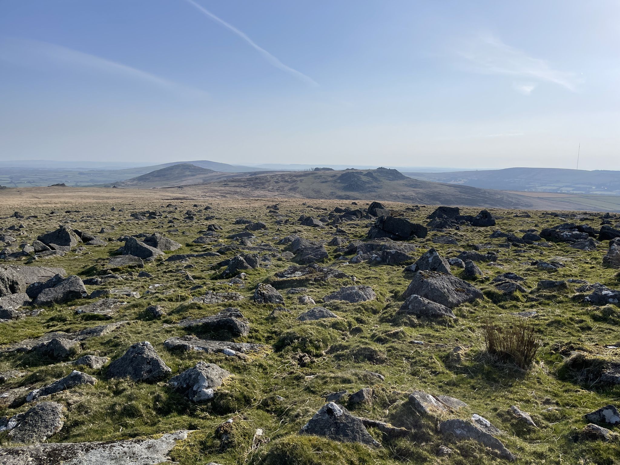
Views all round, to the sea, Cardigan Bay, north and Milford Haven in south.
0
0


The B4329 is the only road that bisects the main spine of the Preseli Hills and it reaches a high point of over 1,300 feet (400m) at Bwlch y Gwynt. There's parking here for those wanting a high start point for a quick raid on the Preseli range's three highest summits. Foel Cwmcerwyn and Foel Feddau rise to the east and Foel Eryr is tantalisingly close to the west.
0
0

Foel Cwmcerwyn is the highest point of the Preseli Hills at 1,759 feet (536m). It also marks Pembrokeshire's County Top and is a UK Marilyn so you can tick it off a few lists if you're hill bagging. From the north, it's an unassuming and fairly gentle (if rather boggy) approach. The south face footpath is a little steeper, with better panoramic views.
5
0
The views from Foel Feddau summit, at 1,432 feet (467m), make the slight detour from the Golden Road, the ridgeline that forms the spine of the Preseli Hills, worthwhile. The views of the steeper east face of Foel Cwmcerwyn are particularly good.
2
0

Because Foel Eryr summit is so easily reached from the nearby Bwlch-gwynt car park to the east, allowing nearly all of the climbing to be done in the car, it's easy to lose the true sense of the scale of the hill and its place in the landscape. Plan a circular walk to really appreciate a Preseli gem. That said if time is short, the reward for a 15 minute walk can be some outstanding views - on the best days you will be able to spot Lundy to the South, Ireland to the West, Snowdonia to the North and Brecon Beacons to the East.
2
0
Frequently Asked Questions
How many family-friendly hiking trails are available around Puncheston?
There are 5 family-friendly hiking trails around Puncheston featured in this guide. These routes are specifically chosen for their suitability for families, offering manageable distances and gentle paths.
Are there any easy, short walks suitable for toddlers or very young children?
Yes, for younger children or those seeking a very gentle stroll, routes like the Foel Eryr Summit Trail are ideal. It's just over 2 km long and takes around 35 minutes, offering an accessible way to enjoy the scenery. Another great option is the Foel Eryr Summit Cairn – View of the Preseli Hills loop from Bwlch y Gwynt, which is even shorter at 1.8 km.
Can we find circular routes that are good for families?
Absolutely! Many of the family-friendly trails around Puncheston are circular, making them convenient for starting and ending at the same point. For example, the Foel Eryr Summit Cairn – View of the Preseli Hills loop from Bwlch y Gwynt and the Bwlch y Gwynt Pass – Foel Eryr Summit Cairn loop from Bwlch y Gwynt are both excellent circular options, offering varied scenery without retracing your steps.
What kind of landmarks or viewpoints can we expect to see on these family hikes?
The family-friendly hikes often lead to fantastic viewpoints and historical sites. You can reach the Foel Eryr Summit Cairn, which offers sweeping panoramic vistas of the Preseli Hills. Further afield, but still accessible, are the impressive Foel Drygarn Hillfort and Cairns, a Bronze Age site with magnificent views.
Are the family-friendly trails around Puncheston suitable for dogs?
Yes, many trails in the Puncheston area, including those in the Preseli Hills, are generally dog-friendly. However, as much of the area is open moorland and farmland, it's crucial to keep dogs on a lead, especially near livestock, and to follow the Countryside Code. Always check specific route details for any restrictions.
What is the best time of year to go hiking with family in Puncheston?
Spring and summer are particularly lovely for family hikes in Puncheston. The weather is generally milder, and the landscapes are vibrant. Summer offers longer daylight hours, perfect for extended outings. However, the Preseli Hills can be exposed, so always be prepared for changing weather conditions regardless of the season.
Are there any moderate difficulty family hikes for slightly older children or more experienced families?
Certainly! For families looking for a bit more of a challenge, routes like Foel Eryr — Pembrokeshire Coast National Park offer a moderate difficulty level. This route covers nearly 10 km and provides a more extensive exploration of the Preseli Hills and the National Park's diverse terrain.
Where can we park when accessing these family-friendly trails?
Many of the trails, especially those leading to Foel Eryr and other parts of the Preseli Hills, often have small parking areas or lay-bys nearby. For example, routes starting from Bwlch y Gwynt typically have parking available. It's always advisable to check the specific route details on komoot for recommended starting points and parking information.
What do other hikers say about the family-friendly trails in Puncheston?
The area is highly rated by the komoot community, with an average score of 4.6 stars from nearly 600 ratings. Reviewers often praise the stunning panoramic views from the Preseli Hills, the sense of tranquility, and the well-maintained paths that make for enjoyable family outings.
Are there any places to stop for refreshments or a picnic along the routes?
While specific cafes directly on the trails are rare in the more remote parts of the Preseli Hills, the village of Puncheston itself has amenities like The Drovers Arms. For picnics, the open moorland and viewpoints offer many scenic spots to enjoy packed lunches amidst nature. Always carry enough water and snacks, especially on longer routes.
What should we bring for a family hike in Puncheston?
Given the varied terrain and potential for changing weather in the Preseli Hills, it's wise to bring layers of clothing, waterproofs, sturdy footwear, and plenty of water and snacks. A map or GPS device (like the komoot app) is also recommended, along with sun protection. For younger children, consider a carrier for longer stretches.
Most popular attractions around Puncheston

Get inspired with the komoot mobile app


Explore more
Browse the best Hikes in other regions.
