The best hikes from bus stations around Barnoldswick
4.5
(1009)
8,405
hikers
48
hikes
Bus station hiking trails around Barnoldswick offer access to varied landscapes, including the lower slopes of Weets Hill in the Pennines, characterized by drumlins and limestone geology. The area uniquely straddles the natural watershed between the Ribble and Aire valleys and features the Leeds and Liverpool Canal. Hikers can explore a mix of hill ascents and flatter canal-side paths, with proximity to the Forest of Bowland and Yorkshire Dales.
Best bus station hiking trails around Barnoldswick
- The most popular bus…
Last updated: September 26, 2026
4.4
(9)
43
hikers
8.50km
02:28
230m
230m
Moderate hike. Good fitness required. Easily-accessible paths. Suitable for all skill levels.
4.7
(3)
37
hikers
Easy hike. Great for any fitness level. Easily-accessible paths. Suitable for all skill levels.

4.4
(5)
24
hikers
Moderate hike. Good fitness required. Easily-accessible paths. Suitable for all skill levels.
5.0
(3)
29
hikers
Moderate hike. Good fitness required. Easily-accessible paths. Suitable for all skill levels.
5.0
(1)
20
hikers
5.78km
01:46
210m
210m
Easy hike. Great for any fitness level. Easily-accessible paths. Suitable for all skill levels.
Get access to more routes and recommendations from other explorers.
Already have an account?
Our route recommendations are based on thousands of hikes, rides, and runs completed by other people on komoot.
Start today with a free account
Your next adventure awaits.
Popular around Barnoldswick
Other adventures around Barnoldswick

Tips from the Community

County Brook is the original divide between Lancashire and the former West Riding of Yorkshire.
0
0

Also on a very clear day you can see Blackpool Tower to the west, approx 40 miles away.
0
0

Scenic views all round on the border between Lancashire and Yorkshire
0
0

There’s a nice down hill towards Barnoldswick.
0
0

Barnoldswick is a historic mill town with characterful cobbled streets and plenty of independent shops and cafes. The views from the town into the Yorkshire Dales are exceptional, with both Ingleborough and Malham Cove visible on clear days. There are plenty of places to eat and Alma Cliffe B&B is a good accommodation option for those walking the Pendle Way long-distance trail.
0
0
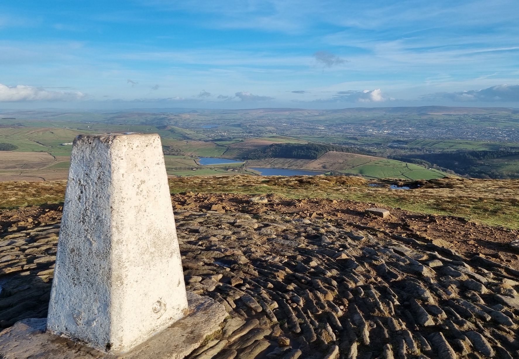
Weets Hill rises to 1,302 feet (397 m) above Barnoldswick and features on the Pendle Way, a 45-mile (72 km) loop of the region. It's the second highest point on the walk, behind the eponymous Pendle Hill. Views from the summit are extensive on a clear day, with the Aire Valley, the Ribble Valley and the distant Yorkshire Dales all visible. The famous Yorkshire Three Peaks are arrayed with Inglebrough on the left, Whernside in the middle and Pen-y-ghent on the right. There's also a bench near the trig point, so you can sit back, relax and enjoy the panorama.
0
0


Plenty of outside seating area and very busy in the sunshine
0
0
Frequently Asked Questions
How many bus station hiking trails are available in Barnoldswick?
There are over 45 hiking trails around Barnoldswick that are easily accessible from bus stations, offering a variety of options for car-free adventures.
What kind of landscapes can I expect on bus-accessible hikes around Barnoldswick?
Hikes from Barnoldswick bus stations offer diverse landscapes, from the gentle, glacially-formed hills of the Pennines, including the distinctive limestone scenery around Weets Hill, to picturesque canal-side walking along the Leeds and Liverpool Canal. You'll find routes that traverse open moorland, provide panoramic views, and follow historic waterways.
Are there easy hiking options accessible by bus in Barnoldswick?
Yes, Barnoldswick offers nearly 20 easy hiking routes that start directly from bus stations. An example is the Weets Pinnacle – Weets Hill Summit & Trig Point loop, which is a shorter, accessible option for enjoying the area's scenery.
What do other hikers say about the bus station trails in Barnoldswick?
The bus station trails in Barnoldswick are highly rated by the komoot community, with an average score of 4.5 stars from over 800 reviews. Hikers often praise the convenience of starting directly from public transport, the varied landscapes, and the rewarding views from spots like Weets Hill.
Are there any circular walks from Barnoldswick bus stations?
Yes, many of the bus-accessible routes in Barnoldswick are circular, allowing you to return to your starting point without retracing your steps. For instance, the Occupation Road – Weets Hill Summit & Trig Point loop is a popular circular hike offering extensive views.
What interesting sights or landmarks can I see along bus-accessible routes?
Many routes offer views of significant landmarks. You can enjoy panoramic vistas from Pendle Hill summit trig point or Sharp Haw Summit. Some trails also pass by the historic Leeds and Liverpool Canal, and you might even spot the Alice Nutter Statue on routes near Pendle Hill.
Can I bring my dog on these hikes?
Most hiking trails around Barnoldswick are dog-friendly, but it's always advisable to keep dogs on a lead, especially when passing through livestock fields or nature conservation areas. Be mindful of local signage and ensure your dog is well-behaved around other hikers and wildlife.
Are there options for a pub lunch along the bus-accessible routes?
Yes, some routes offer opportunities to stop for refreshments. The Cannon's Pub & Eatery – Foulridge loop is an example of a moderate walk that includes a pub, providing a convenient stop for lunch or a drink.
Are there longer, more challenging bus-accessible hikes?
Yes, for those seeking a greater challenge, Barnoldswick offers several moderate to difficult bus-accessible hikes. The Greenberfield Locks – Risebrigg Hill Summit loop is a longer, moderate option that explores more of the local terrain.
What should I consider for winter hiking around Barnoldswick?
Winter hiking in Barnoldswick can be rewarding, but conditions can change quickly, especially on higher ground like Weets Hill. Be prepared for colder temperatures, potential ice or snow, and shorter daylight hours. Essential gear includes warm, waterproof clothing, sturdy boots, and navigation tools. Always check local weather forecasts before heading out.
Which routes offer canal-side walking?
Barnoldswick is uniquely positioned as the highest town on the Leeds and Liverpool Canal, offering excellent canal-side walking. The Cannon's Pub & Eatery – Foulridge loop is a great example of a route that incorporates pleasant stretches along this historic waterway.
Are these bus station trails suitable for families?
Many of the easier and moderate bus-accessible trails are suitable for families, offering manageable distances and varied scenery. Look for routes with flatter sections, such as those along the Leeds and Liverpool Canal, or shorter loops like the Weets Pinnacle – Weets Hill Summit & Trig Point loop, which can be a good introduction to hiking for children.
Most popular routes around Barnoldswick
Most popular attractions around Barnoldswick

Get inspired with the komoot mobile app


Explore more
Browse the best Hikes in other regions.
