The best hikes from bus stations around North Turton
4.4
(555)
5,017
hikers
63
hikes
Bus station hiking trails around North Turton traverse a varied landscape within the West Pennine Moors, featuring tranquil reservoirs, expansive moorlands, and sheltered wooded valleys. The region's terrain includes both gentle waterside paths and more challenging routes with significant elevation gains. Key natural features include the Turton and Entwistle Reservoir, Wayoh Reservoir, and Jumbles Reservoir, alongside open moorland areas such as Turton Heights and Turton Moor. This area provides a blend of accessible paths and routes requiring good fitness.
Best…
Last updated: May 26, 2026
4.8
(95)
582
hikers
11.4km
03:01
110m
110m
Moderate hike. Good fitness required. Easily-accessible paths. Suitable for all skill levels.
4.9
(27)
200
hikers
5.36km
01:25
50m
50m
Easy hike. Great for any fitness level. Easily-accessible paths. Suitable for all skill levels.

Sign up for free
4.5
(15)
58
hikers
13.3km
03:41
230m
230m
Moderate hike. Good fitness required. Easily-accessible paths. Suitable for all skill levels.
3.7
(3)
31
hikers
15.9km
04:29
330m
330m
Moderate hike. Good fitness required. Easily-accessible paths. Suitable for all skill levels.
4.9
(7)
42
hikers
6.54km
01:48
110m
110m
Easy hike. Great for any fitness level. Easily-accessible paths. Suitable for all skill levels.
Get access to more routes and recommendations from other explorers.
Sign up for free
Already have an account?
Our route recommendations are based on thousands of hikes, rides, and runs completed by other people on komoot.
Start today with a free account
Your next adventure awaits.
Login or Signup
Popular around North Turton
Other adventures around North Turton

Tips from the Community

The path around the reservoir is worthwhile. It's used by many runners and dog walkers. Unfortunately, the reservoir is currently low on water.
0
0
Click here for the menu https://thestrawburyduck.co.uk/
0
0
Unfortunately, the reservoir currently has little water.
0
0
The bench under the copper beech invites you to take a rest.
0
0
If the visibility is good, you have a beautiful view of the tower from the circular hiking trail around the reservoir
0
0
Good starting point for a hike around the reservoir
0
0

Food is exceptional, great stop off point after a long walk around the reservoir.
1
0

Frequently Asked Questions
How many bus-accessible hiking trails are available in North Turton?
There are over 50 hiking trails around North Turton that are easily accessible from bus stations. These routes offer a diverse range of experiences, from gentle strolls around reservoirs to more challenging moorland ascents within the West Pennine Moors.
Are there easy or family-friendly hiking options accessible by bus in North Turton?
Yes, North Turton offers many easy and family-friendly routes. Approximately 23 of the bus-accessible trails are rated as easy. Many of these follow the picturesque reservoir paths, such as the 2.9-mile loop around Turton and Entwistle Reservoir, which is largely flat and well-maintained. These routes are ideal for families and those seeking a less strenuous walk.
What kind of terrain can I expect on bus-accessible hikes in North Turton?
The terrain varies significantly. You'll find well-maintained paths around the numerous reservoirs like Turton and Entwistle, Wayoh, and Jumbles. Other routes venture onto open moorland, such as Turton Heights and Turton Moor, which can be more exposed and rugged. There are also wooded valleys, providing shaded sections. Expect a mix of flat sections and moderate ascents, with some routes featuring significant elevation gains.
Are there any circular hiking routes from bus stations in North Turton?
Yes, many of the bus-accessible trails in North Turton are circular, allowing you to start and end your hike at the same bus stop. An example is the Entwistle Reservoir – Turton and Entwistle Reservoir loop from Chapeltown, which offers a moderate 11.4 km circuit exploring the area's natural beauty.
What natural features or landmarks can I see along the bus-accessible trails?
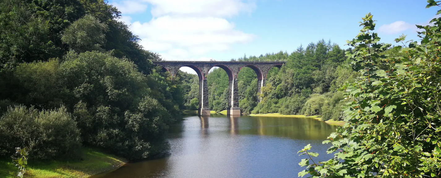
North Turton's trails are rich in natural beauty and historical landmarks. You can explore picturesque reservoirs, expansive moorlands, and wooded valleys. Notable features include the Two Lads' Cairn, Knowl Hill Trig Points, and the Noon Hill Bronze Age burial cairn. The area also features impressive industrial heritage like the Bradshaw Brook Viaduct and Entwistle Multi-arched Viaduct.
Are there any waterfalls accessible from bus routes in North Turton?
While North Turton is known for its reservoirs, you can find some charming waterfalls in the wider area. For example, the Hoghton Bottoms Weir and Viaduct and the Cheesden Lumb Mill Ruins and Waterfall offer scenic spots that can be incorporated into longer hikes, though direct bus access to these specific highlights might require a short walk from a main route.
What are some popular viewpoints or summits reachable by bus-accessible trails?
Many trails lead to excellent viewpoints. The Rivington Trig Point – Winter Hill Summit and TV Mast loop from Belmont offers stunning panoramic views from Winter Hill, one of the highest points in the West Pennine Moors. Another popular spot is Rivington Pike Tower, which provides superb vistas across the landscape.
Can I bring my dog on these bus-accessible hiking trails?
Generally, yes, many trails in North Turton are dog-friendly. However, always keep dogs under control, especially around livestock on moorland paths and near wildlife. Some areas, particularly nature reserves or private land, may have specific restrictions, so it's always best to check local signage. Remember to clean up after your dog to preserve the natural environment for everyone.
Are there pubs or cafes along the bus-accessible hiking routes in North Turton?
Yes, several routes pass by or are close to local amenities. For instance, Jumbles Reservoir has a cafe, and many villages like Chapeltown and Belmont, which serve as starting points for bus-accessible hikes, have pubs where you can refresh yourself after a walk. It's a good idea to check opening times in advance.
What do other hikers enjoy most about hiking in North Turton?
The komoot community rates the hiking experience in North Turton highly, with an average score of 4.4 stars. Reviewers often praise the diverse landscapes, from tranquil reservoir paths to dramatic moorland vistas, and the convenience of accessing these trails directly from public transport. The well-maintained paths and the blend of natural beauty with historical sites are frequently highlighted.
What is the North Turton Trail and can I access it by bus?
The North Turton Trail is a designated route that follows public rights of way across the parishes of Edgworth, Chapeltown, and Belmont. It offers sections or a complete 22.62 km hike. Given that many bus-accessible routes start in these villages, it's possible to access parts of the North Turton Trail directly from bus stops. More information can be found on the North Turton Parish Council website.
Are there any long-distance bus-accessible walks in North Turton?
Yes, for those seeking longer adventures, North Turton offers several extended routes. For example, the Great Hill Summit Shelter – View of Belmont Reservoir loop from Belmont is a moderate 14.7 km hike, and the Lead Mine Clough – Yarrow Reservoir loop from Belmont extends to 16.4 km, providing a full day's exploration from a bus-accessible starting point.
Most popular routes around North Turton
Most popular attractions around North Turton

Get inspired with the komoot mobile app


Explore more
Browse the best Hikes in other regions.
