The best hikes from bus stations around Blairgowrie And Rattray
4.4
(125)
1,013
hikers
37
hikes
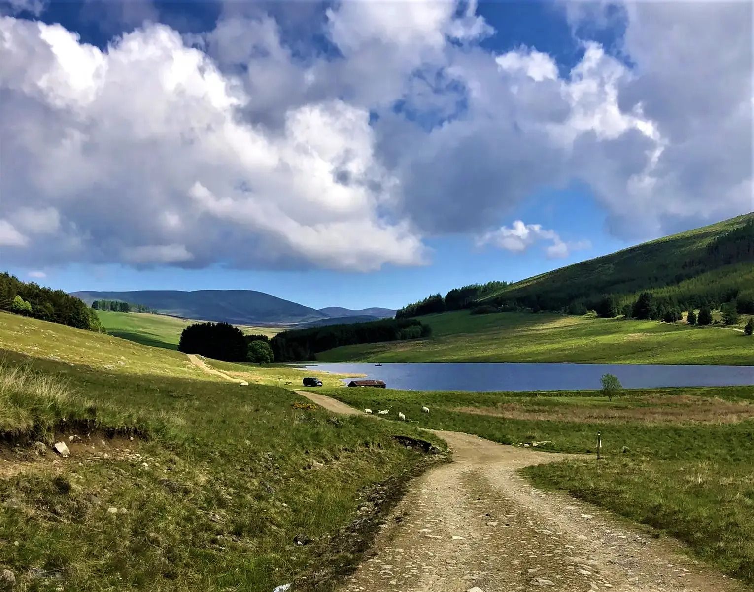
Bus station hiking trails around Blairgowrie And Rattray offer access to a diverse landscape at the foot of the Grampian Mountains. The region features rolling hills, dense forests, and expansive moorland, providing varied terrain for hikers. The River Ericht flows through the area, offering scenic riverside paths, while tranquil lochs provide peaceful settings. This natural environment supports a network of trails suitable for different hiking experiences.
Best bus station hiking trails around Blairgowrie And Rattray
- The most popular bus station hiking route is Knockie Viewpoint – Blairgowrie Town Centre loop from Blairgowrie and Rattray, a 5.3 miles (8.6 km) trail that takes 2 hours 22 minutes to complete. This moderate route offers panoramic views of Blairgowrie and the surrounding countryside from Knockie Hill.
- Another top favourite among local hikers is The Wee Coffee Shop – White Loch loop from Blairgowrie and Rattray, a moderate 4.9 miles (8.0 km) path. This trail leads around White Loch, providing peaceful scenery and opportunities for birdwatching.
- Local hikers also love the Cargill's Leap – Blairgowrie Town Centre loop from Blairgowrie and Rattray, an 8.0 miles (12.9 km) trail leading through riverside paths along the River Ericht, often completed in about 3 hours 35 minutes.
- Hiking around Blairgowrie And Rattray is defined by riverside paths, rolling hills, and tranquil lochs. The network offers options for various ability levels, from easy strolls to moderate ascents.
- The routes in Blairgowrie And Rattray are highly rated by the komoot community with an average score of 4.5 stars from more than 100 reviews. More than 900 hikers have used komoot to explore Blairgowrie And Rattray's varied terrain.
Last updated: August 30, 2026
5.0
(4)
36
hikers
Moderate hike. Good fitness required. Easily-accessible paths. Suitable for all skill levels.
4.0
(6)
16
hikers
Moderate hike. Good fitness required. Easily-accessible paths. Suitable for all skill levels.

Sign up for free
4.0
(1)
16
hikers
Easy hike. Great for any fitness level. Easily-accessible paths. Suitable for all skill levels.
3.8
(4)
18
hikers
5.65km
01:29
50m
50m
Easy hike. Great for any fitness level. Easily-accessible paths. Suitable for all skill levels.
5.0
(1)
6
hikers
13.1km
03:34
200m
200m
Moderate hike. Good fitness required. Easily-accessible paths. Suitable for all skill levels.
Get access to more routes and recommendations from other explorers.
Sign up for free
Already have an account?
Our route recommendations are based on thousands of hikes, rides, and runs completed by other people on komoot.
Start today with a free account
Your next adventure awaits.
Login or Signup
Popular around Blairgowrie And Rattray
Other adventures around Blairgowrie And Rattray

Tips from the Community

Great views over Blairgowrie. The highlight sits on a good hiking and biking track.
0
0
A nice grass/dirt narrow path. April 2025 - there's a fallen tree that has to be climbed over or under.
0
0
Steep climb out from Rattray. Of course, no problem with a powerful ebike.
0
0

You will often see swans here and if you’re about early or late you might see one of the resident beavers.
0
0

A good viewpoint from above, fairly obvious as it is signposted and there is a wooden platform. The trees are over growing so to really see the Linn, it is better to follow some of the rough paths along the riverside below.
0
0
Bustling little town, with several trails, the riverside path, and cafes. Parking near the river too to start a walk.
1
0
Frequently Asked Questions
How many bus station hiking trails are available in Blairgowrie And Rattray?
There are over 40 hiking routes accessible directly from bus stations around Blairgowrie And Rattray, offering a variety of experiences for all skill levels.
What is the best time of year for bus station hikes in Blairgowrie And Rattray?
The spring and autumn months are particularly beautiful, with vibrant wildflowers like bluebells in spring and stunning foliage in autumn. Summer offers longer daylight hours, while winter can provide crisp, scenic walks, especially on lower-lying routes. Always check local conditions before heading out.
Are there easy bus station hikes suitable for beginners or those looking for a gentle stroll?
Yes, there are 21 easy routes accessible by bus. A great option is the Blairgowrie Town Centre – Cargill's Leap loop, which is just under 5 km and offers a pleasant riverside walk. Another gentle choice is the White Loch loop from Carsie, providing tranquil lochside scenery.
What do other hikers say about the bus station trails in Blairgowrie And Rattray?
The komoot community rates the bus station trails in Blairgowrie And Rattray highly, with an average score of 4.5 out of 5 stars from over 100 reviews. Hikers often praise the accessibility, varied scenery, and the convenience of starting directly from public transport.
Are there family-friendly bus accessible walks?
Many of the easier routes are suitable for families. The White Loch loop from Carsie is a good choice, offering flat paths and opportunities for birdwatching. The area's numerous woodlands, like those found in Perthshire's "Big Tree Country," also provide engaging environments for children to explore.
Can I bring my dog on these bus station hikes?
Blairgowrie and Rattray is generally very dog-friendly. Many trails, especially those through woodlands and along rivers, welcome dogs. Always keep dogs under control, especially near livestock, and be mindful of local signage. The riverside paths along the River Ericht are popular for dog walks.
Are there circular routes starting directly from the bus station?
Yes, many of the bus-accessible routes are circular, allowing you to start and end at the same bus stop. For example, the Knockie Viewpoint – Blairgowrie Town Centre loop offers a rewarding circular hike with panoramic views.
What kind of scenery can I expect on these bus station trails?
You can expect a diverse range of scenery, from gentle riverside paths along the River Ericht, past historic mills and salmon leaps like Cargill's Leap, to rolling hills, dense forests, and tranquil lochs such as White Loch. The region sits at the foot of the Grampian Mountains, offering glimpses of more dramatic landscapes.
Are there any historical landmarks or points of interest along these bus-accessible routes?
Yes, several routes feature historical and natural landmarks. You can visit Mill Dam Lochan or explore the area around Loch of the Lowes. The River Ericht itself has remnants of old textile mills and the famous Cargill's Leap. The Knockie Viewpoint – Blairgowrie Town Centre loop takes you to Knockie Hill, offering panoramic views of the town and surrounding countryside.
Can I find routes that offer scenic viewpoints?
Absolutely. The Knockie Viewpoint – Blairgowrie Town Centre loop leads to Knockie Hill, providing excellent panoramic views of Blairgowrie and the surrounding area. Other trails may offer vistas of the Grampian Mountains or serene lochs like Polney Loch.
Are there any longer, more challenging bus-accessible hikes?
While many routes are moderate, there are 4 more difficult trails for those seeking a challenge. The Cargill's Leap – Blairgowrie Town Centre loop is a moderate, longer option at nearly 13 km, offering more elevation gain and a good workout while still being accessible by bus.
Most popular routes around Blairgowrie And Rattray
Most popular attractions around Blairgowrie And Rattray

Get inspired with the komoot mobile app


Explore more
Browse the best Hikes in other regions.
