The best hikes from bus stations around Glendale
4.2
(287)
2,498
hikers
8
hikes
Hiking around Glendale, Arizona, is characterized by the unique Sonoran Desert landscape, featuring rocky hills, iconic saguaro cacti, and diverse desert flora. The region offers varied terrain, from flat paths to more challenging routes through rugged hills, providing panoramic views of the desert environment. This arid climate supports xerophyte plants and diverse wildlife, including desert tortoises and various bird species.
Best bus station hiking trails around Glendale
- The most popular bus station hiking route is View of Neist Point Lighthouse…
Last updated: May 10, 2026
4.4
(24)
165
hikers
Moderate hike. Good fitness required. Easily-accessible paths. Suitable for all skill levels.
4.7
(14)
108
hikers
13.6km
03:51
280m
280m
Moderate hike. Good fitness required. Easily-accessible paths. Suitable for all skill levels.
4.0
(2)
2
hikers
14.8km
04:15
350m
350m
Moderate hike. Good fitness required. Easily-accessible paths. Suitable for all skill levels.
Get access to more routes and recommendations from other explorers.
Sign up for free
Already have an account?
Our route recommendations are based on thousands of hikes, rides, and runs completed by other people on komoot.
Start today with a free account
Your next adventure awaits.
Login or Signup
Popular around Glendale
Other adventures around Glendale

Tips from the Community

From the parking lot, which can be completely full from midday, a beautiful hiking trail winds up and down to the lighthouse. You get an even more beautiful view if you climb a relatively steep hill to the right just before the lighthouse.
0
0

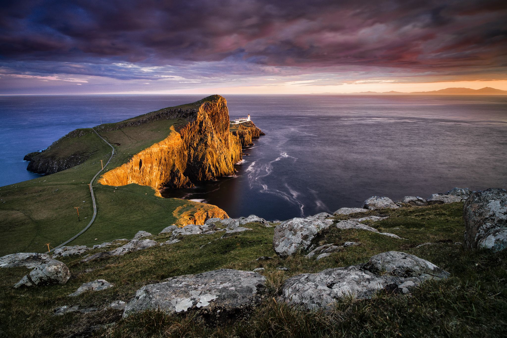
Neist Point Lighthouse is perched on the rugged cliffs of the Isle of Skye. The sweeping views of the dramatic coastline and the Atlantic Ocean are breathtaking, particularly at sunrise and sunset, when the light transforms the landscape into a palette of warm hues. Every vantage point offers a unique perspective, whether you're admiring the lighthouse itself or the surrounding cliffs and sea. It’s a place of raw beauty and tranquillity, where the power of nature feels truly magical, especially when the sun graces the scene.
1
0

Niest Point Lighthouse was first lit on 1st November 1909. It was opperated by a keeper until 1990 when it became automated. The cottages are now used as holiday cottages. Access to the lighthouse is challenging, there is a steep set of steps and then a walk across the exposed headland. The cliffs and position are amazing though, so if you're up for it and the weather is nice go for it!
0
0
Having climbed down the steps from the viewpoint and car park, there is a wide grassy area which gives great views of the cliffs and lighthouse. It's exposed though, and the cliffs are shear, so be careful while trying to find the best view point. Carry on along the path to the lighthouse and headland.
0
0
From here you get a glimpse of Neist Point, which is one of the most iconic and breathtaking landscapes in the region. It's famous for its dramatic cliffs that rise sharply from the ocean, and it's stunning panoramic views of the coastline and the surrounding sea.
2
0

Neist Point is the most westerly headland on the island of Skye, an iconic destination with dramatic cliff scenery, a famous lighthouse, and views to the Outer Hebrides.
0
0

This is simply one of the top places in Scotland that any decent photographer must visit in their lifetime. The views out towards Neist Point and the lighthouse from here are super beautiful, and the photos are taken at sunrise or sunset here. There are so many places to go and see here too; every location gives you a different angle or perspective. It is a powerful place for the soul, simply magical, and if you are here in the sun, then that is a huge bonus.
1
0
The views from here all along Waterstein Road across Moonen Bay towards the impressive cliffs of Waterstein Head and further on down the coast are spectacular. There is ample roadside parking here all along towards Neist Point, but this is a very popular place, especially in the summer.
1
0
Frequently Asked Questions
How many bus station hiking trails are available in Glendale?
Our guide features 8 hiking routes that are easily accessible from bus stations around Glendale, making it convenient to explore the Sonoran Desert without a car.
What is the typical difficulty level of these bus-accessible hiking trails?
The bus-accessible trails in Glendale offer a range of difficulties. You'll find 2 easy routes perfect for a leisurely stroll, 4 moderate trails for a good workout, and 2 more challenging routes for experienced hikers looking for an adventure. For example, the View of Neist Point Lighthouse – Neist Point and Lighthouse loop from Milovaig is a moderate option.
What kind of landscape can I expect on these bus-accessible hikes in Glendale?
These trails immerse you in the unique Sonoran Desert landscape, characterized by rocky hills, iconic saguaro cacti, and diverse desert flora. You can expect panoramic views of the desert and the city from various vantage points, especially in areas like Thunderbird Conservation Park or Deem Hills Recreation Area.
Are there family-friendly hiking options accessible by bus in Glendale?
Yes, Glendale offers several family-friendly trails accessible by public transport. Many parks, such as Thunderbird Conservation Park and Skunk Creek Linear Park, feature easier paths suitable for all ages, allowing families to enjoy the desert environment together.
Can I bring my dog on these bus-accessible hiking trails?
Many trails in Glendale's parks are dog-friendly, but it's always best to check specific park regulations before you go. Generally, dogs are welcome on leash. Remember to bring plenty of water for both yourself and your pet, especially in the desert climate.
Are there circular hiking routes available from Glendale bus stations?
Yes, several routes in this guide are circular, allowing you to start and end your hike at the same bus stop. An example is the Neist Point and Lighthouse – Neist Point Lighthouse loop from Glendale, which offers a full loop experience.
What natural features or landmarks can I see on these bus-accessible trails?
You can discover several interesting points of interest. For instance, the Neist Point Lighthouse is a prominent landmark. Other highlights include the beautiful Coral Beach, Isle of Skye, and historical sites like Dunvegan Castle, all accessible from trails in the region.
When is the best time of year to hike these bus-accessible trails in Glendale?
The best time to hike in Glendale is typically during the cooler months, from late fall through spring (October to April). Summers can be extremely hot, making early morning or late evening hikes the only safe option. Always check the weather forecast and carry ample water.
Are there cafes or places to eat near the bus-accessible trailheads in Glendale?
While some trailheads might be more remote, many bus routes pass through areas with amenities. For example, the Cafe Lephin – Glendale Martyrs Monument loop from Glendale specifically highlights a cafe along its route, providing a convenient stop for refreshments.
What do other hikers enjoy the most about hiking in Glendale?
The komoot community highly rates the hiking experience in Glendale, with an average score of 4.2 stars. Reviewers often praise the stunning desert scenery, the well-maintained trails, and the accessibility of these routes via public transport, making it easy to enjoy nature without needing a car.
Are there any specific safety tips for hiking in the Glendale desert environment?
When hiking in the Sonoran Desert, always carry more water than you think you'll need, wear sun protection (hat, sunscreen, long sleeves), and inform someone of your route and expected return time. Be aware of wildlife, especially snakes and scorpions, and stay on marked trails to avoid getting lost or disturbing fragile ecosystems.
Most popular attractions around Glendale

Get inspired with the komoot mobile app


Explore more
Browse the best Hikes in other regions.
