The best hikes from bus stations around Mozirje
4.3
(87)
633
hikers
3
hikes
Bus station hiking trails around Mozirje offer access to the diverse landscapes of the Upper Savinja Valley in Slovenia. The region features an alpine environment with high and low mountains, dense forests, and lush meadows. The Savinja River flows through the area, complementing scenic valleys such as Logar Valley and Robanov Kot Valley. This varied terrain provides a range of hiking experiences, from gentle riverside paths to more challenging mountain ascents.
Best bus station hiking trails around Mozirje
- The most…
Last updated: October 9, 2026
15
hikers
3.92km
01:05
70m
70m
Easy hike. Great for any fitness level. Easily-accessible paths. Suitable for all skill levels.
2.0
(1)
10
hikers
14.0km
03:46
180m
180m
Moderate hike. Good fitness required. Easily-accessible paths. Suitable for all skill levels.

4.4
(5)
12
hikers
Moderate hike. Good fitness required. Easily-accessible paths. Suitable for all skill levels.
4.0
(1)
12
hikers
6.10km
01:51
180m
180m
Easy hike. Great for any fitness level. Easily-accessible paths. Suitable for all skill levels.
1
hikers
6.02km
01:36
60m
60m
Easy hike. Great for any fitness level. Easily-accessible paths. Suitable for all skill levels.
Our route recommendations are based on thousands of hikes, rides, and runs completed by other people on komoot.
Start today with a free account
Your next adventure awaits.


Tips from the Community

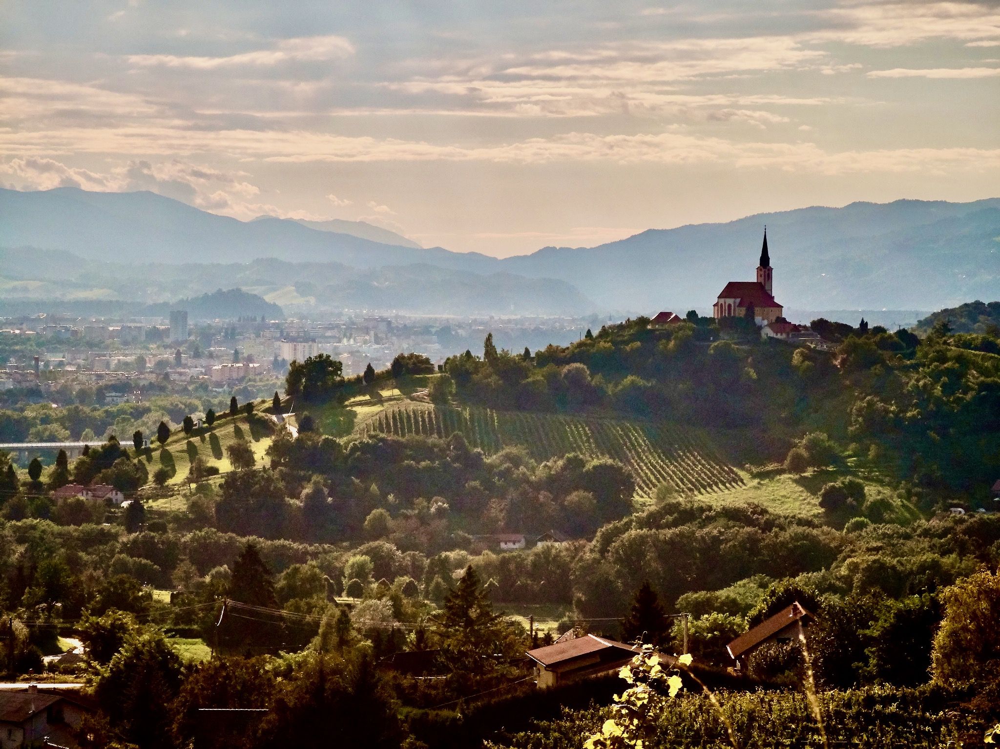
Very beautiful church, it's worth stopping here for a moment and taking a break.
0
0


Completed between the end of 2022 and the beginning of 2023, Vista Park is an extremely evocative place to host concerts, festivals and large events. The entire complex extends for more than 46,000 m² and is able to accommodate up to 30,000 visitors. The stage area is one of the largest in Slovenia and offers state-of-the-art technical support. The architectural design of the space was inspired by the mysterious image of the Pozoj dragon, with its attractive viewing platform that invites you to climb 14 meters and enjoy an exceptional view of Lake Velenje. To the east you can see Kinta Kunte, an interesting garden settlement. To the north you can see the surrounding hills (Lubela, Vodemlja, Razborje) and Uršlja Gora, up to the slopes of Peca. Towards the west you can see Smrekovec and Golte. On the south-east side, beyond the town of Velenje, the view opens onto Paški Kozjak. The surroundings of Vista Park invite guests to stroll on the paths among the green islands that are home to more than 11,000 newly planted trees and shrubs. There is a tennis court, a beach volleyball court and even a bowling alley. The area is also designed for the enjoyment of cyclists, skateboarders and skaters. There is also a nice children's playground with huge 5m high anancus and mastodon sculptures. Below the viewing platform there is a tourist information center (TIC) and the BarVista, from whose terrace a 50 meter long pier begins which invites you to observe the water surface up close. www.visitsaleska.si/en/vista-2/
1
0
The largest coal deposit in Slovenia is located underground in the Šalek Valley. More than 230 million tons of coal have been mined in that area. Mining activity has permanently marked the image of the valley and its people. Where once there were villages, today there are lakes, the result of almost 150 years of lignite extraction. With a surface area of almost 1.4 km² and a volume of over 30 million m³, Velenje is the largest of the three lakes in the Šalek valley and among the largest in Slovenia, comparable to that of Bled. Its catchment area extends for more than 20 km². The lake is 1.4 km long and 1.3 km wide. With a depth of 54 m it is deeper than Lake Bled (31 m) and Lake Bohinj (45 m). On the south-eastern shore, at Plaža Velenje, there is a very popular beach, declared the best natural beach in Slovenia in 2018 and 2022. This place offers many opportunities for sailing, windsurfing, SUP and rowing. The area can count on numerous rooms, equipment, and an inflatable water park. Nestled among green hills, it is also a fantastic place for family travellers. There is no shortage of entertainment, as well as opportunities to play sports or stay near the lake. Relaxation is ensured by clean water, services, free use of deck chairs and tidy wooden surfaces.
1
0
Škalsko Lake is the first of three lakes that began to form in the Šalek Valley following lignite mining activity. The body of water, formed before the Second World War, is the result of the less intense period of the coal industry in the valley. With its 16 hectares it is in fact the smallest of the three. The lake is bordered throughout its perimeter by a cycle/pedestrian path connected to the nearby Lake Velenj, which is much better known and popular. Today sport fishing is practiced in Lake Škalsko. Carp, zander and pike predominate in the lake. The lake is also known for large catfish exceeding 2 meters in length.
1
0

At the lake turn left and keep the lake on your right hand you really come around the lake.
0
0


Very nice campsite in Velenje am See, a former mining lake. Camping site with a beautiful tent lawn and a small restaurant, next door swimming pool. More information: http://camp-jezero.si/
4
0
Frequently Asked Questions
How many bus-accessible hiking trails are available around Mozirje?
This guide features a selection of hiking trails around Mozirje that are easily accessible by bus, offering car-free adventures. While this specific guide highlights a few routes, the broader Mozirje region, particularly the Upper Savinja Valley, provides numerous trails suitable for various skill levels, many of which can be reached via public transport connections from Mozirje.
What kind of terrain and difficulty can I expect on bus-accessible hikes near Mozirje?
The terrain around Mozirje is diverse, ranging from gentle riverside paths along the Savinja River to more challenging alpine ascents in areas like Golte Mountain or Smrekovec. You can find easy walks through forests and meadows, moderate trails with some elevation gain, and even more demanding treks for experienced hikers. The bus-accessible routes often provide a good starting point for exploring this varied landscape.
Are there any family-friendly hiking options accessible by bus from Mozirje?
Yes, Mozirje offers several family-friendly options. For an easy and pleasant experience, consider walks that lead to attractions like Mozirski Gaj, a beautiful flower park. Other gentle trails, such as the 'Frog's trail Blate' or the 'Trail by Škrubov potok' mentioned in the region's offerings, are also suitable for families and can often be reached with short bus connections or walks from bus stops.
Can I bring my dog on these bus-accessible hiking trails?
Generally, dogs are welcome on most hiking trails in Slovenia, including those around Mozirje. However, it's crucial to keep them on a leash, especially in protected areas, near livestock, or when encountering other hikers. Always carry water for your dog and be prepared to clean up after them. Specific rules might apply in certain nature parks or on public transport, so it's advisable to check local regulations if you plan to use buses with your dog.
What natural features or landmarks can I see along bus-accessible routes?
Many bus-accessible routes lead to or pass by stunning natural features. You might encounter the impressive 105-meter-high Rinka Waterfall in Logar Valley, or explore the unique Karst Sinkhole on Golte. The region is also rich in alpine scenery, lush meadows, and dense forests. The Lake and Žlajfer Hut at Treh Ploti is another scenic spot that can be part of a hike.
Are there any circular hiking routes starting from bus stations in Mozirje?
While specific circular routes directly from bus stations are not detailed in this guide, the region offers many opportunities for circular walks. For example, the 'Golte path' on Golte Mountain is a circular trail suitable for everyone. With good planning, you can often combine bus travel to a trailhead with a circular route that brings you back to a bus stop for your return journey.
What is the best time of year to hike these bus-accessible trails?
The best time for hiking in Mozirje and the Upper Savinja Valley is generally from late spring (May) through early autumn (October). During these months, the weather is usually pleasant, trails are clear of snow, and the alpine flora is vibrant. Summer offers the warmest temperatures, while spring and autumn provide cooler weather and beautiful colors. Some lower-altitude trails might be accessible in winter, but higher mountain routes require specialized gear and experience.
Are there any permits required for hiking in the Savinjska Valley?
For general hiking on marked trails in the Savinjska Valley, including those accessible by bus from Mozirje, no specific permits are typically required. However, if you plan to engage in activities like mountain climbing, or access certain protected areas or private lands, it's always wise to check for any specific regulations or permits that might apply. Always respect local signage and environmental guidelines.
What do other hikers enjoy most about the trails around Mozirje?
The hiking experiences around Mozirje are highly rated by the komoot community, with an average score of 4.5 stars from 66 ratings. Reviewers often praise the stunning alpine scenery, the tranquility of the Upper Savinja Valley, and the well-maintained trails that cater to various fitness levels. The accessibility by public transport is also a significant advantage for many.
Where can I find bus schedules and information for reaching trailheads from Mozirje?
For current bus schedules and routes from Mozirje to various trailheads, it's best to consult local public transport providers. The Mozirje Tourist Information Center can also provide up-to-date information on bus connections to popular hiking destinations like Logar Valley or the base of Golte Mountain. Planning your journey in advance is recommended, especially for less frequent routes.
Are there places to eat or stay near bus-accessible trailheads?
Yes, many popular hiking areas around Mozirje, especially those with bus access, have facilities nearby. Mountain huts are a common feature in the Slovenian Alps, offering traditional food and sometimes overnight accommodation. In larger villages or at the start of popular valleys like Logar Valley, you'll often find cafes, restaurants, and guesthouses. For example, the Golte Hotel & Mountain Resort is located in a prime hiking area.
Most popular routes around Mozirje
Most popular attractions around Mozirje

Get inspired with the komoot mobile app


Explore more
Browse the best Hikes in other regions.
