The best hikes from bus stations around Santiago
4.3
(519)
2,291
hikers
20
hikes
Bus station hiking trails around Santiago offer access to diverse landscapes, from the foothills of the Andes to urban green spaces. The region is characterized by its proximity to the Andes Mountains, providing a backdrop of towering peaks and varied terrain. Hikers can find trails through forests, along rivers, and to viewpoints offering expansive city and mountain views. Santiago's surroundings feature ecosystems ranging from native flora in drier climates to forests of quillayes and peumos.
Best bus station hiking trails…
Last updated: July 5, 2026
4.5
(13)
31
hikers
12.4km
03:44
380m
380m
Moderate hike. Good fitness required. Mostly accessible paths. Sure-footedness required.
3.8
(4)
58
hikers
5.39km
01:25
50m
50m
Easy hike. Great for any fitness level. Easily-accessible paths. Suitable for all skill levels.

Sign up for free
3.8
(4)
54
hikers
5.48km
01:27
50m
50m
Easy hike. Great for any fitness level. Easily-accessible paths. Suitable for all skill levels.
5.0
(2)
70
hikers
4.84km
01:14
20m
20m
Easy hike. Great for any fitness level. Easily-accessible paths. Suitable for all skill levels.
5.0
(1)
39
hikers
5.69km
01:51
240m
240m
Easy hike. Great for any fitness level. Easily-accessible paths. Suitable for all skill levels.
Get access to more routes and recommendations from other explorers.
Sign up for free
Already have an account?
Our route recommendations are based on thousands of hikes, rides, and runs completed by other people on komoot.
Start today with a free account
Your next adventure awaits.
Login or Signup
Popular around Santiago
Other adventures around Santiago

Tips from the Community

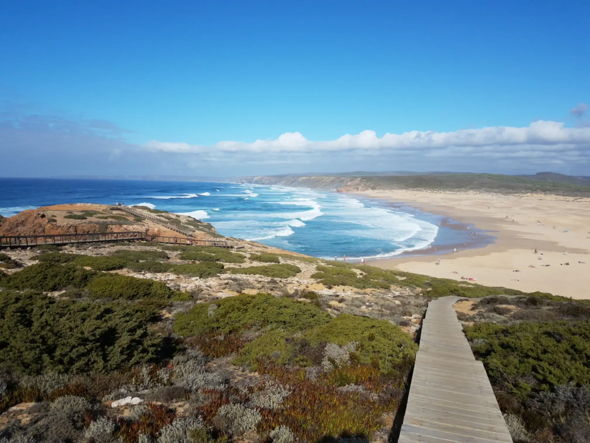
Not recommended without long pants. We were wearing shorts and there were lots of thorns scratching our legs. Views along the coastline are beautiful but we were not thrilled with the trail. The largest part are very small trails that aren't really maintained. Wouldn't repeat it and also not recommend it to others.
1
0

A breathtaking view of the bay of Sesimbra
3
0

Sesimbra is home to some of Portugal’s finest beaches. Right in the center of town is a long stretch of sand, divided into two beaches by a 17th-century fort. To the west of the monument is Praia do Ouro (“Golden Beach”) and to the east is Praia da Califórnia (“California Beach”). Both beaches can be quite crowded in the warmer months with local families, day trippers from Lisbon, and a few tourists. They’re faced by modern hotels and restaurants famous for fresh seafood. In fact, these restaurants attract as many Lisbonites as the beaches, and remain open throughout the year.
4
0
Amélia Cândida Preto Frade (1842–1905) Benefactor Amélia Cândida Preto Frade was born on January 7, 1842, the daughter of Justiniano José Preto and Maria Cândida Preto. She married shipowner José Pedro Frade, a partner in the fishing company Frade & Rumina, and an influential local politician. She made a large donation to the Misericórdia de Sesimbra, also donating the building of the Parish Council and several shares of the Bank of Portugal to both. The street was named after her in 1906, after her death on July 21, 1905.
5
0
Absolute highlight perfect ambience and very good food
4
0
Idyllically situated harbor on the outskirts of Sesimbra.
4
1
SESIMBRA ANTITUBERCULOSO DISPENSÁRIO - The fight against tuberculosis in Portugal began in the 1930s and accompanied the consolidation of the image of the new regime. Carlos Ramos developed the -type project for the tuberculosis pharmacy, to be deployed in the network of public facilities in the Estado Novo. With the introduction of the BCG vaccine in 1965, the number of patients flocking to pharmacies decreased, and in 1980, with the reform of the National Health Service, they were closed or integrated, and some were demolished. Built in 1954, the Sesimbra pharmacy suffered the same damage as the others, no longer fulfilling its original purpose, was abandoned in the mid-1980s, and has remained in this condition to this day. It has been the property of the Sesimbra City Council since 2005.
2
0
An unforgettable place here, far above Sesimbra Incredibly beautiful scenery and views
3
0
Frequently Asked Questions
How many hiking trails are accessible from bus stations around Santiago?
Our guide features around 20 hiking trails that you can easily reach using public transport from Santiago. These routes vary in difficulty, offering options for all experience levels.
Are there easy or beginner-friendly hikes accessible by bus?
Yes, there are several easy routes perfect for beginners or those looking for a relaxed outing. Approximately 9 of the trails in this guide are rated as easy, making them ideal for a gentle introduction to Santiago's natural beauty.
What kind of landscapes can I expect on these bus-accessible trails near Santiago?
The trails accessible by bus from Santiago offer a diverse range of Andean landscapes. You can expect to find everything from the dry, sunny foothills with native flora and fauna, as seen in areas like Parque Aguas de Ramón, to more rugged mountain terrain and stunning views of the Andes. Some trails lead through forests of quillayes and peumos, while others offer glimpses of Chilean palm trees and wetlands.
Are there any trails with waterfalls or significant natural features?
Absolutely. For instance, trails within Parque Aguas de Ramón, located on Santiago's eastern side, feature the notable Salto de Apoquindo, a 30-meter waterfall. The region also boasts impressive massifs, hills, and rivers, particularly in the Cajón del Maipo area, which, while sometimes requiring a bit more travel, showcases the spectacular San Francisco Glacier and Morales Glacier pond.
Can I bring my dog on these bus-accessible hiking trails?
Dog policies vary significantly by park and trail. While some urban parks like Cerro San Cristóbal may allow dogs on leash, natural reserves and national monuments often have strict rules against pets to protect wildlife. It's crucial to check the specific regulations for each trail or park before you go. For example, queries like 'Quebrada de Macul dog friendly policy' or 'El Panul Forest dog friendly policy' are common, indicating the need for prior research.
Are there family-friendly hiking options accessible by public transport?
Many of the easier routes are suitable for families. Trails with gentler inclines and shorter distances, often found in parks closer to the city like Cerro San Cristóbal or sections of Parque Aguas de Ramón, are excellent choices for outings with children. Always check the trail's difficulty and length to ensure it matches your family's capabilities.
What are some popular viewpoints or landmarks along these trails?
Many trails offer incredible panoramic views of Santiago and the Andes. Cerro Manquehue and Cerro San Cristóbal are renowned for their spectacular 360-degree city views. Further afield, areas like Mirador de Los Cóndores in Cajón del Maipo are famous for opportunities to observe Andean condors. While the provided data does not include specific highlights for Santiago, you can explore other guides like Natural Monuments around Santiago for more inspiration.
What do other hikers say about the bus-accessible trails around Santiago?
The hiking experiences around Santiago are highly rated by the komoot community, with an average score of 4.3 stars from over 460 reviews. Hikers often praise the incredible proximity to the Andes, allowing for a quick escape from the city into breathtaking natural environments, and the diverse range of trails suitable for various fitness levels.
Do I need a permit or need to pay fees for any of these bus-accessible hikes?
Some parks and natural reserves, such as Parque Aguas de Ramón or areas within Cajón del Maipo, may require an entrance fee or a permit, especially for conservation efforts. It's always best to check the official website of the specific park or reserve you plan to visit for the most up-to-date information on fees and permit requirements.
What is the best time of year to hike these trails?
The best time to hike around Santiago generally depends on the elevation and specific trail. Spring (September to November) and autumn (March to May) offer pleasant temperatures and vibrant landscapes. Summer (December to February) can be hot, especially in the foothills, but is ideal for higher-altitude trails. Winter (June to August) can bring snow to the higher Andes, making some trails challenging or inaccessible, but lower-elevation routes can still be enjoyed on clear days.
Are there any circular routes available from bus stations?
Yes, many trails are designed as loops, allowing you to start and end at the same point, which is convenient when relying on public transport. While specific circular routes are not detailed in the provided data for Santiago, komoot's route planning tools can help you identify and plan circular hikes from various bus stops.
What should I pack for a day hike on these bus-accessible trails?
Given the varied terrain and climate, it's wise to pack layers of clothing, plenty of water, snacks, sun protection (hat, sunscreen), and sturdy hiking shoes. A map or GPS device (like the komoot app) is also recommended. For higher-altitude trails or during cooler months, consider bringing a waterproof jacket and warmer layers.
Most popular attractions around Santiago

Get inspired with the komoot mobile app


Explore more
Browse the best Hikes in other regions.
