The best walks and hikes in Upper Kiamichi River Wilderness
7
hikers
5
hikes
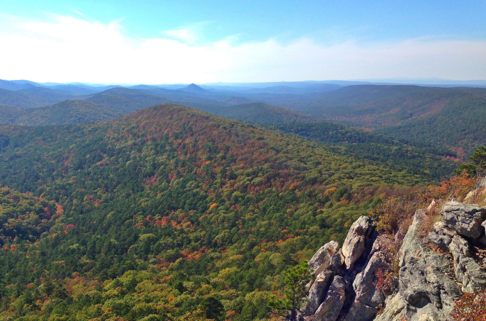
Hiking in Upper Kiamichi River Wilderness features rugged landscapes characterized by prominent, steeply sloped mountain ridges like Pine Mountain and Rich Mountain, reaching elevations of approximately 2,600 feet. These ridges descend into narrow valleys, with the Upper Kiamichi River meandering through the area. The wilderness is covered by dense forests of oak, hickory, and pine, providing diverse ecosystems for exploration.
Best hiking trails in Upper Kiamichi River Wilderness
- The most popular hiking route is Ouachita National Recreation Trail, a…
Last updated: October 2, 2026
3
hikers
3.54km
01:03
60m
60m
Moderate hike. Great for any fitness level. Mostly accessible paths. Sure-footedness required.
7.16km
02:13
230m
330m
The Rough Mountain via Ouachita Trail offers a rugged and rewarding experience, winding through dense pine-oak forests and over rocky terrain. You'll navigate continuous ascents and descents, with the trail…

107km
30:28
2,270m
2,640m
The Ouachita National Recreation Trail offers a rugged, immersive hiking experience through the Ouachita Mountains, characterized by dense pine and oak forests, sharp ridges, and clear streams. You'll traverse diverse…
6
hikers
2.71km
00:48
80m
80m
Easy hike. Great for any fitness level. Easily-accessible paths. Suitable for all skill levels.
854m
00:15
0m
60m
The Queen Wilhelmina Reservoir Trail offers a delightful, easy stroll through peaceful woodlands, leading you to a historic stone reservoir. This short 0.5-mile (0.9 km) route, with no elevation gain,…
Our route recommendations are based on thousands of hikes, rides, and runs completed by other people on komoot.
Start today with a free account
Your next adventure awaits.
Popular around Upper Kiamichi River Wilderness
Other adventures in Upper Kiamichi River Wilderness

Tips from the Community

Queen Wilhelmina State Park offers some of the most breathtaking views in the state from its fully renovated lodge. Known as the original “Castle in the Sky,” originally built in 1898, the lodge is situated on the 2,681-foot Rich Mountain—Arkansas' second highest peak. The original lodge was built in the late 1800s as a Victorian resort named Wilhelmina Inn to honor the young Queen of the Netherlands, after Dutch investors helped fund the construction of the railroad system. The park includes 41 campsites, including five tent sites with water, one hike-in tent site, picnic areas, and several short hiking trails, and the lodge features 40 rooms, a restaurant featuring Southern cuisine, and a gift shop. Dogs are welcome except in the restaurant and the large hearth room.
0
0
This state line location includes a historic boundary marker established in 1877 after a series of contentious surveys aimed at defining the border between Arkansas and what was then called Indian Territory. The inscription on its north face reads “48 M,” for the 48th mile, “1877” on the south face for the year the marker was installed, “ARK” for Arkansas on the east face, and “CHOC” for Choctaw Territory on the west. In 1976, the marker was listed on the National Register of Historic Places, making it one of the few remaining markers from this survey accessible to the public.
0
0
This backpacker's camp, located 300 feet west of the main campground, is open year-round and close to several trail systems, including the Ouachita National Recreation Trail (ONRT), Horsethief Trail, and Billy Creek Trail. It offers five tent pads, a picnic table, a fire ring, lantern poles, and a pit toilet, but no water. The main campground features 23 pull-in campsites with grills, fire rings, lantern poles, and three vault toilets. Situated on the crest of the Winding Stair Mountains, it's a favorite in the area for it's stunning views of the Ouachita Mountain Range. Campsites are first-come, first-served, with a fee of $3 ($8 for the main campground) at a self-pay station.
0
0
This trailhead for the Ouachita National Recreation Trail is a scenic crossing point over the Talimena Scenic Byway for thru hikers, and a starting point for hikers to explore other trails in the area. There is a small trailhead sign, but no parking. However, there is a parking area a short distance away at the Deadman Vista Overlook. Due to the limited availability of water sources in the area, especially during dry seasons, it is an ideal spot to store water for the upcoming few miles until you reach Cedar Branch or Horsethief Spring.
0
0
Frequently Asked Questions
How many hiking trails are available in Upper Kiamichi River Wilderness?
Komoot offers a selection of 5 hiking routes in the Upper Kiamichi River Wilderness, catering to various skill levels. You'll find 2 easy trails, 2 moderate trails, and 1 difficult route to explore.
Are there any easy or family-friendly hikes in the Upper Kiamichi River Wilderness?
Yes, there are several easy options suitable for families. The Hiking loop from Southern Belle Depot is a gentle 2.7 km walk. Another short and easy option is the Queen Wilhelmina Reservoir Trail, which is less than 1 km long.
What kind of terrain and elevation can I expect on trails in this wilderness area?
The Upper Kiamichi River Wilderness is characterized by rugged landscapes with prominent, steeply sloped ridges like Pine Mountain and Rich Mountain, reaching elevations of approximately 2,600 feet. Trails often descend into narrow valleys. For example, the Rough Mountain via Ouachita Trail involves over 220 meters of ascent, offering a good workout and scenic views.
Are there any loop trails in the Upper Kiamichi River Wilderness?
Yes, if you prefer circular routes, you can enjoy the Hiking loop from Rough Mountain. This moderate trail covers about 3.5 km and offers a complete experience without retracing your steps.
What natural features or landmarks can I see while hiking?
The wilderness is rich in natural beauty. You'll encounter the Upper Kiamichi River, which meanders through the landscape, and numerous creeks that often form picturesque miniature waterfalls. The area also boasts dense forests of oak, hickory, pine, and beech. The nearby Talimena Scenic Byway offers stunning panoramic views from its overlooks.
Is the Ouachita National Recreation Trail accessible from this area?
Yes, a significant portion of the Ouachita National Recreation Trail traverses the Upper Kiamichi River Wilderness. This trail allows hikers to access some of the highest mountain ridges in eastern Oklahoma. Be prepared for potential river crossings, as sections of the trail may require getting your feet wet. You can explore a long section of it with the Ouachita National Recreation Trail route.
What kind of wildlife might I encounter?
The region is a haven for wildlife. Hikers may spot white-tailed deer, bobcats, black bears, and various bird species. Wild turkeys and skunks are also common inhabitants of the diverse ecosystems found here.
What is the best time of year to hike in the Upper Kiamichi River Wilderness?
The diverse forests provide ample shade, making spring and fall particularly pleasant for hiking with comfortable temperatures and vibrant foliage. Summer can be warm, but the shaded trails offer relief. Winter hiking is possible, but conditions can be rugged.
Are there any specific considerations for river crossings on trails?
Yes, particularly on trails like the Ouachita National Recreation Trail, you should be prepared for river crossings. The Upper Kiamichi River and its numerous creeks flow through the wilderness, and some sections of trails may require wading through water, especially after rainfall.
What makes the Upper Kiamichi River Wilderness unique for hiking?
Its unique combination of rugged mountain ridges, pristine river systems, dense and diverse forests, and the presence of significant long-distance trails like the Ouachita National Recreation Trail offers an immersive and challenging outdoor experience. The dramatic elevation changes and abundant wildlife contribute to its distinct character.
Most popular routes in Upper Kiamichi River Wilderness

Get inspired with the komoot mobile app


Explore more
Browse the best Hikes in other regions.
