The best walks and hikes in Saint Francis Dam National Monument
5.0
(2)
11
hikers
2
hikes
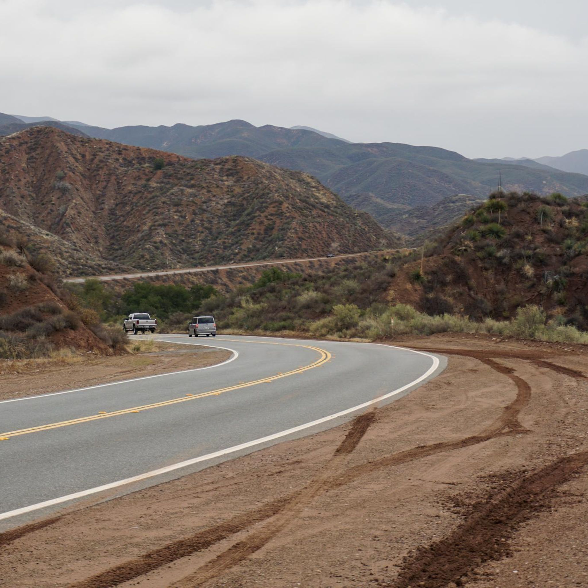
Hiking in Saint Francis Dam National Monument offers a unique blend of natural beauty and historical significance within the San Francisquito Canyon. The area is characterized by rugged canyons, rolling hills, and the San Francisquito Creek, which carves through unique rock formations. Hikers can explore diverse flora, including spring wildflowers and oak trees, and encounter wildlife. The monument also features the remnants of the historic St. Francis Dam, providing a tangible connection to a significant historical event.
Best hiking trails in Saint Francis Dam National Monument
- The most popular hiking route is Haskell Canyon Open Space, a 3.6 miles (5.8 km) trail that takes 1 hour 40 minutes to complete, winding through diverse landscapes.
- Another top favourite among local hikers is Del Sur Ridge, a moderate 10.1 miles (16.2 km) path offering views of canyons and Bouquet Reservoir.
- Local hikers also love the Sierra Pelona OHV Road, a 22.6 miles (36.4 km) trail leading through rugged mountain terrain, often completed in about 11 hours.
- Hiking in Saint Francis Dam National Monument is defined by rugged canyons, rolling hills, and historic dam ruins, with trails offering panoramic views of the Sierra Pelona Mountains. The network offers options for different ability levels, from easy walks to challenging mountain routes.
- The routes in Saint Francis Dam National Monument are highly rated by the komoot community with an average score of 5.0 stars from more than 2 reviews. More than 10 hikers have used komoot to explore Saint Francis Dam National Monument's varied terrain.
Last updated: September 29, 2026
4
hikers
5.77km
01:39
140m
140m
Explore the Haskell Canyon Open Space on an easy 3.6-mile (5.8 km) hike, offering a diverse landscape of spring wildflowers, grasslands, and oak groves. You will gain 470 feet (143 metres) in elevation over approximately 1 hour and 39 minutes. While rated easy, be prepared for some challenging sections, especially if you begin from the Copper Hill entrance, which features a steep initial climb. Reaching the ridgelines rewards you with panoramic views of Santa Clarita and the surrounding mountain ranges.
When planning your visit, remember to bring plenty of sun protection and extra water, as much of the area is exposed to the elements. The Haskell Canyon Open Space has multiple entry points, with the main trailhead located off Copper Hill Road. This is a popular spot for both hikers and mountain bikers, so you might encounter others enjoying the trails.
This trail offers a convenient escape into nature right within Santa Clarita, providing a sense of remoteness despite its proximity to the city. As you explore, keep an eye out for local wildlife such as deer and coyotes. The varied terrain and views make it a notable option for a quick outdoor adventure in the region.
16.2km
04:51
580m
410m
Hike the moderate 10.1-mile Del Sur Ridge trail in Angeles National Forest, gaining 1911 feet with views of canyons and Bouquet Reservoir.

36.4km
11:00
1,280m
950m
Hike the difficult 22.6-mile Sierra Pelona OHV Road for rugged mountain views and a challenging experience in Angeles National Forest.
5.0
(2)
5
hikers
9.58km
02:49
280m
280m
The Castaic Lake Trail loop offers a refreshing escape into Southern California's natural beauty, guiding you through rolling hills dotted with oak woodlands and chaparral. You'll experience a dynamic landscape, with sections following creek beds and the reservoir's edge, culminating in stunning overlooks of the vast Castaic Lake. The terrain is varied, mixing smoother paths with some uneven ground and small hills, providing a pleasant challenge without being overly demanding.
This moderate 6.0-mile (9.6 km) hike, with 903 feet (275 metres) of elevation gain, typically takes around 2 hours and 49 minutes to complete. Parking is readily available within the Castaic Lake Recreational Area, making trailhead access simple. It's a popular spot, so consider an early start to enjoy the quiet and secure a good parking space, especially on weekends. Always bring enough water, particularly during warmer seasons.
Castaic Lake is the largest reservoir in Southern California's state water project, and this trail provides unique perspectives of its scale and the surrounding Angeles National Forest. Beyond the scenic views, the area is a haven for wildlife, especially numerous bird species, making it a great spot for birdwatching. The trail system is also shared with mountain bikers and equestrians, adding to the diverse outdoor experience.
2
hikers
2.84km
00:46
40m
40m
Easy hike. Great for any fitness level. Easily-accessible paths. Suitable for all skill levels.
Our route recommendations are based on thousands of hikes, rides, and runs completed by other people on komoot.
Start today with a free account
Your next adventure awaits.
Popular around Saint Francis Dam National Monument
Tips from the Community

Castaic Lake, the largest reservoir in Southern California's state water project, boasts over 11,000 acres of surrounding parkland. It's a haven for water enthusiasts, offering an array of activities including boating, kayaking, and jet skiing. During the summer months, swimming is permitted at the Lower Lake Lagoon, providing a refreshing option for those looking to cool off and take a dip.
0
0

Chesebrough Park has a few paved paths that run through it and around it. There is also some open green space, restrooms, and a playground at the park. It's easy to make a loop using the park path and sidewalk on the outskirts of the property.
0
0
Frequently Asked Questions
What kind of landscapes can I expect to see while hiking in Saint Francis Dam National Monument?
The monument offers a dramatic mix of rugged canyons and rolling hills, with trails winding through the San Francisquito Canyon. You'll encounter diverse plant life, including vibrant wildflowers in spring, majestic oak trees, and riparian zones along San Francisquito Creek. The towering peaks of the Sierra Pelona Mountains also provide a stunning backdrop.
What are the main historical attractions to explore in the monument?
The primary historical attraction is the site of the St. Francis Dam, which catastrophically failed in 1928. You can explore the scattered concrete remnants and steel reinforcements across 350 acres of the canyon. An interpretive plaque near Pump Station 2 provides detailed historical context. The old San Francisquito Canyon Road, now a trail, also leads directly to the dam site.
Are there any easy hiking trails suitable for beginners or families?
Yes, there are easier options available. For instance, the Haskell Canyon Open Space trail offers a diverse and relatively easy experience. Another accessible option is the Chesebrough Park loop from Copper Hill, which is also rated as easy.
When is the best time of year to go hiking in Saint Francis Dam National Monument?
The ideal times for hiking are typically spring and fall. During these seasons, temperatures are mild, making for more comfortable conditions. Spring is particularly beautiful, as wildflowers bloom vibrantly across the landscape.
Can I bring my dog on the trails in Saint Francis Dam National Monument?
While the monument is managed by the U.S. Forest Service, specific regulations for dogs can vary. Generally, dogs are permitted on trails within the Angeles National Forest, but they must be kept on a leash. Always check local signage for any specific restrictions in certain areas or on particular trails.
Are there any trails that offer panoramic views?
Absolutely. Many trails lead to ridgelines that provide expansive vistas. For example, hikes in the Haskell Canyon Open Space can reward you with panoramic views of Santa Clarita and the surrounding mountain ranges. A faint trail also climbs to the top of the dam's anchoring slope, offering 'dynamite views' of the canyon and the Sierra Pelona Mountains.
What kind of wildlife might I encounter while hiking?
The monument is home to a diverse array of wildlife. You might spot deer, coyotes, and various bird species. The area is also a crucial habitat for several endangered species, including the California red-legged frog and least Bell's vireo, particularly in the riparian zones along San Francisquito Creek.
Are there any longer or more challenging hikes available for experienced trekkers?
Yes, for those seeking a greater challenge, the monument offers more demanding routes. The Sierra Pelona OHV Road is a difficult 22.6-mile route that provides rugged mountain views. Another moderate option is the Del Sur Ridge trail, which spans 10.1 miles with significant elevation gain.
What do other hikers say about their experience in Saint Francis Dam National Monument?
The area is highly rated by the komoot community, with an average score of 5.0 stars. Reviewers often praise the unique blend of natural beauty and profound historical significance, highlighting the reflective and educational experience offered by the dam site and the scenic canyon trails.
Are there any trails that offer views of Castaic Lake?
Yes, some trails provide unique perspectives of Castaic Lake, which is Southern California's largest reservoir. The Castaic Lake Trail loop is a moderate 6.0-mile hike that offers excellent views of the lake and the surrounding Angeles National Forest.
What should I bring with me when hiking in the monument?
Given the varied terrain and remote setting, it's crucial to bring plenty of water, especially during warmer months. Comfortable hiking shoes, sun protection, and snacks are also highly recommended. Be prepared for changing conditions and always carry a map or GPS device.
Most popular routes in Saint Francis Dam National Monument

Get inspired with the komoot mobile app


Explore more
Browse the best Hikes in other regions.
