The best walks and hikes in Cumberland County
4.5
(2)
35
hikers
7
hikes
Hiking trails in Cumberland County, Virginia, traverse a landscape characterized by forests, lakes, and riverine environments. The region offers a mix of flat, accessible paths and trails with gentle elevation changes. Key features include the Appomattox River and Bear Creek Lake, providing varied scenery for outdoor activities.
Best hiking trails in Cumberland County
- The most popular hiking route is Bear Creek Lake Loop Trail, a 3.8 miles (6.1 km) trail that takes 1 hour 35 minutes to complete. This…
Last updated: July 8, 2026
10
hikers
6.06km
01:35
40m
50m
Hike the easy 3.8-mile Bear Creek Lake Loop Trail in Bear Creek Lake State Park, enjoying lake views and native trees.
2.96km
00:46
10m
20m
The High Bridge Trail offers a unique journey across a historic rail-to-trail conversion, providing a wide, level path of finely crushed limestone. You'll experience a pleasant stroll through woodlands and…

Sign up for free
1.76km
00:30
30m
50m
Hike the easy 1.1-mile Kershaw Trail in Sailor's Creek Battlefield State Park, gaining 92 feet over 29 minutes through historic landscapes.
9
hikers
5.41km
01:24
40m
40m
Easy hike. Great for any fitness level. Easily-accessible paths. Suitable for all skill levels.
4.5
(2)
7
hikers
17.1km
04:27
120m
120m
Moderate hike. Good fitness required. Easily-accessible paths. Suitable for all skill levels.
Get access to more routes and recommendations from other explorers.
Sign up for free
Already have an account?
Our route recommendations are based on thousands of hikes, rides, and runs completed by other people on komoot.
Start today with a free account
Your next adventure awaits.
Login or Signup
Popular around Cumberland County
Tips from the Community

Excellent place to take a break. Has clean restrooms and water. Inside has very interesting dioramas of the High-Bridge. Well worth a stop when hiking or biking.
1
0

Easy hardpack trail suitable for all bike types. Bridge offers great views and is quite the engineering feat. Camp Paradise offers a bathroom and water stop with snacks. Nice midwayish replenish point if riding the entire trail from end to end.
0
0

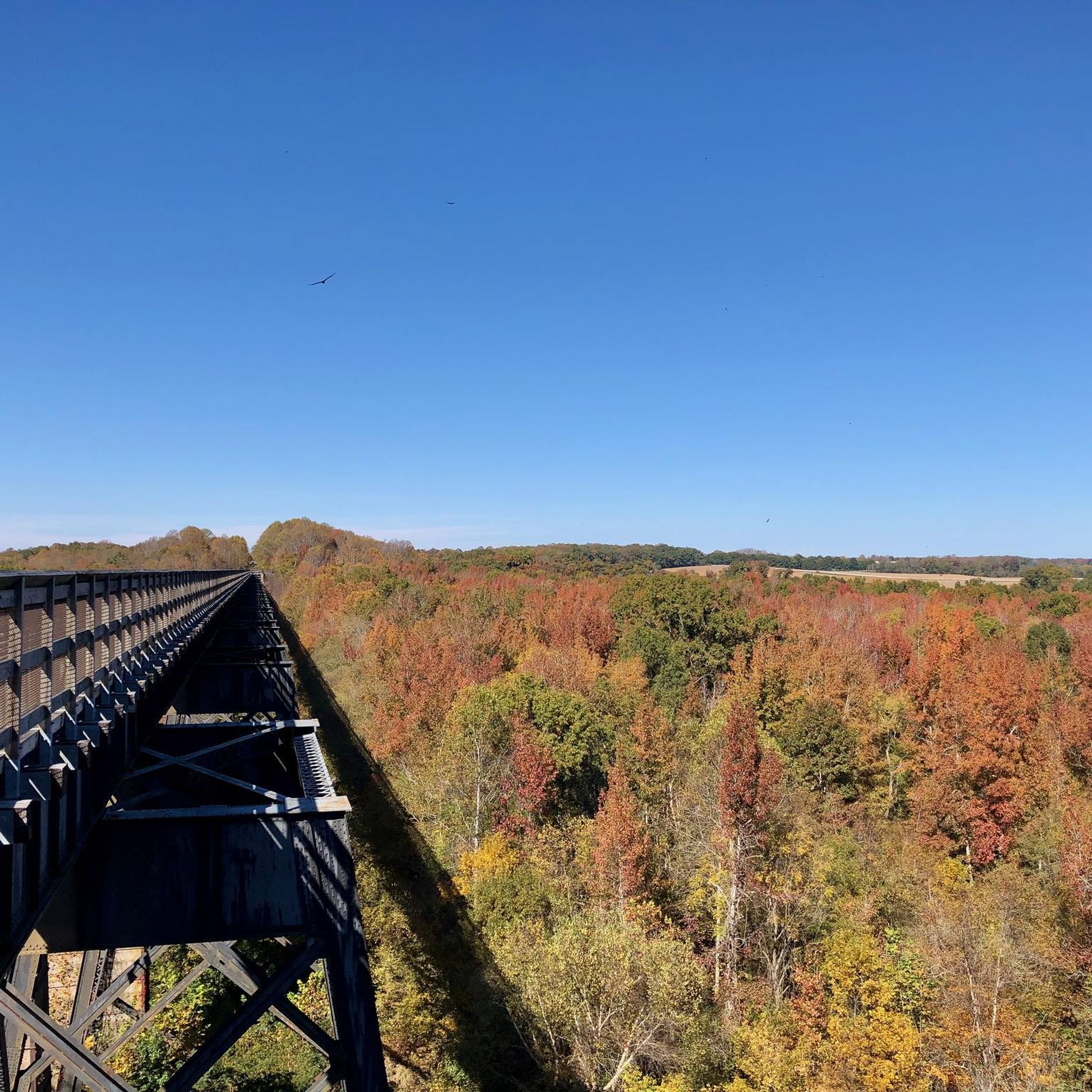
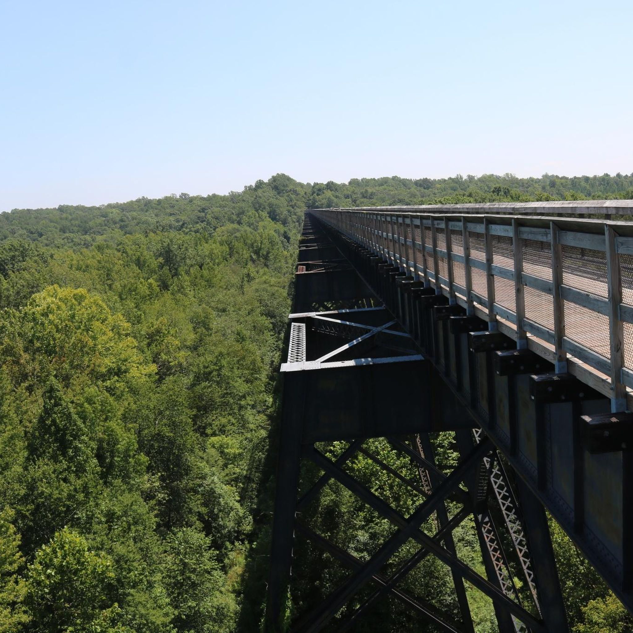
This bridge really is high, sitting 125 feet above the Appomattox River. The bridge itself is more than 2,400 feet long, making it the longest recreational bridge in the state and one of the longest in the country.
0
0

2,400 feet long high bridge at the tree tops (60 to 125 feet tall).
1
0

The bridge is the featured attraction on the 31 mile High Bridge Trail State Park. A Virginia State Park on a converted railroad line. The bridge is 2100 feet long and 125 feet above the Appomattox River.
0
0
Frequently Asked Questions
What kind of hiking trails can I expect in Cumberland County, Virginia?
Cumberland County, Virginia, offers a variety of trails characterized by its forested landscapes, serene lakes, and riverine environments. You'll find a mix of flat, accessible paths and routes with gentle elevation changes, often following the Appomattox River or circling Bear Creek Lake.
Are there any easy, family-friendly hikes in Cumberland County?
Yes, many trails in Cumberland County are suitable for families and those looking for an easy stroll. The Bear Creek Lake Loop Trail is an excellent option, offering an easy 3.8-mile (6.1 km) path that circles Bear Creek Lake within Bear Creek Lake State Park. Another short and easy option is the Kershaw Trail, a 1.1-mile (1.8 km) route through forested areas.
Are there any circular hiking routes in Cumberland County?
Absolutely. The Bear Creek Lake Loop Trail is a popular circular route, perfect for enjoying the lake scenery. For a longer, moderate option, consider the High Bridge – High Bridge Trail loop from High Bridge Visitor Center, which is 10.6 miles (17.1 km) and offers expansive views along a former railway line.
What are the most popular hiking spots in Cumberland County, Virginia?
Hikers frequently visit areas around Bear Creek Lake State Park and the High Bridge Trail. The Bear Creek Lake Loop Trail is particularly popular for its scenic lake views, while the High Bridge Trail offers a unique experience along a historic railway line.
What do other hikers say about the trails in Cumberland County?
The trails in Cumberland County are highly regarded by the komoot community, with an average score of 4.75 stars from 3 reviews. Hikers often praise the quiet forested paths, the scenic lake loops, and the well-maintained nature of the historic rail trails, noting the variety of options for different ability levels.
Are there any trails that follow rivers or offer water views?
Yes, Cumberland County's landscape is characterized by riverine environments and lakes. The Bear Creek Lake Loop Trail offers continuous views of Bear Creek Lake. Additionally, many trails traverse areas near the Appomattox River, providing opportunities for scenic water views.
How many hiking trails are available in Cumberland County, Virginia?
There are 8 hiking routes recorded in Cumberland County, Virginia, on komoot. These include 7 easy trails and 1 moderate trail, offering options for various fitness levels.
Can I find any historic landmarks while hiking in Cumberland County?
Yes, the High Bridge – High Bridge Trail loop from High Bridge Visitor Center features the historic High Bridge, a significant landmark that was once a crucial railway bridge. This trail offers a unique blend of natural beauty and historical interest.
What is the longest hiking trail in Cumberland County?
The longest trail listed is the High Bridge – High Bridge Trail loop from High Bridge Visitor Center, which is a moderate 10.6 miles (17.1 km) in length. It's an excellent option for those seeking a longer excursion.
Are there any trails suitable for a quick walk?
For a quick and easy walk, the Kershaw Trail is a great choice. It's 1.1 miles (1.8 km) long and can typically be completed in under 30 minutes, leading through pleasant forested areas.
What kind of terrain will I encounter on Cumberland County trails?
The trails in Cumberland County primarily feature forested paths, often with packed earth or crushed stone surfaces, especially on former railway lines. You'll find relatively flat terrain around lakes and rivers, with some gentle elevation changes in wooded areas.
Where can I find more information about the trails in Cumberland County, Virginia?
You can explore all the detailed routes, including maps, elevation profiles, and photos, directly on komoot. The guide provides an overview of the top trails, and you can find more options by browsing the region on the komoot website or app.
Most popular routes in Cumberland County

Get inspired with the komoot mobile app


Explore more
Browse the best Hikes in other regions.
