The best gravel rides around Almuniente
5.0
(2)
53
riders
6
rides
Gravel biking around Almuniente offers routes through the semi-arid landscapes of the Huesca region, bordering the Monegros Desert. The Almuniente region topography features wide-open horizons and fast-rolling dirt tracks, with elevations generally remaining below 200 meters. The terrain is characterized by sparse vegetation, including holm oaks and junipers, with poplars found along the Flumen river. This environment provides a network of paths suitable for gravel exploration.
Best gravel bike trails around Almuniente
- The most popular gravel bike trail is Church of Grañén – Hermitage of Santa Quiteria loop from Grañén, a 53.1 miles (85.4 km) trail that takes 7 hours 1 minute to complete. This difficult route explores the wider area, connecting significant landmarks.
- Another top favourite among local gravel bikers is Corona de la Reina loop from Tardienta, a difficult 25.2 miles (40.6 km) path. This route offers a substantial ride through the open, rolling landscapes typical of the region.
- Local gravel bikers also love the Canal de los Monegros – Canal de Monegros loop from Montesusín, a 13.7 miles (22.0 km) trail leading through the canal network, often completed in about 1 hour 26 minutes.
- Gravel biking around Almuniente is defined by its semi-arid terrain, extensive dirt tracks, and the presence of the Monegros Desert landscape. The network offers options for easy, moderate, and difficult routes, catering to various skill levels.
- The routes in Almuniente are highly rated by the komoot community with an average score of 5.0 stars from 2 reviews. More than 50 gravel bikers have used komoot to explore Almuniente's varied terrain.
Last updated: July 2, 2026
5.0
(1)
34
riders
85.4km
07:01
790m
790m
Hard gravel ride. Very good fitness required. Mostly paved surfaces. Suitable for all skill levels.
5.0
(1)
1
riders
40.6km
03:37
530m
530m
Hard gravel ride. Very good fitness required. Mostly paved surfaces. Suitable for all skill levels.

Sign up for free
2
riders
22.0km
01:27
110m
110m
Easy gravel ride. Great for any fitness level. Mostly paved surfaces. Suitable for all skill levels.
2
riders
36.0km
02:21
190m
190m
Moderate gravel ride. Good fitness required. Mostly paved surfaces. Suitable for all skill levels.
1
riders
35.4km
02:23
160m
160m
Moderate gravel ride. Good fitness required. Mostly paved surfaces. Suitable for all skill levels.
Our route recommendations are based on thousands of hikes, rides, and runs completed by other people on komoot.
Start today with a free account
Your next adventure awaits.
Login or Signup
Popular around Almuniente
Tips from the Community

In addition to the Church of the Assumption (in the image), here you can visit the Civil War Interpretation Center, which collects and offers a wide variety of materials to study the war. More information: https://www.turismodearagon.com/ficha/ruta-orwell-y-centro-de-la-guerra-civil-en-robres/
0
0
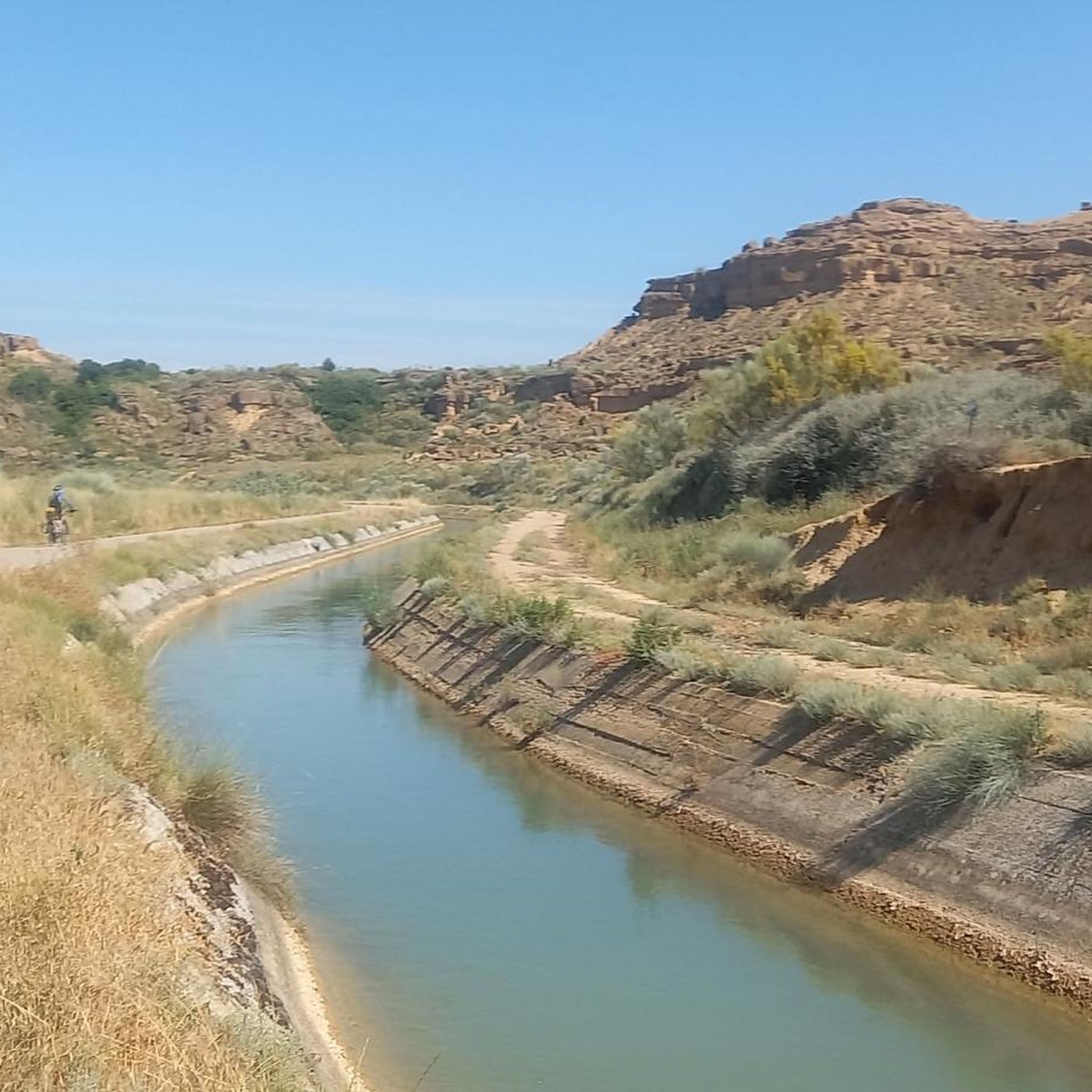
In the middle of the desert, the Canal de Los Monegros serves to irrigate an area of 110,000 hectares. It takes water from the Sotonera reservoir and transfers it to irrigate Los Monegros, La Sobrarbe and Somontano, in the provinces of Huesca and Zaragoza.
0
0
Its old quarter stands on a gentle tozal, where the church and the remains of an old castle predominate over the modern part of the town.
0
0

Monegros Canal near the town of Robres. The Monegros canal is a canal designed in the Alto Aragón Irrigation Plan of 1902. Its construction began in 1915 and it is 130 kilometers long.
0
0
Frequently Asked Questions
What kind of terrain can I expect on gravel bike trails around Almuniente?
The region around Almuniente, including the nearby Monegros Desert, is characterized by wide-open horizons, fast-rolling dirt, and wind-shaped terrain. You'll find a mix of semi-arid landscapes, dirt tracks, and paths, with vegetation ranging from sparse shrubs to holm oaks and poplars along the Flumen river. This makes for routes that prioritize flow, speed, and endurance.
Are there any easy gravel bike routes suitable for beginners in Almuniente?
Yes, there are routes suitable for beginners. For an easier ride, consider the Canal de los Monegros – Canal de Monegros loop from Montesusín. This route covers about 22 km with minimal elevation gain, making it a good option for those new to gravel biking or looking for a relaxed outing.
What are some of the longer or more challenging gravel bike routes in the area?
For a more challenging experience, the Church of Grañén – Hermitage of Santa Quiteria loop from Grañén is a demanding option, stretching over 85 km with significant elevation changes. Another difficult route is the Corona de la Reina loop from Tardienta, which is around 40 km long and also features challenging ascents.
What kind of natural features or landmarks can I see while gravel biking near Almuniente?
Beyond the unique semi-desert landscape, you can encounter various points of interest. The region features diverse flora including holm oaks and poplars. You might also come across historical sites like Posición San Simón or Orwell Trenches, and natural monuments such as Peña Mediodía de Piracés. The Pinar de Frula pine forest is also a notable natural attraction.
Are there any circular gravel bike routes available?
Yes, many of the gravel bike routes around Almuniente are designed as loops. Examples include the Canal de los Monegros – Canal de Monegros loop from Montesusín, the Canal de Monegros loop from Montesusín, and the Embalse del Torrollón loop from Poleñino. These circular routes allow you to start and finish at the same point, offering convenience for your ride.
What is the best time of year for gravel biking in Almuniente?
Given the semi-arid climate, spring and autumn are generally the most pleasant seasons for gravel biking in Almuniente. Temperatures are milder, and the landscape can be particularly beautiful. Summers can be very hot, making early morning or late afternoon rides preferable, while winters are typically mild but can have cooler temperatures.
What do other gravel bikers enjoy most about the routes in Almuniente?
The area is highly rated by the komoot community, with an average score of 5.0 stars. Reviewers often praise the unique, open landscapes of the Monegros region, the fast-rolling dirt tracks, and the sense of adventure offered by the diverse terrain. The quietness and natural beauty are frequently highlighted.
Are there any routes that pass by water features or reservoirs?
Yes, the Embalse del Torrollón loop from Poleñino is a moderate route that takes you past the Embalse del Torrollón reservoir, offering scenic views and a change of scenery from the more arid parts of the region.
Can I find routes that connect different towns or villages in the area?
The network of rural roads and tracks around Almuniente naturally connects several small towns. Routes like the Church of Grañén – Hermitage of Santa Quiteria loop from Grañén start and finish in Grañén, and many routes traverse the countryside between settlements like Montesusín, Tardienta, and Poleñino, allowing you to explore the local communities.
What is the general elevation profile for gravel biking in this region?
While the region is generally characterized by wide-open spaces, the elevation profiles vary. You'll find routes with relatively flat sections, especially along canals, but also more challenging rides with significant climbs and descents, particularly in areas closer to the Monegros Desert's wind-shaped terrain. For example, the Church of Grañén – Hermitage of Santa Quiteria loop from Grañén features nearly 800 meters of elevation gain.
Most popular routes around Almuniente
Most popular attractions around Almuniente

Get inspired with the komoot mobile app


Explore more
Browse the best Gravel rides in other regions.
