The best walks and hikes around Area A (Upper Bridge River Valley)
4.5
(2)
156
hikers
7
hikes
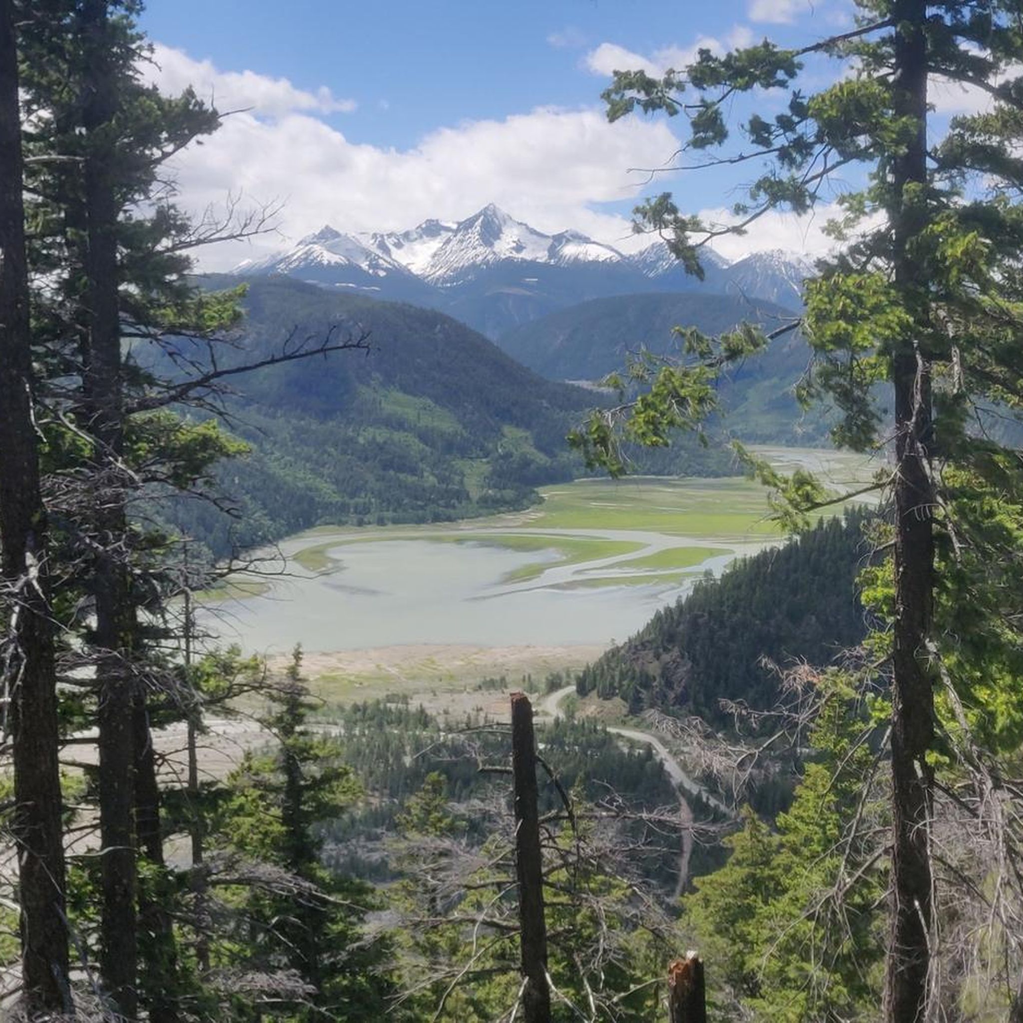
Hiking around Area A (Upper Bridge River Valley) offers diverse landscapes characterized by spectacular mountain ranges and extensive trail networks. The region features massive peaks, ancient glaciers, and a transition from rocky, glaciated areas to grassland meadows. Numerous lakes, including Gun Lake and Carpenter Lake, are integrated into the trail system, providing varied scenery for outdoor exploration.
Best hiking trails around Area A (Upper Bridge River Valley)
- The most popular hiking route is Semaphore Lakes Trail — Semaphore Lakes Area Recreation Site, a 3.7 miles (6.0 km) trail that takes 2 hours 37 minutes to complete. This moderate route leads to alpine lakes surrounded by mountainous terrain.
- Another top favourite among local hikers is Semaphore Lakes Trail loop — Pemberton Meadows, a moderate 3.3 miles (5.3 km) path. This loop offers views of the surrounding peaks and takes approximately 2 hours 26 minutes.
- Local hikers also love the Tenquille Lake via Branch 12 Trail — Hawint Recreation Site, a 9.8 miles (15.8 km) trail leading through varied alpine landscapes, often completed in about 5 hours 6 minutes.
- Hiking around Area A (Upper Bridge River Valley) is defined by mountainous terrain, glaciated valleys, and diverse ecosystems ranging from rocky areas to grassland meadows. The network offers options for various ability levels, from moderate day hikes to more challenging alpine routes.
- The guide includes highly-rated routes that showcase the best of the region's landscape. More than 100 hikers have used komoot to explore Area A (Upper Bridge River Valley)'s varied terrain.
Last updated: October 3, 2026
72
hikers
6.04km
02:37
350m
350m
Moderate hike. Good fitness required. Mostly accessible paths. Sure-footedness required.
4.5
(2)
59
hikers
5.32km
02:26
350m
350m
Moderate hike. Good fitness required. Mostly accessible paths. Sure-footedness required.

5
hikers
19.8km
07:31
1,030m
1,030m
Hard hike. Very good fitness required. Mostly accessible paths. Sure-footedness required.
4
hikers
15.8km
05:06
660m
660m
Hard hike. Very good fitness required. Easily-accessible paths. Suitable for all skill levels.
1
hikers
27.2km
07:56
710m
710m
Hard hike. Very good fitness required. Easily-accessible paths. Suitable for all skill levels.
Get access to more routes and recommendations from other explorers.
Already have an account?
Our route recommendations are based on thousands of hikes, rides, and runs completed by other people on komoot.
Start today with a free account
Your next adventure awaits.
Popular around Area A (Upper Bridge River Valley)

Other adventures around Area A (Upper Bridge River Valley)

Tips from the Community

Spruce Lake is a beautiful and remote alpine lake in the South Chilcotin Mountains. The lakes is accessible via the Gun Creek Trail and you can choose to do a long day hike to the shore, or bring your tent and stay in a primitive campsite for a night under the starry sky.
0
0
Flowing through the South Chilcotin Mountain Park, Gun Creek is a well known for its great hiking, mountain biking, and whitewater rafting and kayaking. It's a very remote area, so if you're planning on venturing out here be sure to take the proper precautions.
0
0
The Gun Creek Trail is well known among hikers and mountain bikers for its stunning scenery. You can head out on a short day hike, or pack your tent and head all the way to Spruce Lake for a beautiful overnight trip.
0
0

This third lake along Semaphore Lakes Trail offers a few camping spots and a pit toilet, along with some stunning views. This lake marks the end of the Semaphore Lakes Trail.
0
0

This unnamed alpine lake is scenic and right off the Semaphore Lakes Trail. There are no camping spots or facilities here, but it's a nice area to explore. A short trail circles the entire lake, and it's less crowded than Semaphore Lake.
0
0
Semaphore Lake is a gem tucked in the Coast Mountains with a turquoise alpine lake and totally framed by the rocky peaks of the Railroad Group. Aim to hike up to Semaphore Lakes during a snow-free time of the year. You can always check current FSR conditions and closures before you go.
0
0
Semaphore Lake Trail is the lead up to the Train Glacier Traverse, the hiking trail that ends before a scramble connecting five peaks – Face, Faceless, Caboose, Tender, Locomotive, and Handcar Peak. No scrambling is needed to complete the Semaphore Lake Trail, which passes several alpine lakes and creeks and, in summer, is lined with colorful wildflowers.
0
0
Branch 12 Trail is one of a few trails leading to Tenquille Lake. It begins at the end of Branch 12 Forest Service Road, and it’s often considered the most direct and scenic trail to the lake. When the forest breaks, views of Mount Barbour and the Owl Creek drainage are stunning.
0
0
Frequently Asked Questions
How many hiking trails are available in Area A (Upper Bridge River Valley)?
The Upper Bridge River Valley offers a diverse network of hiking trails. Our guide features 6 distinct routes, ranging from easy strolls to challenging alpine treks, showcasing the region's varied landscapes.
What types of terrain can I expect when hiking in the Upper Bridge River Valley?
Hikers in the Upper Bridge River Valley will encounter a wide array of terrain. The region is characterized by spectacular mountainous landscapes, ancient glaciers, and rocky areas that transition into grassland meadows. You can expect to traverse friendly ridges, flower-filled meadows, and glaciated valleys.
What is the best time of year to go hiking in the Upper Bridge River Valley?
The Upper Bridge River Valley generally experiences a drier climate compared to coastal British Columbia, making it an excellent destination for hiking. While specific conditions vary, late spring through early fall typically offer the most favorable weather for exploring the trails.
Are there hiking options for beginners or families in the Upper Bridge River Valley?
Yes, the region offers trails suitable for various skill levels. Our guide includes 1 easy route, and many trails cater to those looking for a more relaxed experience. The extensive network ensures there are options for families and beginners to enjoy the natural beauty.
What are some challenging hikes for experienced trekkers in the Upper Bridge River Valley?
For experienced hikers seeking a challenge, the Upper Bridge River Valley provides several demanding routes. Consider the Brian Waddington Hut trail, a difficult 19.8 km route with over 1000m of elevation gain, or the Tenquille Lake via Branch 12 Trail, a difficult 15.8 km journey through varied alpine landscapes.
What natural features or landmarks can I see while hiking in the Upper Bridge River Valley?
The Upper Bridge River Valley is rich in natural beauty. You can explore impressive mountain ranges like Mt. Truax and Mt. Fergusson, ancient glaciers, and numerous pristine lakes such as Gun Lake, Downton Lake, and Tyaughton Lake. Notable highlights include Semaphore Lake and Locomotive Mountain.
Are there any trails that feature lakes in the Upper Bridge River Valley?
Absolutely. Many trails in the Upper Bridge River Valley incorporate the region's beautiful lakes. For example, the Semaphore Lakes Trail leads to stunning alpine lakes. Other prominent lakes in the area include Gun Lake, Downton Lake, and Carpenter Lake, all offering scenic views and often surrounded by hiking paths.
Can I bring my dog on the hiking trails in the Upper Bridge River Valley?
While many areas in British Columbia are dog-friendly, specific regulations can vary by park or recreation site. It's always best to check the local rules for the particular trail you plan to hike. Generally, dogs should be kept on a leash to protect wildlife and ensure a pleasant experience for all users.
Are there opportunities for multi-day hiking or backcountry trips in the Upper Bridge River Valley?
Yes, the Upper Bridge River Valley is well-suited for multi-day backcountry hiking. The region supports extended trips, with options for floatplane drops for one-way alpine excursions and even fully guided or hut-to-hut experiences. The Tenquille Lake Cabin is an example of a backcountry hut available.
What kind of wildlife might I encounter while hiking in the Upper Bridge River Valley?
The Upper Bridge River Valley is rich in wildlife. Hikers might spot bighorn sheep, mountain goats, grizzly and black bears, cougars, lynx, bobcats, wolverines, wolves, coyotes, deer, and moose. Various bird species, including eagles and owls, are also common. Always be bear-aware and carry bear spray.
Is public transport available to reach hiking trailheads in the Upper Bridge River Valley?
Public transport options directly to trailheads in the Upper Bridge River Valley are very limited due to the remote nature of the area. Most visitors rely on personal vehicles to access the hiking routes. Some guided tours may offer transportation from nearby communities.
Are there any circular walks available in the Upper Bridge River Valley?
Yes, there are circular options for hikers. An example is the Semaphore Lakes Trail loop, a moderate 5.3 km path that offers scenic views of the surrounding peaks and returns to its starting point.
Do I need permits to hike in the Upper Bridge River Valley, especially in provincial parks?
Permit requirements can vary depending on the specific area and activity. While many trails in the Upper Bridge River Valley are freely accessible, some areas, particularly within provincial parks like South Chilcotin Mountains Provincial Park, may require permits for overnight stays or specific activities. It's advisable to check with BC Parks or local authorities before your trip.
What historical sites or points of interest can be explored in the Upper Bridge River Valley?
The Upper Bridge River Valley has a rich history, particularly from the late 1800s gold rush era. You can explore remnants of this past in areas like the ghost towns of former mining settlements and the Bralorne Pioneer Museum, offering a glimpse into the region's heritage.
Most popular routes around Area A (Upper Bridge River Valley)
Most popular attractions around Area A (Upper Bridge River Valley)

Get inspired with the komoot mobile app


Explore more
Browse the best Hikes in other regions.
