The best walks and hikes around Turalva/Torralba
4.6
(7)
30
hikers
5
hikes
Hiking around Turalva/Torralba offers a diverse landscape characterized by rolling hills, Mediterranean vegetation, and ancient historical sites. The region features varied terrain, including paths through rural areas and ascents to elevated viewpoints. Trails often traverse areas with a mix of natural beauty and cultural landmarks. This area provides opportunities for exploring the Sardinian interior.
Best hiking trails around Turalva/Torralba
- The most popular hiking route is Discovering Monte Santo, a 3.0 miles (4.8 km) trail that takes 1 hour 54 minutes to complete, featuring an ascent to Monte Santo.
- Another top favourite among local hikers is Domo de Su Rosario loop from Bessude, a moderate 7.6 miles (12.3 km) path. This route offers views of the surrounding countryside and takes approximately 3 hours 46 minutes.
- Local hikers also love the Necropoli di Moseddu loop from Cherèmule/Cheremule, a 3.5 miles (5.6 km) trail leading through historical sites, often completed in about 1 hour 37 minutes.
- Hiking around Turalva/Torralba is defined by rolling hills, Mediterranean scrub, and ancient archaeological areas. The network offers options for different ability levels, from easy walks to moderate ascents.
- The routes in Turalva/Torralba are highly rated by the komoot community with an average score of 4.6 stars from over 5 reviews. More than 20 hikers have used komoot to explore Turalva/Torralba's varied terrain.
Last updated: August 15, 2026
4.0
(1)
14
hikers
4.80km
01:55
380m
380m
Moderate hike. Good fitness required. Easily-accessible paths. Suitable for all skill levels.
5.0
(2)
8
hikers
12.3km
03:42
400m
390m
Moderate hike. Good fitness required. Easily-accessible paths. Suitable for all skill levels.

Sign up for free
5.0
(1)
2
hikers
5.62km
01:38
130m
130m
Easy hike. Great for any fitness level. Easily-accessible paths. Suitable for all skill levels.
4.0
(1)
2
hikers
5.76km
01:38
120m
110m
Easy hike. Great for any fitness level. Easily-accessible paths. Suitable for all skill levels.
5.0
(2)
4
hikers
9.25km
02:46
270m
270m
Moderate hike. Good fitness required. Easily-accessible paths. Suitable for all skill levels.
Our route recommendations are based on thousands of hikes, rides, and runs completed by other people on komoot.
Start today with a free account
Your next adventure awaits.
Login or Signup
Popular around Turalva/Torralba
Tips from the Community

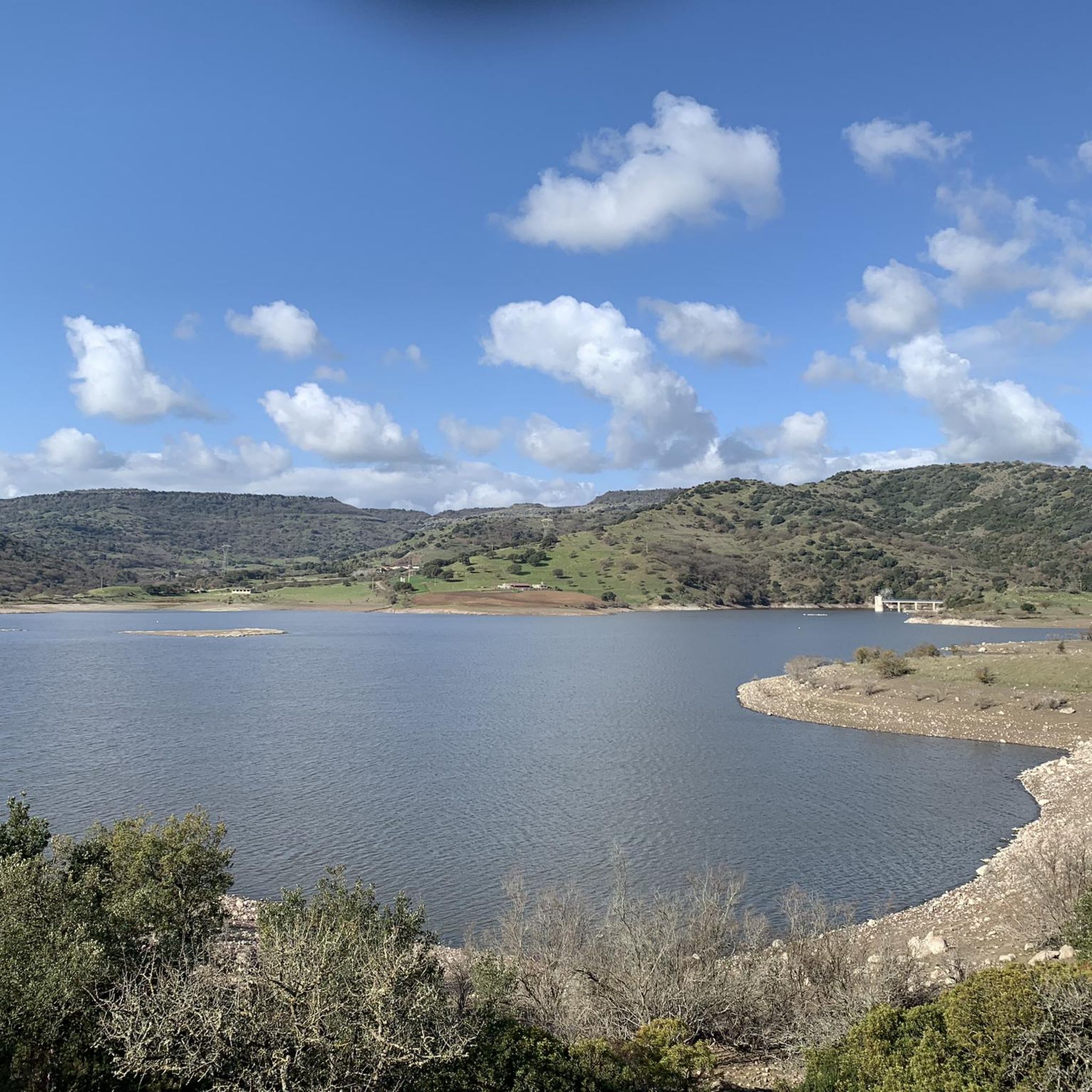
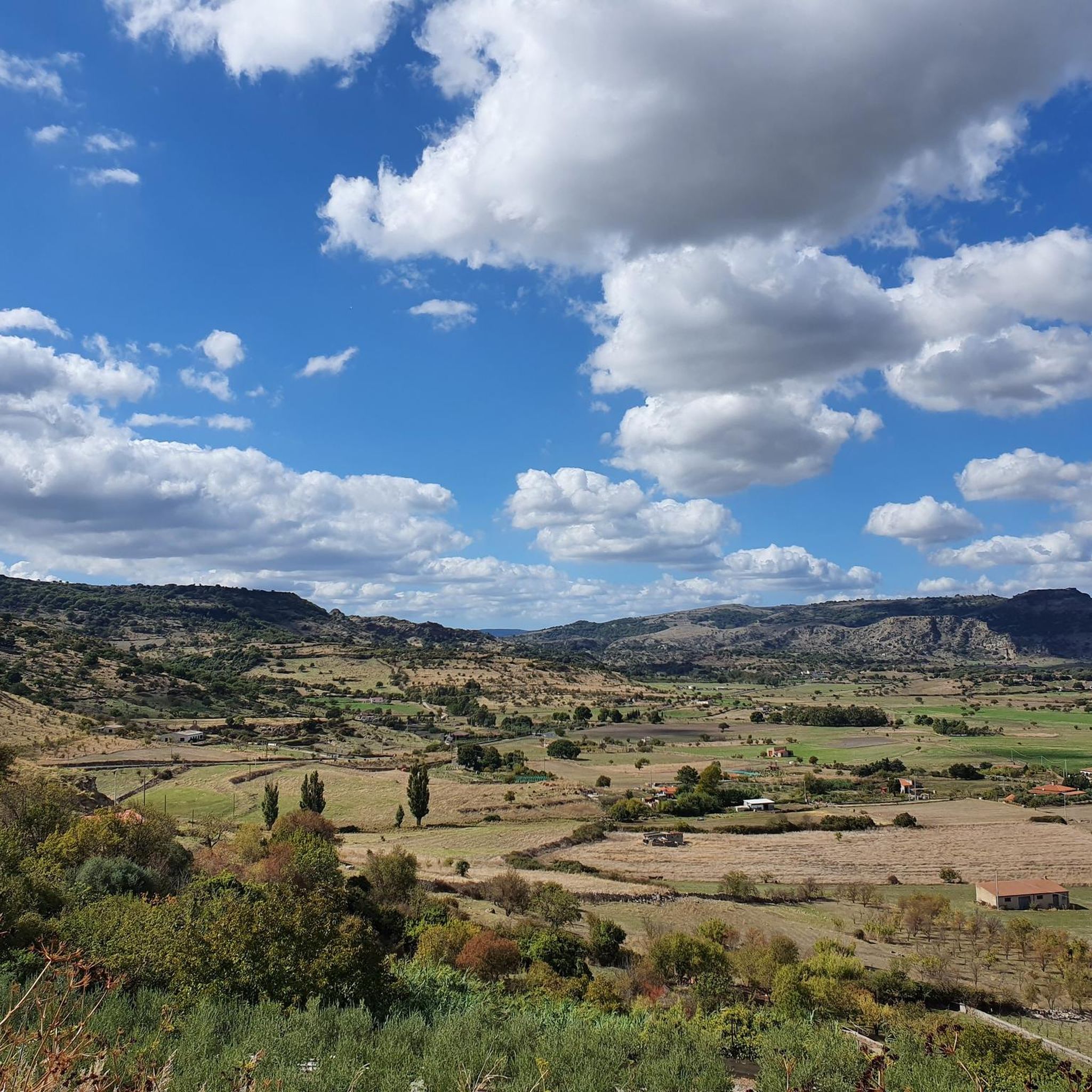
From the panoramic square you can enjoy a beautiful view of the valley, and you can access a public fountain.
3
0
Romanesque church from the 12th century, which since 1950 has housed a community of Benedictine monks in the adjacent monastery
3
0

The church of Saints Elias and Enoch, located on the mesa of Monte Santo, dates back to the Byzantine era (6th-9th century AD) and reflects the traditions of Greek monasticism. Originally, it was a place of worship for hermit monks who lived in cells dug into the mountain. In 1065, the church became the first Benedictine monastery on the island.
1
0
Monte Santo (Monte Santu or Monte Sant'Elies in Sardinian) is an isolated mountain and mesa in Logudoro, with an altitude of 733 meters. During the climb, lithological changes are observed, passing from carbonate rocks to basaltic ones around 650 meters. On the summit, located on the south-western lip, you can enjoy a vast panorama, especially at the summit cross.
1
0
With its unmistakable profile, Monte Santo is an icon of Meilogu, the name of this enchanted corner of Sardinia. Born from ancient volcanic eruptions, this mountain rises among vast green fields, offering breathtaking views.
1
0

A peaceful and very quiet place to take a break. There are some benches with a view of the monastery church and the view of the valley is also wonderful.
0
0
Frequently Asked Questions
How many hiking trails are available in the Turalva/Torralba area?
There are 5 hiking routes available in the Turalva/Torralba region, offering a variety of experiences for different skill levels.
Are there any easy hiking trails suitable for beginners or families?
Yes, the area features 2 easy hiking trails. We recommend the Necropoli di Moseddu loop from Cherèmule/Cheremule, which is about 5.6 km long, or the Su Furraghe loop from Boruta/Borutta, covering approximately 5.8 km.
What kind of natural and historical sights can I expect to see along the trails?
The Turalva/Torralba region is rich in history and natural beauty. You can explore ancient sites like the Nuraghe Santu Antine di Torralba and the Sacred Spring of Su Lumarzu. For scenic views, don't miss the View of Monte Santo. The Discovering Monte Santo route is a great way to experience some of these highlights.
Are there any circular hiking routes in Turalva/Torralba?
Yes, all 5 of the hiking routes in this guide are circular, allowing you to start and end your journey at the same point. For example, consider the Domo de Su Rosario loop from Bessude or the Hiking loop from Boruta/Borutta.
What do other hikers say about the trails in Turalva/Torralba?
The komoot community highly rates the hiking experiences in Turalva/Torralba, with an average score of 4.6 out of 5 stars from 7 visitors. Hikers often praise the blend of historical sites and natural landscapes found along the routes.
What is the longest hiking trail available in the area?
The longest trail in this guide is the Domo de Su Rosario loop from Bessude, which spans approximately 12.3 km and typically takes around 3 hours and 46 minutes to complete.
Are there any moderate trails for more experienced hikers?
Yes, there are 3 moderate trails for those seeking a bit more challenge. The Discovering Monte Santo route is a good option, covering about 4.8 km with significant elevation gain. Other moderate choices include the Domo de Su Rosario loop from Bessude and the Hiking loop from Boruta/Borutta.
Can I find ancient ruins or historical sites directly on the hiking paths?
Absolutely. Many trails in the Turalva/Torralba area pass by significant historical landmarks. For instance, the Necropoli di Moseddu loop from Cherèmule/Cheremule takes you near ancient burial sites, offering a unique historical perspective during your hike.
What are some notable points of interest beyond the hiking trails?
Beyond the trails, the region offers several captivating attractions. You can visit the Rebeccu Medieval Village, explore the Thiesi historic centre, or see the Church of Saint Catherine Martyr. For natural wonders, the Sa Ucca de su Tintirriolu Cave is also nearby.
Are there any trails that offer panoramic views of the landscape?
Yes, several routes provide excellent viewpoints. The Discovering Monte Santo trail, for example, leads to the View of Monte Santo, offering expansive vistas of the surrounding area.
Most popular routes around Turalva/Torralba
Most popular attractions around Turalva/Torralba

Get inspired with the komoot mobile app


Explore more
Browse the best Hikes in other regions.
