Top 5 Mountain Passes around Althengstett
Best mountain passes around Althengstett are situated in a transitional landscape between the Northern Black Forest and the Upper Gäu region of Germany. The area features varying elevations, ranging from 444 to 596 meters above sea level, offering elevated paths and scenic routes. While not characterized by traditional high mountain passes, the region provides diverse outdoor experiences for hiking and cycling. This landscape includes a network of trails that traverse undulating terrain, leading to viewpoints and natural features.
Best mountain…
Last updated: June 24, 2026
Würmtal Pass with insect hotel
Highlight • Structure
Showing Translation
Tip by

Würmtal–Tiefenbronn Ascent
Highlight (Segment) • Climb
Translated by Google •
Tip by

Sign up now to discover places like this
Get recommendations on the best single tracks, peaks, & plenty of other exciting outdoor places.
Sign up for free
Münklingen–Möttlingen Saddle Point
Highlight • Mountain Pass
Translated by Google •
Tip by

Start today with a free account
Your next adventure awaits.
Login or Signup
Tips from the Community

Already rideable without snow in April 🤣
0
0

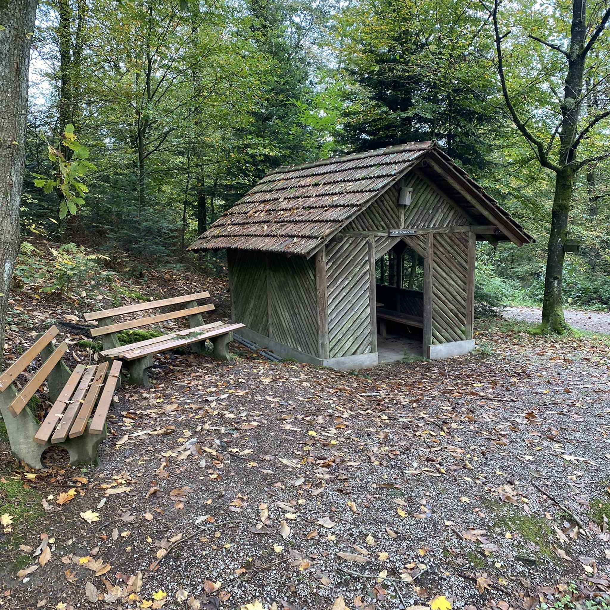
Insect hotels or insect houses are artificially created shelters, nesting and overwintering aids for insects. This one is located directly on the cycle path between Weil der Stadt and Merklingen at the supposedly highest point, namely at 420 meters above sea level.
9
0

The highest point on the cycling and hiking trail between Malmsheim and Weil der Stadt. There's an insect hotel here, which is ironically marked with the Würmtal Pass (420 m above sea level).
8
0

That would be it in both directions for now 😆
0
0

It's a nice climb, as the gradient is moderate and there's relatively little traffic. The downhill is also good, but you should be a bit more careful due to the numerous road defects, especially on the bends.
0
0

The creativity is the best thing about the insect hotel
4
1

Great idea with the self-carved pass sign. The only thing missing is a small refuge. Is the owner reading this? 😁 It has now been fitted out as an insect hotel, presumably to speed up the slow bikers with "bee stings". 😁
0
0

"Pass" is undoubtedly a bit of an exaggeration, but you are definitely "at the top" of the hill here! 😛
0
0
Frequently Asked Questions
What are the most popular scenic routes or elevated paths around Althengstett?
The komoot community highly rates several routes in the area. Among the most popular are Würmtalpass, known for its challenging climb and unique self-carved pass sign, and the Würmtal–Tiefenbronn Ascent, which offers a true mountain pass experience for both climbing and descending. Another favorite is the Münklingen–Möttlingen Saddle Point, which serves as a viewpoint and the highest point of a connecting road, featuring a 14% gradient on one side.
What kind of terrain can I expect on these routes around Althengstett?
The region around Althengstett is characterized by a hilly and forested landscape within the northern Black Forest. You can expect undulating terrain with elevations ranging from approximately 444 to 596 meters above sea level. While not traditional high mountain passes, the routes offer diverse experiences, from challenging ascents with gradients up to 14% to scenic paths winding through forests and along streams.
Are there good hiking trails near these elevated paths?
Yes, the area is well-known for its extensive network of hiking trails. Beyond the specific elevated paths, you can explore picturesque gorges like the Monbachtal Gorge, suitable for all ages with multiple water crossings, or the Wolf Gorge near Bad Liebenzell, which offers an 'alpine-like character' with paths over roots and stones. The Rötelbach Valley also provides a scenic path through wild nature. For more hiking options, explore running trails around Althengstett.
What cycling opportunities are available in the Althengstett area?
Althengstett offers numerous cycling routes catering to various difficulties. You can find routes like the 'Nagold Valley Cycle Path' or the 'Würmtal Cycle Path' which provide moderate to difficult rides through the scenic Black Forest. For mountain biking enthusiasts, there are dedicated MTB trails such as the 'Preaching Place – Merklinger Trail loop'. You can find more details on cycling around Althengstett and MTB trails around Althengstett.
Are there family-friendly options among the scenic routes?
While some routes feature challenging climbs, many trails in the region are suitable for families. For instance, the Monbachtal Gorge is described as a beautiful gorge suitable for hiking for all ages. Generally, the trails cater to various fitness levels, including gentler paths around areas like the Eulenbachsee lake, which are ideal for families looking for a less strenuous outdoor experience.
What natural features or views can I expect to see?
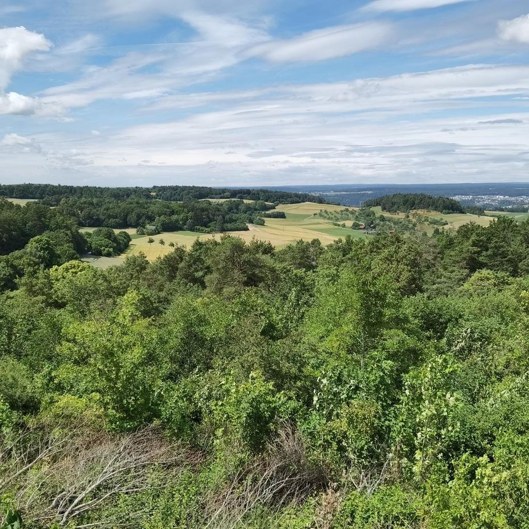
The routes around Althengstett offer enchanting forests, serene water features like the Rötelbach stream and Tälesbach, and picturesque gorges. Many trails lead to higher points that provide panoramic views of the surrounding Black Forest landscape. For example, a route to Liebenzell Castle offers spectacular vistas over the Nagold valley, rewarding hikers for their ascent.
When is the best time of year to visit Althengstett for these routes?
The Black Forest region, including Althengstett, is beautiful throughout the warmer months, typically from spring to autumn. During these seasons, the weather is generally pleasant for hiking and cycling, and the natural scenery is at its most vibrant. Summer offers refreshing environments along streams and in gorges, while autumn brings colorful foliage.
Are the routes around Althengstett dog-friendly?
Many of the hiking and cycling trails in the Black Forest region are generally dog-friendly, allowing you to enjoy the natural beauty with your canine companion. It's always advisable to keep dogs on a leash, especially in nature reserves or areas with wildlife, and to check for specific local regulations or signage along individual routes.
What cultural or historic sites can be found near these routes?
The routes in the Althengstett area often combine natural beauty with cultural points of interest. For example, a challenging route leads to Liebenzell Castle, offering not only spectacular views but also a glimpse into the region's history. You might also encounter historic churches or castle ruins integrated into the landscape, adding a cultural dimension to your outdoor adventures.
How accessible are these routes by public transport or car?
While specific details for each trailhead vary, the region is generally well-connected. Althengstett itself is accessible, and many trailheads for popular routes will have nearby parking facilities. For public transport, local bus services connect towns and villages, which can provide access to various starting points for hikes and rides. It's recommended to check local transport schedules for specific routes.
What makes the routes around Althengstett unique compared to traditional high mountain passes?
Unlike traditional high mountain passes found in alpine regions, the routes around Althengstett are characterized by their location in the northern Black Forest's hilly and forested landscape. They offer elevated paths and scenic routes rather than dramatic, high-altitude crossings. The uniqueness lies in the extensive network of trails that traverse undulating terrain, leading to picturesque gorges, serene valleys, and panoramic viewpoints, providing diverse outdoor experiences without the extreme elevations of the Alps.
Most popular routes around Althengstett
Most popular attractions around Althengstett

Get inspired with the komoot mobile app


Explore more
See even more epic mountain passes by checking out these guides around Althengstett:
