Top 18 Natural Monuments around Todtenweis
Best natural monuments around Todtenweis are found within a region characterized by natural beauty and access to significant natural features. The municipality is situated near the Augsburg Western Forests Nature Park and benefits from its proximity to the Lech River. This area offers a diverse landscape with wooded ridges, gentle hills, and stream valleys. It provides opportunities for outdoor activities such as hiking and cycling.
Best natural monuments around Todtenweis
- The most popular natural monuments is Eglesee, a lake…
Last updated: May 11, 2026
Eglesee
Highlight • Lake
Translated by Google •
Tip by

Augsburg Müllberg Recreation Area
Highlight • Viewpoint
Translated by Google •
Tip by

Sign up now to discover places like this
Get recommendations on the best single tracks, peaks, & plenty of other exciting outdoor places.
Sign up for free
Monte Scherbelino (Augsburg Rubbish Hill)
Highlight • Viewpoint
November to March 8 a.m. to 4 p.m.
April to October 8 a.m. to 6 p.m.
Translated by Google •
Tip by
Chardonnaybach
Highlight • River
Translated by Google •
Tip by
Taglilienfeld Nature Monument
Highlight • Natural Monument
Translated by Google •
Tip by
Sign up for free to discover even more natural monuments around Todtenweis.
Sign up for free
Already have an account?
Start today with a free account
Your next adventure awaits.
Login or Signup

Other adventures around Todtenweis

Tips from the Community

The daylily field near St. Stephan is the largest daylily field in Europe. Daylilies and other orchid species bloom every June. The biotope borders the Lech floodplain forest. Picking is strictly prohibited!
0
0

The DAYLILY FIELD is part of the Lech floodplain forest with its natural growth of trees and shrubs. The floodplain forest is to be preserved as a vegetation bridge between the Alps and the Jura, as climate protection and as a landscape element of the Lech plain. The Lech once had its bed with its widely branched arms at the level of the daylily field. The NATURAL MONUMENT "DAYLILY FIELD" was placed under protection in 1982. The purpose of the protection is to preserve the characteristic remaining area of the original Lech floodplain landscape and to protect the existing plants. The existing, mostly rare plants here include the daylily, as well as the bumblebee orchid, the spider orchid, various types of hagwort, the lady's slipper, the Turk's cap lily, the lemon balm, the flax, the Siberian iris, the daphne and the laserwort. The tendrils of the clematis are also typical of the floodplain forest. The daylily (scientific name from the Greek "Hemerocallis lilio-asphodelus" - which corresponds to the German translation "day beauty") blooms in June. The plant is not native to Central Europe, but to the Mediterranean countries and southeastern Europe. However, it was naturalized in Germany centuries ago. The individual flower usually only opens for one Day. There are up to 8 flowers on one stem, which bloom on consecutive days. The LILY MEADOW with a closed population of thousands of plants is now a botanical treasure and can be described as unique in Central Europe. The property has been owned by the Swabian Natural Science Association since 1930. The annual maintenance is carried out by the "Friends of Nature" e.V. St. Stephan association.
1
0
The Chardonnaybach is an artificially created stream in the "Lechauen Nord" landscape conservation area near Gersthofen, north of Augsburg. It was created in 1996 to re-irrigate the Lech floodplains east of the Lech and thus revitalize valuable wetland habitats. Origin and course: As there was no natural water available on the east side of the Lech, a pipeline (culvert) was laid under the Lech to take water from the Lech side canal to the west. The water pressure now allows one cubic meter of water per second to reach the east bank. There it emerges in an artificial spring and initially feeds the newly created Chardonnaybach, which flows into the Branntweinbach after 850 meters. Ecological significance: The re-irrigation allowed wetland habitats to develop again in the previously dried-up Lech floodplains. The presence of the beaver in particular has contributed to the return of amphibians, dragonflies, reptiles and typical marsh plants. However, the activities of the beaver also mean that pedestrian paths are permanently flooded and the water no longer follows the planned course. Nature conservation is currently trying to specifically direct the activities of the beaver so that the water flows through again. Leisure and recreation: The Chardonnaybach and its surroundings are popular destinations for hikers and nature lovers. A nature trail, known as the “Jungle Trail in the Lechauen Nord”, leads through parts of the biotope and offers informative panels on the flora and fauna of the region. Guided tours are offered by the Augsburg Environmental Station. Getting there: The source of the Chardonnaybach is located east of the Lech near the Gersthofen tennis club. The stream runs directly under the high-voltage power line in the “Lechauen Nord” landscape conservation area. The Chardonnaybach is a successful example of renaturation measures that bring both ecological benefits and create recreational opportunities for the population.
1
0

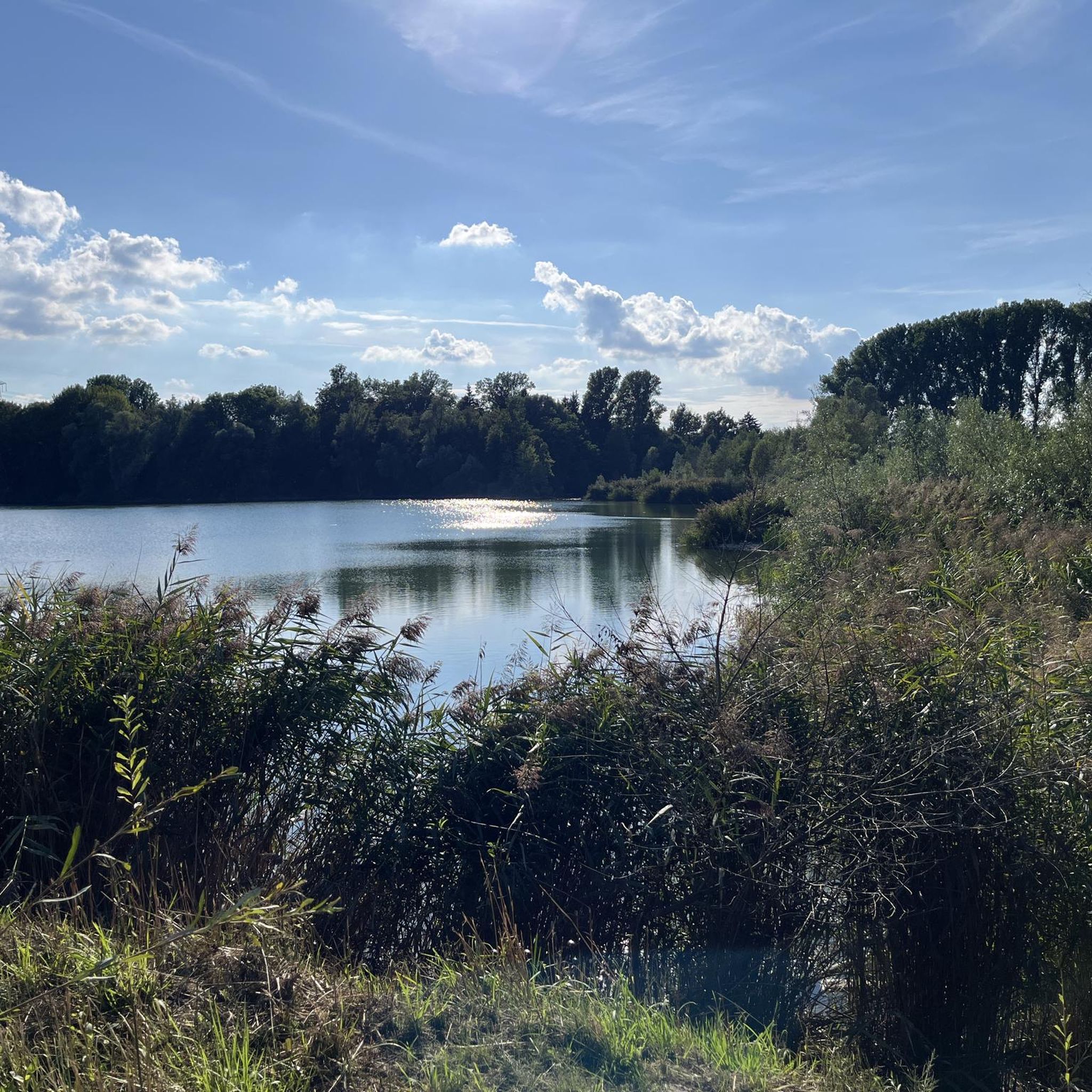
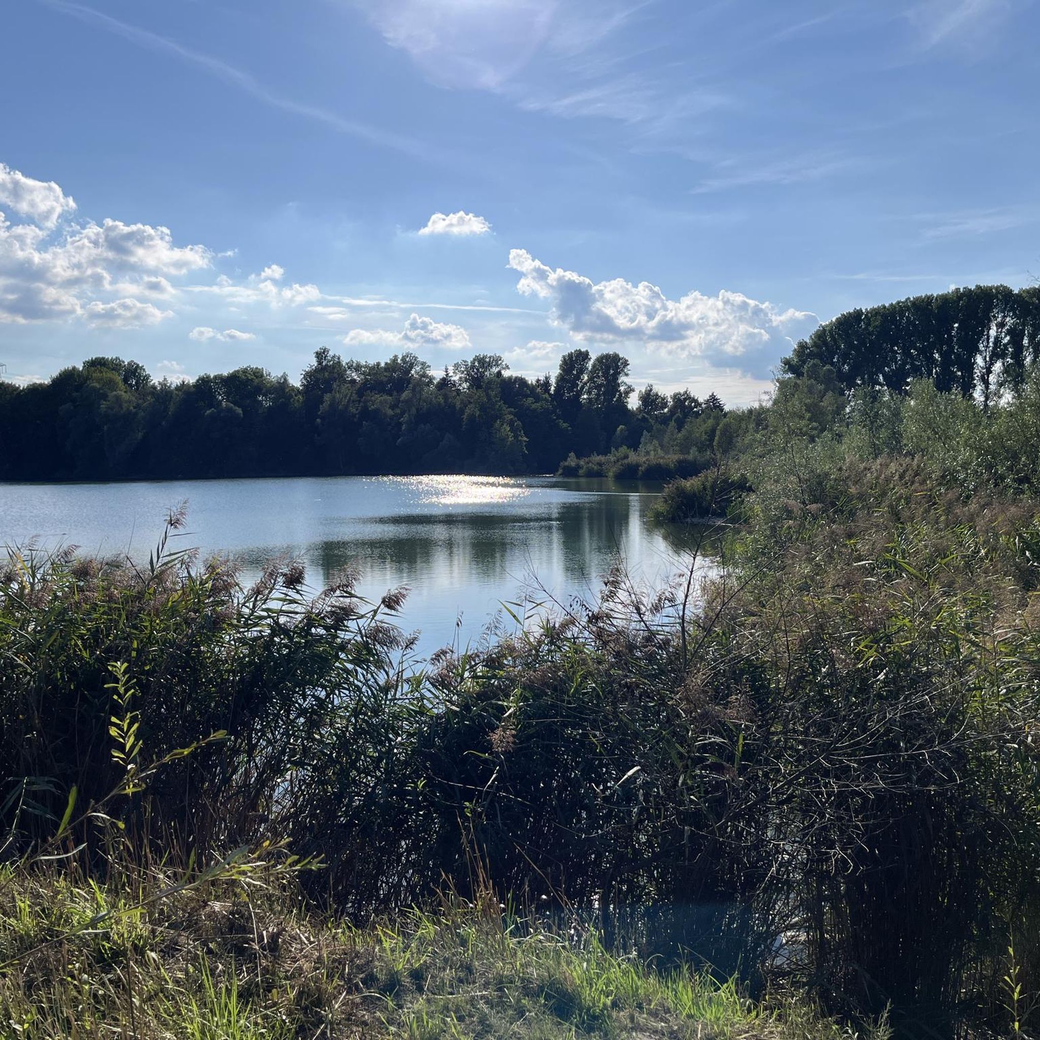
There it lies... still as a grave, gigantic as a mountain and deep as the ocean... the Eglesee🤭😂
1
1


The 8 km long Branntweinbach had its source in what is now the Hammerschmiede area. It ran in a northerly direction through fields and flowed into the Lech opposite Stettenhofen.
25
0
Frequently Asked Questions
What are some of the most popular natural monuments around Todtenweis?
Visitors frequently enjoy exploring Eglesee, a tranquil lake nestled in a forest, often praised for its quiet atmosphere. Another popular spot is Monte Scherbelino (Augsburg Rubbish Hill), which offers panoramic views from its 55-meter height. The Taglilienfeld Nature Monument is also highly regarded, especially for its large field of daylilies and diverse rare plants.
What outdoor activities can I do near the natural monuments around Todtenweis?
The region around Todtenweis, particularly within the Augsburg Western Forests Nature Park and along the Lech River, is ideal for various outdoor activities. You can find numerous opportunities for hiking, cycling, and even gravel biking. For detailed routes, explore the hiking guide for Todtenweis, the running trails guide, or the gravel biking guide.
Are there family-friendly natural monuments or activities near Todtenweis?
Yes, several natural monuments and areas are suitable for families. Augsburg Müllberg Recreation Area and Taglilienfeld Nature Monument are noted as family-friendly. The broader Augsburg Western Forests Nature Park offers gentle, hilly landscapes and extensive forests, providing ample space for family walks, cycling, and nature exploration.
Are the trails and natural monuments around Todtenweis dog-friendly?
Yes, many areas are dog-friendly. For instance, Eglesee is specifically mentioned as perfect for visiting with a dog, where they can bathe and enjoy the peaceful surroundings. When exploring the Augsburg Western Forests Nature Park or along the Lech River, dogs are generally welcome, but always ensure they are kept on a leash where required and that you clean up after them.
What kind of natural features and wildlife can I expect to see?
The region is rich in diverse natural features. You'll encounter extensive forests, gentle hills, and stream valleys within the Augsburg Western Forests Nature Park. The Lech River is a prominent feature, known for its dynamic riverbed. The Taglilienfeld Nature Monument protects rare plants like daylilies, various orchids, and other wild flowers. The area serves as a habitat for a variety of local flora and fauna.
What is the best time of year to visit the natural monuments around Todtenweis?
The best time to visit depends on your interests. The Taglilienfeld Nature Monument is particularly stunning in June when the daylilies are in full bloom. For general outdoor activities like hiking and cycling, spring through autumn (April to October) offers pleasant weather. Note that Monte Scherbelino has seasonal opening hours, typically closing over winter due to the risk of ice.
Are there any unique natural features or 'hidden gems' to discover?
Beyond the well-known spots, you might find the Chardonnaybach interesting. This stream, created in 1996, flows through the 'Lechauen Nord' nature reserve and offers a unique example of engineered natural restoration. Its source is east of the Lech, near the Gersthofen tennis club, and it eventually feeds into the old Branntweinbach bed.
What are the typical difficulty levels for hiking trails near these natural monuments?
Hiking trails in the vicinity of Todtenweis and its natural monuments vary in difficulty. You can find easy loops like the 'Sand Lakes loop from Lechaue westlich Todtenweis' (3.2 km) or the 'Chapel in Landkreis Augsburg – Burgstall Hofmarkbach loop from Todtenweis' (7.1 km). Moderate options include the 'Thierhaupten Monastery – Thierhaupten Abbey Beer Garden loop' (8.7 km), while more challenging routes like the 'Steps to the Lech River – Bicycle Repair Station loop' (25.5 km) are also available. You can explore more options in the hiking guide for Todtenweis.
Where can I find good viewpoints in the area?
For expansive views, Monte Scherbelino (Augsburg Rubbish Hill) is a prime location, offering a panoramic vista of Augsburg and the surrounding landscape, including the Lech plain and distant mountains on clear days. The Augsburg Müllberg Recreation Area also provides excellent vantage points.
What do visitors enjoy most about the natural monuments around Todtenweis?
Visitors particularly appreciate the tranquility and natural beauty of the area. Many enjoy the peaceful atmosphere of places like Eglesee, especially for walks with dogs. The panoramic views from Monte Scherbelino are a highlight, as is the unique botanical splendor of the Taglilienfeld Nature Monument. The overall diverse landscape, offering opportunities for relaxation and various outdoor activities, is highly valued by the komoot community.
Is there information about the Augsburg Western Forests Nature Park?
Yes, Todtenweis is situated near the expansive Augsburg Western Forests Nature Park. This park covers approximately 1,200 square kilometers and is known for its gentle, hilly landscape, extensive forests, and streams like the Schmutter, Neufnach, and Zusam. It's considered a 'green jewel' of the Augsburg region, offering a serene environment for recreation, forest bathing, hiking, and cycling, and is important for local flora and fauna.
Are there specific rules or permits needed for visiting certain natural areas?
While general access to the natural monuments and the Augsburg Western Forests Nature Park is usually unrestricted, specific rules may apply in designated nature reserves, such as those protecting rare plants or wildlife. For instance, the Taglilienfeld Nature Monument is a protected area. Always look for local signage regarding rules on dog leashing, staying on marked paths, and respecting flora and fauna to ensure conservation.
Most popular routes around Todtenweis
Most popular attractions around Todtenweis

Get inspired with the komoot mobile app


Explore more
Extend your search for the best caves by checking out these guides of the top ones around Todtenweis:
