Top 5 Natural Monuments in Reserva Ecológica Los Ilinizas
Best natural monuments in Reserva Ecológica Los Ilinizas are found within the grand Andes Mountains of Ecuador. This reserve features diverse landscapes, including volcanic peaks and a crater lake. The area is characterized by its unique geological features and varied ecosystems, ranging from páramo to subtropical forests. It offers opportunities to experience high-altitude environments and observe distinct natural formations.
Best natural monuments in Reserva Ecológica Los Ilinizas
- The most popular natural monument is Quilotoa Lagoon, a lake located within…
Last updated: July 6, 2026
Quilotoa Lagoon
Highlight • Lake
Tip by

Corazón Summit
Highlight • Summit
Translated by Google •
Tip by

Sign up now to discover places like this
Get recommendations on the best single tracks, peaks, & plenty of other exciting outdoor places.
Sign up for free
View of Quilotoa Lagoon
Highlight • Viewpoint
Translated by Google •
Tip by

Quilotoa Lagoon Viewpoint
Highlight • Viewpoint
Translated by Google •
Tip by

View of Quilotoa Crater Lake
Highlight • Viewpoint
Translated by Google •
Tip by

Sign up for free to discover even more natural monuments in Reserva Ecológica Los Ilinizas.
Sign up for free
Already have an account?
Start today with a free account
Your next adventure awaits.
Login or Signup
Popular around Reserva Ecológica Los Ilinizas

Other adventures in Reserva Ecológica Los Ilinizas

Tips from the Community

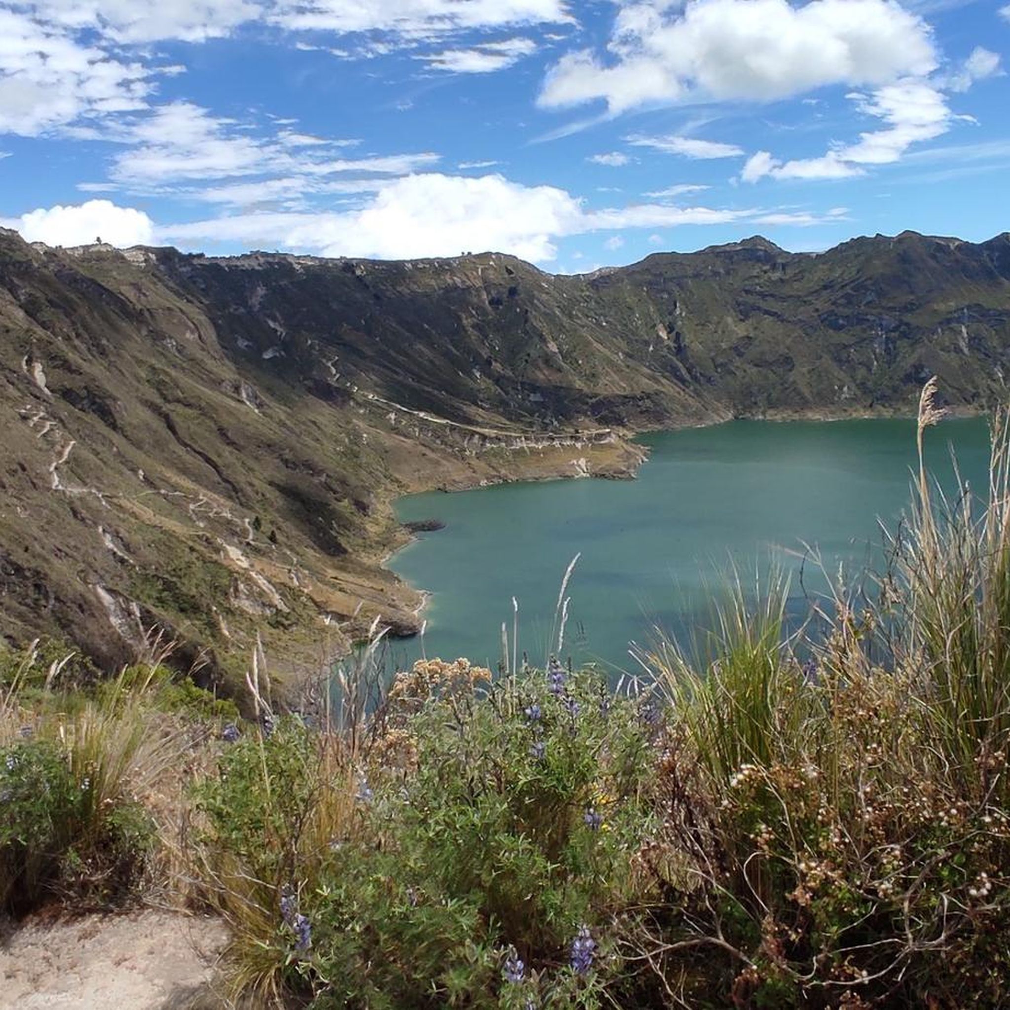
The lake is impressively colored in deep turquoise in its round bed. Jagged is the cliff edge that frames it, creating a path for the hiker to admire the beauty of the lagoon from all sides.
2
0

Beautiful vantage point on the crater rim of Laguna Quilotoa.
1
0

Laguna Quilotoa, an incredibly beautiful place on earth! Easy to reach on foot from the parking lot. You can completely circumnavigate the lagoon on the loop. A sandy path also leads down to the lake (swimming prohibited), which you have to climb back up steeply. Those who like this (dubious) variant can also be carried up by donkey.
0
0

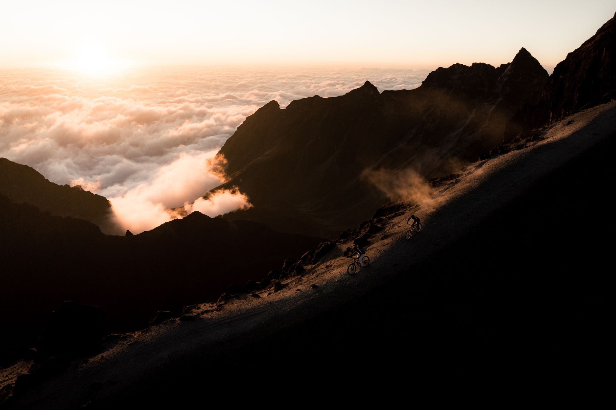
We went from El Chaupi to the Corazón. Our ascent began at the entrance to the Reserva, where we left the car. Then we followed the dirt road to the marked junction of the path to Corazón. From now on we went on muddy paths through the Paramo up to a ridge that led us directly to the summit. This path climbs very steeply in places. One point, a rather exposed rock transition, is a bit daring to cross, but almost everyone can master it with concentration and the use of hands. However, normal dogs have problems here. The point is about 30 minutes from the summit. After overcoming this passage, it goes on with easy scrambling to the summit. If several people are on the move, a helmet is a good idea because of the risk of stones being kicked. I have now been to the Corazón twice and unfortunately, despite the early start (ascent from 6:30 a.m.), the weather never allowed me a clear view of the summit. The photos of the Ilinizas, the Cotopaxi, Ruminahui, Sincholagua and even the Antisana were only possible at the beginning of the hike. The ascent to the summit took about 4 hours. We had taken a few breaks.
1
0

The walk around the crater is interesting. All the way you have an impressive view of the lagoon.
1
0

Go out in the morning to be able to enjoy the road more. Start from the left so when you are more tired you will have the flattest part in front😊
1
0

Quilotoa Lake is about 30 minutes from Latacunga and should not be missed on an Ecuador trip. The walk around the crater takes around 4-5 hours, depending on the breaks you take. For trained people, the circumnavigation is also possible in 3 - 3.5 hours. The highest point is at over 3900 meters. Right on the lake there is the possibility to rent a kayak for $ 3 (30 minutes) to admire the crater from below. Descent to the lake about 40 minutes, ascent about 1 hour. Make sure you wear good shoes. The views are amazing.
3
4

In the afternoon it gets cloudy. Best practice is arriving before noon, or doing a morning hike around the lake.
1
0
Frequently Asked Questions
What are the most popular natural monuments in Reserva Ecológica Los Ilinizas?
The most popular natural monument is Quilotoa Lagoon, a stunning emerald-green crater lake within a dormant volcano. Visitors also highly appreciate Corazón Summit for its challenging ascent and potential views, and the View of Illiniza Sur and Illiniza Norte for expansive valley vistas.
What kind of terrain and elevation can I expect when visiting natural monuments in Reserva Ecológica Los Ilinizas?
The region features diverse terrain, from the high-altitude volcanic peaks of the Ilinizas and Corazón to the caldera surrounding Quilotoa Lagoon. Elevations can reach over 5,000 meters for the Ilinizas peaks, with the highest point around Quilotoa Lagoon at over 3,900 meters. Paths can be steep and muddy, especially in páramo areas, and some ascents involve exposed rock transitions.
Are there family-friendly natural monuments or activities in Reserva Ecológica Los Ilinizas?
While many areas involve challenging hikes, the Quilotoa Lagoon offers more accessible options. You can hike a 2-kilometer trail down to the lagoon or enjoy kayaking on its waters. The 4-kilometer Yagual trail also provides views of paper tree forests, which can be a pleasant walk for families.
What is the best time to visit Reserva Ecológica Los Ilinizas to see its natural monuments?
For the best views, especially of the Ilinizas peaks and other volcanoes, it's often recommended to visit in the morning. For example, at Quilotoa Lagoon, it tends to get cloudy in the afternoon, so arriving before noon is ideal. The dry season (typically June to September) generally offers clearer skies, but weather in the Andes can be unpredictable year-round.
What unique geological features can be observed in the reserve?
The Reserva Ecológica Los Ilinizas is defined by its volcanic origins. You can observe majestic volcanic peaks like Iliniza Norte and Sur, and the distinctive emerald-green Quilotoa Lagoon, which is a crater lake formed within a dormant volcano. The lake's unique color comes from the minerals in its water, and slight hot currents due to volcanic activity are present.
What kind of wildlife and plant life can I expect to see?
The reserve's varied altitudes and ecosystems support diverse flora and fauna. You'll find specialized páramo vegetation like paper trees and chuquiraguas, as well as romerillo and cedar trees. In warmer areas, palms and giant ferns thrive. The reserve is also home to various wildlife, including armadillos and a range of bird species.
Are there opportunities for high-altitude acclimatization in the reserve?
Yes, the region, particularly the Ilinizas peaks, is a popular destination for climbers seeking to acclimate to high altitudes. Ascending Iliniza Norte, for instance, is often used as preparation for more challenging climbs on higher volcanoes like Cotopaxi or Chimborazo.
What hiking opportunities are available near these natural monuments?
The reserve offers various hiking opportunities. Near Quilotoa Lagoon, you can hike around the crater rim, which takes about 4-5 hours, or descend to the lake itself. For more challenging routes, the ascent to Corazón Summit involves steep, muddy paths and takes approximately 4 hours. You can find more detailed hiking routes in the area by visiting the Hiking in Reserva Ecológica Los Ilinizas guide.
What should I wear for hiking in Reserva Ecológica Los Ilinizas?
Given the high altitudes and varied terrain, it's essential to wear good hiking shoes suitable for muddy and steep paths. Layered clothing is recommended to adapt to changing weather conditions, which can include cold temperatures, wind, and potential rain, even on clear days. A helmet might be advisable for ascents like Corazón Summit due to the risk of falling stones.
What do visitors enjoy most about the natural monuments in Reserva Ecológica Los Ilinizas?
Visitors consistently praise the dramatic landscapes and breathtaking views, especially from viewpoints like the View of Cotopaxi and Surrounding Volcanoes. The unique geological features, such as the vibrant Quilotoa Lagoon and the majestic Ilinizas peaks, are also highly appreciated. Many enjoy the sense of accomplishment from challenging hikes and the opportunity for high-altitude acclimatization.
Are there any circular hiking routes available near the natural monuments?
Yes, there are several circular hiking routes. For instance, near Quilotoa, you can find routes like the "Quilotoa Lagoon Viewpoint – Quilotoa Lagoon loop from Quilotoa" which is about 11.26 km and moderately difficult. Another option is the "Corazón Summit loop from Quebrada Ingacorral," a more difficult 14.2 km route. More details on these and other routes can be found in the Hiking in Reserva Ecológica Los Ilinizas guide.
Most popular routes in Reserva Ecológica Los Ilinizas
Most popular attractions in Reserva Ecológica Los Ilinizas

Get inspired with the komoot mobile app


Explore more
Extend your search for the best caves by checking out these guides of the top ones in Reserva Ecológica Los Ilinizas:
