Top 6 Natural Monuments around Carvalhal Benfeito
Natural monuments around Carvalhal Benfeito offer diverse natural attractions within the municipality of Caldas da Rainha. The region features a landscape characterized by coastal elements, historical natural springs, and significant forested areas. Visitors can explore more than 6 natural monuments, providing opportunities for outdoor activities and appreciation of geographical features. The area's natural assets contribute to local biodiversity and recreational spaces.
Best natural monuments around Carvalhal Benfeito
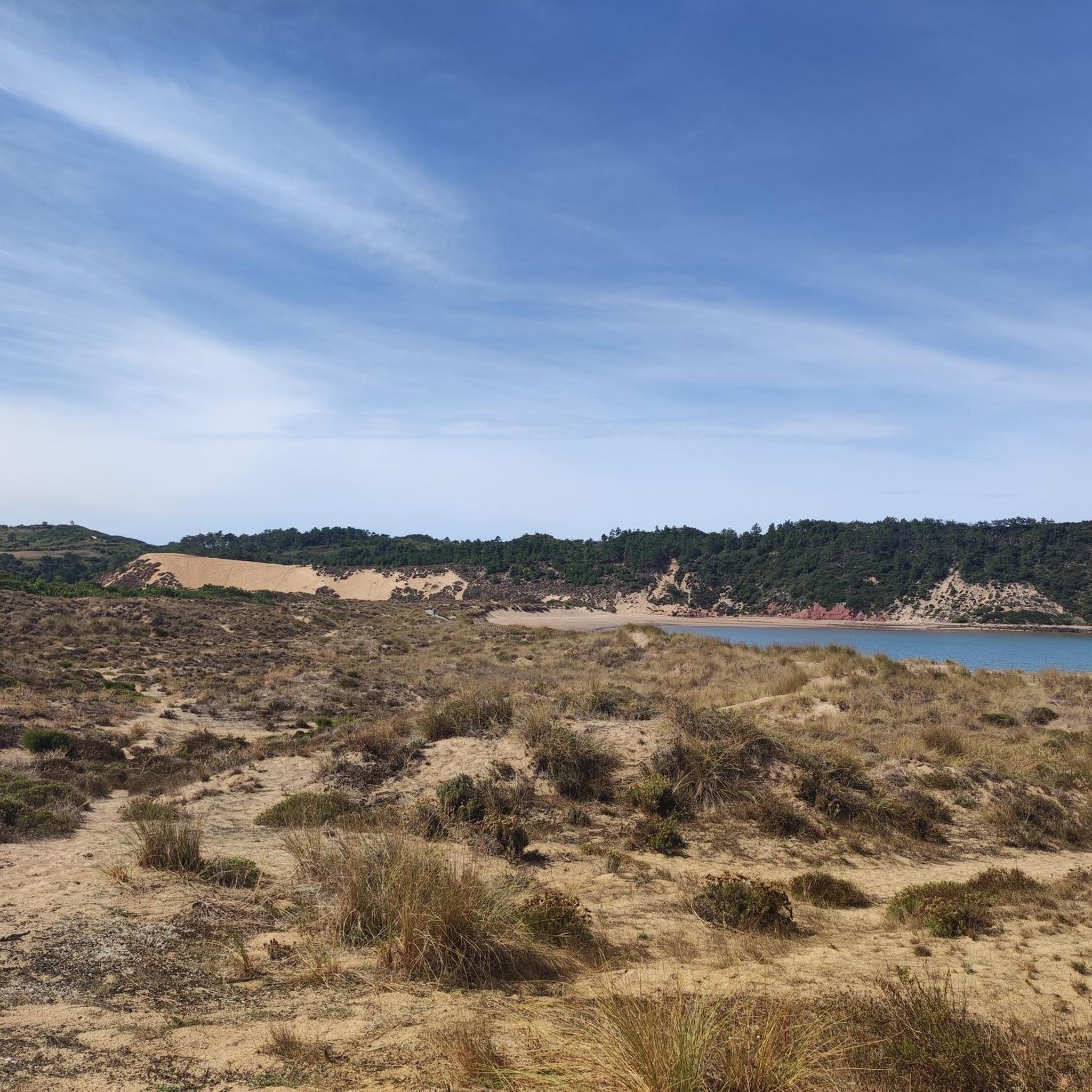
- The most popular natural monuments is Salir do Porto Dune, a dune known for being approximately 50 meters high, making it the highest in Portugal. It offers panoramic views and opportunities for recreation.
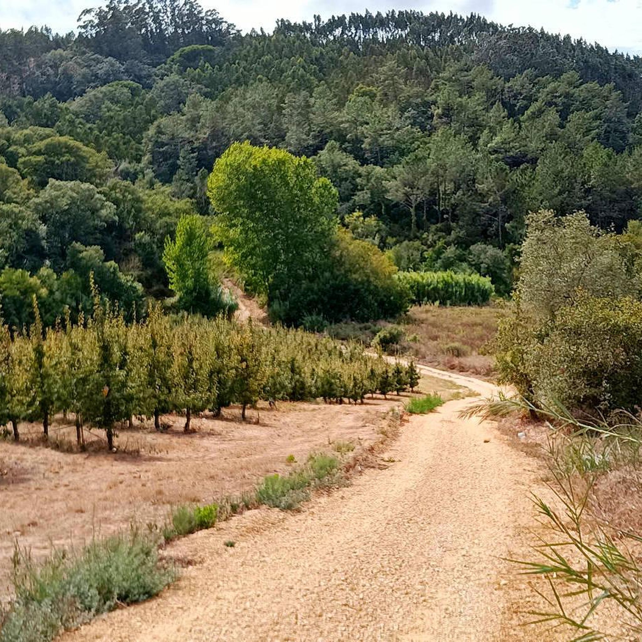
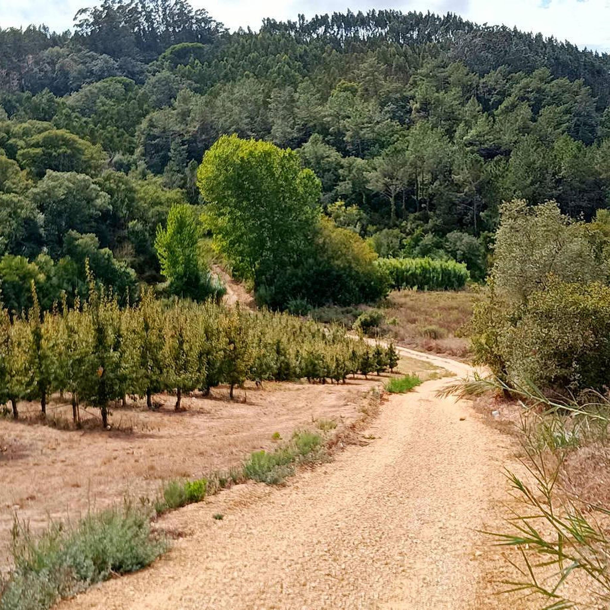
- Another must-see spot is Fonte Pena da Colvina, a natural spring and picnic area. This location historically served as a water source for locals and now provides a designated area for rest and refreshment.
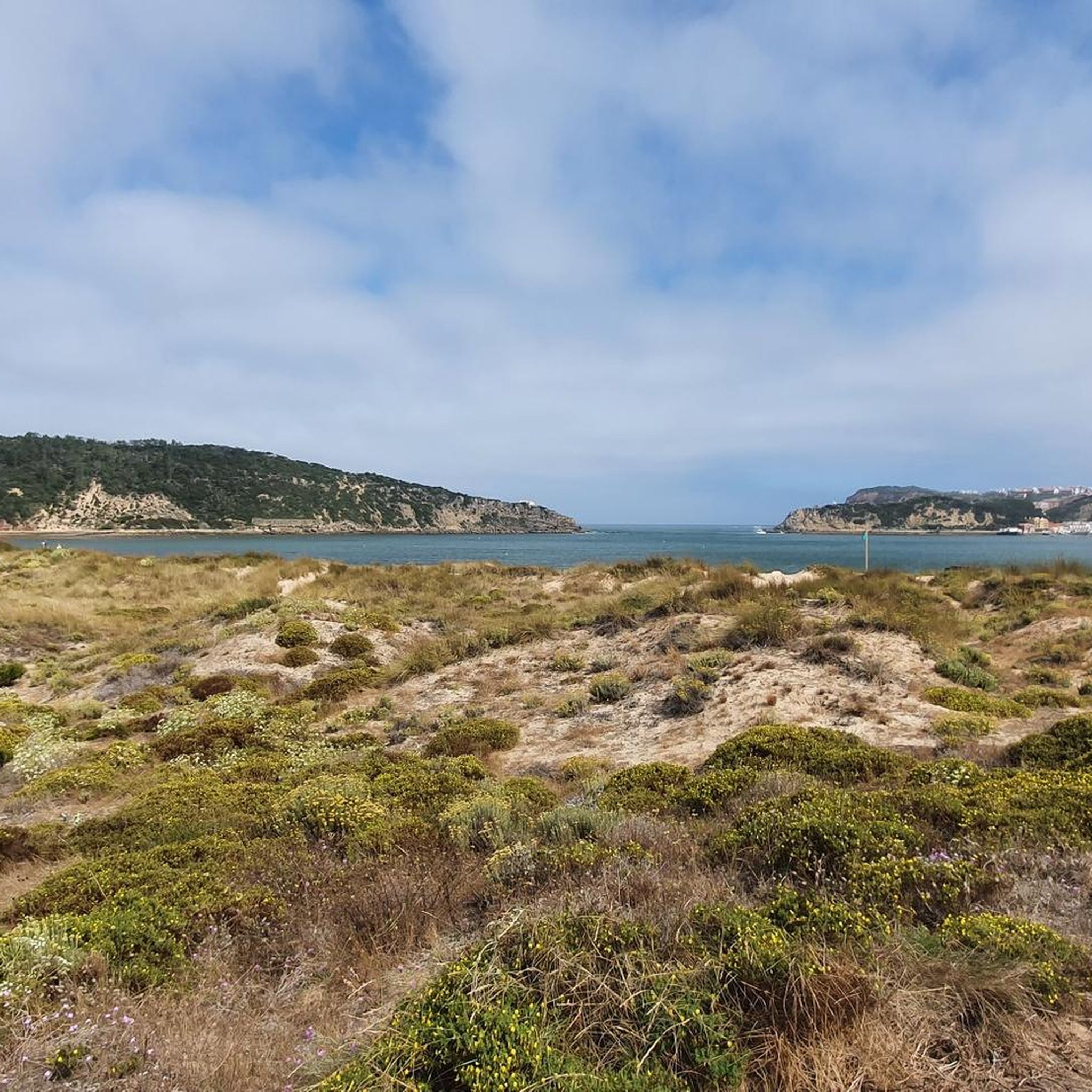
- Visitors also love View of the Coastal Cliffs, a viewpoint offering perspectives of the coastline. The area features paths alongside the cliffs, providing access to the natural formations.
- Carvalhal Benfeito is known for its dunes, natural springs, and coastal viewpoints. The region offers a variety of natural monuments to see and explore, from geological formations to historical water sources.
- The natural monuments around Carvalhal Benfeito are appreciated by the komoot community, with more than 70 upvotes and 60 photos shared by visitors.
Last updated: June 29, 2026
Salir do Porto Dune
Highlight • Natural Monument
This beach is known for its huge dune about 50 meters high, the highest in Portugal.
Translated by Google •
Tip by

Fonte Pena da Colvina
Highlight • Natural Monument
Today it serves as a stopping point to cool off during the walk and, if you wish, you can take advantage of the place to eat whatever you have prepared at home. There is a picnic area next to the fountain.
The place name Pena da Gouvinha suggests that barbarians passed through here. Gouvinha is a personal name of Germanic origin, still documented in the 12th century as Gaudina.
Translated by Google •
Tip by
Sign up now to discover places like this
Get recommendations on the best single tracks, peaks, & plenty of other exciting outdoor places.
Sign up for free
Dinosaur Footprints
Highlight • Natural Monument
Translated by Google •
Tip by

Bocas Gorge
Highlight (Segment) • Gorge
A little of history:
"The Rio Maior rises in a picturesque place called «Bocas», a large gorge that cuts the mountain range, through which the Santarém-Peniche road also passes, located west of the city of Rio Maior. the picnic on Good Summer Day. It is said that in the mid-19th century, still on the Maior river, in winter or in times of plenty of water, boats sailed, almost all sailing or rowing, approaching the Tagus to change the loads to other larger boats."
Source: Memories of Rio Maior - memoriasderiomaior.blogs.sapo.pt/2023.html
Translated by Google •
Tip by
View of the Coastal Cliffs
Highlight • Viewpoint
Tip by

Sign up for free to discover even more natural monuments around Carvalhal Benfeito.
Sign up for free
Already have an account?
Start today with a free account
Your next adventure awaits.
Login or Signup

Tips from the Community

At this exact spot there is only a turning circle for cars - and Google Maps also shows the spot a few 100m further to the southwest: so there is nothing right here!
0
0

The coast is spectacular and there are some paths leading next to the coastal cliffs. It's beautiful there!
1
0

The Pena da Gouvinha fountain used to serve the locals. There was a queue to fill the bottles, so much so that it was decided that each resident could only take eight bottles of water and would have to “give others a chance”. Today it serves as a stopping point to cool off during the walk and, if you wish, you can take advantage of the place to eat whatever you have prepared at home. There is a picnic area next to the fountain. The place name Pena da Gouvinha suggests that barbarians passed through here. Gouvinha is a personal name of Germanic origin, still documented in the 12th century as Gaudina.
3
0

Salir do Porto has a river beach, on the bank of the Tornada River, which flows into the bay of São Martinho do Porto. Salir beach is famous for its sand dune about 50 meters high. Once the largest in Europe, the Salir Dune stands out in the dune landscape of São Martinho Bay. The core of the Dune is partly made up of red sandstone, a vestige of an older dune – a fossil dune. There are other rock beaches in the coastal area that are locally called Quebradas. It was in the Ruins of the artisanal Customs House of Salir that the caravels that participated in the discoveries and conquests were built during the reigns of D. Afonso V and D. João II. The extinct parish was made up of the towns of Salir do Porto, Casais de Salir do Porto and Bouro.
0
0

Climbing up the sand dune and sliding down from the top is the highlight for everyone
3
0
Be sure to go up there from the top, great view and slide down on your bum. Large dune that clings to the rocks there, perfect for hiking. At the foot of the dune, the Tornada river flows into the sea.
3
0
At the end of this segment, towards Rio Maior, on the right side of the road there is a small park where it is possible to stop and walk a little to observe the magnificent natural caves on the banks of the Rio Maior, a practically forgotten river that gave its name to the current city from Rio Maior. Currently, the flow of the river is very low, drying up completely in the summer months. A little of history: "The Rio Maior rises in a picturesque place called «Bocas», a large gorge that cuts the mountain range, through which the Santarém-Peniche road also passes, located west of the city of Rio Maior. the picnic on Good Summer Day. It is said that in the mid-19th century, still on the Maior river, in winter or in times of plenty of water, boats sailed, almost all sailing or rowing, approaching the Tagus to change the loads to other larger boats." Source: Memories of Rio Maior - https://memoriasderiomaior.blogs.sapo.pt/2023.html
3
0
Praia de Salir do Porto is next to the mouth of the Rio Tornada or Rio Salir on the south bank. The sand is very extensive, it is wider in the south and narrows as we walk north. This beach is known for its huge dune about 50 meters high, the highest in Portugal.
3
0
Frequently Asked Questions
What types of natural monuments can I explore around Carvalhal Benfeito?
The region around Carvalhal Benfeito offers a variety of natural monuments, including impressive dunes, historical natural springs, and spectacular coastal viewpoints. You can also find significant forested areas like the Mata Nacional das Mestras, which is ideal for tranquil walks.
Are there any family-friendly natural monuments in the area?
Yes, several natural monuments are suitable for families. The Salir do Porto Dune is a popular spot where children often enjoy climbing and sliding down the sand. Another great option is Fonte Pena da Colvina, which features a picnic area perfect for a family outing.
Where can I go for a picnic or a relaxing break amidst nature?
For a relaxing break or a picnic, Fonte Pena da Colvina is an excellent choice, offering a designated picnic area next to a historical natural spring. The Mata Nacional das Mestras also provides an expansive and tranquil setting, perfect for picnics and enjoying nature.
What are the best places for panoramic views of the coastline?
For stunning coastal views, visit the View of the Coastal Cliffs, where you can find paths alongside the dramatic natural formations. The Salir do Porto Dune also offers panoramic perspectives, being the highest dune in Portugal.
Are there any unique geological features to see?
Absolutely. The Salir do Porto Dune is a remarkable geological feature, standing approximately 50 meters high as the highest dune in Portugal. Additionally, the Bocas Gorge features magnificent natural caves along the banks of the Rio Maior, offering a glimpse into the region's geological history.
What outdoor activities can I do near these natural monuments?
The natural monuments around Carvalhal Benfeito are great starting points for various outdoor activities. You can find numerous routes for hiking, gravel biking, and mountain biking. The Mata Nacional das Mestras is also ideal for leisurely strolls, running, and cycling.
Are there any historical natural sites in the area?
Yes, Fonte Pena da Colvina is a natural spring that historically served as a vital water source for locals. The Bocas Gorge also has historical significance related to the Rio Maior river and its past use for transport.
What do visitors enjoy most about the natural monuments here?
Visitors particularly enjoy the unique experience of climbing and sliding down the Salir do Porto Dune. The tranquil atmosphere and picnic facilities at Fonte Pena da Colvina are also highly appreciated for a refreshing stop.
Is the Mata Nacional das Mestras considered a natural monument?
While not formally designated as a 'natural monument' in the same way as some geological features, the Mata Nacional das Mestras is the most significant natural attraction directly associated with Carvalhal Benfeito. It's the largest forested area in the municipality, offering a vital green space for biodiversity and recreation.
How accessible are the natural monuments for visitors?
Many natural monuments, such as the Salir do Porto Dune and Fonte Pena da Colvina, are generally accessible. However, some areas, like parts of the Mata Nacional das Mestras, might have overgrown sections. It's always a good idea to check specific conditions if you have mobility concerns.
Are there any natural monuments with caves or rock formations?
Yes, the Bocas Gorge is known for its magnificent natural caves located along the banks of the Rio Maior. This area provides an interesting opportunity to observe unique rock formations and learn about the local geology.
Most popular routes around Carvalhal Benfeito
Most popular attractions around Carvalhal Benfeito

Get inspired with the komoot mobile app


Explore more
Extend your search for the best caves by checking out these guides of the top ones around Carvalhal Benfeito:
