Area H (Manning Park/Tulameen/Siwash)
Area H (Manning Park/Tulameen/Siwash)
Top 6 Natural Monuments around Area H (Manning Park/Tulameen/Siwash)
Best natural monuments around Area H (Manning Park/Tulameen/Siwash) encompass a diverse landscape ranging from subalpine meadows and snow-capped peaks to historic mining areas and significant Indigenous sites. This region, primarily centered around E.C. Manning Provincial Park and the village of Tulameen, features varied ecosystems including old-growth forests, pristine lakes, and rugged mountain ranges. The area offers a combination of geological formations, unique flora, and cultural heritage, providing a range of outdoor experiences.
Best natural monuments around Area H (Manning Park/Tulameen/Siwash)
…Last updated: May 28, 2026
Frosty Mountain junction
Highlight • Mountain Pass
Tip by

Pacific Crest Trail Northern Terminus
Highlight • Monument
Tip by
Sign up now to discover places like this
Get recommendations on the best single tracks, peaks, & plenty of other exciting outdoor places.
Sign up for free
Alpine Larch Forest on Frosty Mountain Trail
Highlight • Forest
Tip by
Devil's Stairway
Highlight • Trail
Tip by
Small stream
Highlight • River
Tip by
Sign up for free to discover even more natural monuments around Area H (Manning Park/Tulameen/Siwash).
Sign up for free
Already have an account?
Start today with a free account
Your next adventure awaits.
Login or Signup
Popular around Area H (Manning Park/Tulameen/Siwash)



Other adventures around Area H (Manning Park/Tulameen/Siwash)


Tips from the Community

This stream that runs at least until fall is the closest reliable water source for the campsites at Castle Pass. So fill your bottles!
2
0
Follow a row of switchbacks known as the Devil's Staircase and enjoy the breathtaking scenery of the Pasayten Wilderness. You can see all the way to Canada with Frosty Mountain on the other side of the US/Canada border.
4
0
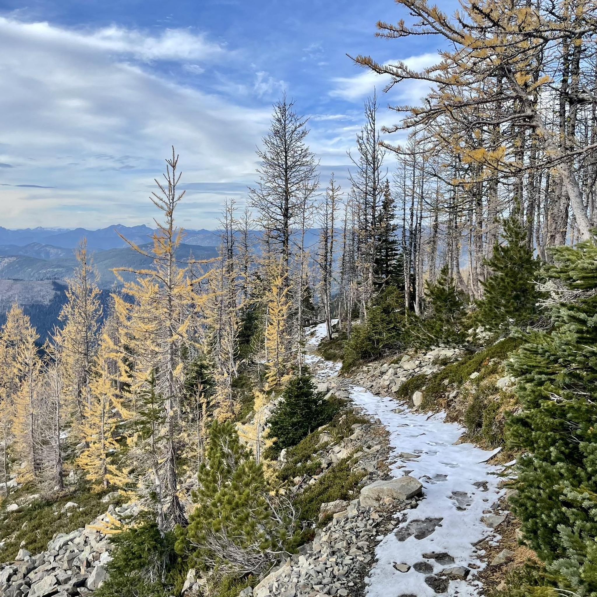
The small larch forest and the scattered larch trees on the way to Frosty Mountain attract many people here every year, especially in autumn. Also known as Mountain Monarch, you will find a very special tree species here, the alpine larch. Some larches are over 2,000 years old. They are especially beautiful to look at in the fall, when they change their green leaf dress for a bright yellow one.
4
0
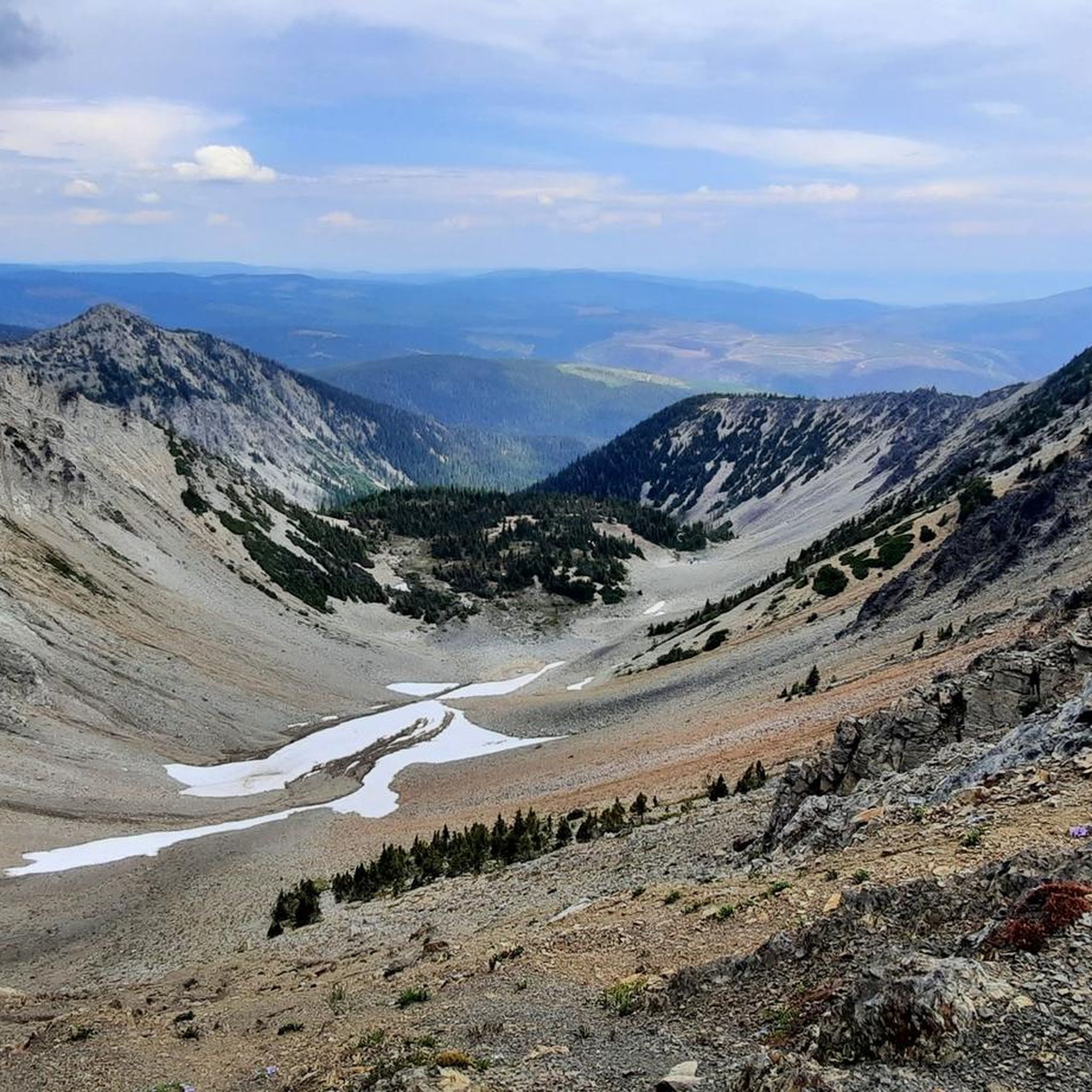
Once you've fought your way up here, a spectacular view of Frosty Mountain and the surrounding mountain landscape awaits. Especially in the sunshine, you can stand it here for a few moments, provided you don't come here in high season, because there's not much space at this crossing. To the actual summit, it's only about 600 meters in distance. However, as it goes over the ridge, it can be dangerous in winter with snow. Then it may be enough to enjoy the view from here.
3
0
The climb from the west is not as steep and arduous as from the east and is the classic walking direction if you hike the loop. Also, you can spend a night at Frosty Creek Camp at about 1,900 meters and climb the summit at 2,400 meters the next day. To spend the night in the backcountry, you'll need a permit that costs 5 dollars a night per person. Also note: In winter and even in fall, Frosty Mountain can be snow covered. So if you are descending to the west, you should have microspikes in your backpack for this case.
0
0
If you come all the way from the Mexican border this is where your epic journey along the 2,650 miles of the Pacific Crest Trail ends. It might also be the start of your adventure if you chose to hike the National Scenic Trail southbound. It is marked with a wooden pillar monument a little south of the international boundary marker to Canada called Monument 78. As of January 25, 2025, the Pacific Crest Trail permit program to enter Canada has ended. You are only allowed to enter Canada using a designated point of entry. On the United States side, the nearest road to pick up a hiker is Hart’s Pass Road (usually passenger-vehicle accessible) which is a hike of around 30 miles south from the northern terminus. As getting to and from the northern terminus is not that easy since there are no roads, here are some helpful tipps for logistics and maps: https://www.pcta.org/discover-the-trail/backcountry-basics/pct-transportation/directions-northern-terminus-pct/
6
1

Frequently Asked Questions
What are some of the most notable natural monuments to visit in the Manning Park area?
In E.C. Manning Provincial Park, you can explore the Alpine Larch Forest on Frosty Mountain Trail, especially stunning in autumn when the larches turn bright yellow. Another highlight is the Frosty Mountain Summit, offering expansive views of the surrounding mountains. Beyond these, the park features the pristine Lightning Lake Chain, vibrant Subalpine Meadows, and the unique Rhododendron Flats.
Are there any natural monuments with historical or cultural significance in the region?
Yes, the Tulameen Ochre Bluffs, also known as the Similkameen Spirit Trail National Historic Site, are a significant natural monument. These bluffs were historically used by First Nations as a source of red ochre for paint and ceremonial purposes, with some pictograph sites dating back around 4000 years. Additionally, the Tulameen River itself holds historical significance for its gold and platinum mining past.
What kind of hiking experiences can I expect around these natural monuments?
The region offers a range of hiking experiences. For challenging ascents, consider the route to Frosty Mountain Summit, often started from Lightning Lake. The Devil's Stairway offers switchbacks with breathtaking views into the Pasayten Wilderness. For easier options, the 8.5 km Lightning Lakes Loop is popular, and the Sumallo Grove provides a short, accessible walk among ancient trees. You can find more hiking options in the Hiking around Area H guide.
When is the best time to visit the natural monuments, especially for specific features?
The best time to visit depends on your interest. For the vibrant display of pinkish-red rhododendrons at Rhododendron Flats, early to mid-June is ideal. The Alpine Larch Forest on Frosty Mountain Trail is particularly beautiful in autumn when the larches turn bright yellow. For general hiking and water activities at Lightning Lake or Otter Lake, the summer months offer pleasant conditions. Be aware that Frosty Mountain can be snow-covered in fall and winter.
Are there any family-friendly natural monuments or activities available?
Yes, the Lightning Lake Chain in Manning Park is excellent for families, offering swimming, canoeing, kayaking, and easy walks like the 8.5 km Lightning Lakes Loop. Otter Lake Provincial Park near Tulameen also provides a great setting for family camping, swimming, and boating. The Sumallo Grove offers a short, easy walk among towering old-growth trees suitable for all ages.
What unique geological features can be found in the region?
The region is largely situated within the Cascade Mountains, including the Hozameen Range, which features rugged snow-capped peaks and diverse geological formations. The geological history involves ancient sedimentary rocks and volcanic activity. The Tulameen River's clear, cold water and rocky terrain are also a result of this geological past, known for its historical gold and platinum deposits.
What water-based activities are available at the natural monuments?
The Lightning Lake Chain in Manning Park is perfect for swimming, canoeing, kayaking, and stand-up paddleboarding. Fishing for lake trout, rainbow, brook trout, and Kokanee is also popular there. Similarly, Otter Lake near Tulameen is an excellent recreational lake for swimming, boating, water-skiing, and fishing for various trout and Kokanee. The Tulameen River is also popular for kayaking and rafting, with varying difficulty levels.
Are there opportunities for stargazing near the natural monuments?
Yes, E.C. Manning Provincial Park is designated as a Dark Sky Preserve. Its remote location and minimal light pollution create exceptionally clear night skies, making it an ideal destination for stargazing. Locations like the Windy Joe Field and Cascade Lookout offer prime viewing opportunities.
What permits might I need for visiting certain natural monuments or for backcountry stays?
If you plan to spend a night in the backcountry, for instance at Frosty Creek Camp near Frosty Mountain Summit, you will need a permit, which costs $5 per night per person. For the Pacific Crest Trail Northern Terminus, while the permit program to enter Canada has ended, you must use a designated point of entry if crossing the border. Always check with park authorities for the latest permit requirements for specific activities or areas.
What do visitors enjoy most about the natural monuments in this area?
Visitors frequently praise the stunning panoramic views from spots like Frosty Mountain Summit and the Pasayten Wilderness from the Devil's Stairway. The unique beauty of the Alpine Larch Forest, especially in autumn, is also a major draw. Many appreciate the diverse recreational opportunities, from serene lake activities to challenging mountain hikes, and the chance to witness ancient trees and significant cultural sites.
Are there any natural monuments that are particularly challenging to access?
The Pacific Crest Trail Northern Terminus is known for its challenging access, as there are no roads directly to it. The nearest road to pick up a hiker on the US side is Hart’s Pass Road, which is about a 30-mile hike south. For detailed logistics and maps, refer to resources like the Pacific Crest Trail Association website. The ascent to Frosty Mountain Summit is also considered challenging, especially from the east.
Where can I find reliable water sources when exploring the natural monuments?
When hiking in the backcountry, it's crucial to know your water sources. The small stream near Castle Pass is a reliable water source that runs at least until fall, making it the closest option for campsites in that area. For those climbing Frosty Mountain Summit, Frosty Creek Camp at about 1,900 meters is a water source, though the stream at the Frosty Mountain glacier can be a difficult climb away.
What other outdoor activities can I do near these natural monuments?
Beyond hiking, the region offers various outdoor activities. You can find numerous running trails, including loops around Lightning Lake, as detailed in the Running Trails around Area H guide. The Kettle Valley Railway Trail also offers opportunities for cycling and walking. The lakes and rivers provide excellent spots for fishing, boating, and paddling.
Most popular routes around Area H (Manning Park/Tulameen/Siwash)
Most popular attractions around Area H (Manning Park/Tulameen/Siwash)

Get inspired with the komoot mobile app


Explore more
Extend your search for the best caves by checking out these guides of the top ones around Area H (Manning Park/Tulameen/Siwash):
