Top 8 Natural Monuments around Area H (Lighthouse Country)
Best natural monuments around Area H (Lighthouse Country) showcase diverse ecosystems, from ancient forests and geological formations to marine environments. This region on Vancouver Island, British Columbia, offers numerous opportunities to experience natural beauty. It encompasses communities like Qualicum Bay, Bowser, and Deep Bay, providing a variety of natural attractions. The area is characterized by its rugged shoreline, quiet beaches, and unique geological features.
Best natural monuments around Area H (Lighthouse Country)
- The most popular natural monuments is Cathedral Trail,…
Last updated: May 11, 2026
Cathedral Trail, MacMillan Park
Highlight • Forest
Translated by Google •
Tip by

The Big Tree (Douglas-fir), MacMillan Provincial Park
Highlight • Natural Monument
Translated by Google •
Tip by

Sign up now to discover places like this
Get recommendations on the best single tracks, peaks, & plenty of other exciting outdoor places.
Sign up for free
Stamp Falls and Canyon
Highlight • Waterfall
Showing Translation
Tip by

Hole-in-the-Wall
Highlight • Waterfall
Tip by

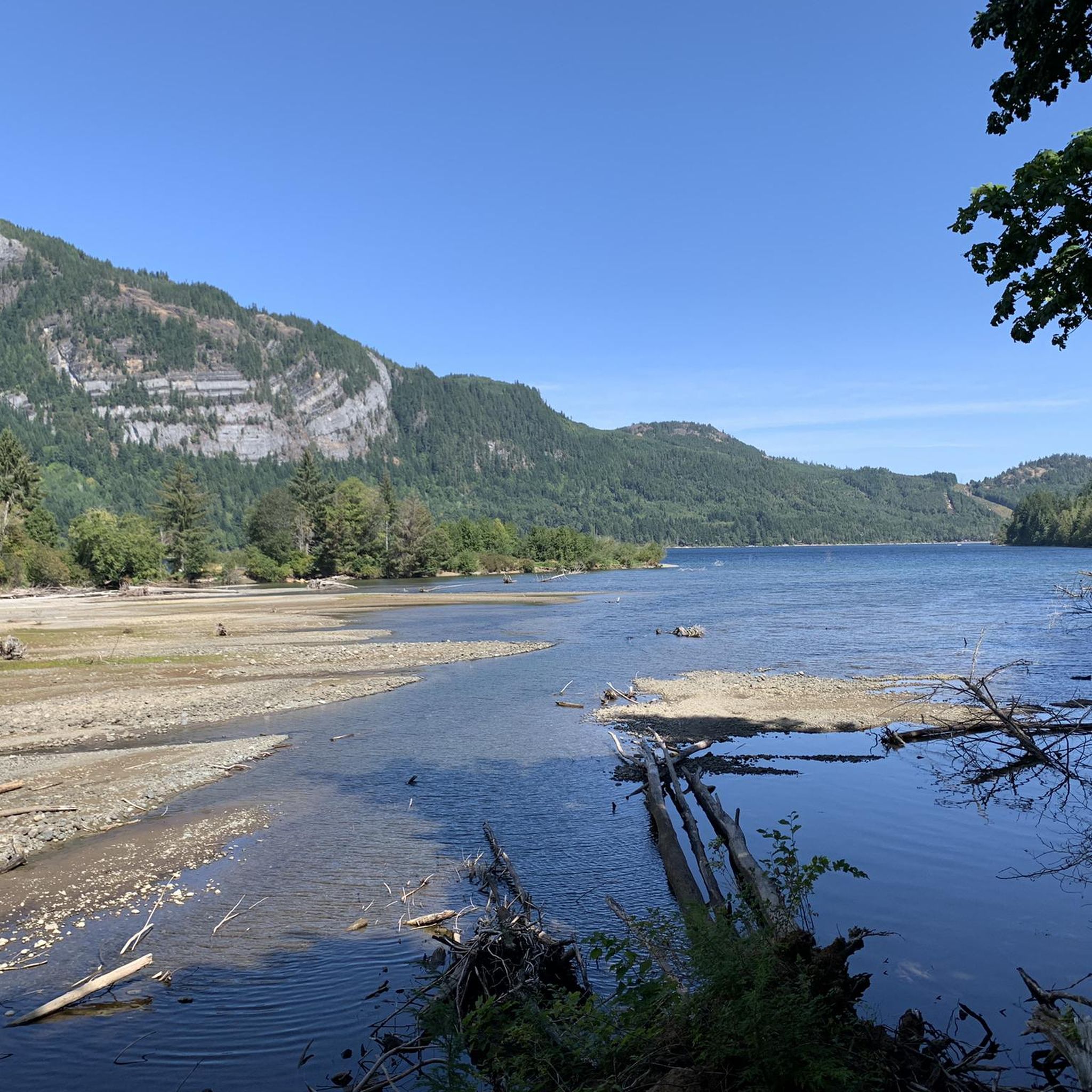
Sproat Lake Provincial Park
Highlight • Lake
Translated by Google •
Tip by

Sign up for free to discover even more natural monuments around Area H (Lighthouse Country).
Sign up for free
Already have an account?
Start today with a free account
Your next adventure awaits.
Login or Signup
Tips from the Community

The tree is taller than the Leaning Tower of Pisa and about 800 years old. ...
0
0

Hole-in-the-Wall is a small but unique natural waterfall. The waterfall gets its name from a literal hole in the wall, creating a “keyhole” effect that’s especially exciting after rain or during spring runoff. Mossy rock walls, ferns, and dense coastal forest surround this waterfall.
1
0

The largest tree in MacMillan Park, "The Big Tree" - a Douglas fir, stands in the Cathedral Grove south of the road. Its name comes from the botanist David Douglas, who identified more than 200 new plant species in the early 19th century, including the Douglas fir. (May 19, 2025)
1
0
A short drive from Port Alberni lies MacMillan Park, directly off Highway 4. The park features the Cathedral Grove, a stand of giant Douglas firs; some trees are over 800 years old. North of the road are ancient Western Red Cedar trees. A severe storm in late 1997 severely damaged the stand. (May 19, 2025) https://bcparks.ca/macmillan-park/
2
0

located in MacMillan Provincial Park at the West end of Cameron Lake, Cathedral Grove is the only highway accessible stand of ancient Douglas Fir forest on Vancouver Island.
0
0

Very nice way
0
0

I didn't see the old car. Maybe it's no longer there. But the hike is worth it. Don't forget your hiking poles if you're not quite so young.
0
0
Frequently Asked Questions
What unique natural features can I explore in Area H (Lighthouse Country)?
Area H (Lighthouse Country) offers a diverse range of natural features. You can explore ancient forests with colossal trees, unique geological formations like cave systems and waterfalls, and extensive coastal shorelines with tide pools. Highlights include the ancient Douglas firs at Cathedral Trail, MacMillan Park, the distinctive "keyhole" waterfall at Hole-in-the-Wall, and the crystal formations within Horne Lake Caves Provincial Park.
Are there family-friendly natural monuments in Area H (Lighthouse Country)?
Yes, several natural monuments are suitable for families. Cathedral Trail, MacMillan Park and The Big Tree (Douglas-fir), MacMillan Provincial Park offer easy paths through ancient forests. Stamp Falls and Canyon is great for viewing salmon migration, and Sproat Lake Provincial Park provides opportunities for swimming and exploring petroglyphs. Horne Lake Caves Provincial Park also offers guided tours for various experience levels, including family-friendly options.
What kind of wildlife can I expect to see near the natural monuments?
The diverse ecosystems in Area H support a variety of wildlife. Near Stamp Falls and Canyon, you can observe thousands of Pacific salmon during their annual migration, which also attracts black bears. Coastal areas like Deep Bay and Sunny Beach are excellent for birdwatching and spotting marine life in tide pools, such as starfish and sand dollars. The ancient forests are home to various bird species and smaller mammals.
When is the best time to visit the natural monuments in Lighthouse Country?
The best time to visit depends on your interests. Spring and summer offer warm weather ideal for water activities at places like Spider Lake Provincial Park and Sproat Lake Provincial Park, and for exploring trails. Fall is excellent for witnessing the salmon migration at Stamp Falls and Canyon. The ancient forests, such as MacMillan Provincial Park, are beautiful year-round, though trails may be wet in winter.
Are there hiking trails available at the natural monuments?
Yes, there are numerous hiking opportunities. MacMillan Provincial Park features beautiful paths through its ancient forest. The Lighthouse Country Regional Trail offers a 3.5 km loop through coastal Douglas-fir forests, and the nearly 10 km Nile Creek Trail provides picturesque scenes of the creek and waterfalls. For more hiking options, you can explore the easy hikes around Area H (Lighthouse Country), which includes routes like Rosewall Creek Falls and the Lighthouse Country Regional Trail South Loop.
What outdoor activities can I do near the natural monuments in Area H (Lighthouse Country)?
Beyond exploring the monuments themselves, Area H offers a range of outdoor activities. Horne Lake and Spider Lake are popular for kayaking, canoeing, stand-up paddleboarding, swimming, and fishing. The coastal shorelines provide opportunities for swimming, surfing, windsurfing, and salmon fishing in Deep Bay. For those interested in cycling, there are various road cycling routes around Area H (Lighthouse Country), and for runners, several running trails are available.
Are there any historical or cultural sites among the natural monuments?
Yes, Sproat Lake Provincial Park is home to the K'ak'awin petroglyphs, which are ancient rock carvings sacred to local indigenous communities. These provide a unique cultural and historical dimension to the natural beauty of the lake.
Where can I find coastal natural monuments or beaches in Area H?
Lighthouse Country boasts 60 miles of coastline along the Strait of Georgia. Notable coastal areas include Sunny Beach in Qualicum Bay and the sheltered waters of Deep Bay, protected by Mapleguard Point. These locations offer beaches for relaxation, opportunities to explore tide pools at low tide, and various water sports.
Are there accessible trails at the natural monuments in Lighthouse Country?
While specific accessibility details vary, many of the main paths in parks like MacMillan Provincial Park (Cathedral Grove) are generally well-maintained and relatively flat, making them accessible for a wider range of visitors. It's always recommended to check specific park information for the most up-to-date accessibility details before your visit.
What do visitors enjoy most about the natural monuments in Area H (Lighthouse Country)?
Visitors frequently highlight the awe-inspiring experience of walking among the colossal, ancient trees in MacMillan Provincial Park, often describing it as an "enchanted landscape." The unique "keyhole" effect of the Hole-in-the-Wall waterfall is also a popular draw, especially after rain. The tranquility of the forests and the opportunity to connect with nature are consistently praised.
Can I explore caves in Area H (Lighthouse Country)?
Yes, Horne Lake Caves Provincial Park offers a unique opportunity to explore a cave system. The park features seven exploration-worthy caves with crystal formations and fossils. Guided tours are available for various experience levels, allowing visitors to safely discover the underground wonders.
Are there opportunities for water sports at the natural monuments?
Absolutely. Horne Lake and Spider Lake Provincial Park are excellent for water-based activities such as kayaking, canoeing, stand-up paddleboarding, and swimming. Sproat Lake Provincial Park also offers crystal-clear waters ideal for swimming and boating. The coastal shorelines provide options for swimming, surfing, and windsurfing.
Most popular attractions around Area H (Lighthouse Country)

Get inspired with the komoot mobile app


Explore more
Extend your search for the best caves by checking out these guides of the top ones around Area H (Lighthouse Country):
