Top 6 Natural Monuments around Saint-Pierre-Langers
Natural Monuments around Saint-Pierre-Langers are characterized by a rural bocage landscape and proximity to the sea in the Manche department of Normandy, France. The area is defined by its rivers, such as the Thar and Allemagne, and the nearby Forêt de la Lucerne. These features contribute to the commune's natural environment, offering opportunities for walking routes and appreciating local ecosystems.
Best natural monuments around Saint-Pierre-Langers
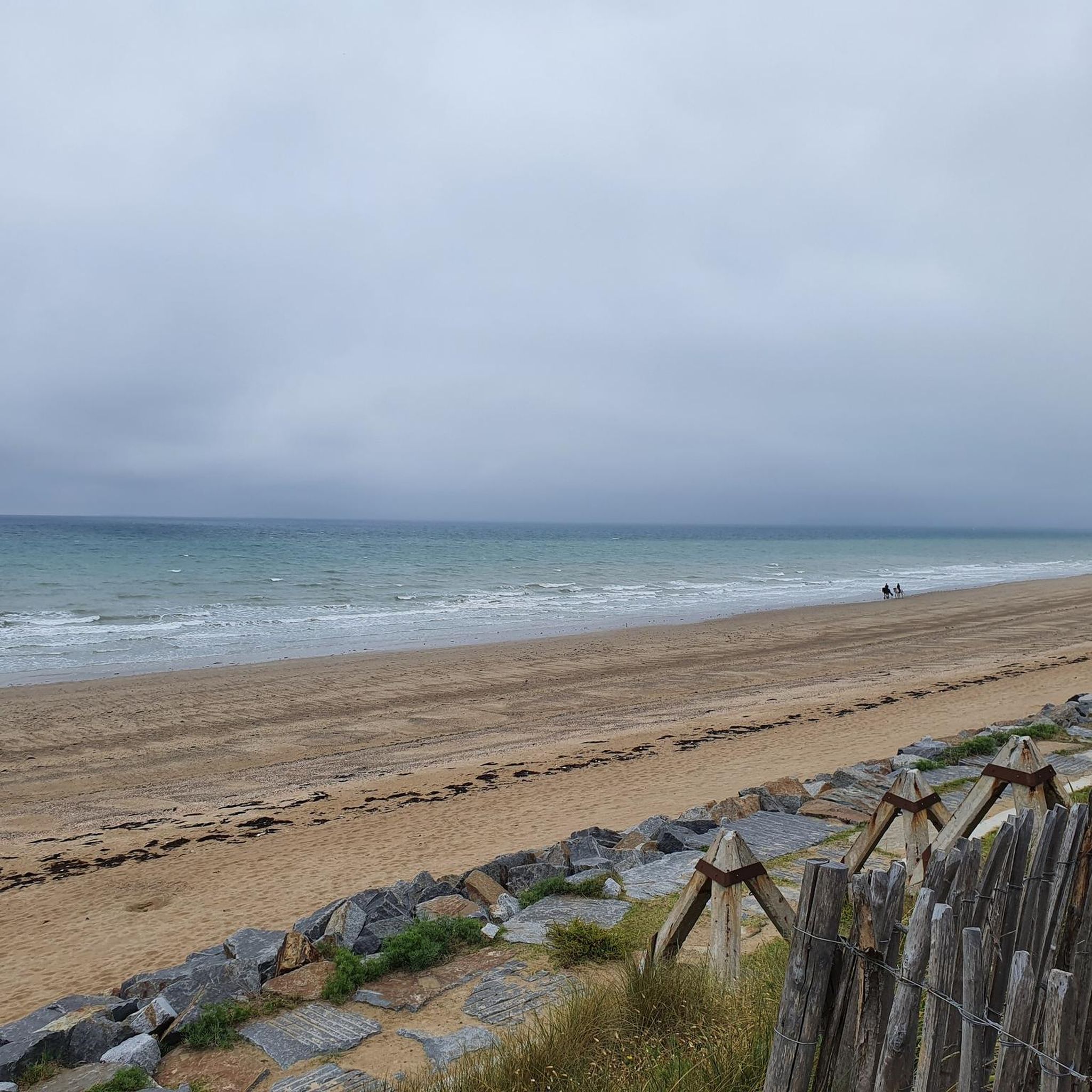
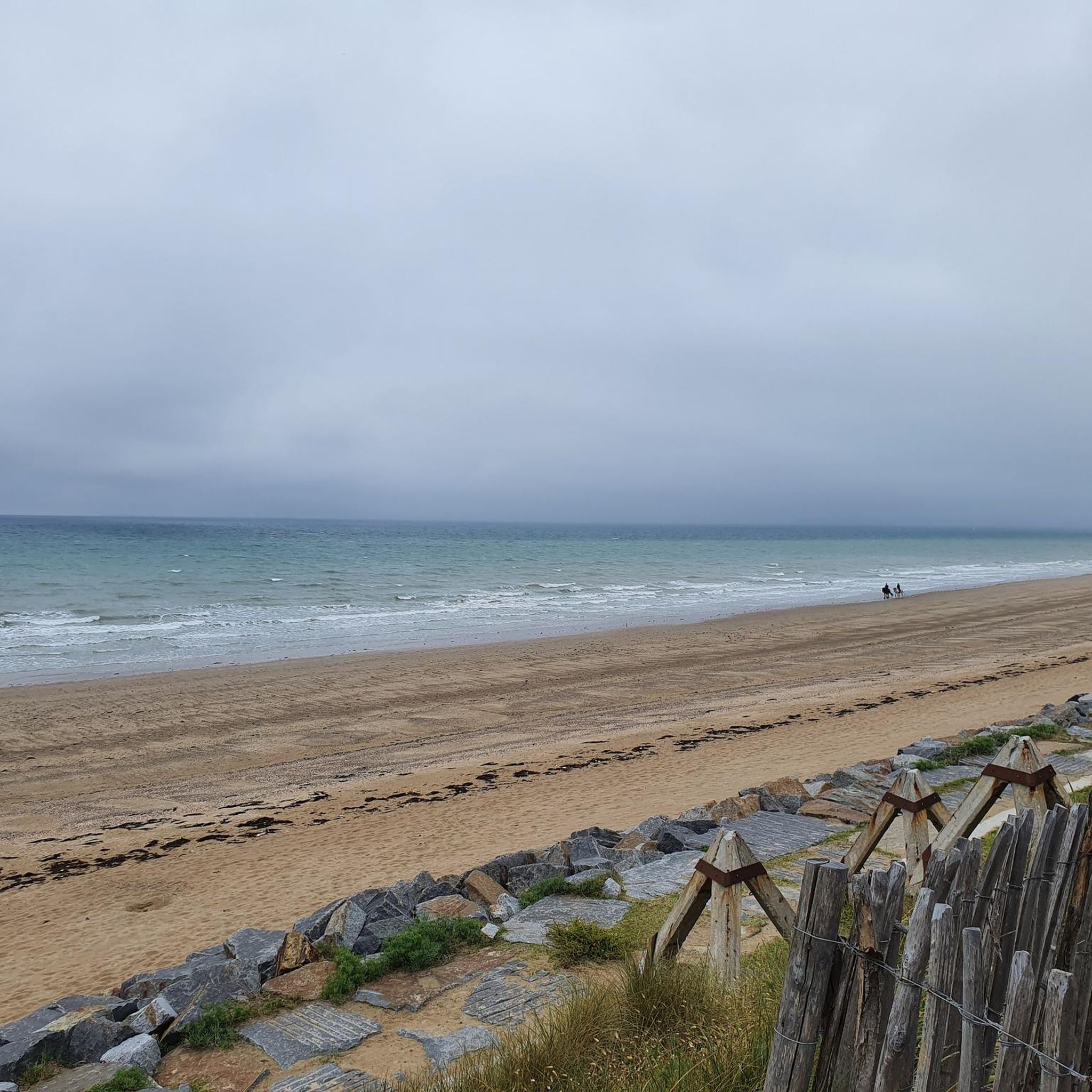
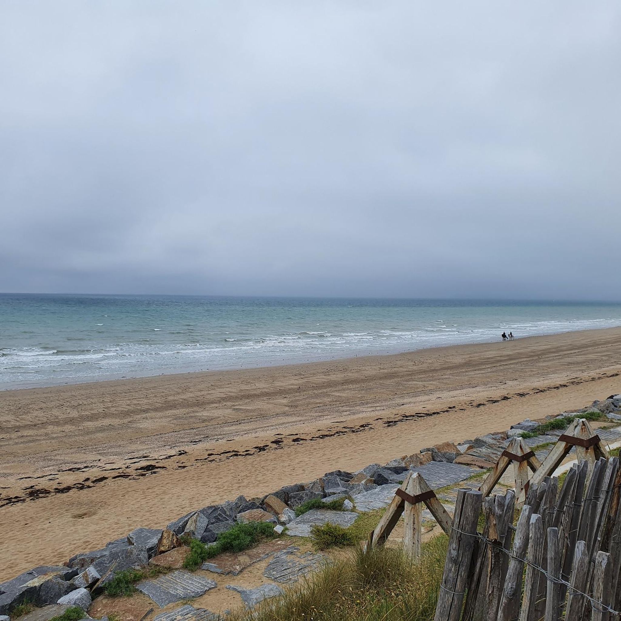
- The most popular natural monuments is View of Mont Saint-Michel and Tombelaine from the bay between Saint-Jean-le-Thomas and Champeaux, a viewpoint that offers expansive panoramas of Mont Saint-Michel and the dune coast. This location provides views after a climb from the bay or along the cliff of Champeaux.
- Another must-see spot is Customs Officers' Path – Lude Valley and Beaches from Carolles to Saint-Jean-le-Thomas, a trail that follows the coastline. This path, part of the GR 223, features panoramic views of Mont Saint-Michel Bay and Brittany.
- Visitors also love Sard Rock, a natural monument culminating at 70 meters. This striking granite rock offers a commanding view of the Bay of Mont Saint-Michel.
- Saint-Pierre-Langers is known for its coastal paths, viewpoints, and natural rock formations. The area offers a variety of natural monuments to see and explore, from river valleys to forest remnants.
- The natural monuments around Saint-Pierre-Langers are appreciated by the komoot community, with more than 70 upvotes and over 30 photos shared by visitors.
Last updated: August 14, 2026
Customs Officers' Path – Lude Valley and Beaches from Carolles to Saint-Jean-le-Thomas
Highlight (Segment) • Trail
Showing Translation
Tip by

Sard Rock
Highlight • Natural Monument
Local legend says that the rock was a refuge for the Devil during his battle with the Archangel Michael—hence its nickname, Rocher du Diable.
Translated by Google •
Tip by
Sign up now to discover places like this
Get recommendations on the best single tracks, peaks, & plenty of other exciting outdoor places.
Sign up for free
Sol Roc
Highlight • Natural Monument
Translated by Google •
Tip by

Les Cent Vergées Peatland
Highlight • Natural
Translated by Google •
Tip by

Translated by Google •
Tip by

Sign up for free to discover even more natural monuments around Saint-Pierre-Langers.
Sign up for free
Already have an account?
Start today with a free account
Your next adventure awaits.
Login or Signup

Tips from the Community

The documentary film "Border Paths – The Customs Officers' Trail" is described on its website as follows: "The historic Customs Officers' Trail begins at the famous pilgrimage site of Mont Saint-Michel and is now one of France's most popular hiking trails. Along its 1,700 kilometers, between Mont Saint-Michel in the north and Saint-Nazaire in the south of the Breton peninsula, hikers can discover impressive landscapes with a rich diversity of flora and fauna. Passing rugged cliffs, expansive dunes, and seemingly endless beaches, hikers become border crossers on a floating border that shifts with the rhythm of the tides." ``` The video about the "Sentier des Douaniers" (duration: 43 minutes / language: German) in the ARD media library can be accessed via the following link =>> https://www.ardmediathek.de/video/grenzwege-der-zoellnerpfad/grenzwege-der-zoellnerpfad/mdr/Y3JpZDovL21kci5kZS9zZW5kdW5nLzI4MjA0MC81MjE2OTktNTAxNzM2
1
0

Between Carolles and Saint-Jean-le-Thomas, beaches, steep coasts, and the picturesque Lude valley alternate. From the valley, the Rocher du Sard and the historic Cabane Vauban offer spectacular views of the Mont-Saint-Michel bay. Part of the route follows the historic customs path, where guards and customs officers once patrolled and monitored the coast. The flat sandy beaches and tidal flats at low tide invite leisurely walks, and the GR 223 combines history and coastal panorama into a charming hike.
28
0
The Rocher du Sard lies above the Vallée du Lude. This striking granite rock rises about 70 meters above the sea and offers a commanding view of the Bay of Mont Saint-Michel. Local legend says that the rock was a refuge for the Devil during his battle with the Archangel Michael—hence its nickname, Rocher du Diable.
26
0


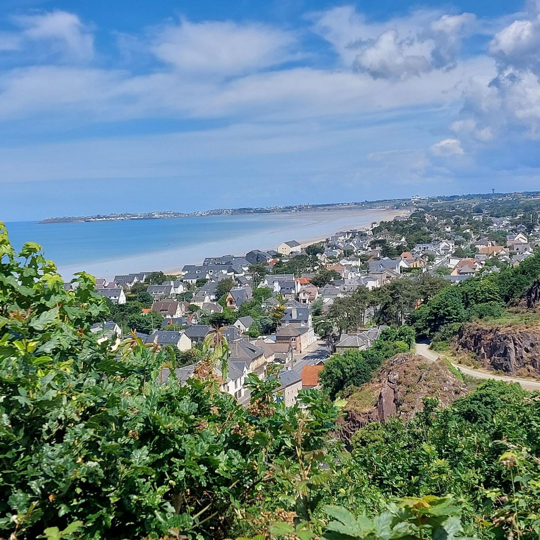
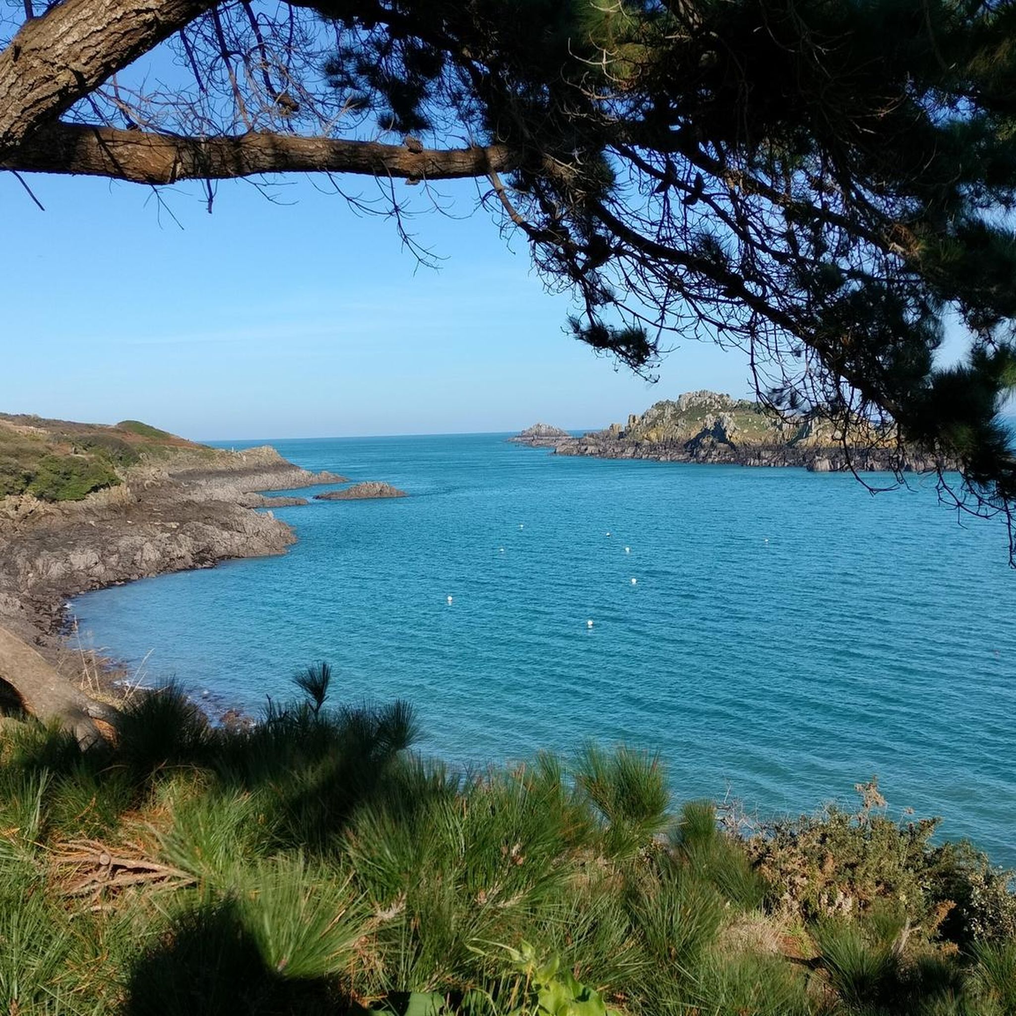
If like me, you come here from the bay of Mont St Michel, it's a beautiful climb that surprises a little but offers by turning your head or stopping on the side a vast panorama overlooking the coast.
0
1

To be visited in different seasons to appreciate the various flowers, heather, broom...
2
0
Departing from Angey, short walk to discover a site of peat moors.
2
0
Frequently Asked Questions
What unique natural features define the landscape around Saint-Pierre-Langers?
The area is characterized by a rural bocage landscape and its proximity to the sea. Key natural features include the Thar River, which forms the northern boundary, and the Allemagne River, an affluent of the Thar known for its relatively steep valley. To the east, the Forêt de la Lucerne, a 370-hectare private forest, offers ancient woodlands with oak, chestnut, beech, and conifer trees, providing habitat for deer and wild boars.
Are there any natural monuments with historical significance in the region?
Yes, the Customs Officers' Path – Lude Valley and Beaches from Carolles to Saint-Jean-le-Thomas has historical significance. This trail, part of the GR 223, is named after the 'Gabelous' (Customs officers) who used these coastal paths from the 17th to the 20th century to protect the French inland from smugglers. Along the path, you can still see old coast guard cabins built of local rock.
Where can I find panoramic views of Mont Saint-Michel Bay?
Several natural monuments offer stunning views of Mont Saint-Michel Bay. The View of Mont Saint-Michel and Tombelaine from the bay between Saint-Jean-le-Thomas and Champeaux provides expansive panoramas after a climb. Additionally, Sard Rock, a striking granite formation culminating at 70 meters, offers a commanding view of the bay. The Customs Officers' Path also features panoramic views of the bay and Brittany.
Are there family-friendly natural sites to visit near Saint-Pierre-Langers?
Yes, Les Cent Vergées Peatland is a family-friendly option. It offers a short walk to discover a unique peat moor site, perfect for appreciating various flowers, heather, and broom throughout the seasons. The Forêt de la Lucerne also provides pathways suitable for family walks.
What kind of wildlife can be observed in the natural areas?
The Forêt de la Lucerne, a significant woodland area to the east of Saint-Pierre-Langers, is home to various wildlife, including deer and wild boars. The river valleys and peatlands also support diverse birdlife and smaller mammals.
What are the best walking routes to explore the natural monuments?
The Customs Officers' Path is a highly recommended trail, part of the GR 223, offering beautiful coastal views. For forest walks, the Forêt de la Lucerne has pathways, and you can find routes like the 'Grand Tour de la Lucerne' which explores the wider forest area. You can find more hiking options on the Hiking around Saint-Pierre-Langers guide.
Are there any unique geological features to see?
Yes, Sard Rock is a notable geological feature. This striking granite rock rises about 70 meters above the sea, offering a dramatic natural landmark and a commanding viewpoint. Local legend even associates it with the Devil during a battle with Archangel Michael.
What outdoor activities can I do near these natural monuments?
Beyond exploring the natural monuments themselves, the region offers various outdoor activities. You can find numerous hiking trails, including those along the coast and in the Forêt de la Lucerne. There are also dedicated routes for road cycling and mountain biking, with options like loops around the Abbaye de La Lucerne or routes with views of Mont Saint-Michel.
What do visitors enjoy most about the natural monuments in this area?
Visitors particularly enjoy the expansive panoramic views of Mont Saint-Michel and the dune coast, especially from viewpoints like the View of Mont Saint-Michel and Tombelaine. The historical aspect and stunning coastal scenery of the Customs Officers' Path are also highly appreciated. The peaceful, natural environment of the peatlands and forests offers a tranquil escape.
Can I visit the Forêt de la Lucerne, and what can I expect there?
The Forêt de la Lucerne is a private forest, but it offers pathways for walking and enjoying nature. It's a remnant of a much larger ancient forest, dominated by oak, chestnut, beech, and conifer trees. You can expect peaceful trails, opportunities for 'forest bathing,' and a chance to observe local wildlife. Nearby, within La Lucerne-d'Outremer, an ancient millennium yew tree can be found, potentially accessible via trails in the wider forest area. For a specific route, consider the Grand Tour de la Lucerne.
Are there any natural monuments accessible for those seeking an easier walk?
Yes, Les Cent Vergées Peatland offers a short and relatively easy walk to explore the peat moors. The Forêt de la Lucerne also has various pathways, some of which are suitable for less strenuous strolls. For specific easy hiking routes, you can check the Hiking around Saint-Pierre-Langers guide, which includes routes like 'In the idyllic Thar valley loop from Angomesnil'.
What is the best season to visit the natural monuments around Saint-Pierre-Langers?
The best time to visit depends on your preferences. Spring and summer offer lush greenery, blooming flowers in areas like Les Cent Vergées Peatland, and generally pleasant weather for coastal walks and forest explorations. Autumn brings beautiful fall foliage to the Forêt de la Lucerne. Coastal paths can be enjoyed year-round, though winter might require more appropriate gear for cooler, potentially windier conditions.
Most popular routes around Saint-Pierre-Langers
Most popular attractions around Saint-Pierre-Langers

Get inspired with the komoot mobile app


Explore more
Extend your search for the best caves by checking out these guides of the top ones around Saint-Pierre-Langers:
