Top 5 Natural Monuments around Saint-Pierre-De-Nogaret
Best natural monuments around Saint-Pierre-De-Nogaret are found within the Aubrac Regional Natural Park, a region celebrated for its preserved natural heritage. This area features significant mountain landscapes and diverse terrain, making it suitable for outdoor activities like hiking. Situated on the foothills of Aubrac, between the Lot Valley and the Monts d'Aubrac, the commune offers a mix of cultivated plateaus and steep-sided valleys. The region is noted for its areas of ecological interest and rich biodiversity, providing opportunities for an…
Last updated: July 4, 2026
Signal de Mailhebiau
Highlight • Summit
Translated by Google •
Tip by

Climb up to Croix de la Roda
Highlight (Segment) • Climb
Tip by

Sign up now to discover places like this
Get recommendations on the best single tracks, peaks, & plenty of other exciting outdoor places.
Sign up for free
Sabot de Malpeyre
Highlight • Viewpoint
Translated by Google •
Tip by
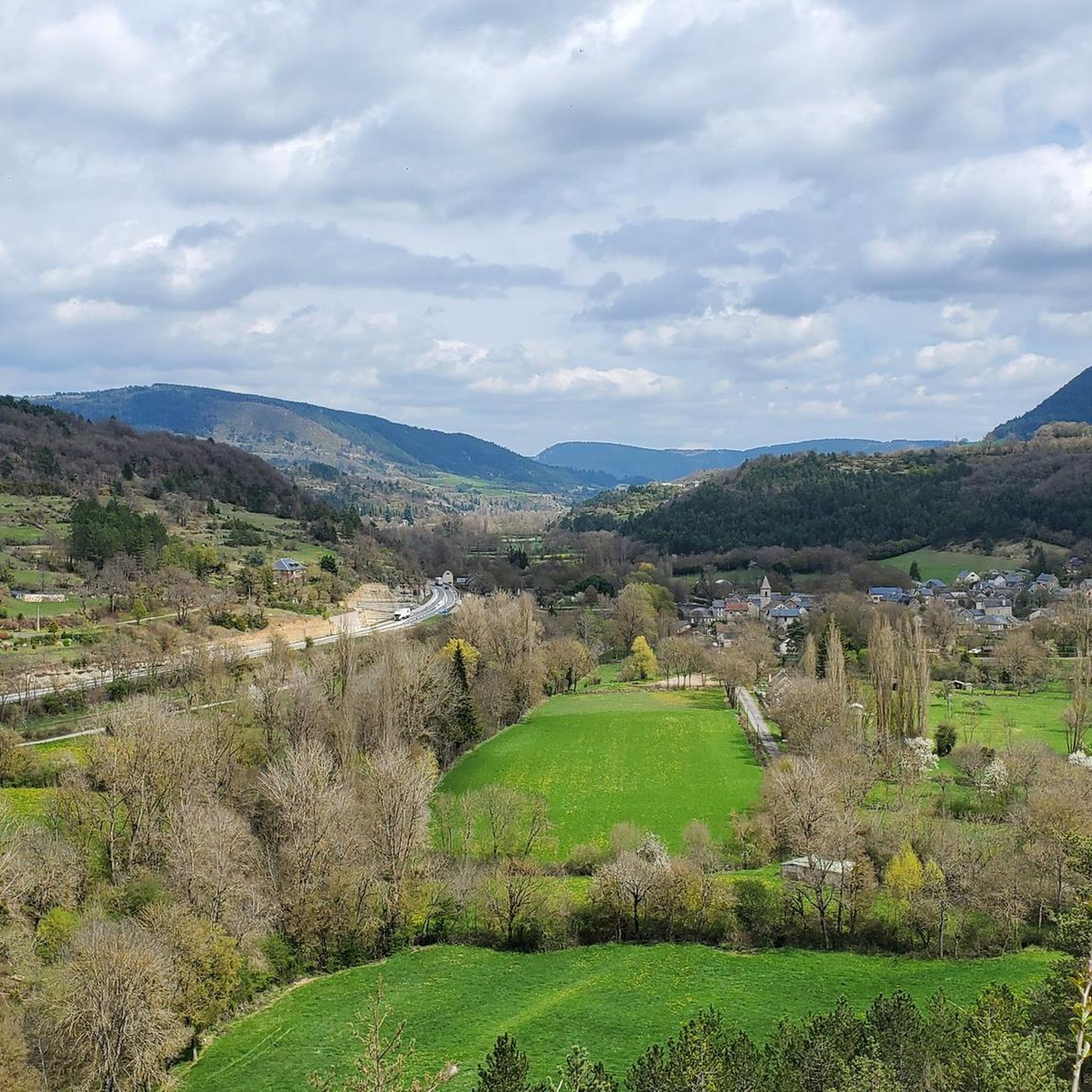
Booz Gorge
Highlight (Segment) • Gorge
Translated by Google •
Tip by

View across to the Cévennes
Highlight • Viewpoint
Tip by
Start today with a free account
Your next adventure awaits.
Login or Signup

Tips from the Community

La croix de la rode, a very particular cross with its circle around it!
0
0


"Thanks" to the motorway, car traffic is limited and you can drive carefree through this gorge.
2
0

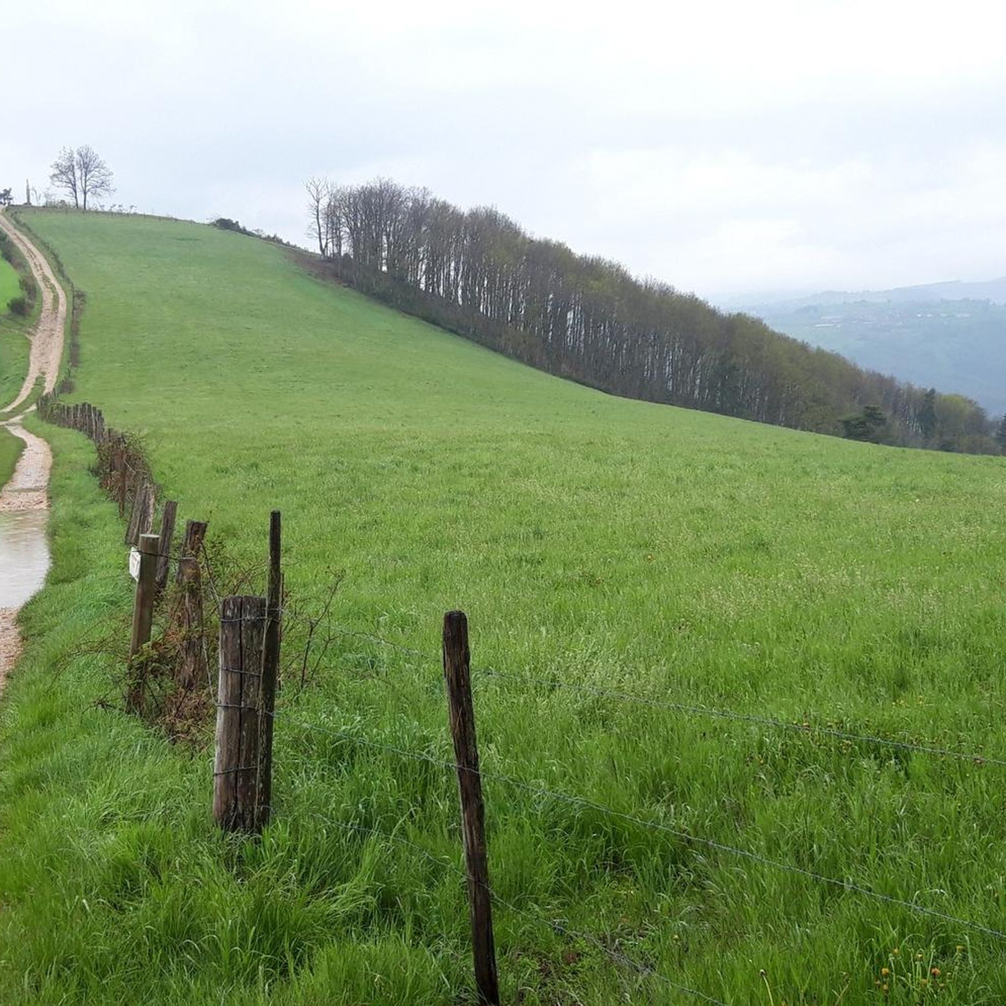
The climb over the 1,400-metre (4,593 ft) peak of the Croix de la Rode is rugged and wild. The section is stunning but exposed to the elements, so come prepared!
0
0
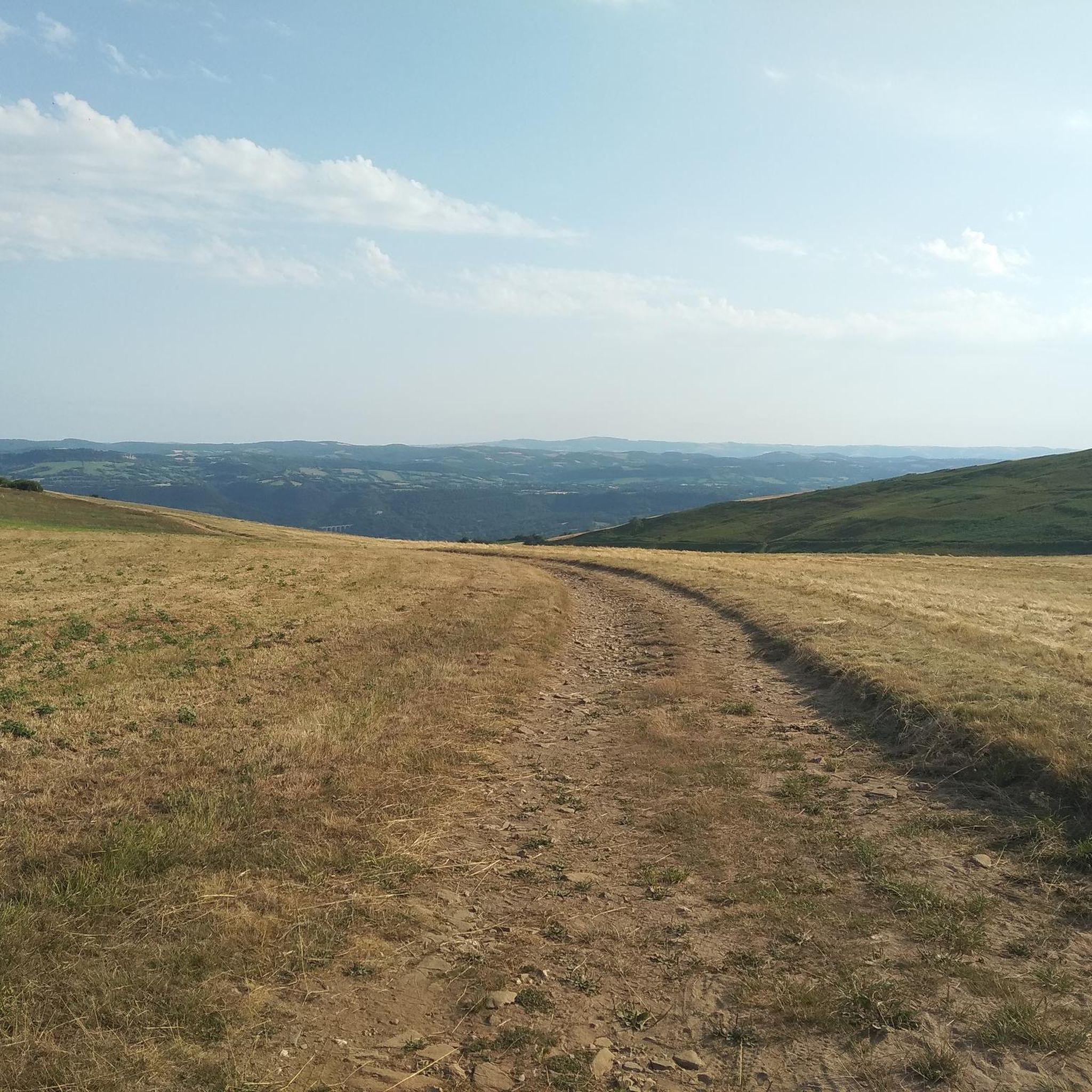
Amongst the hills of the Causses, this high point on open terrain offers stunning views across the valley below out towards the Cévennes national park. Especially stunning for sunset on a clear night.
0
0

The Sabot de Malpeyre is a 30m high rock forming an arch on the heights of the Urugne valley, a few kilometers south of La Canourgue.
0
0
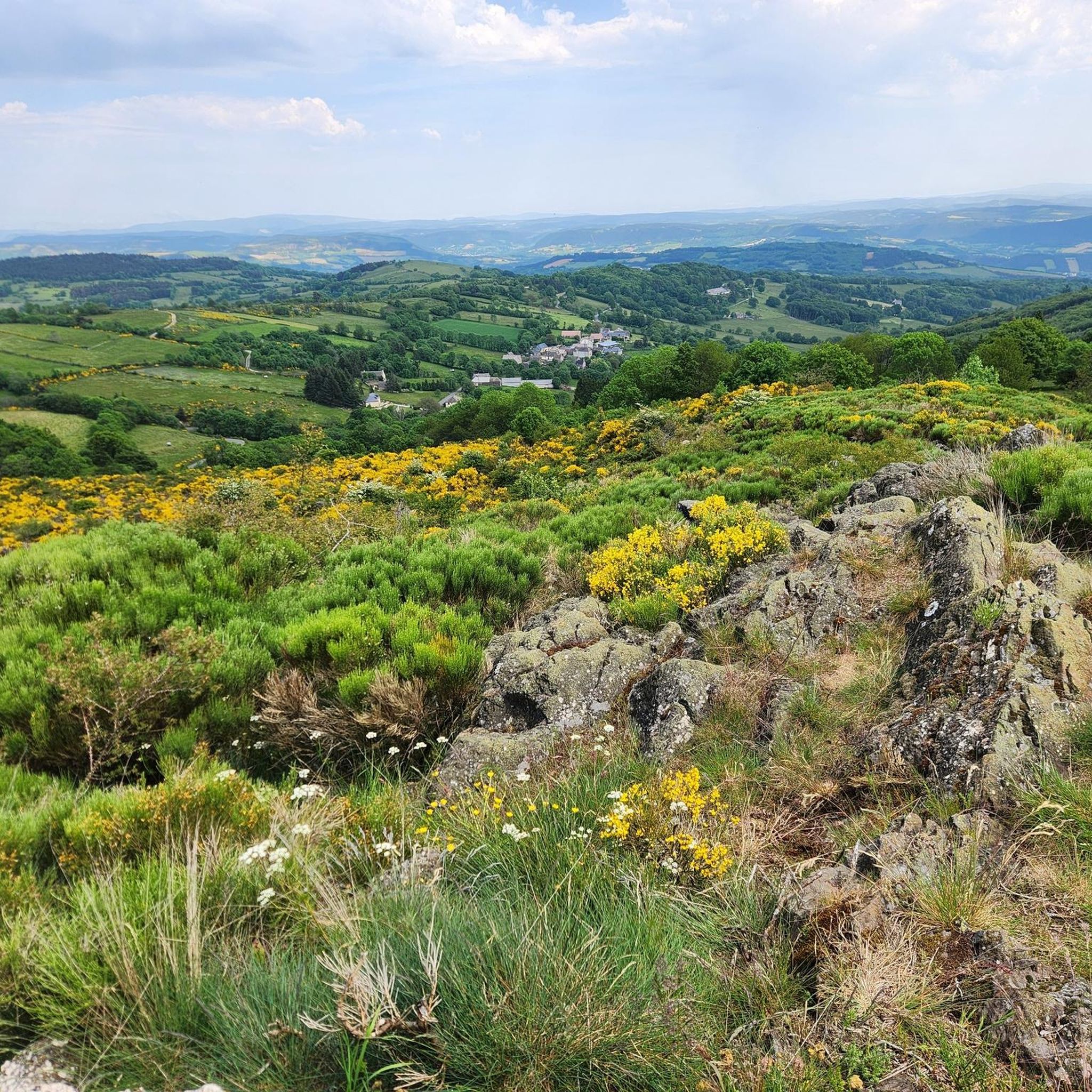
The Signal de Mailhebiau, at an altitude of 1,469m, is the highest point in Aubrac. It offers a magnificent 360° view of Aubrac. An orientation table also makes it possible to identify the peaks of the Massif Central on the horizon.
1
0
Frequently Asked Questions
What unique natural monuments can I explore around Saint-Pierre-De-Nogaret?
Beyond the well-known summits, you can discover distinctive natural formations like the Sabot de Malpeyre, a 30m high rock forming an arch on the heights of the Urugne valley. Another interesting spot is the Booz Gorge, offering a scenic drive with limited car traffic.
Are there any high points or summits with panoramic views in the area?
Yes, the region offers several impressive viewpoints. The Signal de Mailhebiau is the highest point in Aubrac at 1,469m, providing a magnificent 360° view with an orientation table. You can also undertake the challenging Climb up to Croix de la Roda, a rugged summit over 1,400 meters with expansive, exposed views.
What outdoor activities can I do near these natural monuments?
The diverse terrain around Saint-Pierre-De-Nogaret, part of the Aubrac Regional Natural Park, is ideal for various outdoor activities. You can find numerous options for hiking, cycling, and running, with routes catering to different difficulty levels.
Are there specific hiking trails to reach these natural monuments?
Yes, for instance, you can find a moderate 15 km hiking route called the "Signal de Mailhebiau Loop" that takes you to the highest point in Aubrac. Many other trails are available for exploring the region's natural beauty; you can find more details in the hiking guide for Saint-Pierre-De-Nogaret.
What kind of terrain can I expect when exploring the natural monuments?
The region features significant mountain landscapes and diverse terrain. You'll encounter a mix of small cultivated plateaus and steep-sided valleys, especially around the foothills of Aubrac. Some areas, like the climb to Croix de la Roda, are rugged and exposed to the elements.
Are there family-friendly natural monuments or viewpoints?
Yes, the View across to the Cévennes is categorized as family-friendly. This high point on open terrain offers stunning views across the valley, especially beautiful for sunset on a clear night, making it suitable for visitors of all ages.
What is the best time to visit the natural monuments around Saint-Pierre-De-Nogaret?
The Aubrac Regional Natural Park, where Saint-Pierre-De-Nogaret is located, offers a preserved environment that can be enjoyed throughout the warmer months. Spring and autumn provide pleasant temperatures for hiking and exploring, while summer allows for longer days outdoors. Always check local weather conditions before your visit, as mountain areas can be exposed.
Can I bring my dog on trails near the natural monuments?
While specific regulations for each natural monument may vary, generally, the Aubrac Regional Natural Park is welcoming to dogs, provided they are kept under control, especially in areas with livestock or protected wildlife. It's always best to keep your dog on a leash and respect local signage. Many of the hiking trails in the area are suitable for dog walking.
What makes the natural environment around Saint-Pierre-De-Nogaret special?
The area is nestled within the Aubrac Regional Natural Park, recognized for its rich and diversified heritage, including its landscapes, fauna, and flora. It boasts significant mountain landscapes, diverse terrain, and areas of ecological interest, offering a unique blend of unspoiled nature and ecological value. It's a place for a peaceful and authentic experience in a preserved environment.
Are there any natural monuments that are particularly popular with komoot users?
Yes, the Signal de Mailhebiau is highly appreciated by the komoot community, known for its magnificent 360° views. The Sabot de Malpeyre is also a popular spot for its distinctive rock formation.
Where can I find parking when visiting these natural monuments?
While specific parking details for each individual natural monument are not always listed, access points to trails and viewpoints within the Aubrac Regional Natural Park typically have designated parking areas. It's advisable to check maps or local information for the closest parking to your chosen starting point.
What should I wear for hiking to the natural monuments?
Given the mountain landscapes and potentially exposed areas, it's recommended to wear sturdy hiking boots, layers of clothing to adapt to changing weather, and bring rain gear. Sun protection (hat, sunscreen) is also important, especially at higher elevations like the Signal de Mailhebiau or Croix de la Roda.
Most popular routes around Saint-Pierre-De-Nogaret
Most popular attractions around Saint-Pierre-De-Nogaret

Get inspired with the komoot mobile app


Explore more
Extend your search for the best caves by checking out these guides of the top ones around Saint-Pierre-De-Nogaret:
