Top 4 Natural Monuments around Navatejares
Best natural monuments around Navatejares are found within the picturesque Valle del Tormes, nestled on the southern slopes of the Sierra de Gredos. This area, while not having officially designated individual natural monuments, functions as a significant natural treasure. It offers a landscape characterized by diverse ecosystems, rugged mountain ranges, and the Tormes River. The region provides numerous natural attractions for exploration.
Best natural monuments around Navatejares
- The most popular natural monuments is Garganta de la Nava, a gorge…
Last updated: July 1, 2026
Garganta de la Nava
Highlight (Segment) • Gorge
Translated by Google •
Tip by

Laguna de la Nava
Highlight • Lake
Translated by Google •
Tip by

Sign up now to discover places like this
Get recommendations on the best single tracks, peaks, & plenty of other exciting outdoor places.
Sign up for free
Viewpoint of the Puerto de Tornavacas
Highlight • Viewpoint
Translated by Google •
Tip by

Galín Gómez Gorge
Highlight • Gorge
Translated by Google •
Tip by
View of the Sierra de Gredos from Puerto de Umbrías
Highlight • Viewpoint
Translated by Google •
Tip by

Sign up for free to discover even more natural monuments around Navatejares.
Sign up for free
Already have an account?
Start today with a free account
Your next adventure awaits.
Login or Signup


Tips from the Community

This is one of the best-known mountain passes in the Sierra de Gredos area and is also important as it separates the two most important basins in the Iberian Peninsula, the Duero and the Tagus.
0
0

Located in the Sierra de Gredos Regional Park, from Puerto de Umbrías we have fantastic views of the surrounding landscapes.
1
0
Puerto de Umbrías via Nava del Barco is a climb in the Castilla y León region. It has a length of 7.4 kilometers and an ascent of 301 vertical meters with a slope of 4% on average.
0
0

Located at 1,275 meters above sea level, it is recognized as a historic mountain pass in the Sierra de Gredos and represents the physical division point of the Duero and Tagus basins. This site has been the passage of several civilizations. over the centuries and represents a site of great historical importance for the area.
1
1

This impressive granite canyon offers incredible views of the rock formations along the course of the river. There are several waterfalls that fall at different heights and form pools of crystal clear water. This section is, for the most part, an adapted stone walkway that zigzags along the gorge. However, there are also parts of loose stones.
3
0
The Galín Gómez Gorge starts in the town of Nava del Barco and runs through the Sierra de Gredos National Park. Along the course there are several waterfalls with pools of crystal clear water. Around this point, specifically, there is a pleasant walk along the river to enjoy nature without having to face large slopes.
1
1

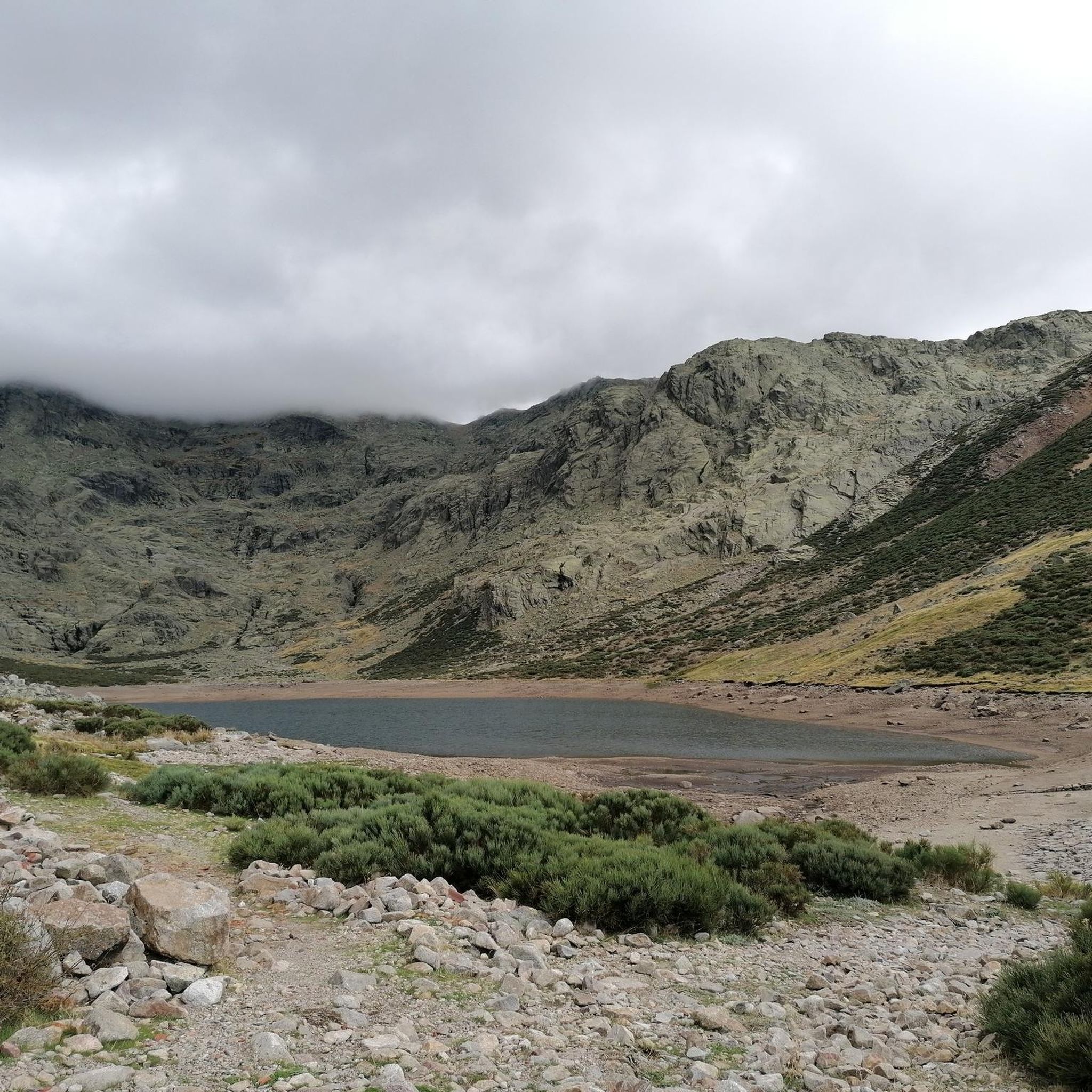
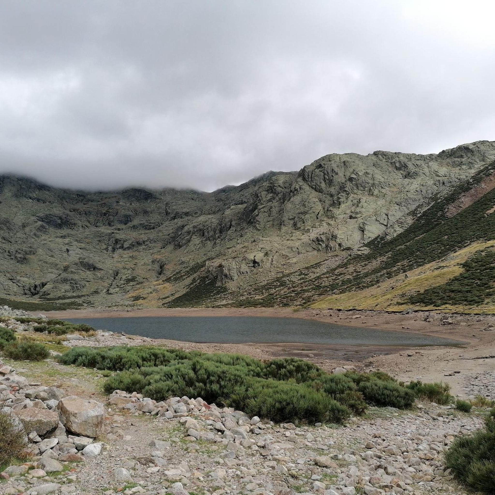
The Laguna de la Nava, also known as the Nava del Barco lagoon, is a lagoon of glacial origin located in the upper part of the gorge of the same name, in the western sector of the Sierra de Gredos; It is located in the municipality of Nava del Barco, in the province of Ávila (Castilla y León, Spain). The lagoon is located at an altitude of about 1,950 meters above sea level at the bottom of a glacial cirque known as the Corral del Diablo.1 Presiding over this glacial cirque is the Alto del Corral del Diablo, with 2,366 meters above sea level.
1
0

The port of Tornavacas is a historic pass in the Sierra de Gredos, it is located at an altitude of 1,274 m and divides the Duero and Tagus basins. The mountain pass has been a place of transit for centuries, cultures, civilizations, armies and transhumant herds have passed through here. Now it is an obligatory step to contemplate the landscape from a pleasant viewpoint located in the port car park or to take a hiking or mountain route through the surrounding mountains. Towards the Cáceres slope, the road plunges into the Jerte valley through the town of Tornavacas, a passageway for Carlos V's entourage when he traveled to the Yuste Monastery in the last days of his life. The Ávila side is gentler and follows the meadows and hills of the Aravalle River to the Tormes basin.
0
0
Frequently Asked Questions
What are the most notable natural features around Navatejares?
The area around Navatejares is rich in natural beauty, primarily defined by its location within the Valle del Tormes and at the foothills of the majestic Sierra de Gredos. Key features include rugged mountain ranges with high peaks and glacial cirques, the lush Tormes River valley, and a diverse ecosystem with extensive forests. In spring, the landscape is transformed by the vibrant yellow bloom of the 'piornos serranos' (broom shrubs).
Which natural monuments are popular with visitors near Navatejares?
Visitors frequently enjoy the Garganta de la Nava, an impressive gorge with granite rock formations and waterfalls, and the serene Laguna de la Nava, a glacial lake reflecting the surrounding peaks. Another appreciated spot is the Viewpoint of the Puerto de Tornavacas, offering panoramic vistas from a historic mountain pass.
Are there any impressive waterfalls to visit?
Yes, the Chorrera del Lanchón is a notable waterfall near Navatejares, featuring an impressive drop of 80 to 90 meters where the Horco stream discharges into the Caballeros throat.
What kind of wildlife can be observed in the Sierra de Gredos area?
The Sierra de Gredos is home to a diverse range of wildlife. You might spot the iconic Iberian ibex (Capra pyrenaica victoriae), various species of eagles, and other native fauna within its extensive forests and open meadows.
What outdoor activities can I do near these natural monuments?
The region offers a variety of outdoor activities. You can find numerous hiking trails, including routes leading to the Plataforma de Gredos and Laguna Grande. The Tormes River also provides opportunities for swimming and fishing. For more specific routes, explore the Hiking around Navatejares guide.
Are there hiking trails suitable for different difficulty levels?
Yes, the hiking trails around Navatejares cater to various skill levels. For instance, you can find easy routes like the 'Ruta de la Ribera del Tormes' or more challenging ones such as the 'Senda de la Laguna de la Nava (PR-AV 39)'. You can explore more options in the Hiking around Navatejares guide.
Can I go cycling near the natural monuments?
Absolutely. The area around Navatejares offers several cycling routes. You can find options ranging from moderate to difficult, such as the 'Castillo de Valdecorneja, puente del Tormes y Puerto de Umbrías' circular route. Discover more cycling adventures in the Cycling around Navatejares guide.
What is the best time of year to visit the natural monuments around Navatejares?
Spring is an exceptionally beautiful time to visit, as the landscape around Navatejares undergoes a spectacular transformation with the blooming of the 'piornos serranos' (broom shrubs), painting the scenery with vibrant yellow hues. The warmer months are also ideal for water-related activities in the Tormes River.
Are there any historical sites among the natural monuments?
The Viewpoint of the Puerto de Tornavacas is not only a natural viewpoint but also a historic mountain pass. Located at 1,275 meters above sea level, it has served as a passage for various civilizations over centuries and represents a significant historical point, dividing the Duero and Tagus basins.
What do visitors appreciate most about the natural monuments in this region?
Visitors frequently highlight the incredible views of granite rock formations and waterfalls at places like Garganta de la Nava, and the serene beauty of the glacial Laguna de la Nava. The panoramic vistas from viewpoints like the Puerto de Tornavacas are also highly praised, along with the overall wild beauty and diverse ecosystems of the Sierra de Gredos.
Are there running trails available near Navatejares' natural monuments?
Yes, there are several running trails in the vicinity, ranging from easy to difficult. For example, you can find routes like 'Castillo de El Barco de Ávila — circular por alrededores del Río Tromes' for an easier run or more challenging options like 'Circos de Nava y de la Laguna del Barco'. More details can be found in the Running Trails around Navatejares guide.
Most popular attractions around Navatejares

Get inspired with the komoot mobile app


Explore more
Extend your search for the best caves by checking out these guides of the top ones around Navatejares:
