Top 6 Mountain Passes around Llocnou De Sant Jeroni
Best mountain passes around Llocnou De Sant Jeroni are situated within the Serra de la Safor, a mountain range in the Valencian Community. This region features significant mountainous terrain and offers various hiking opportunities. Notable geological formations include the Circo de la Safor, characterized by its rocky horseshoe shape and imposing crests. The area provides diverse landscapes for outdoor activities, with routes offering panoramic views of the coastal plain and interior.
Best mountain passes around Llocnou De Sant Jeroni
- The…
Last updated: July 1, 2026
Port de la Drova
Highlight (Segment) • Mountain Pass
Translated by Google •
Tip by

View of Alt de Benicadell
Highlight • Summit
Translated by Google •
Tip by

Sign up now to discover places like this
Get recommendations on the best single tracks, peaks, & plenty of other exciting outdoor places.
Sign up for free
Puerto de l'Orxa - Alpatro
Highlight • Mountain Pass
Translated by Google •
Tip by

La Drova Pass + cattle track towards Barx
Highlight (Segment) • Mountain Pass
Translated by Google •
Tip by

Port de Salem and Beniarrés
Highlight • Mountain Pass
Translated by Google •
Tip by
Sign up for free to discover even more mountain passes around Llocnou De Sant Jeroni.
Sign up for free
Already have an account?
Start today with a free account
Your next adventure awaits.
Login or Signup

Tips from the Community


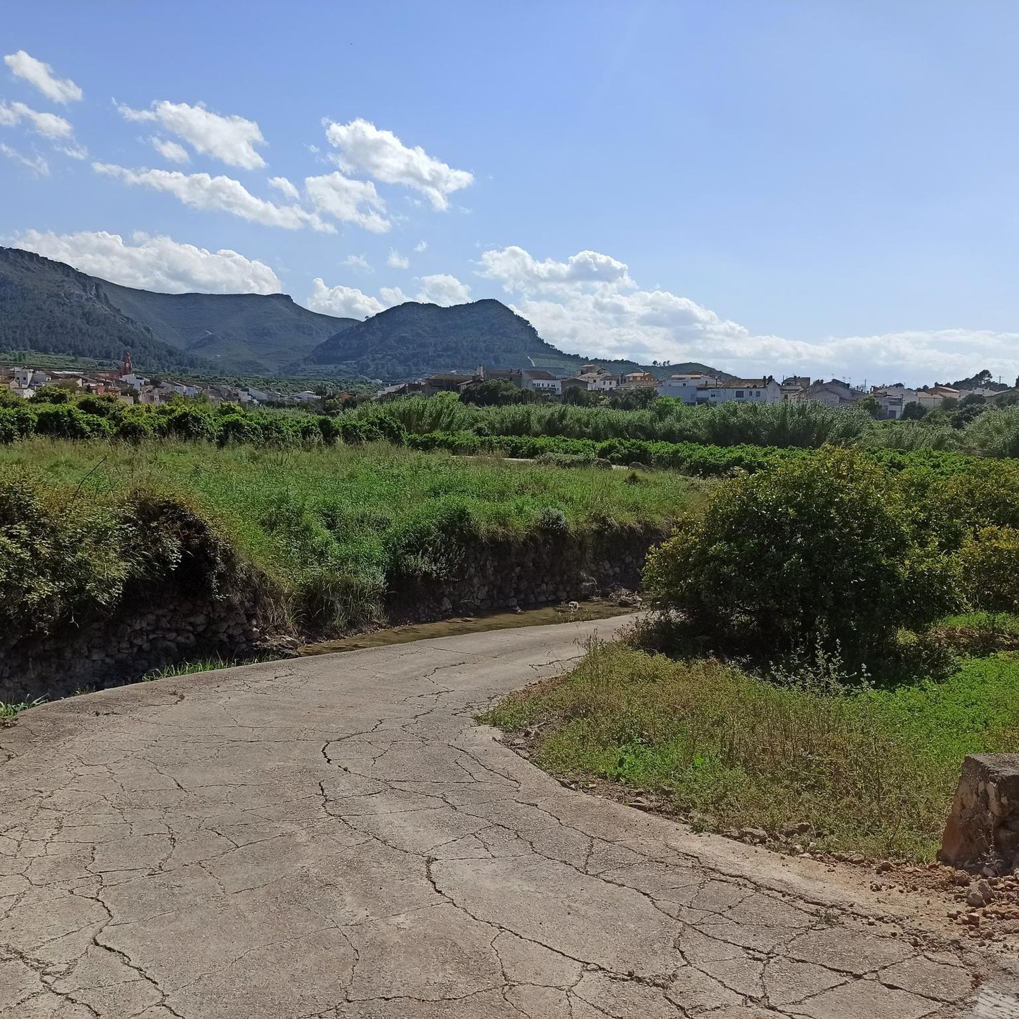
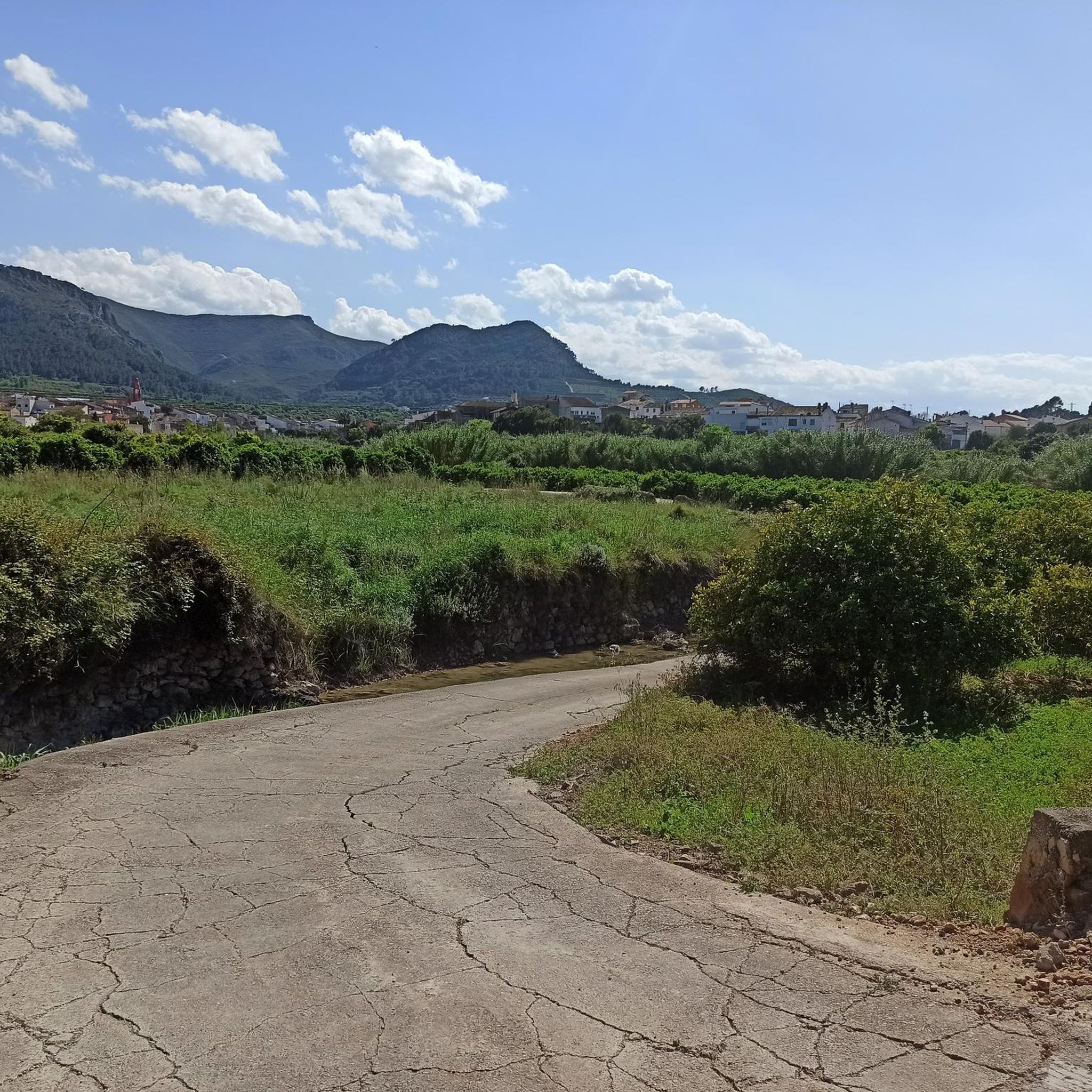
There are several points along this route from which you can admire the impressive silhouette of the Benicadell massif. The Alt de Benicadell, with a height of 1,105 metres, is a prominent peak in the Sierra de Benicadell, which forms a natural border between the provinces of Valencia and Alicante. The region around the Benicadell offers numerous opportunities for cycling tours that lead through varied landscapes with impressive views.
5
0

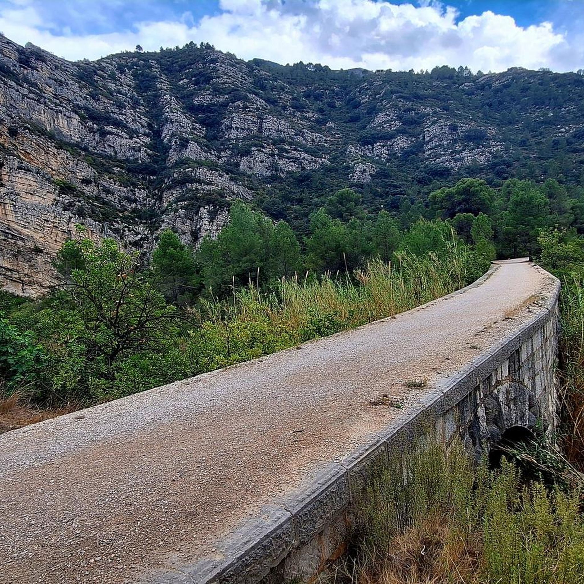
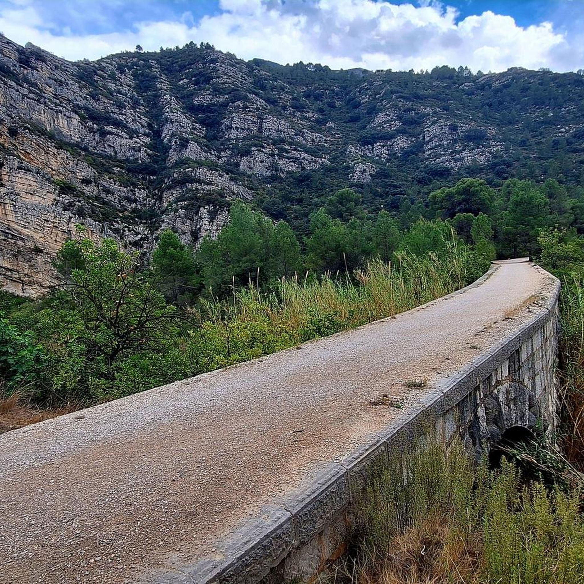
Puerto de la Drova, or Collado del Mollons, is a climb in the Costa del Azahar region. It has a length of 9.8 kilometers and a climb of 359 vertical meters with a slope of 3.7% on average, which implies a difficulty level of 201. The top of the climb is located at 382 meters above sea level. At the top, you can access the Parpalló Borrell Environmental Interpretation Center, a space to disseminate and help interpret the environmental aspects of the area where it is located.
2
0

This port is one of the classics of the area. It can be done uphill from Gandia, so the journey is 10km that starts with a very gentle slope and gets steeper at the end with the true port (3.5km). Going downhill, you have to be careful because high speeds are achieved thanks to the good asphalt and the layout of the curves. And I say that you need to be careful not only for physical integrity, but also because the civil guard charges cyclists with excessive speed.
1
0

Mythical ascent for the people of Gandia
1
0
The Benicadell accompanies the cyclist during the ascent and descent of the mountain pass between Castelló de Rugat and Beniarrés.
2
0

Very picturesque and demanding stretch. With a good surface, riding here is very entertaining, but you will have to overcome slopes over 20%, both up and down, so make sure your brakes are in optimal condition.
2
1
Frequently Asked Questions
What are the most notable mountain passes and viewpoints around Llocnou De Sant Jeroni?
The region, situated within the Serra de la Safor, offers several impressive spots. Highly regarded is La Drova Pass + cattle track towards Barx, known for its beautiful views and a detour into the forest. Another significant point is the View of Alt de Benicadell, offering excellent vistas of the prominent Benicadell massif. For a natural pass with extraordinary views, consider Alt de Pinaro.
Are there challenging mountain passes for experienced hikers or cyclists?
Yes, for those seeking a challenge, Puerto de l'Orxa - Alpatro is a demanding mountain pass known for its steep and long climbs, with sections exceeding a 20% gradient. The terrain within the Circo de la Safor also presents medium to high technical level routes with significant elevation changes and accentuated slopes.
What kind of natural features can I expect to see in the mountain passes area?
The Serra de la Safor, where these passes are located, is a biodiversity paradise. You'll encounter dramatic landscapes, including the unique rocky horseshoe shape of the Circo de la Safor, imposing crests, and steep slopes. The area is rich in ecological diversity, offering opportunities for bird watching and connecting with nature amidst Mediterranean forests and varied microenvironments.
What outdoor activities can I do near these mountain passes?
Beyond exploring the passes themselves, the region is excellent for various outdoor activities. You can find numerous hiking trails, such as the PR-CV 100: Rótova Trails, and cycling routes like the Tour of the Monasteries of La Safor and La Vall d'Albaida. For more options, explore the hiking guide or the cycling guide for Llocnou De Sant Jeroni.
Are there any family-friendly options for exploring the mountain areas?
While some passes are challenging, the broader Serra de la Safor region offers trails suitable for families. Look for routes with moderate or easy difficulty ratings in the nearby hiking guides. For instance, the Senda del Castell Trail (SL-CV 138) is an easy option. Always check the specific trail details for elevation and terrain to ensure it matches your family's capabilities.
Can I bring my dog on the mountain trails and passes?
Generally, the natural areas around Llocnou De Sant Jeroni are welcoming to dogs, but it's always best to check local regulations for specific trails or protected areas within the Serra de la Safor. Ensure your dog is on a leash, especially in areas with wildlife or other hikers, and always clean up after your pet.
What is the best time of year to visit the mountain passes around Llocnou De Sant Jeroni?
The region enjoys a Mediterranean climate. Spring (April-May) and autumn (September-October) are generally ideal, offering pleasant temperatures for hiking and cycling. Summers can be hot, especially at midday, while winters are mild but can bring cooler temperatures at higher elevations. Always check the local weather forecast before your visit.
Are there any environmental or interpretation centers in the area?
Yes, near Port de la Drova, you can access the Parpalló Borrell Environmental Interpretation Center. This center serves as a space to disseminate and help interpret the environmental aspects of the area, providing valuable insights into the local ecology and natural features.
What kind of views can I expect from the mountain passes?
From the heights of the Serra de la Safor, including many passes and viewpoints, you can enjoy spectacular panoramic views. These often include vistas of the coastal plain, the Serpis river, and on clear days, the sea on one side and the Benicadell massif and the valleys around Alcoy on the other. The Circo de la Safor itself offers breathtaking vistas.
Is there parking available near the trailheads for the mountain passes?
While specific parking facilities for every trailhead may vary, many popular hiking and cycling routes in the Serra de la Safor region, including those leading to mountain passes, typically have designated parking areas or roadside spots nearby. It's advisable to research specific trailheads in advance for detailed parking information.
Do I need any permits to hike in the Serra de la Safor area?
The Serra de la Safor is a natural area, and generally, permits are not required for hiking on established trails. However, it's always good practice to check for any specific local regulations or temporary restrictions, especially if you plan to visit protected zones or engage in activities beyond standard hiking.
What makes the Circo de la Safor a unique natural feature?
The Circo de la Safor is a unique 'rocky amphitheater' characterized by its spectacular horseshoe shape and imposing crests, reaching up to 1,012 meters at the Alt de la Safor. Its dramatic appearance is due to significant elevation changes and steep slopes, offering a truly distinctive and memorable landscape for visitors.
Most popular routes around Llocnou De Sant Jeroni
Most popular attractions around Llocnou De Sant Jeroni

Get inspired with the komoot mobile app


Explore more
See even more epic mountain passes by checking out these guides around Llocnou De Sant Jeroni:
