Top 7 Natural Monuments around Guirguillano
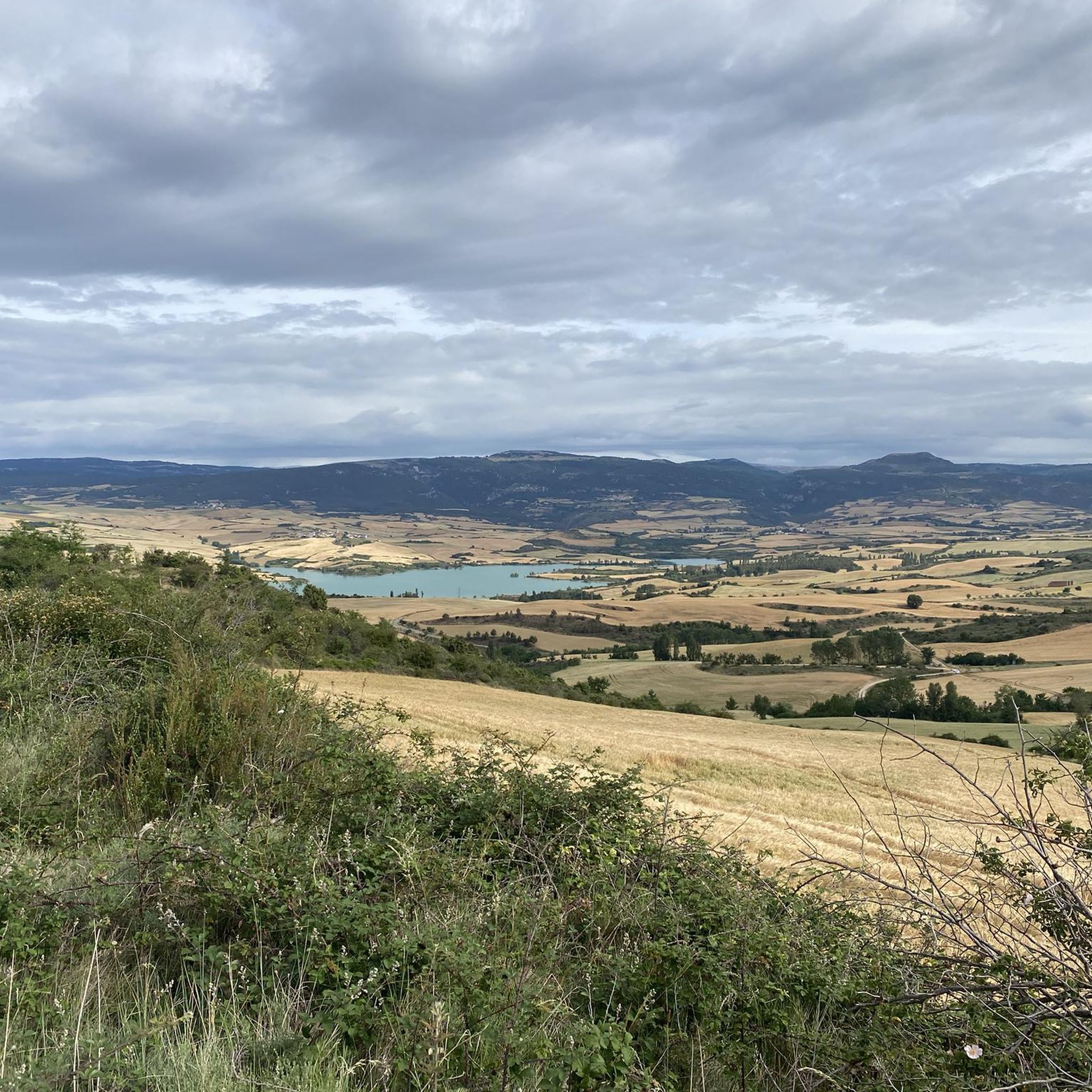
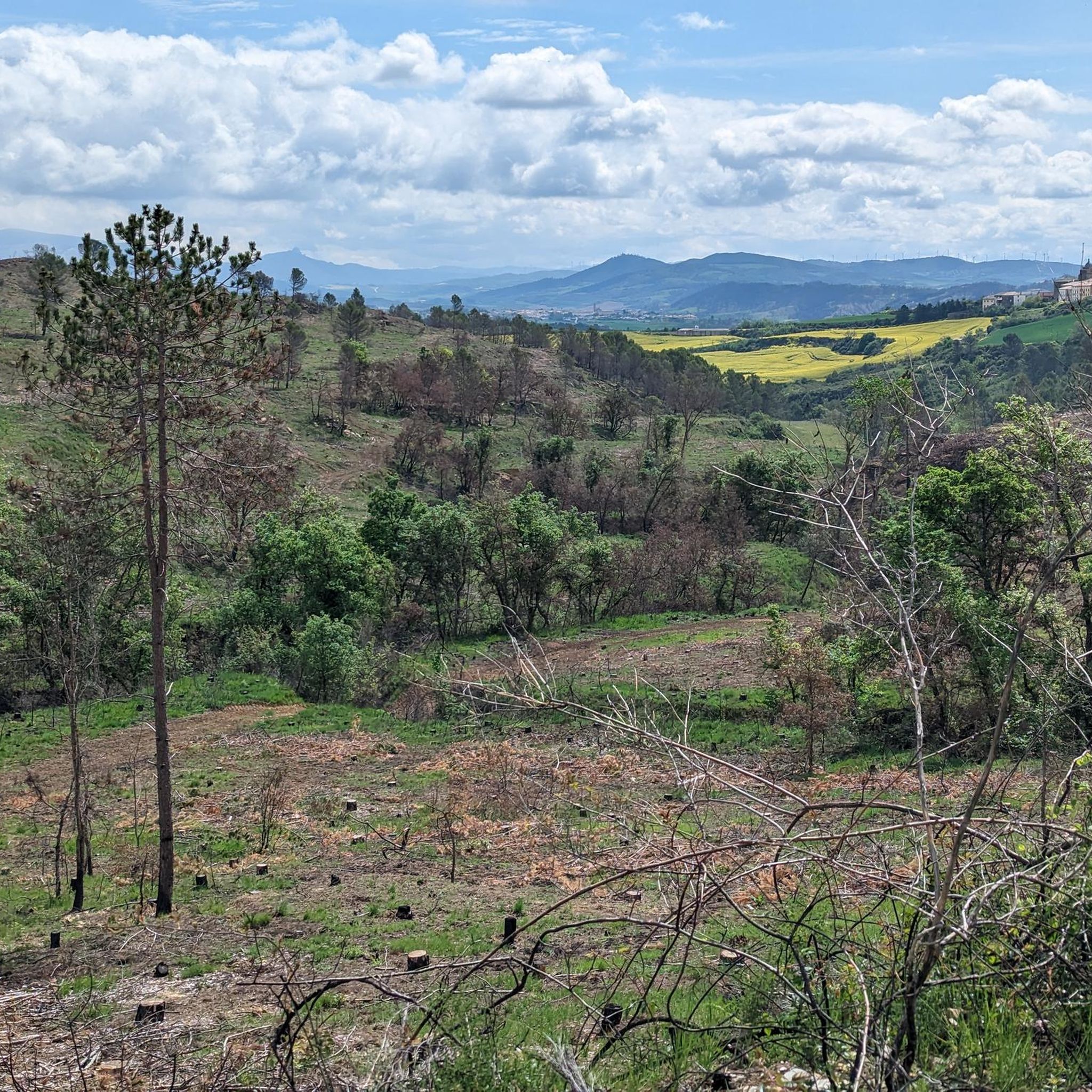
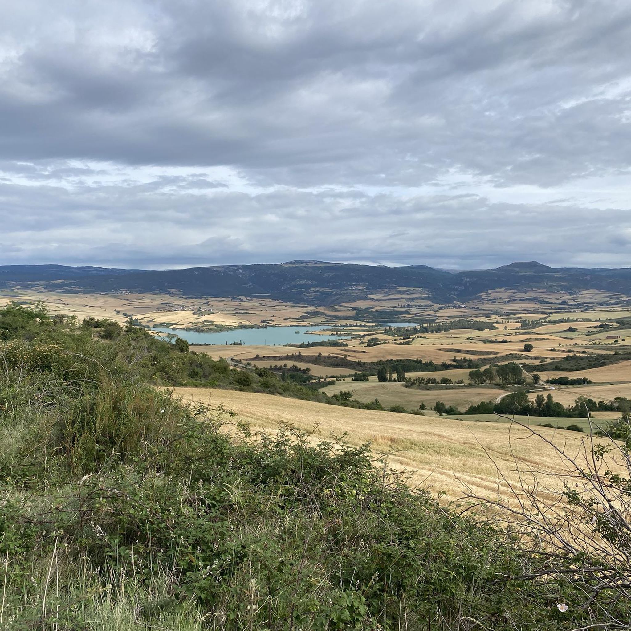
Best natural monuments around Guirguillano include a rugged mountain range with lush forests and elevated viewpoints. The area is characterized by a sierra that descends towards the Arga river, featuring forests of gall oaks, oaks, junipers, and reforested pine. Guirguillano offers panoramic views of the surrounding natural landscape, providing opportunities for hiking and appreciating natural features. These natural areas contribute to the region's appeal for outdoor activities.
Best natural monuments around Guirguillano
- The most popular natural monuments is Artazul Waterfall…
Last updated: October 4, 2026
Artazul Waterfall
Highlight • Waterfall
Path to the cascade can be flooded. If you want to go higher from the cascade, the terrain may be muddy and slippery!
Tip by

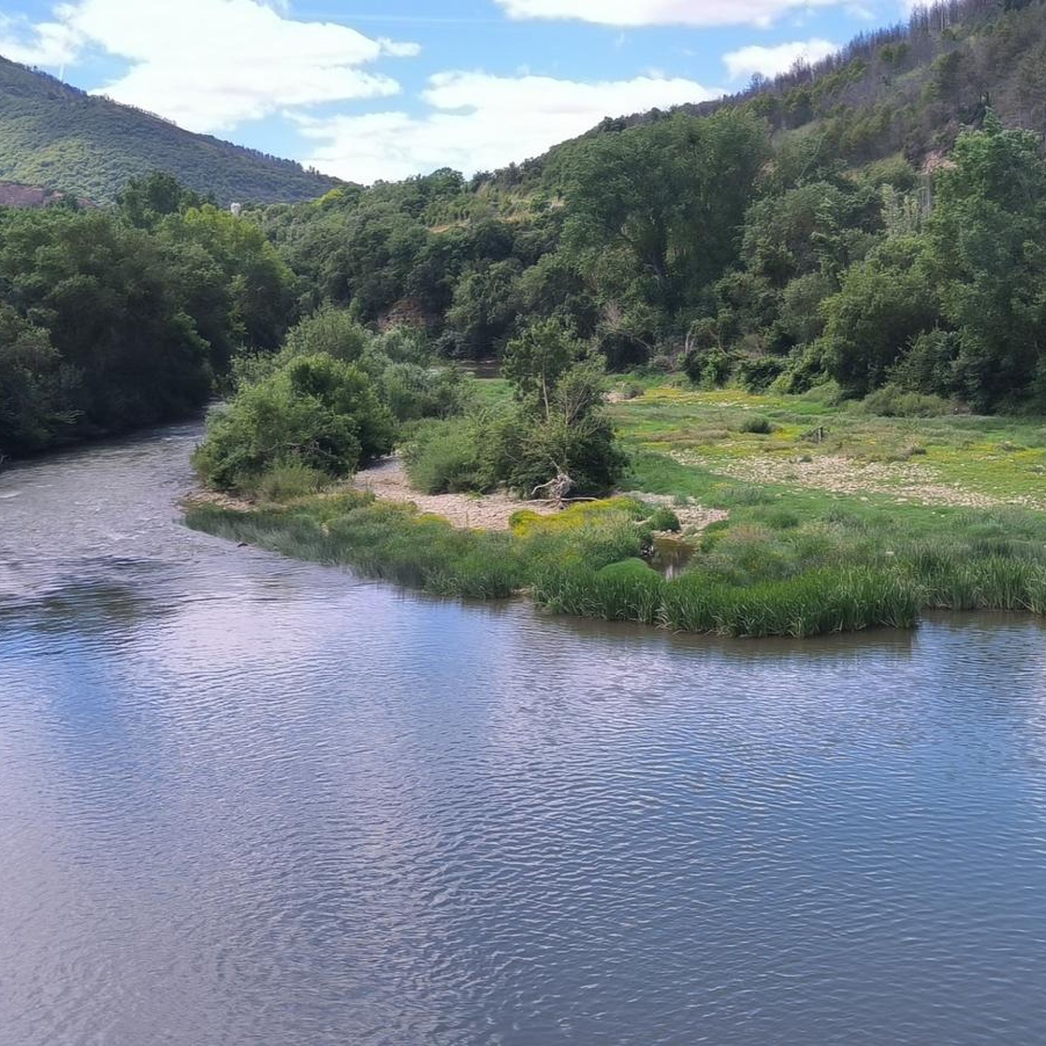
Source of the Ubagua River
Highlight • River
Translated by Google •
Tip by

Sign up now to discover places like this
Get recommendations on the best single tracks, peaks, & plenty of other exciting outdoor places.
Ubagua Canyon
Highlight (Segment) • Canyon
Translated by Google •
Tip by

AltoDelTxaparro
Highlight • Summit
Translated by Google •
Tip by
ViewsPeñaTxikita+Grande
Highlight • Viewpoint
Translated by Google •
Tip by
Sign up for free to discover even more natural monuments around Guirguillano.
Already have an account?
Start today with a free account
Your next adventure awaits.
Tips from the Community

Magnificent rocks, characteristic of the area and which help us to orient ourselves.
0
0

I recommend my "out" route rather than the "in" route in my itinerary. I had a tough time getting to the monolith through a real sea of boxwood.
2
0
A paradisiacal place and a stone's throw from the parking lot. Of course, when the ground is wet, access will be very difficult.
5
1
In my opinion the best watchtower to contemplate the two rocks at the same time.
2
0

A waterfall of about 40m, an unmissable place for any nature lover. You will also enjoy a beautiful and picturesque path to get here, the environment is simply wonderful.
4
0
Signposted site on the itinerary of the Ubagua River Canyon indicating its source.
2
0
A conditioned path runs through the entire canyon, it is worth seeing, although it would be more beautiful if the entire course carried water.
2
0
Above the spring, the canyon no longer carried water today.
2
1
Frequently Asked Questions
What are some of the most popular natural monuments to visit around Guirguillano?
Visitors frequently enjoy the Artazul Waterfall, known for its beautiful 40-meter cascade. Another popular spot is the Source of the Ubagua River, which is clearly signposted along the Ubagua River Canyon itinerary. The Ubagua Canyon itself also features a conditioned path for exploration.
Are there any natural viewpoints offering panoramic views near Guirguillano?
Yes, the area is known for its panoramic views. The View from Alto del Perdón, located at 770 meters, offers exceptional vistas towards Pamplona and the Pyrenees to the north, and the Valdizarbe Valley to the south. It's a pleasant spot with tables to rest and enjoy the scenery. Another summit offering views is AltoDelTxaparro.
What kind of terrain and natural features can I expect to find in the Guirguillano area?
The region around Guirguillano is characterized by a rugged mountain range that descends towards the Arga river. You'll find lush forests of gall oaks, oaks, and junipers, alongside extensive reforested pine forests. The natural features include waterfalls like Artazul Waterfall, rivers such as the Ubagua, and canyons like the Ubagua Canyon, as well as various summits and viewpoints.
What outdoor activities can I do near the natural monuments around Guirguillano?
The diverse landscape around Guirguillano is ideal for various outdoor activities. You can find numerous routes for cycling, mountain biking, and running. For cycling, consider exploring routes like the easy Aragonese Way Trail. Mountain bikers can tackle trails such as the 'Vuelta al Embalse de Alloz', while runners have options like the 'Running loop from 44. fazeria'. You can find more details on these activities in the dedicated guides for Cycling around Guirguillano, MTB Trails around Guirguillano, and Running Trails around Guirguillano.
What is the difficulty level of trails leading to natural monuments in this area?
Many trails leading to natural monuments in the Guirguillano area are rated as intermediate. For instance, the path to Artazul Waterfall can be subject to flooding, and higher terrain may be muddy and slippery. The Ubagua Canyon has a conditioned path, making it more accessible, but some areas like the approach to AltoDelTxaparro can be challenging due to dense vegetation.
What do visitors enjoy most about the natural monuments around Guirguillano?
Visitors consistently praise the natural beauty and tranquility of the area. The Artazul Waterfall is often described as a 'paradisiacal place' and an 'unmissable' spot for nature lovers, with a beautiful and picturesque path leading to it. The panoramic views from spots like Alto del Perdón are also highly appreciated for their expansive vistas and opportunities to rest.
Is the path to Artazul Waterfall always accessible?
The path leading to the Artazul Waterfall can sometimes be subject to flooding, especially after heavy rains. If you plan to venture higher up from the cascade, be aware that the terrain may be muddy and slippery, making access more difficult when wet. It's advisable to check local conditions before your visit.
Are there any natural monuments that are particularly suitable for families?
While specific 'family-friendly' designations are not always available, the conditioned path through the Ubagua Canyon offers a more accessible option for families to explore. The Source of the Ubagua River is also a signposted site that can be an interesting point of discovery for children.
What is the best time of year to visit the natural monuments around Guirguillano?
The best time to visit largely depends on the specific natural monument and your preferred activity. Spring and autumn generally offer pleasant temperatures for hiking and exploring the forests. During wetter periods, paths to waterfalls like Artazul Waterfall might be flooded or muddy. For lush greenery and flowing water, spring after rainfall can be particularly rewarding.
Are there any protected natural areas near Guirguillano?
While Guirguillano itself is within a naturally scenic area with rugged sierras and forests, officially designated 'natural monuments' with specific names are not prominently listed within the municipality. However, the broader Navarra region, where Guirguillano is located, offers significant protected areas such as the Bardenas Reales Natural Park and various gorges, though these are not directly within Guirguillano. The natural features within Guirguillano contribute to the region's natural heritage.
Where can I find information about the natural heritage of the broader Navarra region?
For more information on the natural heritage and biodiversity of the broader Navarra region, you can visit the official tourism website: visitnavarramedia.com.
Most popular routes around Guirguillano
Most popular attractions around Guirguillano

Get inspired with the komoot mobile app


Explore more
Extend your search for the best caves by checking out these guides of the top ones around Guirguillano:
