The 5 Most Amazing Peaks around Gächlingen
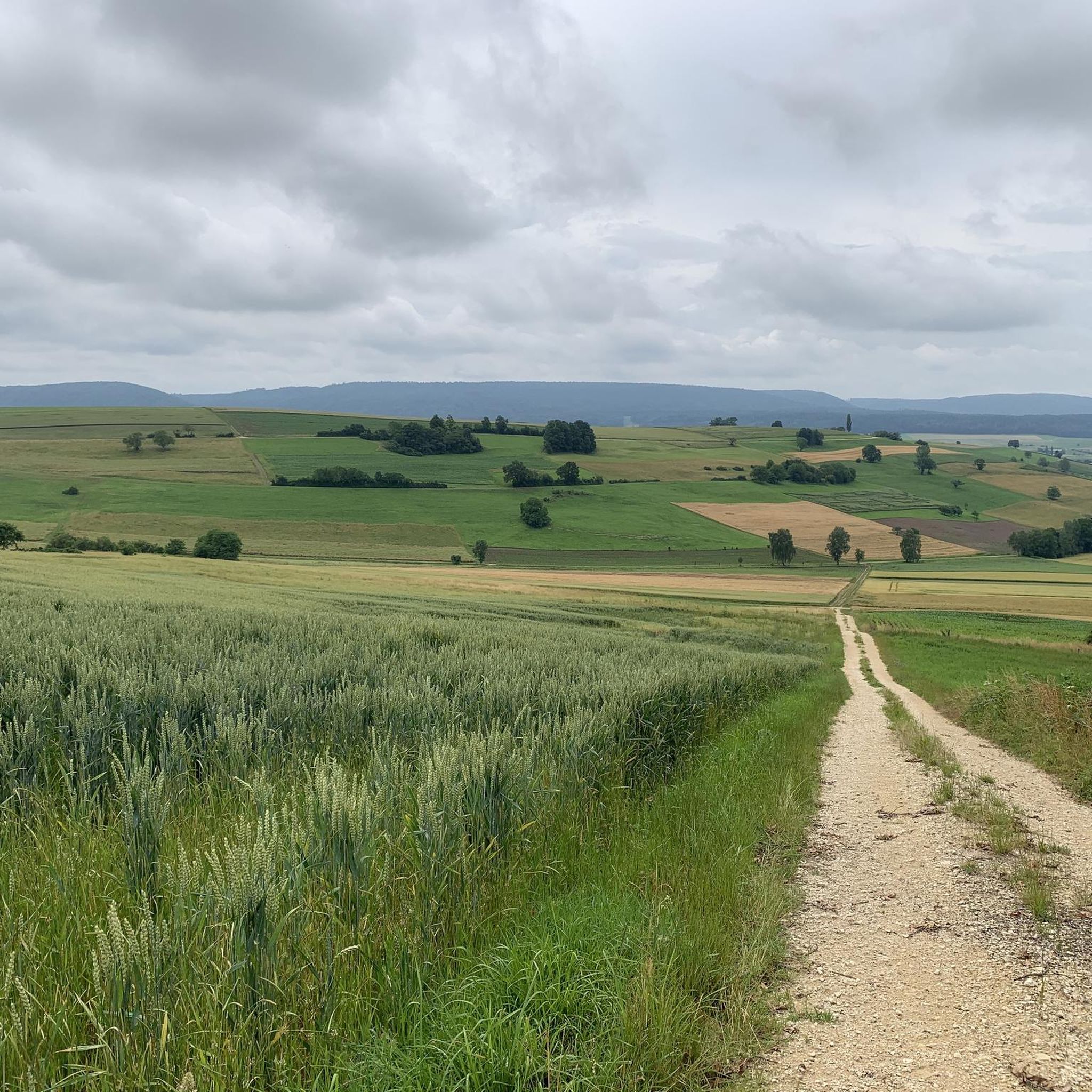
Best mountain peaks around Gächlingen are found within the scenic Randen mountain range, part of the Jura Mountains in the canton of Schaffhausen, Switzerland. Gächlingen, a wine-producing village, serves as a starting point for exploring this hilly area. The Randen offers various elevated points and observation towers that provide expansive views. This region is characterized by gentle rolling hills and rich biodiversity, making it ideal for nature lovers and hikers.
Best mountain peaks around Gächlingen
- The most popular mountain peaks…
Last updated: September 27, 2026
Hagenturm Observation Tower
Highlight • Viewpoint
Translated by Google •
Tip by

Siblinger Randen Tower
Highlight • Viewpoint
de.m.wikipedia.org/wiki/Siblinger_Randenturm
Translated by Google •
Tip by

Sign up now to discover places like this
Get recommendations on the best single tracks, peaks, & plenty of other exciting outdoor places.
Weizen Station — Sauschwänzlebahn Terminus
Highlight • Monument
On September 8, 2014, the Wutachtalbahn was honored by the Federal Chamber of Engineers as a Historic Landmark of Civil Engineering in Germany.
Translated by Google •
Tip by

Zälgli
Highlight • Rest Area
Translated by Google •
Tip by

Siblingerhöhe
Highlight • Viewpoint
Translated by Google •
Tip by

Sign up for free to discover even more peaks around Gächlingen.
Already have an account?
Start today with a free account
Your next adventure awaits.

Tips from the Community

Stop for the Sauschwänzlebahn cable car. From here, you can enjoy many beautiful hikes, including the start of the Schluchtensteig trail.
6
0

The Sauschwänzlebahn (Sauschwänzlebahn) will be running through the region from May onwards. There are restroom facilities, parking, and a snack bar. However, it is only open during the train's operating hours.
3
0


We were given a break to relax in the morning hours. As quiet and peaceful as ever.
1
1

The most beautiful of all 4 Randen towers we visited.
2
0

On the 19 m high platform, visitors are treated to an extraordinary panorama from the Vorarlberg Alps, across the mountains of eastern and central Switzerland to the peaks of the Bernese Oberland and further to the Black Forest heights.
2
0
The viewing platform can be reached via 225 steps. Above the treetops, there is a unique panoramic view from the Black Forest to the Alps. The Hagenhütte is about a 10-minute walk below the Hagenturm. This hut is open to everyone all year round, every weekend on Saturday from 12:00 p.m. to 4:00 p.m. and on Sunday from 10:00 a.m. to 4:00 p.m. (current opening times: http://kos-altkadetten.ch/) Drinks, a small snack and delicious cakes can be bought from the hut warden. The range varies depending on the hut warden.
4
0

The station of Weizen is the station of the village of Weizen, a district of the small town of Stühlingen in the district of Waldshut. The station is located at kilometer 20.4 of the Wutach Valley Railway, which runs from Lauchringen via Stühlingen and Blumberg to Immendingen. Today, feeder trains run here in the summer half-year to the museum railway to Blumberg-Zollhaus, which also only runs in the summer half-year and starts here.
5
0
Frequently Asked Questions
What are the most notable mountain peaks and viewpoints around Gächlingen?
The Randen mountain range, accessible from Gächlingen, offers several elevated points and observation towers. Key highlights include the Hagenturm Observation Tower, which is near the highest point in the canton of Schaffhausen and provides panoramic views of the Swiss Alps and Black Forest. Another popular spot is the Siblinger Randen Tower, offering 360-degree views of the Klettgau valley and distant mountain ranges. The Zälgli area also provides a viewpoint and a pleasant rest area.
What is the highest point in the Randen mountain range near Gächlingen?
The highest point in the canton of Schaffhausen, located within the Randen range, is Hagen (or Hage) at 912 meters (2,992 ft). The Hagenturm Observation Tower stands at 40 meters high, bringing visitors to an elevation of 952 meters for expansive views.
Are there family-friendly mountain trails and facilities in the Randen area?
Yes, the Randen mountain range is well-suited for families. The area around the Siblinger Randen Tower is equipped with playgrounds and barbecue facilities, making it ideal for a full day out. Additionally, Zälgli is a large meadow area with fire pits, tables, benches, and shelter, perfect for family picnics and games.
What kind of views can I expect from the observation towers in the Randen?
From the Hagenturm Observation Tower, you can enjoy breathtaking panoramic views that include the Swiss Alps, the Black Forest, Hegau, and even Lake Constance on clear days. The Siblinger Randen Tower offers vistas across the picturesque Klettgau valley, the dense Randen forests, and distant mountain ranges like the Vorarlberg Alps and the Bernese Oberland peaks.
What outdoor activities can I do near the mountain peaks around Gächlingen?
The Randen mountain range is crisscrossed by numerous hiking trails suitable for various fitness levels. Beyond hiking, you can explore the area through other activities. For running enthusiasts, there are several options, including the 'Schmerlat Airfield loop from Gächlingen' which is a moderate 10.2 km route. Mountain biking is also popular, with trails like the 'Siblinger Randen House – Siblinger Höhe loop from Siblingen' covering 11.6 km. Gravel biking offers routes such as the 'Engewald Singletrack – Beringer Randenhaus loop from Neunkirch'. You can find more details on these and other routes in the Running Trails around Gächlingen, MTB Trails around Gächlingen, and Gravel biking around Gächlingen guides.
What natural features characterize the Randen mountain range?
The Randen mountain range is known for its gentle rolling hills, which contrast with the more dramatic peaks found elsewhere in Switzerland. It boasts a rich biodiversity, including many endangered or rare animal and plant species, such as magnificent orchids that bloom in spring. The region features idyllic forests, charming streams, and diverse landscapes.
Are there any historical sites near the mountain peaks?
Yes, the area around the Siblinger Randen Tower has historical significance, with an old spur castle from the Bronze Age and medieval ramparts with cellars visible nearby.
What is the best time to visit the Randen mountain range for hiking?
The Randen mountain range is beautiful throughout the warmer months. Spring is particularly special for observing the rich biodiversity, including magnificent orchids. Summer offers pleasant conditions for hiking and enjoying the outdoor facilities. Autumn brings vibrant colors to the forests, making it another excellent time to visit.
How accessible are the mountain peaks and viewpoints by public transport or car?
Gächlingen serves as an excellent starting point for exploring the Randen. While specific public transport details to each tower vary, the region is generally well-connected for hikers. For example, the Siblinger Randen Tower is located near Siblingen, a neighboring municipality, making it accessible. Parking information for trailheads is usually available locally.
What do visitors appreciate most about the mountain peaks around Gächlingen?
Visitors frequently praise the expansive panoramic views from the observation towers, especially the ability to see distant mountain ranges like the Alps and the Black Forest on clear days. The family-friendly facilities, such as playgrounds and barbecue areas at Siblinger Randen Tower and the rest area at Zälgli, are also highly valued. The tranquil nature, diverse landscapes, and well-maintained hiking trails through forests and past streams contribute to a relaxing and enriching outdoor experience.
Can I find food and drink options near the hiking trails in the Randen?
While Gächlingen itself offers amenities as a wine-producing village, specific cafes or restaurants directly at every trailhead in the Randen might be limited. However, areas like the Zälgli provide rest areas with fire pits, tables, and benches, encouraging visitors to bring their own provisions for a picnic or barbecue. It's advisable to check local information for establishments in nearby villages like Siblingen or Neunkirch before your hike.
Most popular routes around Gächlingen
Most popular attractions around Gächlingen

Get inspired with the komoot mobile app


