The best gravel rides in Moraine Hills State Park
5.0
(1)
17
riders
2
rides
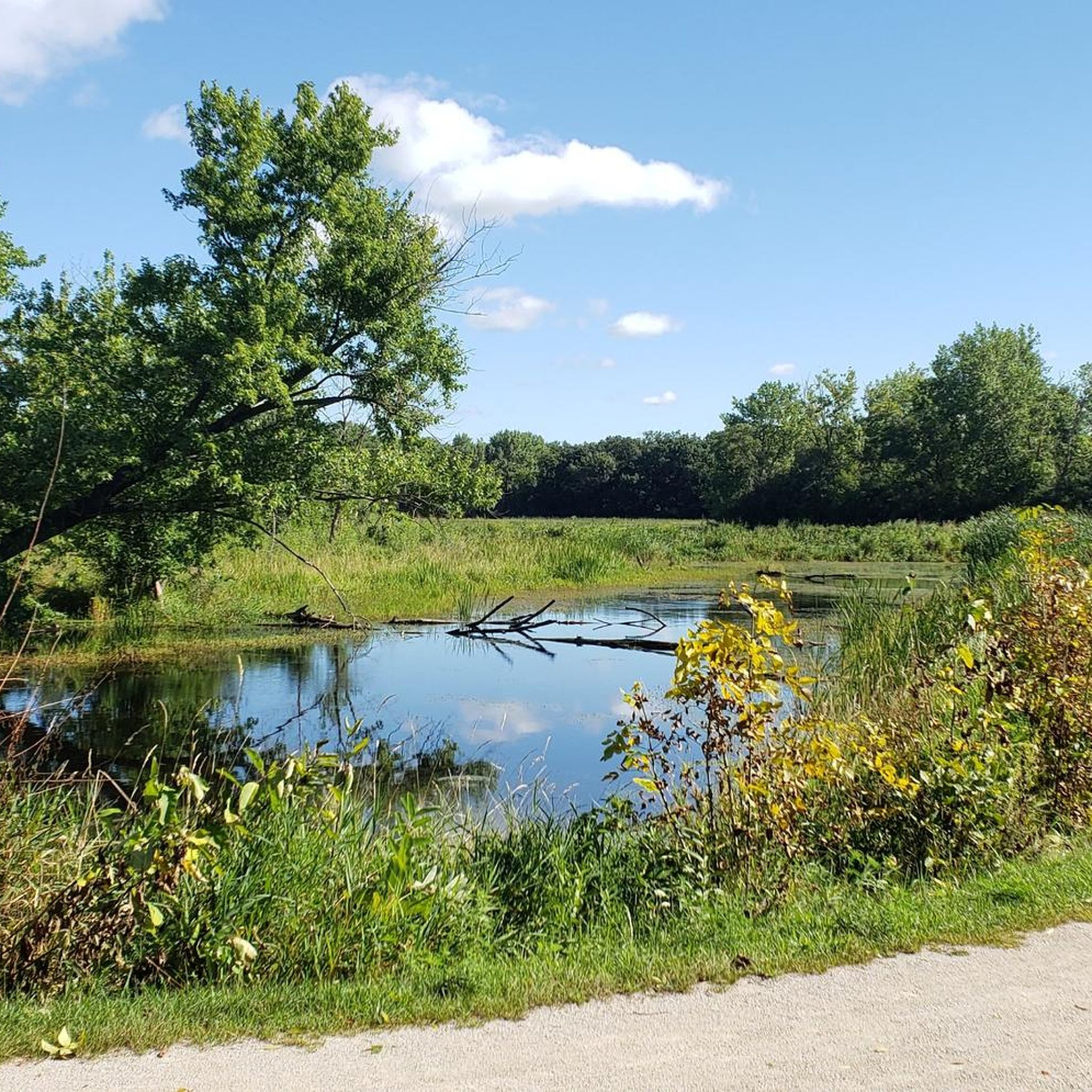
Gravel biking in Moraine Hills State Park offers routes through a landscape shaped by unique glacial topography, featuring rolling hills and ridges. The park's extensive trail system includes many paths surfaced with crushed limestone, providing ideal conditions for gravel cyclists. This terrain, characterized by "kettle-moraine topography," presents a varied environment of open prairies, shaded woodlands, and waterside views along the Fox River and Lake Defiance.
Best gravel bike trails in Moraine Hills State Park
- The most popular gravel bike trail is Petersen Park Beach – North Branch Conservation Area loop from McHenry, a 33.0 miles (53.2 km) trail that takes 3 hours 27 minutes to complete. This route navigates through varied landscapes, offering a comprehensive experience of the park's natural features.
- Another top favourite among local gravel bikers is Millennium Trail, a moderate 18.3 miles (29.5 km) path. This trail provides a balanced ride across diverse terrain, suitable for those seeking a moderate challenge.
- Local gravel bikers also love the Independence Grove Lake – Schreiber Lake loop from Wauconda, a 55.7 miles (89.7 km) trail leading through a mix of natural areas and lake views, often completed in about 4 hours 27 minutes.
- Gravel biking in Moraine Hills State Park is defined by glacial topography, crushed limestone trails, and the scenic Fox River. The network offers options for different ability levels, primarily featuring moderate routes.
- The routes in Moraine Hills State Park are highly rated by the komoot community with an average score of 5.0 stars from more than 1 review. More than 20 gravel bikers have used komoot to explore Moraine Hills State Park's varied terrain.
Last updated: August 19, 2026
5
riders
Moderate gravel ride. Good fitness required. Mostly paved surfaces. Suitable for all skill levels.
5.0
(1)
8
riders
29.5km
02:07
130m
130m
Moderate gravel ride. Good fitness required. Mostly paved surfaces. Suitable for all skill levels.

Sign up for free
4
riders
89.7km
04:28
350m
350m
Moderate gravel ride. Good fitness required. Mostly paved surfaces. Suitable for all skill levels.
Our route recommendations are based on thousands of hikes, rides, and runs completed by other people on komoot.
Start today with a free account
Your next adventure awaits.
Login or Signup


Tips from the Community

For those riding out from the City of Chicago to the countryside of McHenry County, the Metra Rail Service offers regular and convenient service to Union Station in downtown Chicago. The City of McHenry also has a wide variety of restaurants and bars with outdoor dining facilities to relax, quench a thirsty throat or satisfy a hungry stomach.
0
0
The stretch of the McHenry / Illinois Prairie Trail Bergseen Richmond and Ringwood is a ver smooth cycling path on hard packed limestone. It is very suitable for road bikes, as well as gravel and MTB. I would highly recommend tyres with widths of =>28mm. The path is well kept, with the exception of within the city limits of Richmond. The trail is paved south of Ringwood all the way down to Oswego, IL with the exception of one or two small sections of hard packed roadbike suitable gravel. In Ringwood itself is a bar located directly on the trail with an outdoor terrace which makes it easy to for one to dine and drink, while being able to keep an eye on your bike.
0
0
There is a low traffic road which more or less parallels the busy County Highway H. These roads are all asphalted, mostly smooth surfaced asphalt with the occasional blemish here and there. Rolling hills and country farms dot each side of the road. A very enjoyable route, except the last 2 miles on County Highway H has a lot of vehicle traffic, but the shoulder is wide and clean. For the most part of this section the motorists were very nice, leaving ample room when passing.
0
0
I love cycling to this village. It has many outdoor cafés and bars which are great when cycling, just park your bike, near your table so you can keep an eye on it. The restaurants serve very good food, If you are an early bird, a very hearty breakfast with real well balanced coffee is made. If you are Italian, German, Swiss or French and looking for a good strong European coffee, stop here. In the evening it is really nice with the bars and their open patios.
0
0
This beautiful well packed and smooth cycle path on hard packed gravel is a joy, until one gets into the Richmond City Limits. It seems the city does not take very well care of their trail under their jurisdiction. The crossings are rough with some short cement edges and some metal objects sticking out. Look before you cross, as they can be rough. Richmond it self is a beautiful village with a very European touch to it. Filled with great restaurants and well preserved brick buildings.
0
0
This stretch of Harts Road in the Wildlife Zone is in much better shape than the rest of the road. The pavement is asphalt with a few blemishes here and there but easily rode with tyres => 28mm.
0
0


The Lake at Independence Grove is a must-visit stop along the Des Plaines River Trail, offering cyclists a scenic and easy ride through a 115-acre retreat. Once a gravel quarry, this reclaimed space now features smooth paths, gentle terrain, and beautiful lake views—perfect for beginners and family-friendly outings. Visit in the spring, and you might spot colorful wildflowers adding even more charm to this peaceful ride.
0
0
Frequently Asked Questions
What kind of terrain can I expect on gravel bike trails in Moraine Hills State Park?
The park is known for its unique glacial topography, featuring rolling hills and ridges. Most trails are surfaced with crushed limestone, providing ideal conditions for gravel cycling. You'll encounter a varied environment of open prairies, shaded woodlands, and waterside views along the Fox River and Lake Defiance.
Are there any easy or beginner-friendly gravel bike routes in Moraine Hills State Park?
Yes, while many routes are moderate, the park offers trails suitable for beginners. The Bangs Lake – Bangs Lake loop from Wauconda is a good option, covering about 18.4 miles with manageable elevation changes. Additionally, shorter park trails like the 2-mile Fox River Trail or the 3.7-mile Lake Defiance Trail offer scenic, less strenuous rides.
What are some of the most scenic natural features or landmarks I can see while gravel biking in the park?
Moraine Hills State Park is rich in natural beauty. You can explore areas showcasing kettle-moraine topography, the tranquil Leatherleaf Bog Trail, and the expansive Lake Defiance. The park also borders the Fox River, offering picturesque views. Don't miss the Lone Tree at Moraine Hills State Park for a unique photo opportunity.
Are there any circular gravel bike routes available?
Yes, many of the park's trails are designed as loops or can be combined to form circular routes. For instance, the Petersen Park Beach – North Branch Conservation Area loop from McHenry is a comprehensive 33-mile circular route. Within the park, the Lake Defiance Trail is a 3.7-mile loop offering waterside views.
What is the best time of year to go gravel biking in Moraine Hills State Park?
The park is enjoyable year-round, but spring and fall offer particularly pleasant conditions with milder temperatures and beautiful foliage. Spring brings blooming wildflowers, while autumn showcases vibrant colors. Summers are also popular, but be prepared for warmer weather and potential humidity.
Are there any challenging gravel bike routes for experienced riders?
For those seeking a longer and more challenging ride, the Independence Grove Lake – Schreiber Lake loop from Wauconda is a substantial 55.7-mile route with significant elevation gain, providing a demanding experience across varied terrain.
What do other gravel bikers say about their experience in Moraine Hills State Park?
The routes in Moraine Hills State Park are highly rated by the komoot community, with an average score of 5.0 stars. Reviewers often praise the well-maintained crushed limestone trails, the diverse scenery, and the peaceful atmosphere that makes for an enjoyable ride.
Is there parking available for gravel bikers in Moraine Hills State Park?
Yes, Moraine Hills State Park offers several day-use areas, which typically include parking facilities. These areas provide convenient access to the trailheads for gravel bikers.
Can I bring my dog on the gravel bike trails in Moraine Hills State Park?
Moraine Hills State Park is generally pet-friendly, but specific rules for dogs on bike trails can vary. It's always best to check the official park regulations regarding pets on trails to ensure compliance and a pleasant experience for everyone.
Are there any specific trails that offer great viewpoints?
Absolutely. The park's glacial topography naturally creates elevated points offering scenic vistas. The Fox River Trail Views highlight provides excellent perspectives of the meandering river. Additionally, the Beautiful view from the shaded area is another popular spot for panoramic views within the park.
How long are the gravel bike trails in Moraine Hills State Park?
The park features over 10 miles of dedicated trails, with individual segments like the Fox River Trail (2 miles), Leatherleaf Bog Trail (3.2 miles), and Lake Defiance Trail (3.7 miles). When combined, these can form longer routes, such as the Millennium Trail, which is about 18.3 miles.
Are there any places to eat or stay near Moraine Hills State Park?
While the park itself has picnic areas and concessions at the McHenry Dam, for cafes, pubs, or accommodation, you would need to look in the nearby towns surrounding Moraine Hills State Park, such as McHenry or Wauconda.
Most popular routes in Moraine Hills State Park
Most popular attractions in Moraine Hills State Park

Get inspired with the komoot mobile app


Explore more
Browse the best Gravel rides in other regions.
